Showing posts with label hot springs. Show all posts

Sunday, December 11, 2022

Inyo NF & Mono County (Olympus Pt. 2) - Mammoth Lakes Trip

My parents and I spent 2 nights at Mammoth Lakes, CA between October 21 to October 23 in 2022. We explored Yosemite National Park, Inyo National Forest, Mono County, and Humboldt-Toiyabe National Forest in California enjoying the scenery and autumn foliage. I took photos with my phone, my Olympus mirrorless camera, and my Canon EOS 5D Mark III camera. The photos will be split into several blog posts. I hope you enjoy viewing my photos! 

High Resolution Photos: If you want to see high resolution photos of any of the photos you see here, use the following links. If you wish to purchase prints of any of the photos, please contact me here. To view my best Inyo National Forest & Mono County photos from 2019 to 2022, use this link. To see all of my photos from Inyo National Forest & Mono County on this trip, use this link.

Parts: 

Cellphone: Part 1 | Part 2 | Part 3

Olympus: Part 1 | Part 2

Canon: Part 1 | Part 2

This is part 2 of the photos that were shot on my Olympus mirrorless camera. The photos are from the Inyo National Forest in California and Mono County, CA. The photos are from Hot Creek Geologic Site, Benton Crossing Road & Owens River Bridge, Minaret Vista, and Bald Mountain Lookout.

This blog post contains photos I took on day 2 and 3. On day 2, we explored Mammoth Lakes, CA (cellphone photos only), Hot Creek Geologic Site, Wild Willy's Hot Springs (Canon DSLR photos only), Lake Crowley (Canon DSLR and cellphone photos only), and Convict Lake (Canon DSLR photos only).

It was snowing quite heavily in Mammoth Lakes, CA on day 2 of our trip, so our family traveled out into the desert. The next few photos are from Hot Creek Geologic Site in the Inyo National Forest.

A scenery photo of Hot Creek & hot springs (bottom), clouds, desert, and mountains. The photo was shot at Hot Creek Geologic Site in the Inyo National Forest.
Approximate GPS location (type into Google): 37° 39' 39" N 118° 49' 40" W

A black and white process of the photo above.

A scenery photo of Hot Creek, Glass Mountain Ridge (in the distance), clouds, and desert. The photo was shot at Hot Creek Geologic Site in the Inyo National Forest.
Approximate GPS location (type into Google): 37° 39' 42" N 118° 49' 38" W

A black and white process of the photo above.

A scenery photo of Hot Creek and clouds. The photo was shot at Hot Creek Geologic Site in the Inyo National Forest.
Approximate GPS location (type into Google): 37° 39' 42" N 118° 49' 40" W

A black and white process of the photo above.

After we were done at Hot Creek Geologic Site, we visited Brees Lookout approximately 1/4 mile down the road on the boundary of the Inyo National Forest and Mono County, CA. This lookout provides a great overlook of Hot Creek Geologic Site.

A scenery photo of Hot Creek Geologic Site, Hot Creek, hot springs (center), Eastern Sierras (in the distance), and clouds. The photo was shot at Brees Lookout in the Inyo National Forest.
Approximate GPS location (type into Google): 37° 39' 44" N 118° 49' 37" W

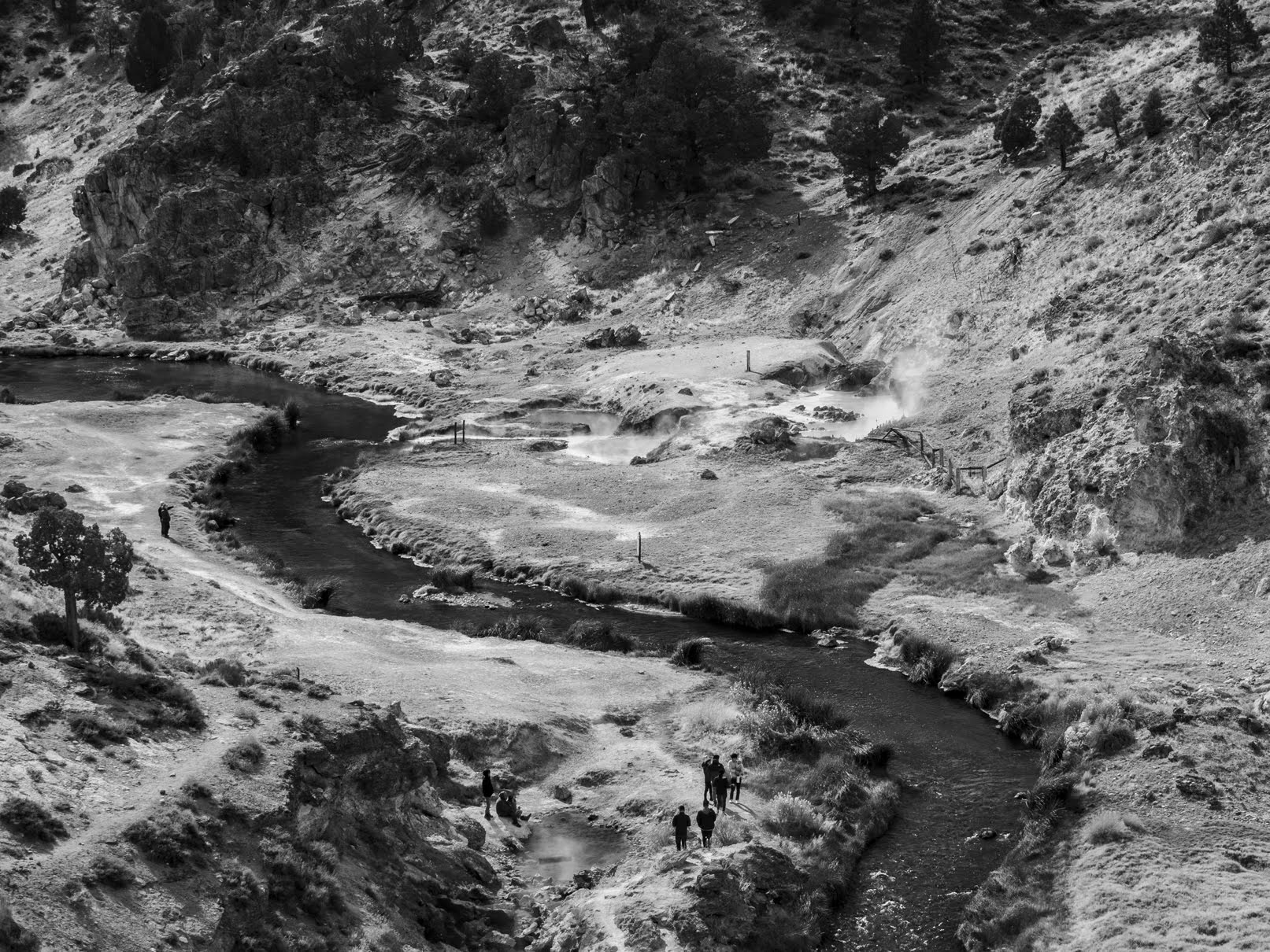
A scenery photo of Hot Creek Geologic Site, Hot Creek, and hot springs (center). The photo was shot at Brees Lookout in the Inyo National Forest.
Photo shot at the same spot as above.

A black and white process of the photo above.

After we explored Hot Creek Geologic Site and Brees Lookout, we went to Wild Willy's Hot Springs in Mono County, CA (Canon DSLR photos only). Then after Wild Willy's Hot Springs, we dropped by Benton Crossing/Owens River Bridge, and then went to Lake Crowley in Mono County, CA (Canon DSLR and cellphone photos only).

The last of my day 2 photos from my Olympus mirrorless camera were shot at Benton Crossing/Owens River Bridge (near Benton Crossing Road & Owens River Bridge) in Mono County, CA.

A scenery photo of Eastern Sierras (in the distance) and Owens River. The photo was shot near Benton Crossing Road and Owens River Bridge in Mono County, CA.
Approximate GPS location (type into Google): 37° 41' 56" N 118° 45' 47" W

A black and white process of the photo above.

A scenery photo of Owens River Bridge, Owens River, and Eastern Sierras (in the distance). The photo was shot near Benton Crossing Road and Owens River Bridge in Mono County, CA.
Photo shot near the same spot as above.

A black and white process of the photo above.

A scenery photo of Eastern Sierras (in the distance) and Owens River. The photo was shot near Benton Crossing Road and Owens River Bridge in Mono County, CA.
Photo shot near the same spot as above.

A black and white process of the photo above.

After taking some of my best photos ever near Owens River Bridge, we headed for Lake Crowley in Mono County, CA (Canon DSLR and cellphone photos only) before finishing up at Convict Lake in the Inyo National Forest (Canon DSLR photos only).

Next up, are my Olympus mirrorless camera photos from day 3, the last day of my trip. On our last day, we explored Mammoth Lakes, CA visiting several locations in the town, including the various lakes surrounding the town in the bordering Inyo National Forest (most of these photos were shot on my cellphone and my Canon DSLR). We also drove up Bald Mountain in the Inyo National Forest. After Bald Mountain, we visited Virginia Lakes in the Humboldt-Toiyabe National Forest (cellphone photos only) before heading home.

Our first stop of the day was Minaret Vista in the Inyo National Forest. We visited the vista on day 2 as well, but because of the heavy snowstorm in Mammoth Lakes and the Sierra Nevada mountains, we literally drove into a cloud, and was not able to see anything. On day 2, Minaret Vista was a total white-out. Since I knew the view would be really nice in good weather (thanks to Google Maps), I decided to give it another try on the last day of our trip.

A scenery photo of forest and the Sierra Nevada mountain range. The photo was shot at Minaret Vista in the Inyo National Forest.
Approximate GPS location (type into Google): 37° 39' 23" N 119° 03' 41" W

A scenery photo of forest and the Sierra Nevada mountain range. The photo was shot at Minaret Vista in the Inyo National Forest.
Photo shot near the same spot as above.

A scenery photo of forest and the Sierra Nevada mountain range. The photo was shot at Minaret Vista in the Inyo National Forest.
Photo shot near the same spot as above.

After we were done in Mammoth Lakes, CA, we went to Bald Mountain in the Inyo National Forest. We drove up to Bald Mountain Lookout on Bald Mountain.

Travel Tip: You may need a vehicle with moderate clearance to make it up the last 1.5 miles of dirt and gravel road up to Bald Mountain Lookout. Our family drives a 2006 Honda Pilot and we made it all the way up. The road to Bald Mountain Lookout is not paved, so you will be driving a little over 11 miles on dirt and gravel roads after you turn off of US Route 395. The road is very wide and in fairly good condition with exception to the last 1.5 miles. The hard part starts at the intersection of Bald Mountain Road and Bald Mountain Springs Road (Forest Road 02S481). The last 1.5 miles of Bald Mountain Road (Forest Road 02S162) is really steep, rocky, bumpy, and most of it is only wide enough for 1 vehicle to pass through. As you get close to Bald Mountain Lookout, there is another dirt road that splits from the main road (Forest Road 01S05H) that will lead you to another (lower) peak, but the road looks very narrow, rough, primitive, and only passable with an OHV (SxS), dirt bike, or mountain bike. Don't forget, the vehicle driving uphill always has the right-of-way. We were here on a Sunday, and we only saw 1 other vehicle on our drive in. Looking at the guestbook in the Bald Mountain Warming Hut, there were only 2 signatures (1 for each day) for the 2 days prior, so you will most likely not meet anyone on your drive. Bald Mountain Lookout is only accessible via snowmobiles, backcountry skiing, or snowshoeing when the road is covered in snow.

A scenery photo of Mono Lake, Paoha Island, and forest. The photo was shot at Bald Mountain Lookout on Bald Mountain in the Inyo National Forest.

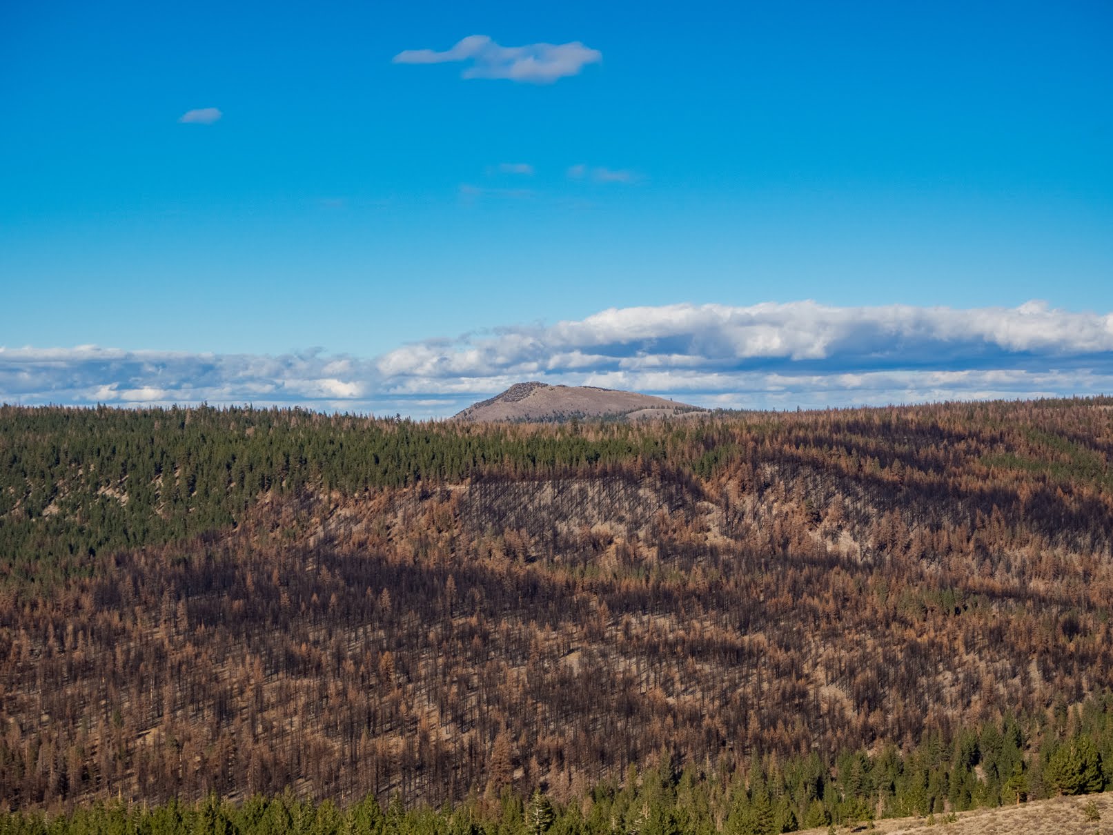
A scenery photo of forest, burned forest, mountain, and clouds. The photo was shot at Bald Mountain Lookout on Bald Mountain in the Inyo National Forest.

A scenery photo of Eastern Sierras and Mammoth Yosemite Airport (left). The photo was shot at Bald Mountain Lookout on Bald Mountain in the Inyo National Forest.

After Bald Mountain, we went to Virginia Lakes in the Humboldt-Toiyabe National Forest (cellphone photos only), and then drove home via State Route 108 (Sonora Pass).

This is all the photos for today. I hope you have enjoyed viewing the photos! Please don't forget to share the blog post with your friends and family members! Also, if you want to get notifications when I post up more photos, "Like" us on Facebook or follow me on Instagram. These links can also be found on the top of the right sidebar.

Parts: 

Cellphone: Part 1 | Part 2 | Part 3

Olympus: Part 1 | Part 2

Canon: Part 1 | Part 2

Copyright Warning: These photos are some of my best and most popular works of art. Unauthorized usage and reproductions are strictly prohibited. Please contact me here to purchase prints and negotiate photo licenses.

Wednesday, March 12, 2014

Lassen Volcanic National Park (Part 2) - California, USA

From 7/17/2013 to 8/2/2013, I took a road trip from the SF Bay Area to Vancouver, BC, Canada. Half of the trip was spent driving up the west coast. On my trip, I visited many famous places such as Seattle, Butchart Gardens, Mount Rainier, and much more. Obviously I got many coastal shots and many places that isn't as famous. The reason I am posting it now is because the high amount of photos I took equaled a high amount of processing time. I took a bit over 2000 photos on the trip. After stitching the panoramas, compositing the HDRs, and picking out photos from the repeats, I have a bit over 1000 photos to show you guys. The photos will be split into parts. I will link you to the previous and next parts on each post just like I did with my Death Valley National Park photos and my Yellowstone/Grand Teton National Park photos. Hope you enjoy viewing this chain of posts!

Full Resolution Photos and Prints: If you want to see full resolution photos or buy prints of any of the photos you see, they are up on my portfolio for viewing. To view my best Lassen Volcanic National Park photos, use this link. To view all of my day 16 photos, use this link.

Next Post >>
<< Previous Post

Today I have part 2 of the photos from Lassen Volcanic National Park in California, USA. Photos from the park was split into 2 parts. In my opinion, Lassen Volcanic National Park feels a bit like a mini-Yellowstone. The park features many geothermal features and a volcano, Lassen Peak. Lassen Peak is the southernmost active volcano in the Cascade Range and the highest point in Lassen Volcanic National Park. The peak is about 5,229 ft (1,594 m) high. One of the most famous places in the park is Bumpass Hell (requires a bit of hiking) which includes many steam vents, mud pots, and hot springs.

Travel Advice: Please note if you are planning to visit this park or similar places (such as Yellowstone), please stay on the designated boardwalks around the geothermal areas! People has been burned alive after falling through the thin crust after going off trail! You have been warned. Also, these places aren't for the weak or frail. I had a headache for 2 days after visiting Lassen Volcanic National Park. I suspect I was mildly poisoned from all the sulfur fumes I breathed down while photographing the geothermal areas. You should try to minimize your exposure to the fumes. These are just advice from me. I am no doctor and all the recommendations are based solely off of personal experience. You follow the advice at your own risk. The photographer can not be held responsible for any injuries or death as result of following these advice.

More sunset photos from Bumpass Hell continuing from the previous post. 
Approximate GPS location (type into Google) according to the Canon GP-E2 GPS Receiver: 40 27 27 N 121 30 07 W 

Approximate GPS location (type into Google) according to the Canon GP-E2 GPS Receiver: 40 27 28 N 121 30 08 W 

Approximate GPS location (type into Google) according to the Canon GP-E2 GPS Receiver: 40 27 26 N 121 30 04 W 

Approximate GPS location (type into Google) according to the Canon GP-E2 GPS Receiver: 40 27 26 N 121 30 04 W 

Approximate GPS location (type into Google) according to the Canon GP-E2 GPS Receiver: 40 27 26 N 121 30 03 W 

Now facing the opposite side of the boardwalk from the photo above, I shoot (in my opinion) one of my best sunset shots ever. 

I wondered how the sunset would look through the steam vent. I took two photos with the sun shining through the steam. 
Approximate GPS location (type into Google) according to the Canon GP-E2 GPS Receiver: 40 27 27 N 121 30 03 W 

More sunset shot from Bumpass Hell. 
Approximate GPS location (type into Google) according to the Canon GP-E2 GPS Receiver: 40 27 28 N 121 30 03 W 

A small hot spring at Bumpass Hell. 
Approximate GPS location (type into Google) according to the Canon GP-E2 GPS Receiver: 40 27 29 N 121 30 03 W 

Approximate GPS location (type into Google) according to the Canon GP-E2 GPS Receiver: 40 27 29 N 121 30 03 W 

A photo of the boardwalk in the area. 

Last photo from Bumpass Hell before I head back as it was getting dark. 
Approximate GPS location (type into Google) according to the Canon GP-E2 GPS Receiver: 40 27 27 N 121 30 06 W 

HDR composition of the sunset at the trail head. I made it out just in time. :)
Approximate GPS location (type into Google) according to the Canon GP-E2 GPS Receiver: 40 27 58 N 121 30 39 W 

Now a few photos from Sulphur Works in the pitch dark night. This is a photo of a mud pot. These photos were taken a bit past dusk and was heavily white balanced to compensate for the blue cast of the night. This is why these photos looks almost like they were taken during the day. 
Approximate GPS location (type into Google) according to the Canon GP-E2 GPS Receiver: 40 26 58 N 121 32 04 W 

Here is another photo from Sulphur Works. 
Approximate GPS location (type into Google) according to the Canon GP-E2 GPS Receiver: 40 26 58 N 121 32 06 W 

These are all the photos for today and for day 16. I hope you have enjoyed viewing them. Next time I will continue with photos from Shasta Lake. Please don't forget to share the blog post with your friends and family members! Also, if you want to get notifications when I post up more photos, "Like" us on Facebook or follow me on Twitter and Instagram. These links can also be found on the top of the right sidebar.

Next Post >>

Tuesday, March 11, 2014

Lassen Volcanic National Park (Part 1) - California, USA

From 7/17/2013 to 8/2/2013, I took a road trip from the SF Bay Area to Vancouver, BC, Canada. Half of the trip was spent driving up the west coast. On my trip, I visited many famous places such as Seattle, Butchart Gardens, Mount Rainier, and much more. Obviously I got many coastal shots and many places that isn't as famous. The reason I am posting it now is because the high amount of photos I took equaled a high amount of processing time. I took a bit over 2000 photos on the trip. After stitching the panoramas, compositing the HDRs, and picking out photos from the repeats, I have a bit over 1000 photos to show you guys. The photos will be split into parts. I will link you to the previous and next parts on each post just like I did with my Death Valley National Park photos and my Yellowstone/Grand Teton National Park photos. Hope you enjoy viewing this chain of posts!

Full Resolution Photos and Prints: If you want to see full resolution photos or buy prints of any of the photos you see, they are up on my portfolio for viewing. To view my best Lassen Volcanic National Park photos, use this link. To view all of my day 16 photos, use this link.

Next Post >>
<< Previous Post

Today I have photos from Lassen Volcanic National Park in California, USA. Photos from this part will be split into 2 parts. In my opinion, Lassen Volcanic National Park feels a bit like a mini-Yellowstone. The park features many geothermal features and a volcano, Lassen Peak. Lassen Peak is the southernmost active volcano in the Cascade Range and the highest point in Lassen Volcanic National Park. The peak is about 5,229 ft (1,594 m) high. One of the most famous places in the park is Bumpass Hell (requires a bit of hiking) which includes many steam vents, mud pots, and hot springs.

Travel Advice: Please note if you are planning to visit this park or similar places (such as Yellowstone), please stay on the designated boardwalks around the geothermal areas! People has been burned alive after falling through the thin crust after going off trail! You have been warned. Also, these places aren't for the weak or frail. I had a headache for 2 days after visiting Lassen Volcanic National Park. I suspect I was mildly poisoned from all the sulfur fumes I breathed down while photographing the geothermal areas. You should try to minimize your exposure to the fumes. These are just advice from me. I am no doctor and all the recommendations are based solely off of personal experience. You follow the advice at your own risk. The photographer can not be held responsible for any injuries or death as result of following these advice.

First stop, Manzanita Lake inside Lassen Volcanic National Park near the entrance. 
Approximate GPS location (type into Google) according to the Canon GP-E2 GPS Receiver: 40 32 15 N 121 34 14 W 

 Next photo is near Hot Rock also pretty close to the entrance. At Hot Rock, you can see a giant rock that fell out of the volcano... The lighting wasn't so good at the time, so I decided to get a shot of the forest behind it instead. 
Approximate GPS location (type into Google) according to the Canon GP-E2 GPS Receiver: 40 32 06 N 121 29 26 W 

This is not Hot Rock but was at a view point near there. I think this was another volcanic rock that came out during an eruption. Can't remember too well. Gotta start taking notes in the field. HAHA
 Approximate GPS location (type into Google) according to the Canon GP-E2 GPS Receiver: 40 30 59 N 121 27 56 W 

Scenery inside the park. 
  Approximate GPS location (type into Google) according to the Canon GP-E2 GPS Receiver: 40 31 00 N 121 27 56 W 

 Still in that view point from the big rock above. I think these are a type of obsidian. Not too sure. 
 Approximate GPS location (type into Google) according to the Canon GP-E2 GPS Receiver: 40 30 57 N 121 27 59 W 

I now move away from the view point above and go to Summit Lake. The water was cold as usual. Not sure how those people are managing to swim in the lake...
  Approximate GPS location (type into Google) according to the Canon GP-E2 GPS Receiver: 40 29 38 N 121 25 27 W 

 Two photos from Upper Meadow. 
  Approximate GPS location (type into Google) according to the Canon GP-E2 GPS Receiver: 40 227 35 N 121 28 03 W 

 A photo shot near Kings Creek. 
  Approximate GPS location (type into Google) according to the Canon GP-E2 GPS Receiver: 40 28 30 N 121 30 21 W 

This photo is facing the Lassen Peak I was talking about the description at the beginning.  
  Approximate GPS location (type into Google) according to the Canon GP-E2 GPS Receiver: 40 28 30 N 121 30 21 W 

Photo from Lake Helen. 
 Approximate GPS location (type into Google) according to the Canon GP-E2 GPS Receiver: 40 28 02 N 121 30 32 W 

I now begin my hike into Bumpass Hell.
 Approximate GPS location (type into Google) according to the Canon GP-E2 GPS Receiver: 40 27 59 N 121 30 43 W 

 The trail of Bumpass Hell. 
Approximate GPS location (type into Google) according to the Canon GP-E2 GPS Receiver: 40 27 39 N 121 30 30 W 

A arrive at the geothermal area of Bumpass Hell. Here is a steam vent. By the time I got there, it was near sunset. You will see quite some contrast and color differences in the photos shot here. 
Approximate GPS location (type into Google) according to the Canon GP-E2 GPS Receiver: 40 27 27 N 121 30 11 W  

The hot springs in the area. 
Approximate GPS location (type into Google) according to the Canon GP-E2 GPS Receiver: 40 27 27 N 121 30 10 W  

More photos from Bumpass Hell and the steam vents. Same location as above. 

The off flow of the hot springs in the area. 
Approximate GPS location (type into Google) according to the Canon GP-E2 GPS Receiver: 40 27 26 N 121 30 08 W  

These are all the photos for today. I hope you have enjoyed viewing them. Next time I will continue with the rest of my photos from Lassen Volcanic National Park. Please don't forget to share the blog post with your friends and family members! Also, if you want to get notifications when I post up more photos, "Like" us on Facebook or follow me on Twitter and Instagram. These links can also be found on the top of the right sidebar.

Next Post >>