Showing posts with label squirrels. Show all posts

Sunday, May 18, 2025

Monterey, CA & Pacific Grove, CA (Cellphone Photos)

On the 17th May 2025, my parents and I took a trip to Monterey, CA and Pacific Grove, CA. We visited Coast Guard Pier, Monterey State Historic Park, Presidio of Monterey, Lovers Point Park, and more. I took photos on my phone and on my Olympus mirrorless camera, and the photos are split into 2 posts. I hope you enjoy viewing my photos!

Parts: Cellphone Photos | Olympus Photos

This blog post has the cellphone photos I took. The photos are from several locations in Monterey, CA and Pacific Grove, CA including places like Coast Guard Pier, Monterey State Historic Park, Presidio of Monterey, and Lovers Point Park.

Message from the Photographer: Unfortunately my Olympus mirrorless camera's lens failed half way during our day trip this time. Luckily it is just a cheap kit lens, so I have a new one on the way. It would seem the internal motor failed in the lens (camera body is fine). Probably the first message you've seen that didn't involve Long COVID (LC)! However there is a little update on my health as well. My LC doctor and I are trying different doses of Low Dose Naltrexone (LDN) to see which dose works the best. I am by no means back to normal as the COVID infection left me with quite a number of health problems, however the LDN is helping me with energy to a certain extent at the cost of side effects.

Since we hit Monterey, CA first, we parked at Presidio of Monterey and walked a loop around the coastal wharf areas. I first checked out the museum at the presidio, and also the Sloat Monument (no photos). After that we walked over to San Carlos Beach and Coast Guard Pier.

A photo of sea lions on rocks. The photo was shot at Coast Guard Pier in Monterey, CA.

A photo of sea lions on rocks. The photo was shot at Coast Guard Pier in Monterey, CA.

A photo of sea lions on rocks. The photo was shot at Coast Guard Pier in Monterey, CA.

Then we walked along the Monterey Peninsula Recreational Trail, and looped over to California's First Theater in Monterey State Historic Park.

A scenery photo of the garden behind California's First Theatre in Monterey State Historic Park in Monterey, CA.

A photo California's First Theatre in Monterey State Historic Park in Monterey, CA.

Next we started walking back toward Presidio of Monterey, CA to get back to our car.

A photo of the monument at the Vizcaíno Serra Landing Site. The photo was shot on Pacific Street (near Presidio of Monterey) in Monterey, CA.

After we got back to Presidio of Monterey, I ate the burrito I bought earlier in Sand City, CA. I was starving at this point.

A photo of the Junipero Serra Monument at the Presidio of Monterey in Monterey, CA.

After my parents and I finished our lunch, we headed to the location in Pacific Grove, CA that my father wanted to visit, Lovers Point Park. Due to long COVID, I was moderately tired at this point so I mostly rested in the car, until this "friendly" seagull decided to interrupt my nap.

A photo of the seagull that pooped on our car, along with Monterey Bay Coastal Trail on the right. The photo was shot on Ocean View Blvd (near Lovers Point Beach) in Pacific Grove, CA.

A photo of the seagull that pooped on our car, along with Monterey Bay Coastal Trail on the right. The photo was shot on Ocean View Blvd (near Lovers Point Beach) in Pacific Grove, CA.

A photo of the seagull that pooped on our car, along with Monterey Bay Coastal Trail on the right. The photo was shot on Ocean View Blvd (near Lovers Point Beach) in Pacific Grove, CA.

Maybe you can guess what happened after. I was napping in the passenger seat when this thing landed on our vehicle. It quickly occurred to me that the seagull will want to poop on our vehicle. I tried to shoo it away however it didn't budge. I think the seagulls around this area are used to humans as there are way too many. Anyways, the seagull looked at me dead in the eyes and let it rip. 😑 You can see the clear streak underneath the bird in the first photo.

I didn't get much of a nap after that seagull encounter, plus I had to use the bathroom. I took a small walk around the Lovers Point Park area. The parking spaces in this area is very tight, I had to climb over to the driver's seat before I could get out, as the passenger side door is blocked in.

A photo of Monterey Bay, Pacific Grove, flowers, and clouds. The photo was shot at Lovers Point Park in Pacific Grove, CA.

A photo of squirrels and a seagull. The photo was shot at Lovers Point Park in Pacific Grove, CA.

A photo of squirrels and seagulls. The photo was shot at Lovers Point Park in Pacific Grove, CA.

A photo of Monterey Bay, Pacific Grove, flowers, and clouds. The photo was shot on the trail by Ocean View Blvd in Pacific Grove, CA.

This is all the photos for today. I hope you have enjoyed viewing the photos! Please don't forget to share the blog post with your friends and family members! Also, if you want to get notifications when I post up more photos, "Like" us on Facebook or follow me on Instagram. These links can also be found on the top of the right sidebar.

Parts: Cellphone Photos | Olympus Photos

Friday, May 12, 2023

Morgan Territory & Los Vaqueros Reservoir (Cellphone Photos)

Yesterday, on 11 May 2023, my mom and I took short hike through Morgan Territory Regional Preserve in Livermore, CA and walked a short distance into Los Vaqueros Watershed in Contra Costa County, CA. I took photos with my cellphone. I hope you enjoy viewing my photos!

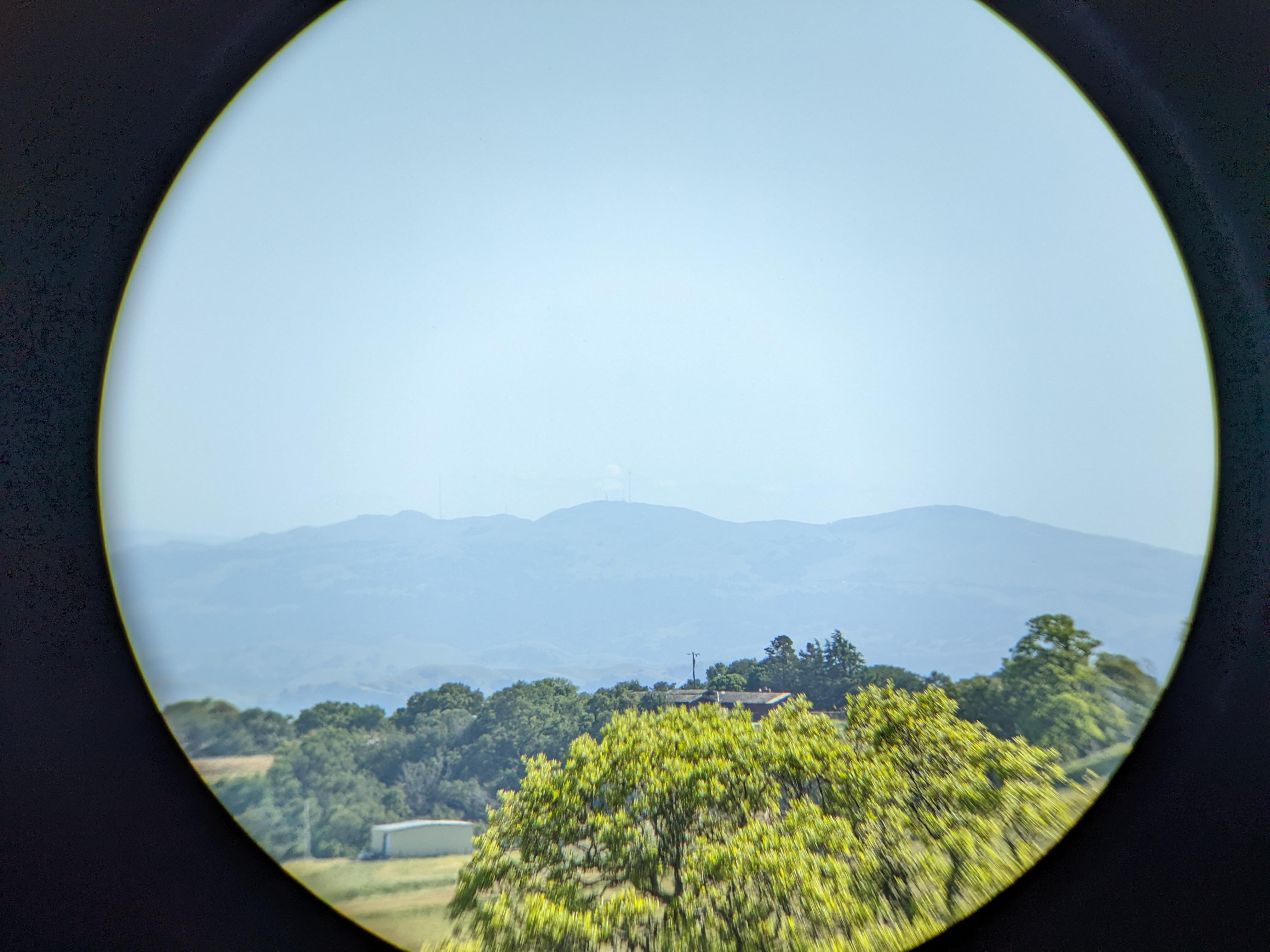
One of the main purposes of my trip today was to test my new Vanguard BA-195 Binocular Tripod Adapter (Product Link - Affiliate Link). The binoculars I used was the Bushnell Engage X 10x42mm Binoculars (Product Link - Affiliate Link). The Vanguard binocular tripod adapter performed very well and the set up didn't wobble at all. The most issue I had was with my binoculars rotating a tiny bit on the mount, but you really can't blame it as it is mounted by a screw. This is way better than the first binocular tripod adapter I got (which I had returned), the Staoptics Binocular Tripod Adapter with Quick Release (Product Link - Affiliate Link). Not only did the Staoptics adapter have an extra long screw which was too long for my Bushnell binoculars, my binoculars just kept rotating and wobbling on the mount. I used the Staoptics one for a little over a week before I returned it. If you're looking for a quality binocular tripod adapter, go with the Vanguard BA-195 Binocular Tripod Adapter (Product Link - Affiliate Link). I used Vanguard tripods for many years for my photography, and they are a brand I trust. If I had known Vanguard makes binocular tripod mounts, I would have went directly with theirs instead of messing around with other brands.

A photo shot through my binoculars.
A photo of Mt. Allison (center), Mission Peak (right), trees, a house, and a storage shed. The photo was shot on Whipsnake Trail in Morgan Territory Regional Preserve in Livermore, CA.
Binoculars Used: Bushnell Engage X 10x42mm Binoculars (Product Link - Affiliate Link)

A photo shot through my binoculars.
A photo of Sunol Peak (center), a green hill, and trees. The photo was shot on Whipsnake Loop Trail in Los Vaqueros Watershed in Contra Costa County, CA.
Binoculars Used: Bushnell Engage X 10x42mm Binoculars (Product Link - Affiliate Link)

A photo shot through my binoculars.
A photo of Stockton, CA and farms. The photo was shot near Whipsnake Loop Trail in Los Vaqueros Watershed in Contra Costa County, CA.
Binoculars Used: Bushnell Engage X 10x42mm Binoculars (Product Link - Affiliate Link)

A photo shot through my binoculars.
A photo of Stockton, CA and farms. The photo was shot near Whipsnake Loop Trail in Los Vaqueros Watershed in Contra Costa County, CA.
Binoculars Used: Bushnell Engage X 10x42mm Binoculars (Product Link - Affiliate Link)

A scenery photo of Los Vaqueros Reservoir (foreground), Clifton Court Forebay (in the distance on the left), windmills & Tracy, CA (right), and trees. The photo was shot near Whipsnake Loop Trail in Los Vaqueros Watershed in Contra Costa County, CA.

A photo shot through my binoculars.
A photo of two black tailed deer, green hill, and trees. The photo was shot near Whipsnake Trail in Morgan Territory Regional Preserve in Livermore, CA.
Binoculars Used: Bushnell Engage X 10x42mm Binoculars (Product Link - Affiliate Link)

A photo shot through my binoculars.
A photo of a black tailed deer, green hill, and trees. The photo was shot near Whipsnake Trail in Morgan Territory Regional Preserve in Livermore, CA.
Binoculars Used: Bushnell Engage X 10x42mm Binoculars (Product Link - Affiliate Link)

A photo shot through my binoculars.
A photo of two black tailed deer, green hill, and trees. The photo was shot near Whipsnake Trail in Morgan Territory Regional Preserve in Livermore, CA.
Binoculars Used: Bushnell Engage X 10x42mm Binoculars (Product Link - Affiliate Link)

A photo shot through my binoculars.
A photo of two black tailed deer, green hill, and trees. The photo was shot near Whipsnake Trail in Morgan Territory Regional Preserve in Livermore, CA.
Binoculars Used: Bushnell Engage X 10x42mm Binoculars (Product Link - Affiliate Link)

A photo shot through my binoculars.
A photo of a squirrel and grass. The photo was shot near Whipsnake Trail in Morgan Territory Regional Preserve in Livermore, CA.
Binoculars Used: Bushnell Engage X 10x42mm Binoculars (Product Link - Affiliate Link)

A photo shot through my binoculars.
A photo of a squirrel and grass. The photo was shot near Whipsnake Trail in Morgan Territory Regional Preserve in Livermore, CA.
Binoculars Used: Bushnell Engage X 10x42mm Binoculars (Product Link - Affiliate Link)

This is all the photos for today. I hope you have enjoyed viewing the photos! Please don't forget to share the blog post with your friends and family members! Also, if you want to get notifications when I post up more photos, "Like" us on Facebook or follow me on Instagram. These links can also be found on the top of the right sidebar.

Friday, April 14, 2017

Birds & Squirrels - Arroyo Del Valle Trail - Pleasanton, CA

On March 12th, 2017, I took a walk along Arroyo Del Valle Trail in Pleasanton, CA and took some photos of squirrels and birds. Here are the bird and squirrel photos I shot that day. A travel vlog was shot during March too and it can be viewed here.

Full Resolution Photos: If you want to see full resolution photos of any of the photos you see here, use the following links. If you wish to purchase prints of any of the photos, please contact me here. To view my best 2016 to 2017 Pleasanton, CA photos, use this link. To my best wildlife photos, use this link. To view all of my 2017 photos shot in Pleasanton, CA, use this link.

A squirrel napping on a tree branch. 

Black and white process of the photo above. 

The position it was lying in was so cute I had to shoot off another few shots. 

Black and white process of the photo above. 

Another photo of the squirrel napping on the branch. I think it noticed my camera. :) 

 Black and white process of the photo above.

 Western Scrub Jay (Aphelocoma californica)

Black and white process of the photo above. 

 Mallard Ducks (Anas platyrhynchos)

 Oak Titmouse (Baeolophus inornatus)

Black and white process of the photo above. 

Oak Titmouse (Baeolophus inornatus

 Black and white process of the photo above.

A squirrel eating something on a tree. 

Black and white process of the photo above. 

A squirrel eating something on a tree. 

Black and white process of the photo above.

This is all the photos for today. I hope you have enjoyed the photos! A travel vlog was shot during March too and it can be viewed here. Please don't forget to share the blog post with your friends and family members! Also, if you want to get notifications when I post up more photos, "Like" us on Facebook or follow me on Twitter and Instagram. These links can also be found on the top of the right sidebar.

Thursday, September 10, 2015

Muir Woods National Monument - Mill Valley, CA (9-3-2015)

On 9-3-2015 I took a walk and hike through Muir Woods National Monument in Mill Valley, CA. This park is famous for its Coast Redwood (Sequoia sempervirens) trees. I took many forest scenery photos along with a few chipmunk photos. In this blog post, I will show you the photos I took in the park.

Full Resolution Photos: If you want to see full resolution photos of any of the photos you see here, use the following links. If you wish to purchase prints of any of the photos, please contact me here. To view my best Muir Woods National Monument photos, use this link. To see all of my photos from this trip, use this link.

A photo of a bridge across the creek in the park. 
Approximate GPS location (type into Google) according to the Canon GP-E2 GPS Receiver: 37 53 36 N 122 34 24 W 

A photo shot toward the canopy of the forest from the bottom. As you can see the Coast Redwood (Sequoia sempervirens) trees are very tall. 
Approximate GPS location (type into Google) according to the Canon GP-E2 GPS Receiver: 37 53 40 N 122 34 30 W 

Another photo of a bridge leading over the creek. 
Approximate GPS location (type into Google) according to the Canon GP-E2 GPS Receiver: 37 53 44 N 122 34 31 W  

A photo of the creek.  
Approximate GPS location (type into Google) according to the Canon GP-E2 GPS Receiver: 37 53 52 N 122 34 31 W

Another photo of the creek. 
Approximate GPS location (type into Google) according to the Canon GP-E2 GPS Receiver: 37 53 52 N 122 34 31 W  

Approximate GPS location (type into Google) according to the Canon GP-E2 GPS Receiver: 37 53 55 N 122 34 34 W  

Another photo of the tall Coast Redwood (Sequoia sempervirens) trees. 
Approximate GPS location (type into Google) according to the Canon GP-E2 GPS Receiver: 37 53 55 N 122 34 34 W  

A photo of the bottom of the forest.  
Approximate GPS location (type into Google) according to the Canon GP-E2 GPS Receiver: 37 54 04 N 122 34 49 W

A trail through the woods. 
Approximate GPS location (type into Google) according to the Canon GP-E2 GPS Receiver: 37 54 07 N 122 35 11 W  

Another photo of the creek in the park. 
Approximate GPS location (type into Google) according to the Canon GP-E2 GPS Receiver: 37 53 46 N 122 34 31 W  

A photo of the walking trail through the park. 
Approximate GPS location (type into Google) according to the Canon GP-E2 GPS Receiver: 37 53 40 N 122 34 31 W   

A black and white process of the photo above.  

 It has been years since I posted a photo of myself on here. So here is me dressed in pink! Sunny, the photographer behind this blog! Of course I had to get photos of myself in the woods. :) Photo shot with a Canon Speedlite 600EX-RT and a wireless remote shutter release.

At the end of my trip, I decided to get some chipmunk photos after I saw a few running around.  

A black and white process of the photo above.   

Another photo of a chipmunk.  

A black and white process of the photo above.   

Another photo of a chipmunk.  

A black and white process of the photo above.  

This is all the photos for today! I hope you have enjoyed viewing the photos! Please don't forget to share the blog post with your friends and family members! Also, if you want to get notifications when I post up more photos, "Like" us on Facebook or follow me on Twitter and Instagram. These links can also be found on the top of the right sidebar.

Copyright Warning: These photos are some of my most popular works of art. Unauthorized usage and reproductions are strictly prohibited. Please contact me here to purchase prints and negotiate photo licenses.