Showing posts with label sr-89. Show all posts

Saturday, November 1, 2025

Hope Valley (Part 3) - Humboldt-Toiyabe National Forest

On the 17 October 2025, my parents and I took a trip Eldorado National Forest, Humboldt-Toiyabe National Forest, and Lake Tahoe. We drove on State Route 88, State Route 89, and then to Lake Tahoe before circling back to the SF Bay via State Route 80. I went there to see aspen autumn foliage and the small amount of snow in the mountains. It was beautiful. I took photos with my phones, and the photos are split into 4 posts. I hope you enjoy viewing my photos!

Message from the Photographer: This is the first Sierra Nevada trip since I caught COVID. I got hit with the worst altitude sickness ever. I have been wanting to go for 2 years now, but did not dare due to the amount of respiratory issues I've had with Long COVID. I decided to take a risk this time and paid for it hard. Unfortunately my health is nowhere near where it was before the COVID infection, and there is no end in sight for Long COVID. (More information at the end of the blog post.)

Parts: 1 | 2 | 3 | 4 

This blog post are photos from State Route 88 and State Route 89 in Humboldt-Toiyabe National Forest in California. Photos are from Hope Valley and most of them are of aspen autumn foliage. I dropped by Picketts Junction and Desolation Hotel Hope Valley.

 A scenery photo of Hope Valley, Pickett Peak, Hawkins Peak, forest, and snow. The photo was shot on the side of State Route 88.

A scenery photo of Hope Valley, aspen autumn foliage, Waterhouse Peak (right), aspen trees, pine trees, forest, and snow. The photo was shot on the side of State Route 88.

A scenery photo of Hope Valley, aspen autumn foliage, Waterhouse Peak (right), aspen trees, pine trees, forest, and snow. The photo was shot on the side of State Route 88.

A scenery photo of Hope Valley, aspen autumn foliage, Waterhouse Peak, aspen trees, pine trees, forest, and snow. The photo was shot on the side of State Route 88.

A scenery photo of Hope Valley, aspen autumn foliage, Waterhouse Peak (right), aspen trees, pine trees, and forest. The photo was shot on the side of State Route 88.

A scenery photo of Hope Valley, Freel Peak, Jobs Sister, Jobs Peak, State Route 88, snow, and forest.

A photo of Hope Valley, snowy mountain, aspen autumn foliage (right), and State Route 88.

Next up is Desolation Hotel Hope Valley (14255 CA-88, Hope Valley, CA 96120), which used to be called Sorensen's Resort. I've heard a lot about this hotel and it's pretty aspen trees during autumn, and on this trip, I finally got to see it. It is a beautiful hotel.

A scenery photo of aspen autumn foliage, Desolation Hotel Hope Valley, car park, cars, cabins, aspen trees, and pine trees.

A scenery photo of aspen autumn foliage, Desolation Hotel Hope Valley, snow, aspen trees, and cabins.

A scenery photo of aspen autumn foliage, Desolation Hotel Hope Valley, snow, aspen trees, pond, cabin, mountains, and pine trees.

A scenery photo of aspen autumn foliage, Desolation Hotel Hope Valley, snow, aspen trees, cabins, and pine trees.

A scenery photo of aspen autumn foliage, Desolation Hotel Hope Valley, aspen trees, and cabins.

A photo of bear art at Desolation Hotel Hope Valley. Also in the photo are aspen autumn foliage, aspen trees, pine trees, and cabins.

A photo of bear art at Desolation Hotel Hope Valley. Also in the photo are aspen trees, pine trees, and cabins.

A scenery photo of Hope Valley, aspen autumn foliage, aspen trees, pine trees, and mountains. The photo was taken on the side of State Route 88 near Desolation Hotel Hope Valley.

A scenery photo of Desolation Hotel Hope Valley, aspen autumn foliage, State Route 88, aspen trees, pine trees, car park, cars, and cabins.

A scenery photo of Hope Valley, aspen autumn foliage, aspen trees, pine trees, and mountains. The photo was taken on the side of State Route 88 near Desolation Hotel Hope Valley.

A scenery photo of aspen autumn foliage, Desolation Hotel Hope Valley, State Route 88, aspen trees, pine trees, and cabins.

A scenery photo of Hope Valley, mountains, forest, power lines, and snow. The photo was shot at the intersection of Carson River Road and State Route 88 in Alpine Village, CA.

A scenery photo of Hope Valley, State Route 88, mountains, forest, power lines, and snow. The photo was shot near the intersection of Carson River Road and State Route 88 in Alpine Village, CA.

We turned around at Carson River Road, and headed towards Lake Tahoe. We stopped by Picketts Junction for photos.

A scenery photo of Freel Peak, Jobs Sister, Jobs Peak, aspen autumn foliage (left), State Route 88 (left), forest, and snow. The photo was shot near Picketts Junction at the intersection of State Route 88 and State Route 89.

A scenery photo of Picketts Peak (center), West Fork Carson River, State Route 88 (in the distance), State Route 89 (right), Picketts Junction (right), snow, and forest. The photo was shot near Picketts Junction at the intersection of State Route 88 and State Route 89.

This is all the photos for today. I hope you have enjoyed viewing the photos! Next time I will have sunset photos from Eagle Rock at Lake Tahoe Basin Management Unit in California. Please don't forget to share the blog post with your friends and family members! Also, if you want to get notifications when I post up more photos, "Like" us on Facebook or follow me on Instagram. These links can also be found on the top of the right sidebar.

Full Altitude Sickness Story: This was my first trip into the Sierra Nevada mountains since COVID-19 infection in November 2023. I got hit with the worst altitude sickness ever, and it went beyond anything I had expected or experienced before. At 6000ft (1800m), I start feeling affects of altitude what I used to get at 8500ft (2600m). By the time we got up to 8000ft (2400m), I was dealing with air hunger, a bad throbbing headache, nearly lost my lunch (swallowed it back a few times), a really wet cough, and severe dizziness that didn't go away even sitting down. Blood O2 was a persistent 85%-90%. 7000ft (2130m) wasn't much better, but blood O2 was around 87%-93%. Around 6300ft (1900m), I was able to maintain a persistent 95% O2, but my heart rate was very fast, and the air hunger was pretty bad. My body was resisting me very badly up there, however I was pretty happy getting to see snow and autumn foliage again. I most likely won't be doing another trip into the Sierras unless I can get oxygen.

Parts: 1 | 2 | 3 | 4 

Wednesday, December 21, 2022

Eldorado & Humboldt-Toiyabe NF (Cellphone Photos) - California

On 19 December 2022, my parents and I took a day trip to Eldorado National Forest and Humboldt-Toiyabe National Forest to see snow. We mostly drove along State Route 88 and then a short section of State Route 89. The photos are split into 2 blog posts. I hope you enjoy viewing my photos!

Parts: Cellphone Photos | Olympus Photos

These are the photos I took on my cellphone. The photos are from both Eldorado National Forest and Humboldt-Toiyabe National Forest. The photos were shot at Peddler Hill Scenic Viewpoint, Shot Rock Vista Overlook, Silver Lake, Caples Lake, Red Lake, Hope Valley, Picketts Junction, and more.

The first national forest we arrive at is Eldorado National Forest.

A scenery photo of Lower Bear River Reservoir, snow, mountains, forest, and clouds. The photo was shot at Peddler Hill Scenic Viewpoint in the Eldorado National Forest.

A scenery photo of snow, mountains, forest, and clouds. The photo was shot at Peddler Hill Scenic Viewpoint in the Eldorado National Forest.

A scenery photo of snow, mountains, forest, and clouds. The photo was shot at Shot Rock Vista Overlook in the Eldorado National Forest.

Travel Tip: You will need snowshoes to access Shot Rock Vista Overlook when it is covered with this much snow. If you don't have snowshoes, you will sink. Please also know that it is a bit dangerous as there are bushes and boulders buried under snow that is not visible. If you step on them, you will sink. I broke through the thin layer of snow and ice above a bush one time on my walk over to the view point.

A scenery photo of snow, mountains, forest, and clouds. The photo was shot at Shot Rock Vista Overlook in the Eldorado National Forest.

A scenery panorama of snow, mountains, forest, and clouds. The orange you see on the right is not because of sunset. There was actually heavy smog in Central Valley, which caused that orange glow. The photo was shot at Shot Rock Vista Overlook in the Eldorado National Forest.

A scenery photo of snow, mountains, forest, and clouds. The photo was shot on the side of State Route 88 in the Eldorado National Forest.

A scenery photo of Silver Lake, Treasure Island, snow, mountains, forest, and clouds. The photo was shot on Plasse Road in the Eldorado National Forest.

A scenery photo of Caples Lake, snow, mountains, forest, and clouds. The photo was shot on the side of State Route 88 in the Eldorado National Forest.

After Caples Lake, we drove past Carson Pass and crossed into the Humboldt-Toiyabe National Forest.

A scenery photo of Red Lake, Hawkins Peak (in the distance), snow, mountains, forest, and clouds. The photo was shot at Red Lake Vista Point on the side of State Route 88 in the Humboldt-Toiyabe National Forest.

A scenery photo of snow, mountains, forest, and clouds. The photo was shot at Red Lake Vista Point on the side of State Route 88 in the Humboldt-Toiyabe National Forest.

A scenery photo of Elephants Back (in the distance), snow, mountains, forest, and clouds. The photo was shot at Red Lake Vista Point on the side of State Route 88 in the Humboldt-Toiyabe National Forest.

A scenery photo of Red Lake, Red Lake Peak, snow, mountains, forest, and clouds. The photo was shot on Red Vista Road in the Humboldt-Toiyabe National Forest.

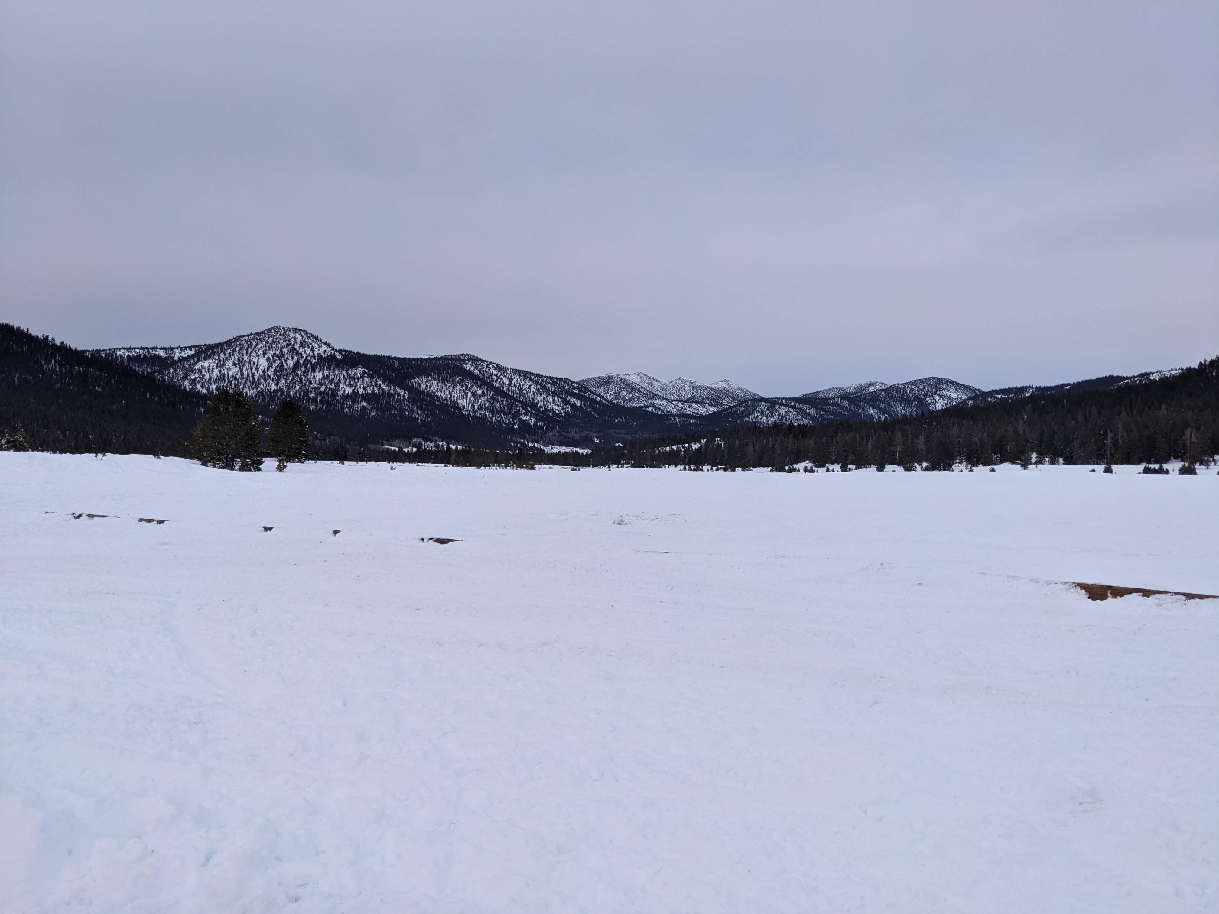
A scenery photo of Pickett Peak (left), Hawkins Peak (right), snow, mountains, forest, and clouds. The photo was shot at Hope Valley Sno-Park in the Humboldt-Toiyabe National Forest.

A scenery photo of snow, mountains, forest, and clouds. In the photo in the center are Freel Peak, Jobs Sister, and Jobs Peak (in the center). The photo was shot at Hope Valley Sno-Park in the Humboldt-Toiyabe National Forest.

A scenery photo of Pickett Peak, snow, mountains, forest, and clouds. The photo was shot at Picketts Junction near Burnside Road in the Humboldt-Toiyabe National Forest.

A scenery photo of snow, mountains, forest, and clouds. In the photo on the left is Waterhouse Peak. In the photo on the right are Freel Peak, Jobs Sister, and Jobs Peak. The photo was shot at Picketts Junction near Burnside Road in the Humboldt-Toiyabe National Forest.

A scenery photo of Waterhouse Peak, snow, mountains, forest, and clouds. The photo was shot on the side of State Route 89 in the Humboldt-Toiyabe National Forest.

A scenery photo of Pickett Peak, State Route 89 (right), snow, mountains, forest, and clouds. The photo was shot in the Humboldt-Toiyabe National Forest.

This is all the photos for today. I hope you have enjoyed viewing the photos! Please don't forget to share the blog post with your friends and family members! Also, if you want to get notifications when I post up more photos, "Like" us on Facebook or follow me on Instagram. These links can also be found on the top of the right sidebar.

Parts: Cellphone Photos | Olympus Photos

Friday, August 16, 2019

Red Lake & Picketts Junction (Part 5) - Humboldt-Toiyabe National Forest

On March 16th and April 13th, I took 2 separate trips to Eldorado National Forest and Humboldt-Toiyabe National Forest traveling on State Route 88 and a tiny bit of State Route 89. I took many photos while I was there of the snowy winter scenery and I am here to show you. I hope you enjoy viewing the photos.

Full Resolution Photos: If you want to see full resolution photos of any of the photos you see here, use the following links. If you wish to purchase prints of any of the photos, please contact me here. To see my best photos from Eldorado National Forest and Humboldt-Toiyabe National Forest, use this link. To see all of my photos from this trip, use this link.

Parts: 1 | 2 | 3 | 4 | 5 | 6 | 7 | 8

This is part 5 of my photos. The photos are shot on April 13th. The photos are from Red Lake and near Picketts Junction in Humboldt-Toiyabe National Forest.

A snowy scenery photo of Red Lake and Red Lake Peak shot near Red Vista Road.
Approximate GPS location (type into Google): 38° 41' 57" N 119° 58' 05" W

Black and white process of the photo above.

A snowy scenery photo of Red Lake shot near Red Vista Road. Photo shot near the same spot as above.

 Black and white process of the photo above.

A snowy scenery photo of mountains shot near Red Vista Road. Photo shot near the same spot as above.
Approximate GPS location (type into Google): 38° 41' 57" N 119° 58' 04" W

A snowy scenery photo of Red Lake shot near Red Vista Road.
Approximate GPS location (type into Google): 38° 41' 58" N 119° 58' 05" W

 Black and white process of the photo above.

A snowy scenery photo of West Fork Carson River shot near Picketts Junction at the Intersection of State Route 88 and State Route 89.
Approximate GPS location (type into Google): 38° 46' 43" N 119° 55' 07" W

Black and white process of the photo above.

A snowy scenery photo of Picketts Peak (center) and West Fork Carson River shot near Picketts Junction at the Intersection of State Route 88 and State Route 89.
Approximate GPS location (type into Google): 38° 46' 42" N 119° 55' 07" W

Black and white process of the photo above.

A snowy scenery photo of Picketts Peak (center) and West Fork Carson River shot near Picketts Junction at the Intersection of State Route 88 and State Route 89. Photo shot near the same spot as above.

 Black and white process of the photo above.

A snowy scenery photo of West Fork Carson River shot near Picketts Junction at the Intersection of State Route 88 and State Route 89.
Approximate GPS location (type into Google): 38° 46' 43" N 119° 55' 06" W

Black and white process of the photo above.

A snowy scenery photo of West Fork Carson River  and State Route 89 bridge shot near Picketts Junction at the Intersection of State Route 88 and State Route 89.
Approximate GPS location (type into Google): 38° 46' 40" N 119° 55' 08" W

Black and white process of the photo above.

A snowy scenery photo of West Fork Carson River, Freel Peak, Jobs Sister, and Jobs Peak shot near Picketts Junction at the Intersection of State Route 88 and State Route 89.
Approximate GPS location (type into Google): 38° 46' 41" N 119° 55' 08" W

Black and white process of the photo above.

This is all the photos for today! I hope you have enjoyed viewing the photos! Next time I have more of my photos from April 13th in Humboldt-Toiyabe National Forest in California shot near Hope Valley Sno-Park. Please don't forget to share with your the blog post friends and family members! Also, if you want to get notifications when I post up more photos, "Like" us on Facebook or follow me on Twitter and Instagram. These links can also be found on the top of the right sidebar.

Parts: 1 | 2 | 3 | 4 | 5 | 6 | 7 | 8