Showing posts with label lee vining. Show all posts

Saturday, December 3, 2022

Lee Vining, Inyo NF, Mono County (Canon Pt. 1) - Mammoth Lakes Trip

My parents and I spent 2 nights at Mammoth Lakes, CA between October 21 to October 23 in 2022. We explored Yosemite National Park, Inyo National Forest, Mono County, and Humboldt-Toiyabe National Forest in California enjoying the scenery and autumn foliage. I took photos with my phone, my Olympus mirrorless camera, and my Canon EOS 5D Mark III camera. The photos will be split into several blog posts. I hope you enjoy viewing my photos! 

High Resolution Photos: If you want to see high resolution photos of any of the photos you see here, use the following links. If you wish to purchase prints of any of the photos, please contact me here. To view my best Inyo National Forest & Mono County photos from 2019 to 2022, use this link. To view my best sunset and night photography photos from 2019 to 2022, use this link. To see all of my photos from Inyo National Forest & Mono County on this trip, use this link.

Parts: 

Cellphone: Part 1Part 2 | Part 3

Olympus: Part 1 | Part 2

Canon: Part 1 | Part 2

This is part 1 of the photos that were shot on my Canon DSLR. The photos are from Lee Vining, CA, Inyo National Forest in California, and Mono County, CA. The photos are from Mono Lake Vista Point, Hot Creek Geological Site, Lake Crowley, and more. 

This blog post contains photos I took on day 1 and 2. On day 1, we drove to Mammoth Lakes, CA from the SF Bay Area via State Route 120 through Yosemite National Park.

I only took photos in Yosemite National Park with my cellphone and my Olympus mirrorless camera, so I first start off this blog post (Canon DSLR photos) with night time high ISO long exposure photos from Mono Lake Vista Point in Lee Vining, CA. If you have been following me, you'll know my vision has been partially fixed by an experimental treatment (Visual Imagery Project by the Visual Snow Initiative). I have recovered around 50% of my night vision, and my day time vision is mostly back to normal. I still can't drive at night, and my parents do assist me somewhat with these night photography photos. I'm very happy to be able to start back up on night photography somewhat. I really hope you enjoy viewing these photos because it is still quite a hassle for me (needing my parents' assistance, along with a lot of trial and error) to take these photos as I still can't see very well at night.

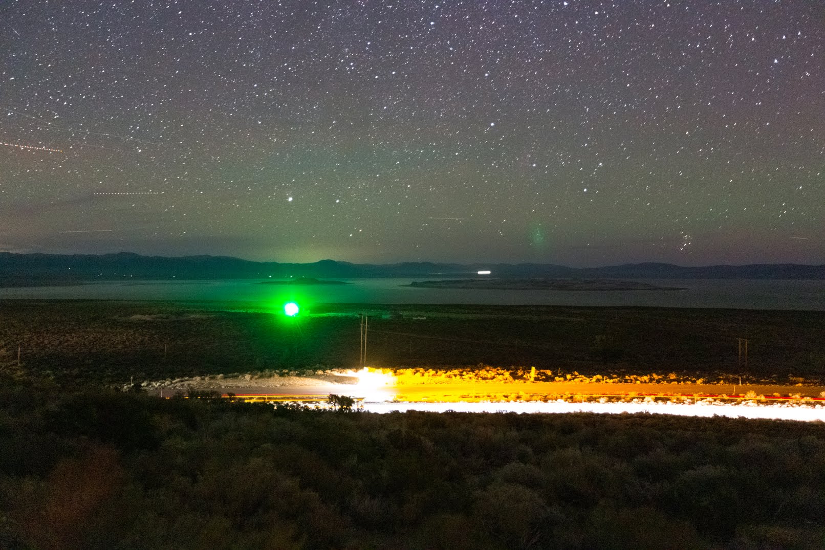
Two high ISO long exposure scenery photos of stars, Mono Lake, Negit Island (left), Paoha Island (right), and US-395 (bottom). I think the green dot on the left was from a lighthouse. The photo was shot at Mono Lake Vista Point in Lee Vining, CA.
Approximate GPS location (type into Google): 37° 56' 53" N 119° 06' 37" W

Two high ISO long exposure scenery photos of the Milky Way. The photo was shot at Mono Lake Vista Point in Lee Vining, CA. Unfortunately due to how sensitive the camera sensor is, it picked up some of the green light from that lighthouse at Mono Lake.
Approximate GPS location (type into Google): 37° 56' 53" N 119° 06' 37" W

Next up are the day 2 photos. On day 2 we explored Mammoth Lakes, CA (cellphone photos only), Hot Creek Geologic Site (Olympus Mirrorless & cellphone photos only), Wild Willy's Hot Springs, Lake Crowley, and Convict Lake.

It was snowing quite heavily in Mammoth Lakes, CA on day 2 of our trip, so our family traveled out into the desert. The next few photos are from our drive to Hot Creek Geologic Site in the Inyo National Forest.

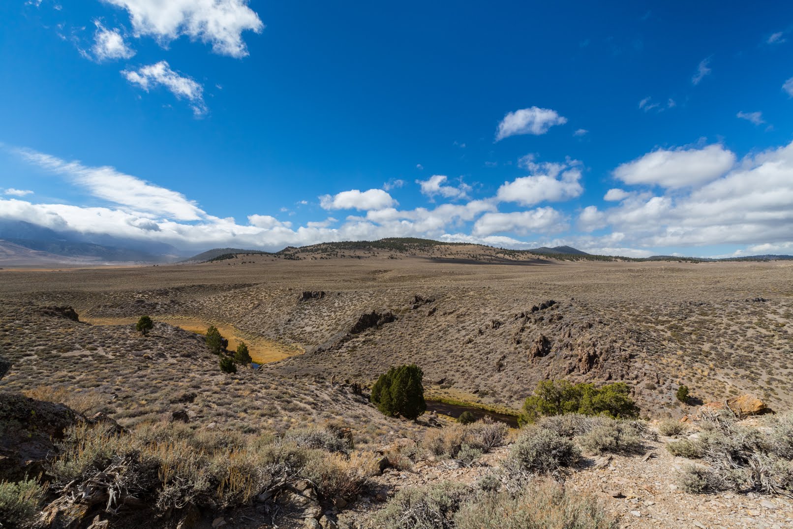
A scenery photo of clouds, desert, Hot Creek, and the Eastern Sierras (left). The photo was shot near Hot Creek Hatchery Road in the Inyo National Forest.
Approximate GPS location (type into Google): 37° 39' 11" N 118° 50' 15" W

A scenery photo of clouds, desert, Glass Mountain Ridge (in the distance), and Hot creek Hatchery Road. The photo was shot in the Inyo National Forest.
Photo shot near the same spot as above.

A black and white process of the photo above.

After we explored Hot Creek Geologic Site (Olympus Mirrorless & cellphone photos only), we went to Wild Willy's Hot Springs in Mono County, CA.

A scenery photo of clouds, desert, Eastern Sierras (in the distance on the left), and Glass Mountain Ridge (right). The photo was shot on Wild Willy's Hot Springs Trail in Mono County, CA.
Approximate GPS location (type into Google): 37° 39' 35" N 118° 46' 07" W

A black and white process of the photo above.

After Wild Willy's Hot Springs, we dropped by Benton Crossing/Owens River Bridge (Olympus Mirrorless photos only), and then went to Lake Crowley in Mono County, CA.

A scenery photo of clouds, desert, Lake Crowley (in the distance), and Eastern Sierras & Owens Gorge Road (left). The photo was shot in the Inyo National Forest.
Approximate GPS location (type into Google): 37° 35' 34" N 118° 41' 15" W

A black and white process of the photo above.

A scenery photo of clouds, desert, Eastern Sierras (in the distance), and Lake Crowley (right). The photo was shot near Owens Gorge Road in the Inyo National Forest.
Approximate GPS location (type into Google): 37° 35' 33" N 118° 41' 15" W

A black and white process of the photo above.

A scenery photo of clouds, desert, dirt roads, Lake Crowley, and Eastern Sierras. The photo was shot near Lake Crowley Eastsid in Mono County, CA.
Approximate GPS location (type into Google): 37° 35' 22" N 118° 42' 22" W

A black and white process of the photo above.

After we finished up at Lake Crowley, we headed to Convict Lake in the Inyo National Forest. We got there just in time for sunset.

A sunset scenery photo of clouds, Convict Lake, and Laurel Mountain. The photo was shot at Brook Trout Lookout in the Inyo National Forest.
Approximate GPS location (type into Google): 37° 35' 37" N 118° 51' 05" W

A black and white process of the photo above.

A sunset scenery photo of clouds, Convict Lake, and Laurel Mountain. The photo was shot on Lakeshore Trail in the Inyo National Forest.
Approximate GPS location (type into Google): 37° 35' 36" N 118° 51' 05" W

A black and white process of the photo above.

A sunset scenery photo of clouds, Convict Lake, and Laurel Mountain. The photo was shot on Fisherman's Trail in the Inyo National Forest.
Approximate GPS location (type into Google): 37° 35' 21" N 118° 51' 18" W

A black and white process of the photo above.

This is all the photos for today. I hope you have enjoyed viewing the photos! Please don't forget to share the blog post with your friends and family members! Also, if you want to get notifications when I post up more photos, "Like" us on Facebook or follow me on Instagram. These links can also be found on the top of the right sidebar.

Parts: 

Cellphone: Part 1Part 2 | Part 3

Olympus: Part 1 | Part 2

Canon: Part 1 | Part 2

Copyright Warning: These photos are some of my best and most popular works of art. Unauthorized usage and reproductions are strictly prohibited. Please contact me here to purchase prints and negotiate photo licenses.

Friday, October 21, 2022

Autumn Foliage (Olympus Photos) - Humboldt-Toiyabe/Lee Vining

This blog post contains photos of Sierra Nevada aspen tree autumn foliage! On 15 October 2022, my parents and I went to Stanislaus National Forest, Humboldt Toiyabe National Forest, Lee Vining, Inyo National Forest, and Yosemite National Park in California. We drove on State Route 108, U.S. Route 395, and State Route 120 to look at autumn foliage. I took photos with my phone, my Olympus mirrorless camera, and my Canon EOS 5D Mark III camera. I hope you enjoy viewing my photos! 

High Resolution Photos: If you want to see high resolution photos of any of the photos you see here, use the following links. If you wish to purchase prints of any of the photos, please contact me here. To see all of my photos from this trip, use this link (Humboldt-Toiyabe National Forest) and this link (Lee Vining, CA).

Parts: Cellphone Photos | Olympus Photos | Canon Photos

These photos were shot on my Olympus mirrorless camera. In the photos are autumn foliage scenery, scenery from near State Route 108 (in Humboldt-Toiyabe National Forest), and scenery from Lee Vining, CA.

A scenery photo of the Marine Corps Mountain Warfare Training Center and Mt. Patterson. The photo was shot on the side of State Route 108 in Humboldt-Toiyabe National Forest.
Approximate GPS location (type into Google): 38° 19' 39" N 119° 33' 19" W

A scenery photo of autumn foliage on aspen trees and West Walker River (left). The photo was shot on the side of State Route 108 in Humboldt-Toiyabe National Forest.
Only after I got home, did I notice the road marker on the bottom of the photo. 😑
Photo shot near the same spot as above.

A scenery photo of autumn foliage on aspen trees. The photo was shot on the side of State Route 108 in Humboldt-Toiyabe National Forest.
Approximate GPS location (type into Google): 38° 21' 02" N 119° 32' 05" W

A scenery photo of autumn foliage on aspen trees. The photo was shot on the side of State Route 108 in Humboldt-Toiyabe National Forest.
Photo shot near the same spot as above.

A scenery photo of autumn foliage on aspen trees. The photo was shot on the side of State Route 108 in Humboldt-Toiyabe National Forest.
Photo shot near the same spot as above.

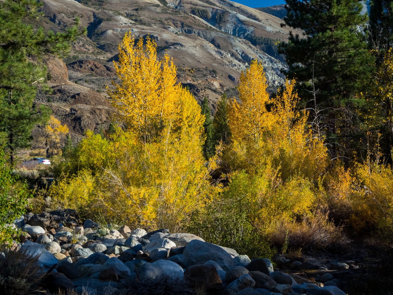
A scenery photo of autumn foliage on aspen trees. The photo was shot on the side of U.S. Route 395 near Conway Summit in Lee Vining, CA.
Approximate GPS location (type into Google): 38° 06' 46" N 119° 10' 41" W

Travel Tip: Do not speed on US-395 (and don't speed in general). California Highway Patrol frequently catch speeders this highway. My parents and I, when we visit Mono Lake and the Eastern Sierras, we'd always see cops pulling over speeders. I've also been told by other photographers and travelers that this is fairly common. Remember you are passing through rural towns out in the middle of nowhere... This is where the cops make their money. 😁 If your vehicle has cruise control, you can put it to good use on this highway (do so at your own risk, if you fall asleep with cruise control on, you can die).

A scenery photo of autumn foliage on aspen trees. The photo was shot on the side of U.S. Route 395 near Conway Summit in Lee Vining, CA.
Approximate GPS location (type into Google): 38° 06' 26" N 119° 10' 39" W

A scenery photo of autumn foliage on aspen trees. The photo was shot on the side of U.S. Route 395 near Conway Summit in Lee Vining, CA.
Photo shot near the same spot as above.

A scenery photo of autumn foliage on aspen trees. The photo was shot on the side of U.S. Route 395 near Conway Summit in Lee Vining, CA.
Photo shot near the same spot as above.

This is all the photos for today. I hope you have enjoyed viewing the photos! Please don't forget to share the blog post with your friends and family members! Also, if you want to get notifications when I post up more photos, "Like" us on Facebook or follow me on Twitter and Instagram. These links can also be found on the top of the right sidebar.

Parts: Cellphone Photos | Olympus Photos | Canon Photos

Sunday, October 16, 2022

Autumn Foliage (Cellphone Photos) - Stanislaus/Humboldt-Toiyabe/Inyo

This blog post contains photos of Sierra Nevada aspen tree autumn foliage! On 15 October 2022, my parents and I went to Stanislaus National Forest, Humboldt Toiyabe National Forest, Lee Vining, Inyo National Forest, and Yosemite National Park in California. We drove on State Route 108, U.S. Route 395, and State Route 120 to look at autumn foliage. I took photos with my phone, my Olympus mirrorless camera, and my Canon EOS 5D Mark III camera. I hope you enjoy viewing my photos! 

Parts: Cellphone Photos | Olympus Photos | Canon Photos

These photos were shot on my cellphone. In the photos are autumn foliage scenery, scenery of the Middle Fork Stanislaus River shot from Column of the Giants, scenery from near State Route 108, Sonora Pass, scenery of Mt. Patterson, scenery of West Walker River and West Walker River Bridge, Mono Lake Vista Point, scenery from Lundy Lake Road, and scenery of Lundy Lake.

A scenery of the Middle Fork Stanislaus River. Photo from Columns of the Giants Geologic Site in Stanislaus National Forest.

A scenery of the Middle Fork Stanislaus River. Photo from Columns of the Giants Geologic Site in Stanislaus National Forest.
There is a tiny bit of autumn foliage on the aspen trees at this altitude, but most of it is still green. You can see a tiny bit in the middle of my photo.

A scenery of the Middle Fork Stanislaus River. Photo shot near State Route 108 in Stanislaus National Forest.

A scenery photo from a vista point on the side of State Route 108 in Stanislaus National Forest. On the right is Night Cap Peak.

A scenery photo of autumn foliage on the aspen trees near State Route 108. The photo is from Stanislaus National Forest.

A scenery photo of autumn foliage on the aspen trees and State Route 108. The photo is from Stanislaus National Forest.

A scenery photo of autumn foliage on the aspen trees and State Route 108. The photo is from Stanislaus National Forest.
Approximate GPS location (type into Google): 38° 19' 17.9" N 119° 40' 25.0" W

A scenery photo of autumn foliage on the aspen trees and State Route 108. The photo is from Stanislaus National Forest.

A scenery photo of autumn foliage on the aspen trees and State Route 108. The photo is from Stanislaus National Forest.

A scenery photo of autumn foliage on the aspen trees and State Route 108. The photo is from Stanislaus National Forest.

A scenery photo shot at Sonora Pass near State Route 108. The photo is from Humboldt-Toiyabe National Forest.

A scenery photo shot at Sonora Pass near State Route 108. The photo is from Humboldt-Toiyabe National Forest.

A scenery photo of autumn foliage on the aspen trees near State Route 108. The photo is from Humboldt-Toiyabe National Forest.
Approximate GPS location (type into Google): 38° 19' 11.0" N 119° 36' 32.2" W

A scenery photo of autumn foliage on the aspen trees near State Route 108. The photo is from Humboldt-Toiyabe National Forest.
Approximate GPS location (type into Google): 38° 18' 24.5" N 119° 35' 36.4" W

A scenery photo of Mt. Patterson shot near State Route 108. The photo is from Humboldt-Toiyabe National Forest.

A scenery photo of autumn foliage on the aspen trees near State Route 108. The photo is from Humboldt-Toiyabe National Forest.

A scenery photo of autumn foliage on the aspen trees and West Walker River near State Route 108. The photo is from Humboldt-Toiyabe National Forest.

A scenery photo of autumn foliage on the aspen trees near State Route 108. The photo is from Humboldt-Toiyabe National Forest.
Approximate GPS location (type into Google): 38° 21' 02.1" N 119° 32' 05.1" W

A scenery photo of autumn foliage on the aspen trees and West Walker River near State Route 108. The photo is from Humboldt-Toiyabe National Forest.

A scenery photo of West Walker River. Photo shot near West Walker River Bridge and State Route 108 in Humboldt-Toiyabe National Forest.

A scenery photo of West Walker River and West Walker River Bridge (State Route 108) in Humboldt-Toiyabe National Forest.

A scenery photo shot near West Walker River Bridge and State Route 108 in Humboldt-Toiyabe National Forest.

A scenery photo of Mono Lake shot at Mono Lake Vista Point (on the side of US-395) in Lee Vining, CA.

Travel Tip: Do not speed on US-395 (and don't speed in general). California Highway Patrol frequently catch speeders this highway. My parents and I, when we visit Mono Lake and the Eastern Sierras, we'd always see cops pulling over speeders. I've also been told by other photographers and travelers that this is fairly common. Remember you are passing through rural towns out in the middle of nowhere... This is where the cops make their money. 😁 If your vehicle has cruise control, you can put it to good use on this highway (do so at your own risk, if you fall asleep with cruise control on, you can die).

A scenery photo of autumn foliage on aspen trees shot near Lundy Lake and Lundy Lake Road. The photo is from Inyo National Forest.

A scenery photo of autumn foliage on aspen trees shot near Lundy Lake and Lundy Lake Road. The photo is from Inyo National Forest.

A sunset scenery photo of Lundy Lake. The photo is from Inyo National Forest. There are a tiny bit of autumn foliage on aspen trees on both sides.

This is all the photos for today. I hope you have enjoyed viewing the photos! Please don't forget to share the blog post with your friends and family members! Also, if you want to get notifications when I post up more photos, "Like" us on Facebook or follow me on Twitter and Instagram. These links can also be found on the top of the right sidebar.

Parts: Cellphone Photos | Olympus Photos | Canon Photos