Showing posts with label sea figs. Show all posts

Saturday, July 1, 2023

Fitzgerald Marine Reserve - Moss Beach, CA

On 23 June 2023, my mom and I took a trip to Fitzgerald Marine Reserve in Moss Beach, CA and Mavericks Beach in El Granada, CA. I took photos with my cellphone and mirrorless camera. The photos are split into 2 blog posts. I hope you enjoy viewing my photos!

High Resolution Photos: If you want to see high resolution photos of any of the photos you see here, use the following links. If you wish to purchase prints of any of the photos, please contact me here. To see all of my photos from this trip, use this link.

Parts: Cellphone Photos | Olympus Photos

These photos were shot on my Olympus mirrorless camera. The photos were shot at Fitzgerald Marine Reserve in Moss Beach, CA.

A scenery photo of houses, clouds, Moss Beach, and the Pacific Ocean.
Approximate GPS location (type into Google): 37° 31' 28" N 122° 31' 03" W

A photo of Harbor Seals (Phoca vitulina), beach, and the Pacific Ocean.
Approximate GPS location (type into Google): 37° 31' 24" N 122° 31' 02" W

A scenery photo of flowers, mountains, houses, clouds, Moss Beach, and the Pacific Ocean.
The flowers in the photo are California Goldfields (Lasthenia californica), Cow Parsnip (Heracleum maximum), Sea Figs (Carpobrotus chilensis), Yellow Bush Lupine (Lupinus arboreus), Yellow Mustard Flowers.
Photo shot near the same spot as above.

A scenery photo of the cypress tree tunnel.
Approximate GPS location (type into Google): 37° 31' 19" N 122° 30' 56" W

This is all the photos for today. I hope you have enjoyed viewing the photos! Please don't forget to share the blog post with your friends and family members! Also, if you want to get notifications when I post up more photos, "Like" us on Facebook or follow me on Instagram. These links can also be found on the top of the right sidebar.

Parts: Cellphone Photos | Olympus Photos

Saturday, May 20, 2023

Bodega Head & Duncan's Landing (Part 1) - Sonoma Coast State Park

On 7 May 2023, my mom and I took a day trip to Sonoma Coast State Park in Sonoma County, CA. We went to the various beaches in the state park, took a hike along Red Hill Trail, and visited Bodega Bay, Jenner, and Duncans Mills, CA. We saw the Russian River, harbor seals (Phoca vitulina), and lots of wild flowers. I took photos with my cellphone and mirrorless camera. The photos are split into 4 blog posts (I took most of the photos on my mirrorless camera). I hope you enjoy viewing my photos!

High Resolution Photos: If you want to see high resolution photos of any of the photos you see here, use the following links. If you wish to purchase prints of any of the photos, please contact me here. To see my best Sonoma Coast State Park photos, use this link. To see my best flower photos from 2019 to 2023, use this link. To see all of my photos from this trip, use this link.

Parts: 1 | 2 | 3 | Cellphone Photos

This is part 1 of the photos shot on my Olympus mirrorless camera. The photos in this blog post were shot at Bodega Head, a few spots along State Route 1, and Duncan's Landing in Sonoma Coast State Park.

The first spot my mom and I arrived at was Bodega Head near Bodega Bay, CA.

A scenery photo of Bodega Bay, Bodega Harbor, Yellow Mustard Flowers (bottom left), clouds, and green hills. The photo was shot on Westshore Road at Bodega Head.
Approximate GPS location (type into Google): 38° 18' 25" N 123° 03' 28" W

A scenery photo of the Pacific Ocean, clouds, rocks, and cliffs. The photo was shot on Overlook Trail at Bodega Head.
 The flowers in the photo are California Goldfields (Lasthenia californica), Sea Figs (Carpobrotus chilensis), and Sky Lupine (Lupinus nanus). 
Approximate GPS location (type into Google): 38° 18' 21" N 123° 03' 52" W

A scenery photo of Bodega Bay, Bodega Harbor (left), Doran Regional Park (center), clouds, and green hills. The photo was shot at the Bodega Head Trail Parking Lot at Bodega Head.
The flowers in the photo are Cow Parsnip (Heracleum maximum) and Yellow Bush Lupine (Lupinus arboreus).
Approximate GPS location (type into Google): 38° 18' 12" N 123° 03' 27" W

A scenery photo of Westshore Road (center), and Bodega Harbor & Bodega Bay (right). The photo was shot at the Bodega Head Trail Parking Lot at Bodega Head.
The flowers in the photo are Cow Parsnip (Heracleum maximum) and Yellow Bush Lupine (Lupinus arboreus).
Photo shot at the same spot as above.

A scenery photo of Bodega Bay, Bodega Rock (slightly left of center), Dillon Beach (in the distance slightly left of center), Tomales Bay (in the distance in the center), Tomales Point (in the distance slightly right of center), the Pacific Ocean, clouds, and green hills. The photo was shot on Bodega Head Trail at Bodega Head.
The flowers in the photo are Cow Parsnip (Heracleum maximum).
Approximate GPS location (type into Google): 38° 18' 01" N 123° 03' 17" W

Next, my mom and I started traveling up State Route 1 towards Duncan's Landing. We stopped at a few spots along the highway before we got there.

A scenery photo of Arched Rock (in the distance on the right), State Route 1 (right), the Pacific Ocean, rocks, cliffs, clouds, and mountains. The photo was shot at Coleman Beach Overlook.
The flowers in the photo are California Goldfields (Lasthenia californica) and Sea Figs (Carpobrotus chilensis).
Approximate GPS location (type into Google): 38° 21' 49" N 123° 04' 12" W

A scenery photo of Arched Rock (center), State Route 1 (right), the Pacific Ocean, rocks, cliffs, clouds, and mountains. The photo was shot at Arched Rock Overlook.
The flowers in the photo are Sea Figs (Carpobrotus chilensis) and Yellow Mustard Flowers.
Approximate GPS location (type into Google): 38° 21' 59" N 123° 04' 19" W

A scenery photo of Arched Rock (center), Salmon Creek Beach & Bodega Bay (in the distance in the center), State Route 1 (left), the Pacific Ocean, rocks, clouds, and cliffs. The photo was shot at Carmet Beach Parking Lot.
The flowers in the photo are Sea Figs (Carpobrotus chilensis).
Approximate GPS location (type into Google): 38° 22' 19" N 123° 04' 34" W

A black and white process of the photo above.

Next, my mom and I arrived at Duncan's Landing.

A scenery photo of Wright's Beach, Hogback (left), the Pacific Ocean, rocks, mountains, and clouds. The photo was shot at Duncan's Landing.
The flowers in the photo are Sea Figs (Carpobrotus chilensis).
Approximate GPS location (type into Google): 38° 23' 43" N 123° 05' 46" W

A scenery photo of Duncans Point, the Pacific Ocean, rocks, mountains, cliffs, and clouds. The photo was shot at Duncan's Landing.
The flowers in the photo are Sea Figs (Carpobrotus chilensis).
Approximate GPS location (type into Google): 38° 23' 36" N 123° 05' 40" W

A scenery photo of Duncan's Landing Overlook, a huge patch of Sea Figs (Carpobrotus chilensis), Yellow Mustard Flowers (in the distance on the right), mountains, clouds, and rocks. The photo was shot at Duncan's Landing.
Approximate GPS location (type into Google): 38° 23' 38" N 123° 05' 40" W

A black and white process of the photo above.

A scenery photo of Duncan's Landing Overlook (left), a huge patch of Sea Figs (Carpobrotus chilensis), Yellow Mustard Flowers (in the distance), mountains, clouds, and rocks. The photo was shot at Duncan's Landing.
Photo shot at the same spot as above.

A scenery photo of Duncan's Landing Overlook (center), a huge patch of Sea Figs (Carpobrotus chilensis), the Pacific Ocean (right), mountains, clouds, and rocks. The photo was shot at Duncan's Landing.
Approximate GPS location (type into Google): 38° 23' 42" N 123° 05' 43" W

A scenery photo of Duncan's Landing Overlook (center), Duncans Cove (left), the Pacific Ocean (left), a huge patch of Sea Figs (Carpobrotus chilensis), Yellow Mustard Flowers (in the distance on the right), clouds, and rocks. The photo was shot at Duncan's Landing.
Approximate GPS location (type into Google): 38° 23' 42" N 123° 05' 41" W

This is all the photos for today. I hope you have enjoyed viewing the photos! Please don't forget to share the blog post with your friends and family members! Also, if you want to get notifications when I post up more photos, "Like" us on Facebook or follow me on Instagram. These links can also be found on the top of the right sidebar.

Parts: 1 | 2 | 3 | Cellphone Photos

Monday, May 8, 2023

Sonoma Coast State Park (Cellphone Photos) - Sonoma County, CA

On 7 May 2023, my mom and I took a day trip to Sonoma Coast State Park in Sonoma County, CA. We went to the various beaches in the state park, took a hike along Red Hill Trail, and visited Bodega Bay, Jenner, and Duncans Mills, CA. We saw the Russian River, harbor seals (Phoca vitulina), and lots of wild flowers. I took photos with my cellphone and mirrorless camera. The photos are split into 4 blog posts (I took most of the photos on my mirrorless camera). I hope you enjoy viewing my photos!

Parts: 1 | 2 | 3 | Cellphone Photos

These photos were shot on my cellphone. This blog post is going to be somewhat short, because I shot most of the photos on my Olympus mirrorless camera. All of the photos in this blog post were shot in Sonoma Coast State Park.

A scenery photo of Salmon Creek Beach, Salmon Creek, houses in Bodega Bay, CA (left), the Pacific Ocean (right), and clouds. The flowers in the photo are Sea Figs (Carpobrotus chilensis).

A close up photo of Sea Figs (Carpobrotus chilensis). The photo was shot at Duncan's Landing Overlook.

A scenery photo of Sea Figs (Carpobrotus chilensis), Yellow Mustard Flowers (in the distance on the right), rocks, clouds, and green hills. The photo was shot at Duncan's Landing Overlook.

A scenery photo of rocks, plants, hills, and clouds. The flowers in the photo are Cow Parsnip (Heracleum maximum). The photo was shot on Red Hill Trail.

A scenery photo of the Russian River, Jenner, CA, Coast Redwoods (Sequoia sempervirens), hills, clouds, and the Pacific Ocean (in the distance on the left). The flowers in the photo are Cow Parsnip (Heracleum maximum) and Douglas Iris (Iris douglasiana). The photo was shot on Red Hill Trail.

A scenery photo of the Russian River, Jenner, CA, hills, clouds, and the Pacific Ocean (left). The flowers in the photo are Douglas Iris (Iris douglasiana). The photo was shot on Red Hill Trail.

A close up photo of a mushroom, flowers, and grass. The photo was shot on Red Hill Trail.

A photo shot through my binoculars.
A photo of Harbour Seals (Phoca vitulina) lying on Goat Rock State Beach right next to the Russian River. The photo was shot at Goat Rock State Beach.
Binoculars Used: Bushnell Engage X 10x42mm Binoculars (Product Link - Affiliate Link)

A photo shot through my binoculars.
A photo of Harbour Seals (Phoca vitulina) lying on Goat Rock State Beach right next to the Russian River. The photo was shot at Goat Rock State Beach.
Binoculars Used: Bushnell Engage X 10x42mm Binoculars (Product Link - Affiliate Link)

A sunset scenery photo of Blind Beach, Goat Rock State Beach, Goat Rock, hills, and clouds. The photo was shot at the Blind Beach parking lot.

This is all the photos for today. I hope you have enjoyed viewing the photos! Please don't forget to share the blog post with your friends and family members! Also, if you want to get notifications when I post up more photos, "Like" us on Facebook or follow me on Instagram. These links can also be found on the top of the right sidebar.

Parts: 1 | 2 | 3 | Cellphone Photos

Saturday, April 22, 2023

Flowers Along State Route 1 (Pescadero, CA)

On 5 April 2023, my parents and I drove along State Route 1 in search of flower viewing opportunities. We drove from Santa Cruz to Half Moon Bay (the last of my photos are from Pescadero State Beach). I took photos with my cellphones and mirrorless camera. The photos are split into 2 blog posts. I hope you enjoy viewing my photos!

High Resolution Photos: If you want to see high resolution photos of any of the photos you see here, use the following links. If you wish to purchase prints of any of the photos, please contact me here. To see my best photos from State Route 1 (from Pescadero to Big Sur), use this link. To see my best flower photos from 2019 to 2023, use this link. To see all of my photos from this trip, use this link.

Parts: Cellphone Photos | Olympus Photos

These photos were shot on my Olympus mirrorless camera. The photos are from Gazos Creek State Beach, Pigeon Point Light Station State Historic Park, and Pescadero State Beach in Pescadero, CA.

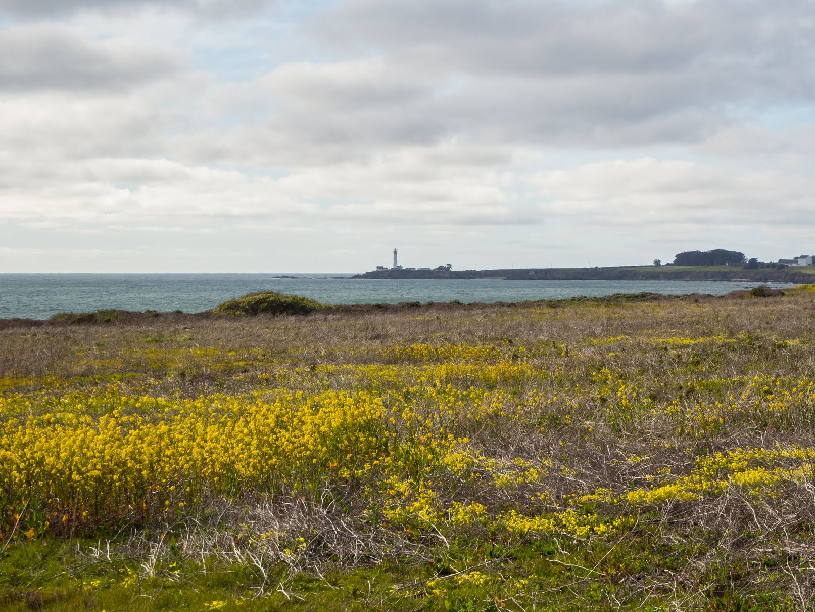
A scenery photo of Pigeon Point Lighthouse (center), yellow mustard flowers, the Pacific Ocean, and clouds. The photo was shot at Gazos Creek State Beach.
Approximate GPS location (type into Google): 37° 10' 00" N 122° 21' 43" W

A scenery photo of seagulls, clouds, the Pacific Ocean, and Gazos Creek State Beach.
Approximate GPS location (type into Google): 37° 09' 52" N 122° 21' 47" W

A black and white process of the photo above.

A scenery photo of clouds, green hills, trees, the Pacific Ocean (left), Gazos Creek State Beach, and yellow mustard flowers (in the distance).
Approximate GPS location (type into Google): 37° 09' 54" N 122° 21' 48" W

A scenery photo of yellow mustard flowers, grass, mountains, clouds, and the Pacific Ocean (right). The photo is from Pigeon Point Bluffs on the side of State Route 1.
Approximate GPS location (type into Google): 37° 11' 00" N 122° 23' 05" W

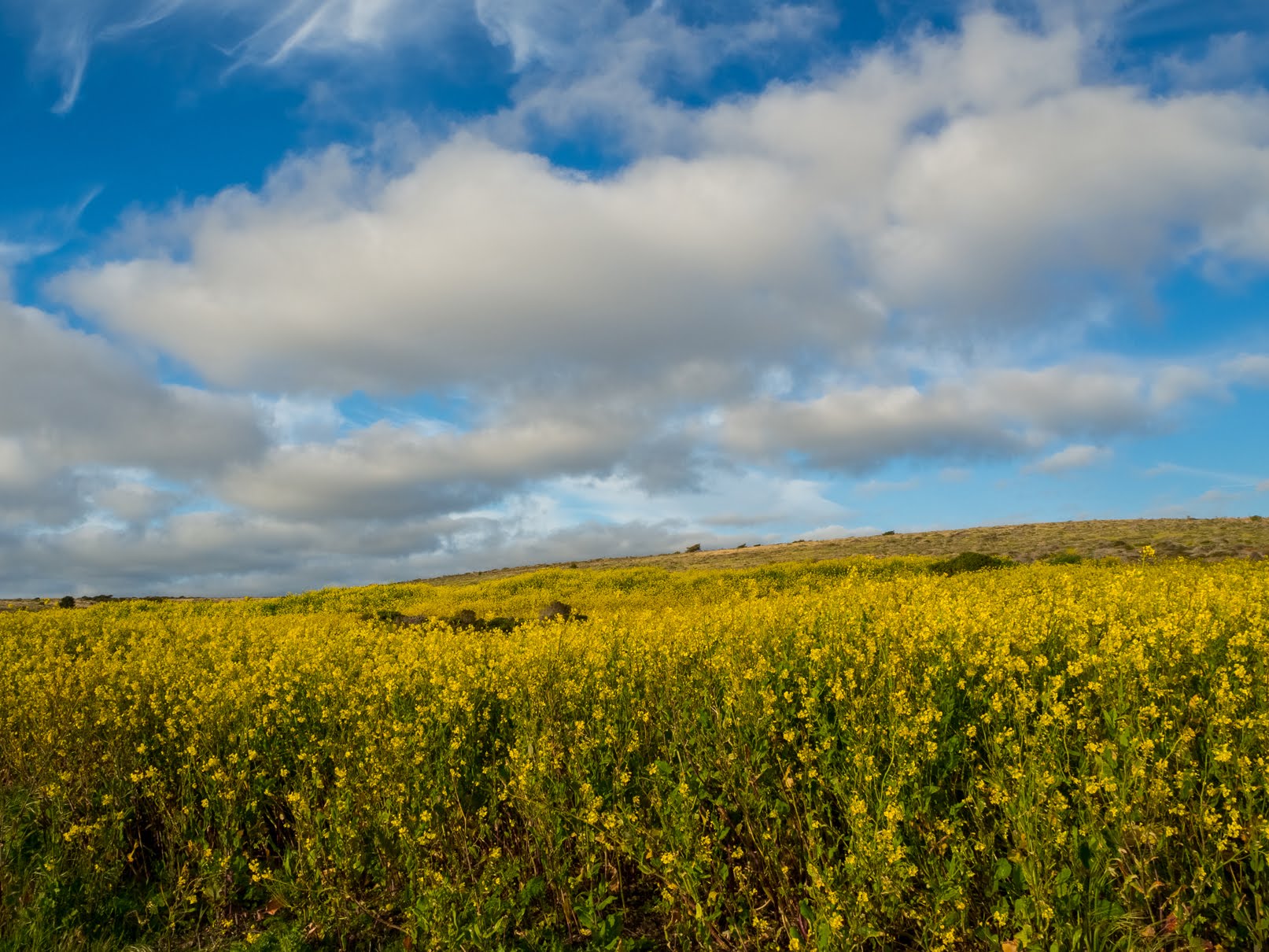
A scenery photo of yellow mustard flowers, grass, mountains, and clouds. The photo is from Pigeon Point Bluffs on the side of State Route 1.
Photo shot at the same spot as above.

A scenery photo of Wild Radish Flowers (Raphanus raphanistrum), yellow mustard flowers, grass, mountains, clouds, and the Pacific Ocean (right). The photo is from Pigeon Point Bluffs on the side of State Route 1.
Approximate GPS location (type into Google): 37° 10' 59" N 122° 23' 06" W

A scenery photo of yellow mustard flowers, Wild Radish Flowers (Raphanus raphanistrum), and clouds. The photo is from Pigeon Point Light Station State Historic Park.
Approximate GPS location (type into Google): 37° 11' 04" N 122° 23' 43" W

A scenery photo of yellow mustard flowers, Wild Radish Flowers (Raphanus raphanistrum), and clouds. The photo is from Pigeon Point Light Station State Historic Park.
Photo shot at the same spot as above.

A scenery photo of Pigeon Point Lighthouse, Sea Figs (Carpobrotus chilensis), yellow mustard flowers (in the distance on the left), a beach (right), the Pacific Ocean (right), high voltage powerlines (left), and clouds. The photo is from Pigeon Point Light Station State Historic Park.
Approximate GPS location (type into Google): 37° 11' 00" N 122° 23' 41" W

A black and white process of the photo above.

A scenery photo of yellow mustard flowers, Wild Radish Flowers (Raphanus raphanistrum), and clouds. The photo is from Pigeon Point Light Station State Historic Park.
Approximate GPS location (type into Google): 37° 11' 25" N 122° 23' 49" W

A scenery photo of yellow mustard flowers and clouds. The photo is from Pigeon Point Light Station State Historic Park.
Photo shot near the same spot as above.

A scenery photo of yellow mustard flowers and clouds. The photo is from Pigeon Point Light Station State Historic Park.
Photo shot near the same spot as above.

A scenery photo of Pigeon Point Lighthouse (center), yellow mustard flowers, Sea Figs (Carpobrotus chilensis), the Pacific Ocean (right), high voltage power lines (right), and clouds. The photo is from Pigeon Point Light Station State Historic Park.
Approximate GPS location (type into Google): 37° 11' 30" N 122° 23' 50" W

A black and white process of the photo above.

A scenery photo of Pigeon Point Lighthouse (center), yellow mustard flowers, Sea Figs (Carpobrotus chilensis), the Pacific Ocean (right), high voltage power lines (right), and clouds. The photo is from Pigeon Point Light Station State Historic Park.
Approximate GPS location (type into Google): 37° 11' 29" N 122° 23' 49" W

A scenery photo of Pigeon Point Lighthouse (center), yellow mustard flowers, Sea Figs (Carpobrotus chilensis), the Pacific Ocean (right), high voltage power lines (right), and clouds. The photo is from Pigeon Point Light Station State Historic Park.
Photo shot at the same spot as above.

A black and white process of the photo above.

A sunset scenery photo of Pescadero Marsh, mountains, and clouds. The photo was shot on North Pond Trail (on the bridge) at Pescadero Marsh in Pescadero State Beach.
Approximate GPS location (type into Google): 37° 16' 08" N 122° 24' 35" W

A black and white process of the photo above.

A sunset scenery photo of a rock with a hole in it, clouds, and the Pacific Ocean. The photo was shot at Pescadero State Beach.
Approximate GPS location (type into Google): 37° 16' 01" N 122° 24' 43" W

A black and white process of the photo above.

This is all the photos for today. I hope you have enjoyed viewing the photos! Please don't forget to share the blog post with your friends and family members! Also, if you want to get notifications when I post up more photos, "Like" us on Facebook or follow me on Instagram. These links can also be found on the top of the right sidebar.

Parts: Cellphone Photos | Olympus Photos

Copyright Warning: These photos are some of my best and most popular works of art. Unauthorized usage and reproductions are strictly prohibited. Please contact me here to purchase prints and negotiate photo licenses.