Showing posts with label eastern sierras. Show all posts

Monday, April 10, 2023

Eldorado & Humboldt-Toiyabe NF (Cellphone Photos) - California

On 9 April 2023, my parents and I took a day trip to Eldorado National Forest and Humboldt-Toiyabe National Forest to see snow. We also dropped by Mesa Vista, CA during sunset. We mostly drove along State Route 88. I took photos with my cellphones. I hope you enjoy viewing my photos!

The California megastorms definitely left their marks on the Sierra Nevada mountain range. I have never seen this much snow before.

A photo of me standing next to the snow wall at Peddler Hill Scenic Viewpoint. The photo is from the Eldorado National Forest.

A photo of me standing next to the snow wall at Peddler Hill Scenic Viewpoint. The photo is from the Eldorado National Forest.

A photo of me standing next to the snow wall at Iron Mountain Sno-Park. The photo is from the Eldorado National Forest.

A photo of me standing next to the snow wall at Iron Mountain Sno-Park. The photo is from the Eldorado National Forest.

The snow walls were tall! It was my first time seeing snow walls this tall. The tallest snow wall I saw on the trip was at Carson Spur, but that is an avalanche area and there was no place to park. I think parts of the snow wall at Carson Spur was the height of a 2 story house. I really wanted to take a photo of the snow walls at Carson Spur, but there wasn't any opportunities. If you want to take scenery photos right now while driving along State Route 88, I think you would need to bring a ladder. It was almost impossible to climb up a little bit to raise your phone over the snow wall in most places.

A scenery photo of Silver Lake, Thunder Mountain, snow, and forest. The photo was shot at the intersection of State Route 88 and Kays Road in the Eldorado National Forest.

A scenery photo of forest, snow, and clouds shot on the side of State Route 88 in Eldorado National Forest.

You can see in the previous 2 photos, my cellphone barely cleared the snow wall. I managed to climb up a tiny bit and raised my cellphone just barely enough to clear the snow wall. 

A scenery photo of a snowy mountain, snow covered meadow, forest, and clouds. The photo was shot at Kirkwood Mountain Resort in Kirkwood, CA and Eldorado National Forest.

A scenery photo of snowy mountains, snow covered meadow, forest, and clouds. The photo was shot at Kirkwood Mountain Resort in Kirkwood, CA and Eldorado National Forest.

There was a "ramp" onto the meadow at Kirkwood Mountain Resort. The meadow is located near the intersection of State Route 88 and Kirkwood Meadows Drive.

A scenery photo of Carson Pass (Elevation 8574), State Route 88, snow walls, trees, and avalanche warning signs. The photo was shot at Carson Pass Sno-Park in Humboldt-Toiyabe National Forest.

Next my parents and I arrive at Red Lake in Humboldt-Toiyabe National Forest. I did some snowshoeing at this location. There wasn't too much to see unfortunately. My parents and I did get to use the Motorola T100 Talkabout Radio and the Motorola T107 Talkabout Radio to communicate. Only I have snowshoes, so my parents didn't follow me on most of my walk (they did climb the pile of snow next to the parking lot to get photos of Red Lake). The 2 radios did better than I expected. My parents and I were communicating just fine 0.45 mile apart in heavily obstructed conditions (trees, forest, snow, and a hill). Granted, there was a slight hiss to the transmission at that distance with the obstructions, but we could understand each other just fine. At 0.43 mile and with moderate obstruction (snow and trees), the hiss disappeared. I was quite surprised because these low powered radios only transmit at 0.2W and has short stubby antennas. For the price I paid for these, it went beyond my expectations.

There is a "ramp" for people snowshoeing and backcountry skiing at Red Lake. 

A scenery photo of Red Lake and Red Lake Peak. The photo was shot at Red Lake in Humboldt-Toiyabe National Forest.

A scenery photo from Red Lake in Humboldt-Toiyabe National Forest.
Left: Red Lake Peak
Center: Red Lake
Right: Freel Peak, Jobs Sister, Jobs Peak, Pickett Peak, Hawkins Peak

A panorama from Red Lake in Humboldt-Toiyabe National Forest.
Center: Red Lake & Red Lake Peak
Right: Freel Peak, Jobs Sister, Jobs Peak, Pickett Peak, Hawkins Peak

A scenery photo of Freel Peak, Jobs Sister, and Jobs Peak (in the center). The photo was shot at Hope Valley Sno-Park in Humboldt-Toiyabe National Forest.

A scenery photo of Pickett Peak (left), Hawkins Peak (right), forest, and clouds. The photo was shot at Hope Valley Sno-Park in Humboldt-Toiyabe National Forest.

A scenery photo of West Fork Carson River, forest, and mountains. The photo was shot on the side of State Route 89 near Picketts Junction in Humboldt-Toiyabe National Forest.

Our final destination on this day trip was Mesa Vista, CA. We ended up seeing the sunset on Emigrant Trail.

A sunset scenery photo of the snow covered Eastern Sierras, grassy plains, and ranches. The photo was shot on Emigrant Trail in Mesa Vista, CA.

A sunset scenery photo of cows, the snow covered Eastern Sierras, grassy plains, and ranches. The photo was shot on Emigrant Trail in Mesa Vista, CA.

A sunset scenery photo of the snow covered Eastern Sierras, grassy plains, and ranches. The photo was shot on Emigrant Trail in Mesa Vista, CA.

A sunset scenery photo of cows, the snow covered Eastern Sierras, grassy plains, and ranches. The photo was shot on Emigrant Trail in Mesa Vista, CA.

A sunset scenery photo of the snow covered Eastern Sierras and giant plains with desert plants. The photo was shot on Emigrant Trail in Mesa Vista, CA.

A sunset scenery photo of the snow covered Eastern Sierras, giant plains with desert plants, and ranches. The photo was shot on Emigrant Trail in Mesa Vista, CA.

A sunset scenery photo of the snow covered Eastern Sierras, Emigrant Trail, and ranches. The photo was shot in Mesa Vista, CA.

A sunset scenery photo of snow covered mountains, giant plains with desert plants, and ranches.

A sunset scenery photo of the snow covered Eastern Sierras, giant plains with desert plants, and ranches. The photo was shot on Emigrant Trail in Mesa Vista, CA.

A sunset scenery photo of snow covered mountains, giant plains with desert plants, and ranches.

After Mesa Vista, CA, we turned back to get back to the SF Bay Area.

A sunset scenery photo of Waterhouse Peak (left), State Route 88 & 89, mountains, clouds, and snow.

This is all the photos for today. I hope you have enjoyed viewing the photos! Please don't forget to share the blog post with your friends and family members! Also, if you want to get notifications when I post up more photos, "Like" us on Facebook or follow me on Instagram. These links can also be found on the top of the right sidebar.

Sunday, December 11, 2022

Inyo NF & Mono County (Olympus Pt. 2) - Mammoth Lakes Trip

My parents and I spent 2 nights at Mammoth Lakes, CA between October 21 to October 23 in 2022. We explored Yosemite National Park, Inyo National Forest, Mono County, and Humboldt-Toiyabe National Forest in California enjoying the scenery and autumn foliage. I took photos with my phone, my Olympus mirrorless camera, and my Canon EOS 5D Mark III camera. The photos will be split into several blog posts. I hope you enjoy viewing my photos! 

High Resolution Photos: If you want to see high resolution photos of any of the photos you see here, use the following links. If you wish to purchase prints of any of the photos, please contact me here. To view my best Inyo National Forest & Mono County photos from 2019 to 2022, use this link. To see all of my photos from Inyo National Forest & Mono County on this trip, use this link.

Parts: 

Cellphone: Part 1 | Part 2 | Part 3

Olympus: Part 1 | Part 2

Canon: Part 1 | Part 2

This is part 2 of the photos that were shot on my Olympus mirrorless camera. The photos are from the Inyo National Forest in California and Mono County, CA. The photos are from Hot Creek Geologic Site, Benton Crossing Road & Owens River Bridge, Minaret Vista, and Bald Mountain Lookout.

This blog post contains photos I took on day 2 and 3. On day 2, we explored Mammoth Lakes, CA (cellphone photos only), Hot Creek Geologic Site, Wild Willy's Hot Springs (Canon DSLR photos only), Lake Crowley (Canon DSLR and cellphone photos only), and Convict Lake (Canon DSLR photos only).

It was snowing quite heavily in Mammoth Lakes, CA on day 2 of our trip, so our family traveled out into the desert. The next few photos are from Hot Creek Geologic Site in the Inyo National Forest.

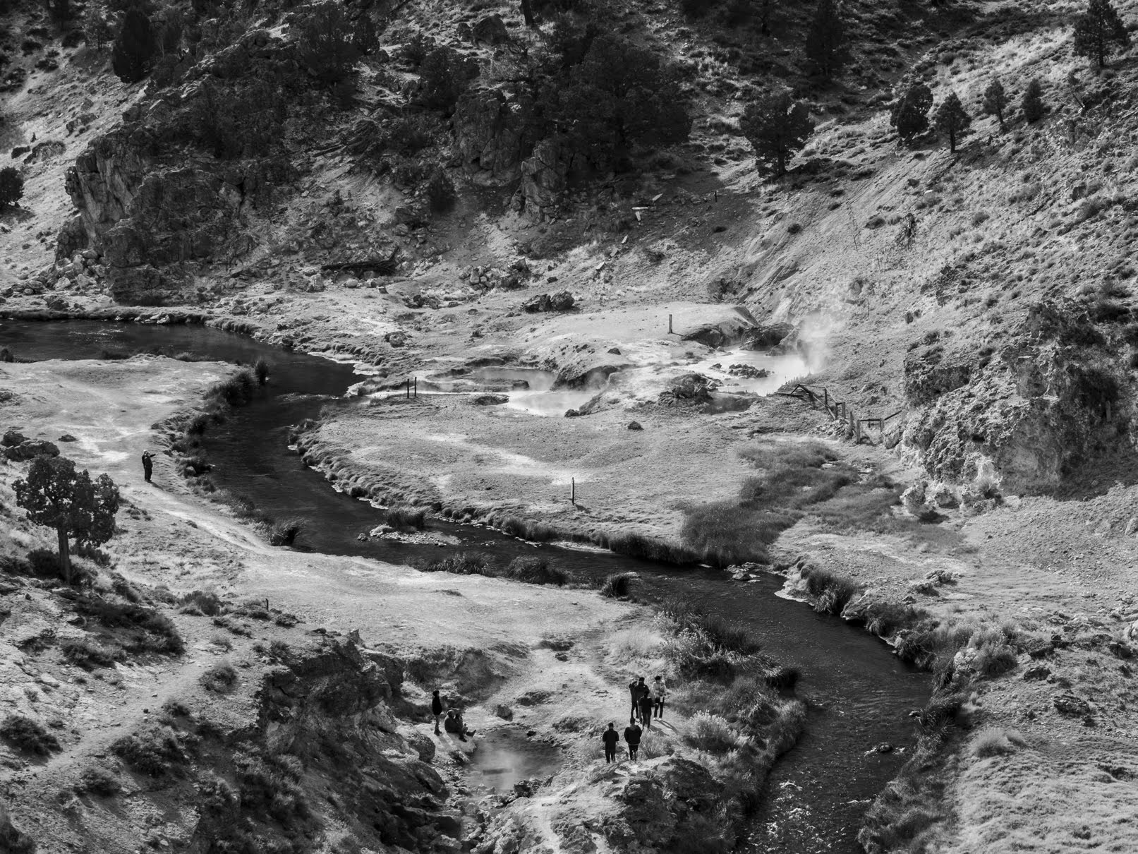
A scenery photo of Hot Creek & hot springs (bottom), clouds, desert, and mountains. The photo was shot at Hot Creek Geologic Site in the Inyo National Forest.
Approximate GPS location (type into Google): 37° 39' 39" N 118° 49' 40" W

A black and white process of the photo above.

A scenery photo of Hot Creek, Glass Mountain Ridge (in the distance), clouds, and desert. The photo was shot at Hot Creek Geologic Site in the Inyo National Forest.
Approximate GPS location (type into Google): 37° 39' 42" N 118° 49' 38" W

A black and white process of the photo above.

A scenery photo of Hot Creek and clouds. The photo was shot at Hot Creek Geologic Site in the Inyo National Forest.
Approximate GPS location (type into Google): 37° 39' 42" N 118° 49' 40" W

A black and white process of the photo above.

After we were done at Hot Creek Geologic Site, we visited Brees Lookout approximately 1/4 mile down the road on the boundary of the Inyo National Forest and Mono County, CA. This lookout provides a great overlook of Hot Creek Geologic Site.

A scenery photo of Hot Creek Geologic Site, Hot Creek, hot springs (center), Eastern Sierras (in the distance), and clouds. The photo was shot at Brees Lookout in the Inyo National Forest.
Approximate GPS location (type into Google): 37° 39' 44" N 118° 49' 37" W

A scenery photo of Hot Creek Geologic Site, Hot Creek, and hot springs (center). The photo was shot at Brees Lookout in the Inyo National Forest.
Photo shot at the same spot as above.

A black and white process of the photo above.

After we explored Hot Creek Geologic Site and Brees Lookout, we went to Wild Willy's Hot Springs in Mono County, CA (Canon DSLR photos only). Then after Wild Willy's Hot Springs, we dropped by Benton Crossing/Owens River Bridge, and then went to Lake Crowley in Mono County, CA (Canon DSLR and cellphone photos only).

The last of my day 2 photos from my Olympus mirrorless camera were shot at Benton Crossing/Owens River Bridge (near Benton Crossing Road & Owens River Bridge) in Mono County, CA.

A scenery photo of Eastern Sierras (in the distance) and Owens River. The photo was shot near Benton Crossing Road and Owens River Bridge in Mono County, CA.
Approximate GPS location (type into Google): 37° 41' 56" N 118° 45' 47" W

A black and white process of the photo above.

A scenery photo of Owens River Bridge, Owens River, and Eastern Sierras (in the distance). The photo was shot near Benton Crossing Road and Owens River Bridge in Mono County, CA.
Photo shot near the same spot as above.

A black and white process of the photo above.

A scenery photo of Eastern Sierras (in the distance) and Owens River. The photo was shot near Benton Crossing Road and Owens River Bridge in Mono County, CA.
Photo shot near the same spot as above.

A black and white process of the photo above.

After taking some of my best photos ever near Owens River Bridge, we headed for Lake Crowley in Mono County, CA (Canon DSLR and cellphone photos only) before finishing up at Convict Lake in the Inyo National Forest (Canon DSLR photos only).

Next up, are my Olympus mirrorless camera photos from day 3, the last day of my trip. On our last day, we explored Mammoth Lakes, CA visiting several locations in the town, including the various lakes surrounding the town in the bordering Inyo National Forest (most of these photos were shot on my cellphone and my Canon DSLR). We also drove up Bald Mountain in the Inyo National Forest. After Bald Mountain, we visited Virginia Lakes in the Humboldt-Toiyabe National Forest (cellphone photos only) before heading home.

Our first stop of the day was Minaret Vista in the Inyo National Forest. We visited the vista on day 2 as well, but because of the heavy snowstorm in Mammoth Lakes and the Sierra Nevada mountains, we literally drove into a cloud, and was not able to see anything. On day 2, Minaret Vista was a total white-out. Since I knew the view would be really nice in good weather (thanks to Google Maps), I decided to give it another try on the last day of our trip.

A scenery photo of forest and the Sierra Nevada mountain range. The photo was shot at Minaret Vista in the Inyo National Forest.
Approximate GPS location (type into Google): 37° 39' 23" N 119° 03' 41" W

A scenery photo of forest and the Sierra Nevada mountain range. The photo was shot at Minaret Vista in the Inyo National Forest.
Photo shot near the same spot as above.

A scenery photo of forest and the Sierra Nevada mountain range. The photo was shot at Minaret Vista in the Inyo National Forest.
Photo shot near the same spot as above.

After we were done in Mammoth Lakes, CA, we went to Bald Mountain in the Inyo National Forest. We drove up to Bald Mountain Lookout on Bald Mountain.

Travel Tip: You may need a vehicle with moderate clearance to make it up the last 1.5 miles of dirt and gravel road up to Bald Mountain Lookout. Our family drives a 2006 Honda Pilot and we made it all the way up. The road to Bald Mountain Lookout is not paved, so you will be driving a little over 11 miles on dirt and gravel roads after you turn off of US Route 395. The road is very wide and in fairly good condition with exception to the last 1.5 miles. The hard part starts at the intersection of Bald Mountain Road and Bald Mountain Springs Road (Forest Road 02S481). The last 1.5 miles of Bald Mountain Road (Forest Road 02S162) is really steep, rocky, bumpy, and most of it is only wide enough for 1 vehicle to pass through. As you get close to Bald Mountain Lookout, there is another dirt road that splits from the main road (Forest Road 01S05H) that will lead you to another (lower) peak, but the road looks very narrow, rough, primitive, and only passable with an OHV (SxS), dirt bike, or mountain bike. Don't forget, the vehicle driving uphill always has the right-of-way. We were here on a Sunday, and we only saw 1 other vehicle on our drive in. Looking at the guestbook in the Bald Mountain Warming Hut, there were only 2 signatures (1 for each day) for the 2 days prior, so you will most likely not meet anyone on your drive. Bald Mountain Lookout is only accessible via snowmobiles, backcountry skiing, or snowshoeing when the road is covered in snow.

A scenery photo of Mono Lake, Paoha Island, and forest. The photo was shot at Bald Mountain Lookout on Bald Mountain in the Inyo National Forest.

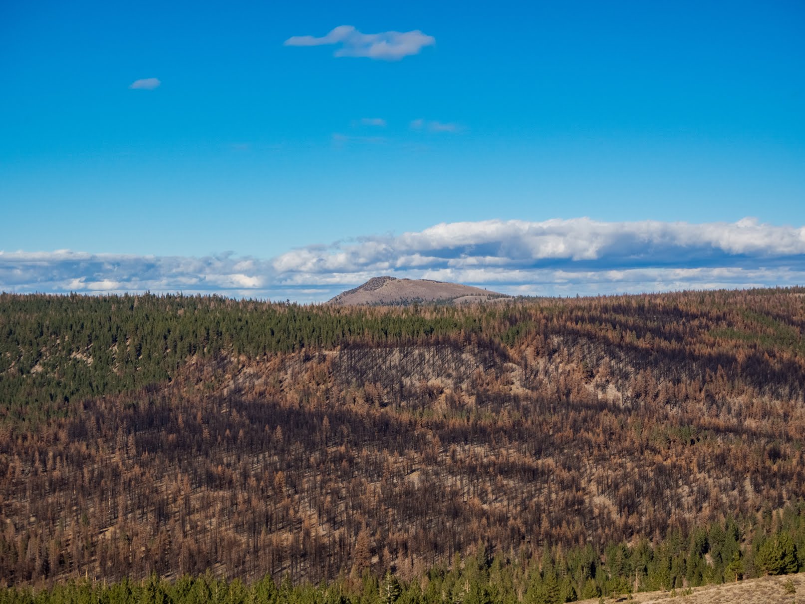
A scenery photo of forest, burned forest, mountain, and clouds. The photo was shot at Bald Mountain Lookout on Bald Mountain in the Inyo National Forest.

A scenery photo of Eastern Sierras and Mammoth Yosemite Airport (left). The photo was shot at Bald Mountain Lookout on Bald Mountain in the Inyo National Forest.

After Bald Mountain, we went to Virginia Lakes in the Humboldt-Toiyabe National Forest (cellphone photos only), and then drove home via State Route 108 (Sonora Pass).

This is all the photos for today. I hope you have enjoyed viewing the photos! Please don't forget to share the blog post with your friends and family members! Also, if you want to get notifications when I post up more photos, "Like" us on Facebook or follow me on Instagram. These links can also be found on the top of the right sidebar.

Parts: 

Cellphone: Part 1 | Part 2 | Part 3

Olympus: Part 1 | Part 2

Canon: Part 1 | Part 2

Copyright Warning: These photos are some of my best and most popular works of art. Unauthorized usage and reproductions are strictly prohibited. Please contact me here to purchase prints and negotiate photo licenses.

Sunday, December 4, 2022

Mammoth Lakes & Inyo NF (Canon Pt. 2) - Mammoth Lakes Trip

My parents and I spent 2 nights at Mammoth Lakes, CA between October 21 to October 23 in 2022. We explored Yosemite National Park, Inyo National Forest, Mono County, and Humboldt-Toiyabe National Forest in California enjoying the scenery and autumn foliage. I took photos with my phone, my Olympus mirrorless camera, and my Canon EOS 5D Mark III camera. The photos will be split into several blog posts. I hope you enjoy viewing my photos! 

High Resolution Photos: If you want to see high resolution photos of any of the photos you see here, use the following links. If you wish to purchase prints of any of the photos, please contact me here. To view my best Inyo National Forest & Mono County photos from 2019 to 2022, use this link. To see all of my photos from Inyo National Forest & Mono County on this trip, use this link.

Parts: 

Cellphone: Part 1 | Part 2 | Part 3

Olympus: Part 1 | Part 2

Canon: Part 1 | Part 2

This is part 2 of the photos that were shot on my Canon DSLR. The photos are from Mammoth Lakes, CA and the Inyo National Forest. The photos are from the various lakes and spots around Mammoth Lakes, CA, Bald Mountain in the Inyo National Forest, and more.

This blog post contains photos I took on day 3, the last day of my trip. On our last day, we explored Mammoth Lakes, CA visiting several locations in the town, including the various lakes surrounding the town in the bordering Inyo National Forest. We also drove up Bald Mountain in the Inyo National Forest in California. After Bald Mountain, we visited Virginia Lakes in the Humboldt-Toiyabe National Forest in California (cellphone photos only) before heading home.

Our first stop of the day was Minaret Vista in the Inyo National Forest. We visited the vista on day 2 as well, but because of the heavy snowstorm in Mammoth Lakes and the Sierra Nevada mountains, we literally drove into a cloud, and was not able to see anything. On day 2, Minaret Vista was a total white-out. Since I knew the view would be really nice in good weather (thanks to Google Maps), I decided to give it another try on the last day of our trip.

A scenery photo of forest and the Sierra Nevada mountain range. The photo was shot at Minaret Vista in the Inyo National Forest.
Approximate GPS location (type into Google): 37° 39' 23" N 119° 03' 41" W

After Minaret Vista, we went to go explore the various lakes around Mammoth Lakes in the Inyo National Forest.

A scenery photo of forest and Glass Mountain Ridge (in the distance). The photo was shot on Lake Mary Road (near Twin Lakes Vista) in Mammoth Lakes, CA/Inyo National Forest.
Approximate GPS location (type into Google): 37° 37' 30" N 119° 00' 21" W

A scenery photo of Lake Mary and Mammoth Crest (in the distance). The photo was shot near Lake Mary Road in Mammoth Lakes, CA/Inyo National Forest.
Approximate GPS location (type into Google): 37° 36' 21" N 119° 00' 11" W

A scenery photo of Lake Mary and Mammoth Mountain. The photo was shot on the Lake Mary Marina Pier at Lake Mary Marina in Mammoth Lakes, CA/Inyo National Forest.
Approximate GPS location (type into Google): 37° 36' 00" N 118° 59' 59" W

After we were done exploring the lakes, we explored various spots in Mammoth Lakes, CA and looked at the autumn foliage in town.

A scenery photo of Mammoth Lakes, CA, Glass Mountain Ridge (in the distance on the left), and White Mountains (in the distance on the right). The photo was shot at The Bluffs on Le Verne Street in Mammoth Lakes, CA.
Approximate GPS location (type into Google): 37° 37' 22" N 118° 59' 06" W

A scenery photo of Mammoth Lakes, CA, Glass Mountain Ridge (in the distance on the left), and White Mountains (in the distance on the right). The photo was shot at The Bluffs on Le Verne Street in Mammoth Lakes, CA.
Photo shot at the same spot as above.

A scenery photo of autumn foliage on aspen trees. The photo was shot near Old Mammoth Road in Mammoth Lakes, CA.
Approximate GPS location (type into Google): 37° 37' 57" N 118° 58' 25" W

A scenery photo of autumn foliage on aspen trees. The photo was shot near Old Mammoth Road in Mammoth Lakes, CA.
Approximate GPS location (type into Google): 37° 37' 58" N 118° 58' 25" W

A scenery photo of autumn foliage on aspen trees. The photo was shot near Timber Creek Road in Mammoth Lakes, CA.
Approximate GPS location (type into Google): 37° 37' 56" N 118° 58' 30" W

A black and white process of the photo above.

A scenery photo of autumn foliage on aspen trees and Timber Creek Road. The photo was shot in Mammoth Lakes, CA.
Approximate GPS location (type into Google): 37° 37' 54" N 118° 58' 31" W

A scenery photo of autumn foliage on aspen trees and Timber Creek Road. The photo was shot in Mammoth Lakes, CA.
Approximate GPS location (type into Google): 37° 37' 55" N 118° 58' 31" W

A scenery photo of autumn foliage on aspen trees. The photo was shot near the intersection of Timber Creek Road and Old Mammoth Road in Mammoth Lakes, CA.
Approximate GPS location (type into Google): 37° 37' 55" N 118° 58' 27" W

Up next, we left Mammoth Lakes, and drove up to Bald Mountain Lookout on Bald Mountain in the Inyo National Forest.

Travel Tip: You may need a vehicle with moderate clearance to make it up the last 1.5 miles of dirt and gravel road up to Bald Mountain Lookout. Our family drives a 2006 Honda Pilot and we made it all the way up. The road to Bald Mountain Lookout is not paved, so you will be driving a little over 11 miles on dirt and gravel roads after you turn off of US Route 395. The road is very wide and in fairly good condition with exception to the last 1.5 miles. The hard part starts at the intersection of Bald Mountain Road and Bald Mountain Springs Road (Forest Road 02S481). The last 1.5 miles of Bald Mountain Road (Forest Road 02S162) is really steep, rocky, bumpy, and most of it is only wide enough for 1 vehicle to pass through. As you get close to Bald Mountain Lookout, there is another dirt road that splits from the main road (Forest Road 01S05H) that will lead you to another (lower) peak, but the road looks very narrow, rough, primitive, and only passable with an OHV (SxS), dirt bike, or mountain bike. Don't forget, the vehicle driving uphill always has the right-of-way. We were here on a Sunday, and we only saw 1 other vehicle on our drive in. Looking at the guestbook in the Bald Mountain Warming Hut, there were only 2 signatures (1 for each day) for the 2 days prior, so you will most likely not meet anyone on your drive. Bald Mountain Lookout is only accessible via snowmobiles, backcountry skiing, or snowshoeing when the road is covered in snow.

A scenery photo of Mono Lake (in the distance), Paoha Island (in the distance on the left), Eastern Sierras (left), and forest. The photo was shot at Bald Mountain Lookout on Bald Mountain in the Inyo National Forest.
Approximate GPS location (type into Google): 37° 47' 03" N 118° 54' 06" W

A scenery photo of Eastern Sierras (in the distance) and forest. The photo was shot at Bald Mountain Lookout on Bald Mountain in the Inyo National Forest.
Photo shot near the same spot as above.

A scenery photo of Mono Lake & Paoha Island (in the distance on the right), Eastern Sierras (in the distance on the left), and forest. The photo was shot at Bald Mountain Lookout on Bald Mountain in the Inyo National Forest.
Photo shot near the same spot as above.

A scenery photo of Eastern Sierras (in the distance), Lake Crowley (in the distance on the left), and Mammoth Yosemite Airport (in the distance in the center). The photo was shot at Bald Mountain Lookout on Bald Mountain in the Inyo National Forest.
Approximate GPS location (type into Google): 37° 47' 00" N 118° 54' 05" W

A black and white process of the photo above.

A scenery photo of Mono Lake (in the distance), Paoha Island (in the distance in the center), Eastern Sierras (in the distance on the left), and forest. The photo was shot at Bald Mountain Lookout on Bald Mountain in the Inyo National Forest.
Approximate GPS location (type into Google): 37° 47' 03" N 118° 54' 06" W

After enjoying the scenery at Bald Mountain, we began our drive to Virginia Lakes in the Humboldt-Toiyabe National Forest (cellphone photos only). Before we got there, we stopped by West Portal Scenic View Point/Aeolian Buttes Viewpoint (Forest Road 01S116) on the side of US-395 in the Inyo National Forest.

A scenery photo of Mono Lake (in the distance), Paoha Island (in the distance on the right), and Negit Island (in the distance slightly right of the center). The photo was shot at West Portal Scenic View Point/Aeolian Buttes Viewpoint (Forest Road 01S116) in the Inyo National Forest.
Approximate GPS location (type into Google): 37° 50' 35" N 119° 04' 03" W

After Virginia Lakes in the Humboldt-Toiyabe National Forest (cellphone photos only), we drove home via State Route 108 (Sonora Pass).

This is all the photos for today. I hope you have enjoyed viewing the photos! Please don't forget to share the blog post with your friends and family members! Also, if you want to get notifications when I post up more photos, "Like" us on Facebook or follow me on Instagram. These links can also be found on the top of the right sidebar.

Parts: 

Cellphone: Part 1 | Part 2 | Part 3

Olympus: Part 1 | Part 2

Canon: Part 1 | Part 2