On 27 November 2022, my parents and I took a trip to Sonoma County, CA to see Windows XP's "Bliss Hill" and later we went to Napa Valley, CA to see autumn foliage. I took photos and video with my phone, and photos on my mirrorless camera. I hope you enjoy viewing my photos!
Parts: Cellphone Photos | Mirrorless Photos
These photos were all shot on my cellphone. I took most of my photos on my cellphone yesterday as I didn't see anything that was particularly pretty or interesting.
Our first stop was Windows XP's "Bliss Hill". This was the location where the most famous photograph in the world was captured. The default Window's XP wallpaper called "Bliss" was taken by Charles O'Rear in 1996 on the side of Fremont Drive in Sonoma, CA. The photo's original name was "Bucolic Green Hills" but was renamed "Bliss" after Microsoft purchased the rights to it. Since I already wrote a lengthy blog post on the default Windows XP wallpaper here, I'm going to keep it short in this blog post.
A scenery photo of a vineyard and autumn foliage shot on the side of Fremont Drive in Sonoma, CA. The photo was shot close to the location of the world famous default Windows XP wallpaper "Bliss". The approximate coordinates of this location is (type into Google) 38° 14' 56.6" N 122° 24' 37.3" W.
After "Bliss Hill" in Sonoma, CA, we headed to Napa Valley, CA to see more autumn foliage. I think we were approximately 2 weeks too late so we didn't see anything particularly pretty or interesting. I was mostly in bed for a bit over a week due to nerve pain and migraines unfortunately.
Our first stop in Napa Valley was Yountville, CA.
A scenery photo of a vineyard and autumn foliage shot on State Lane in Yountville, CA.
Approximate GPS location (type into Google): 38° 25' 21.6" N 122° 20' 50.5" W
A scenery photo of a vineyard and autumn foliage shot on Yountville Cross Road in Yountville, CA.
Approximate GPS location (type into Google): 38° 25' 22.3" N 122° 20' 48.1" W
A scenery photo of a vineyard and autumn foliage shot on Silverado Trail in Yountville, CA.
Approximate GPS location (type into Google): 38° 25' 26.0" N 122° 20' 15.4" W
A scenery photo of a vineyard and autumn foliage shot on Silverado Trail in Yountville, CA.
Approximate GPS location (type into Google): 38° 25' 26.3" N 122° 20' 15.3" W
A scenery photo of a vineyard and autumn foliage shot on Silverado Trail in Yountville, CA.
Approximate GPS location (type into Google): 38° 25' 26.9" N 122° 20' 15.9" W
Up next, we arrived in St. Helena, CA.
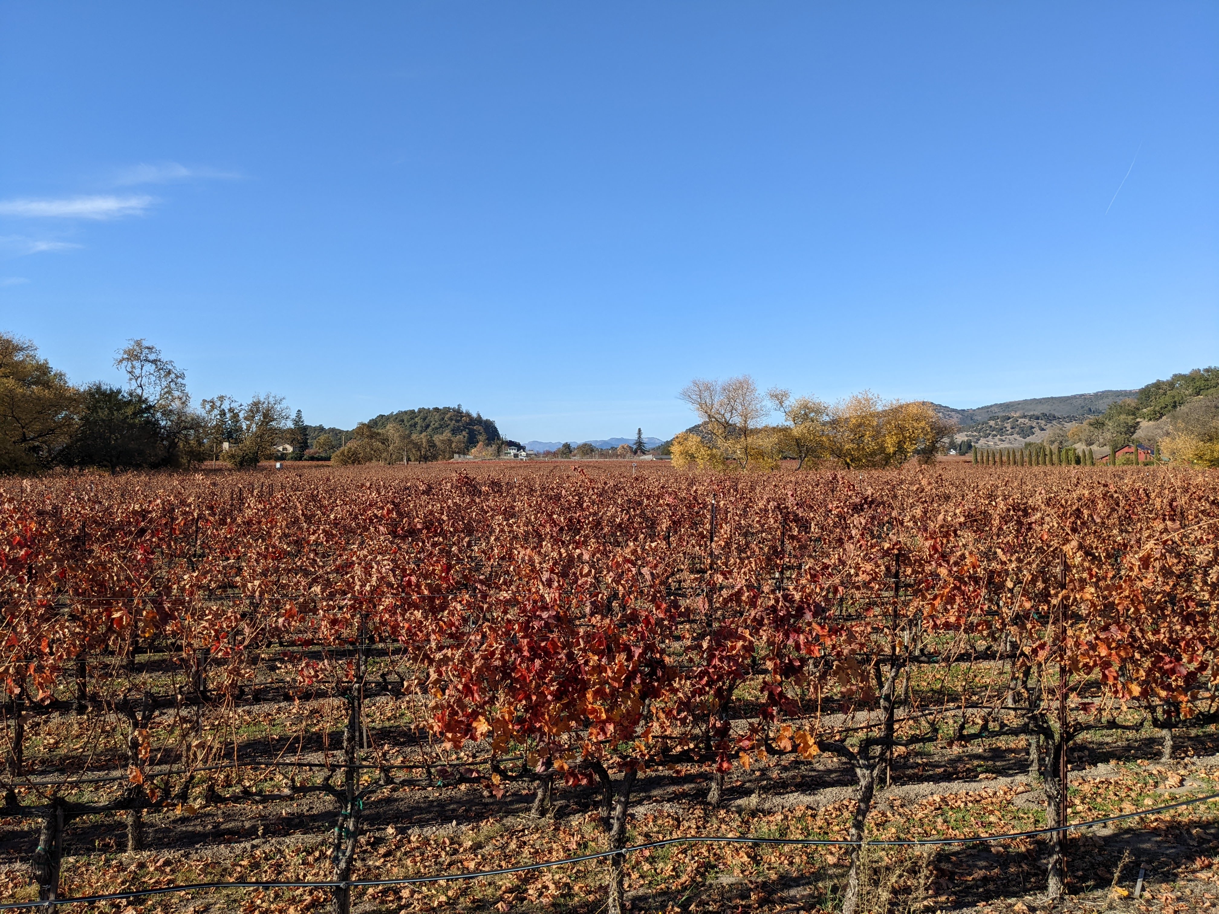
A scenery photo of 2 vineyards and autumn foliage shot on Wheeler Lane in St. Helena, CA.
Approximate GPS location (type into Google): 38° 29' 02.0" N 122° 26' 04.6" W
We spent some time exploring Downtown St. Helena next.
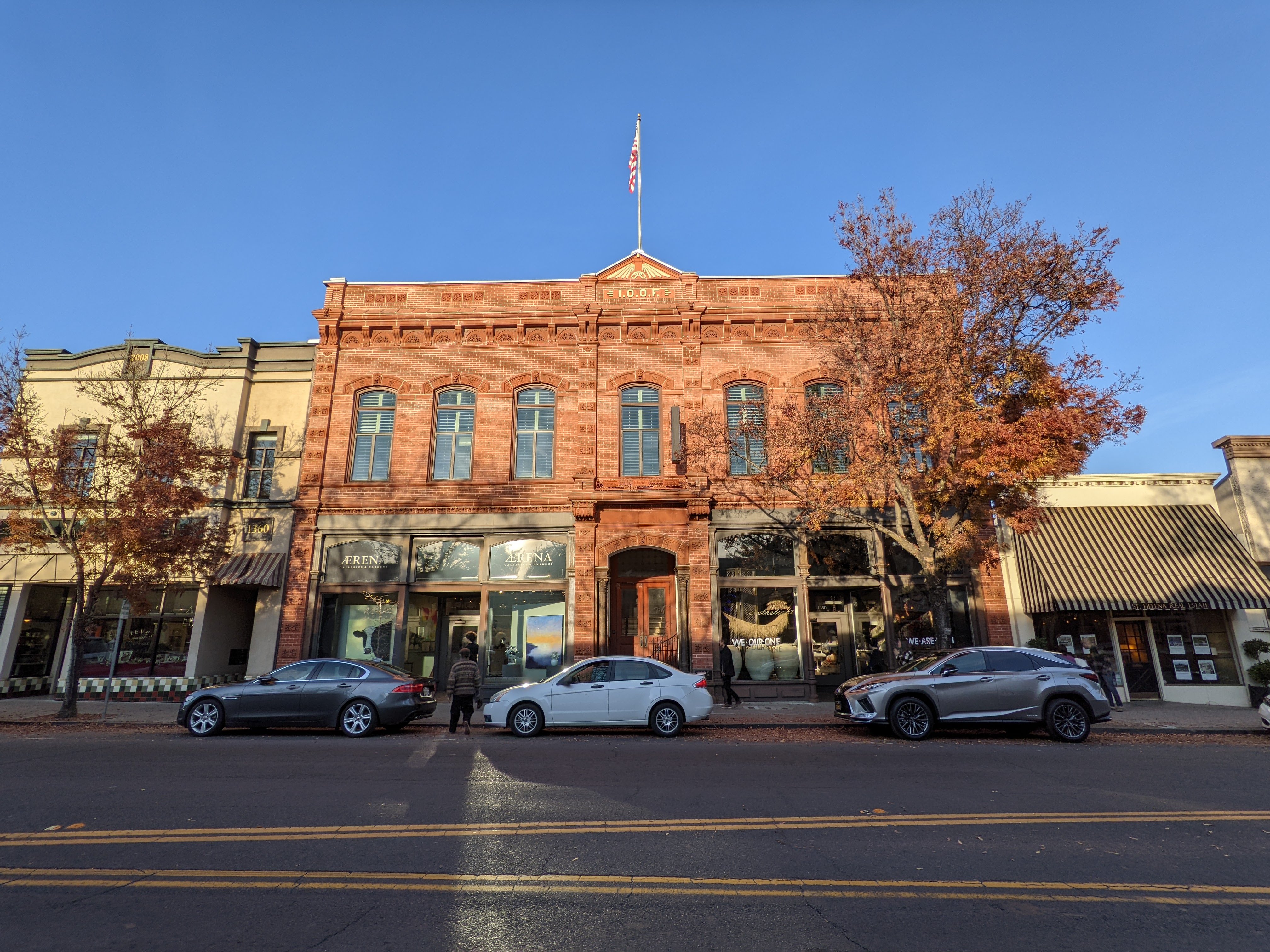
A scenery photo of a historic building in Downtown St. Helena. The photo was shot on Main St. in St. Helena, CA.
Approximate GPS location (type into Google): 38° 30' 17.1" N 122° 28' 09.4" W
A scenery photo of a historic building and a wine barrel Christmas tree (since wine is what Napa Valley is known for) in Downtown St. Helena.
Approximate GPS location (type into Google): 38° 30' 16.0" N 122° 28' 07.6" W
A scenery photo of a wine barrel Christmas tree (since wine is what Napa Valley is known for) in Downtown St. Helena.
Approximate GPS location (type into Google): 38° 30' 16.0" N 122° 28' 07.6" W
A scenery photo of a historic building in Downtown St. Helena. The photo was shot on Main St. in St. Helena, CA.
Approximate GPS location (type into Google): 38° 30' 17.9" N 122° 28' 11.3" W
After we were finished with St. Helena, we drove back to Napa, CA for dinner, however the restaurant (Yak and Yeti Restaurant) I had planned for us to eat at didn't open until 5 PM, so we exhausted some time at a local park called Trancas Crossing Park. This gave me an opportunity to test my new radios/walkie talkies, the Motorola T100 Talkabout Radio (
Product Link - Affiliate Link).
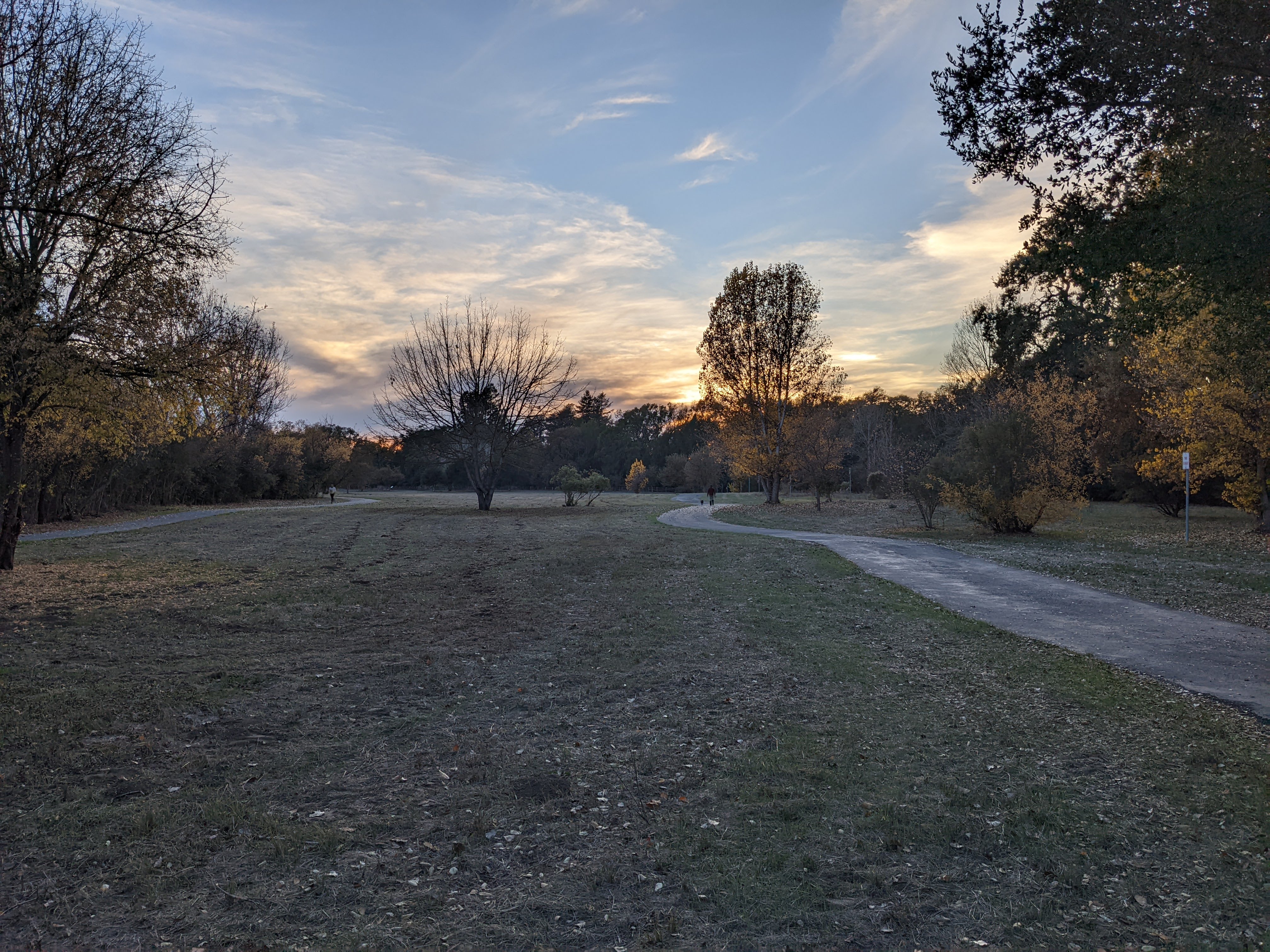
A sunset scenery photo from Trancas Crossing Park in Napa, CA.
Approximate GPS location (type into Google): 38° 19' 43.8" N 122° 17' 07.8" W
A sunset scenery photo from Trancas Crossing Park in Napa, CA.
Approximate GPS location (type into Google): 38° 19' 48.6" N 122° 17' 03.1" W
A sunset scenery photo of autumn foliage from Trancas Crossing Park in Napa, CA.
Approximate GPS location (type into Google): 38° 19' 48.6" N 122° 17' 03.1" W
A sunset scenery photo from Trancas Crossing Park in Napa, CA.
Approximate GPS location (type into Google): 38° 19' 50.0" N 122° 16' 59.4" W
A sunset scenery photo from Trancas Crossing Park in Napa, CA.
Approximate GPS location (type into Google): 38° 19' 39.8" N 122° 16' 59.9" W
My mom and I tested the Motorola T100 Talkabout Radio (Product Link - Affiliate Link) with her in the car. The maximum distance between her and I in the park was around 0.4 mile. The radio/walkie talkie worked flawlessly in our limited test. I used AmazonBasics 800 mAh Rechargeable AAA Batteries (Product Link - Affliliate Link) in the radios.
After taking a walk at Trancas Crossing Park in Napa, we went to Yak and Yeti Restaurant (3150 B Jefferson St, Napa, CA 94559) for dinner. This is an Indian and Nepalese food restaurant located in a random strip mall in Napa. They had great vegetarian food for me, and non-vegetarian dishes for my parents. The servings were a bit small but the food wasn't expensive either. Note that mild means not spicy at all, which we didn't know. If you like spicy, go for at least a medium. If you're in Napa, I highly recommend you give this restaurant a try. After dinner, we went home.
This is all the photos for today. I hope you have enjoyed viewing the photos! Please don't forget to share the blog post with your friends and family members! Also, if you want to get notifications when I post up more photos, "Like" us on Facebook or follow me on Twitter and Instagram. These links can also be found on the top of the right sidebar.
Parts: Cellphone Photos | Mirrorless Photos