On 12 December 2022, my parents and I took a day trip to Yosemite National Park in California to see snow. Unfortunately we did not get to visit Yosemite Valley on this trip because a rockslide on Big Oak Flat Road blocked Yosemite Valley access from State Route 120. We were pretty disappointed when we saw the news (in Groveland, CA where I went to go buy some lunch), and detouring to State Route 140 would take too long for a day trip. We ended up walking part of the closed Big Oak Flat Road (getting some photos from the long tunnel where you normally can't take photos since there will be vehicles driving in there), and drove around Foresta, CA. The photos are split into 2 blog posts. I hope you enjoy viewing my photos!
High Resolution Photos: If you want to see high resolution photos of any of the photos you see here, use the following links. If you wish to purchase prints of any of the photos, please contact me here. To view my best Yosemite National Park photos from 2020 to 2022, use this link. To view my best sunset and night photography photos from 2019 to 2022, use this link. To view my best black and white and abstract photos from 2020 to 2022, use this link. To see all of my photos from Yosemite National Park in 2022, use this link.
Parts: Cellphone Photos | Olympus Photos
These are the photos I took on my Olympus mirrorless camera. The photos are from Big Oak Flat Road and Foresta, CA.
The first of the photos are from Big Oak Flat Road (the closed section). Big Oak Flat Road was closed at the Foresta Junction that day due to the rockslide. My dad and I ended up walking part of the closed road getting photos from areas that you normally can't because there will be other vehicles driving around.
Note: I do not recommend bypassing road closures. They are there for your safety. If you decide to bypass a road closure, you do so at your own risk. In this case, I knowingly walked into an area that recently had a rockslide. I decided to take that risk, along with my parents and 2 other tourists. Again, do so at your own risk, and always assess your risks before proceeding.
A photo of the Long Tunnel (part of Big Oak Flat Road).
A black and white process of the photo above.
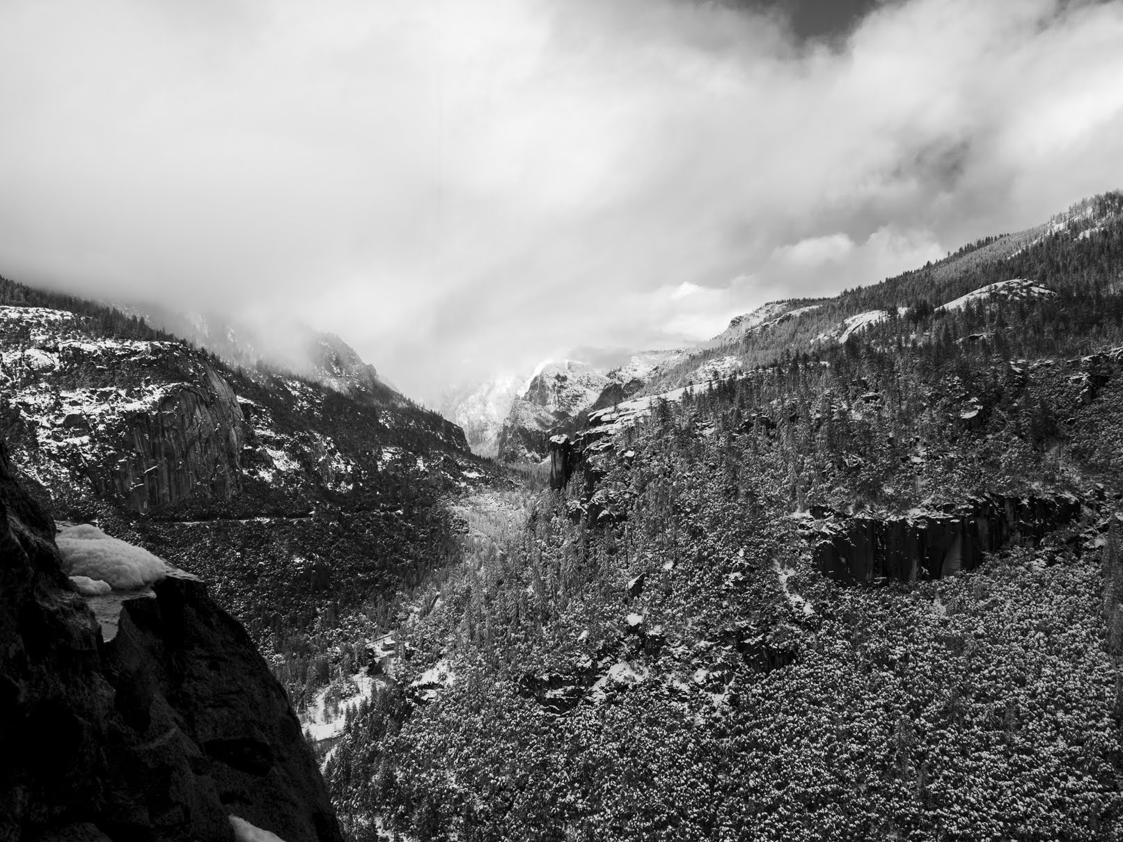
An HDR composition of the Long Tunnel (part of Big Oak Flat Road), snow, and forest.
A black and white process of the HDR composition above.
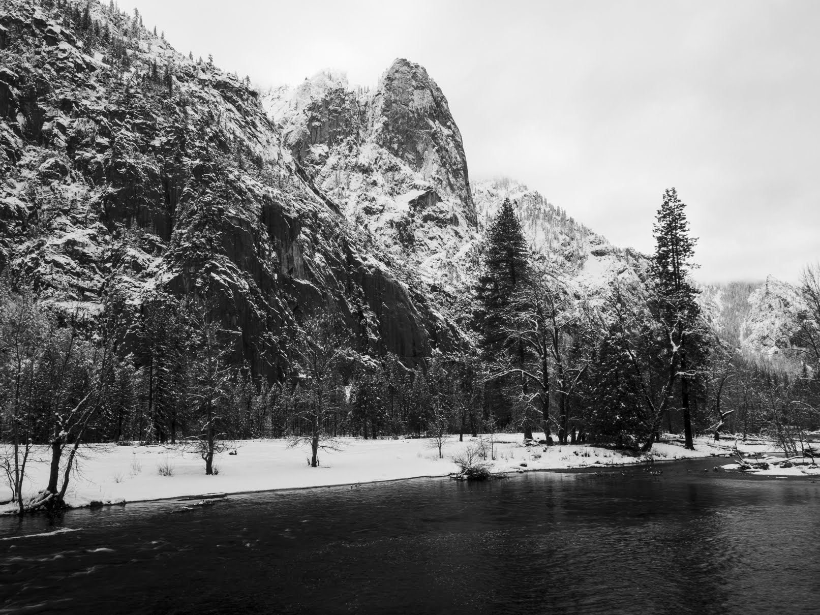
A snowy scenery photo of Merced River (left), granite mountains, snow, fog, clouds, and forest. There was water dripping down from the granite rockface above, and you can see my camera actually caught it in the photo on the top (vertical lines). The photo was shot at the end of the ventilation tunnel for the Long Tunnel (part of Big Oak Flat Road).
A black and white process of the photo above.
An HDR composition of the Long Tunnel (part of Big Oak Flat Road), snow, and forest.
Up next are scenery photos from the viewpoint on the other side of the Long Tunnel on Big Oak Flat Road.
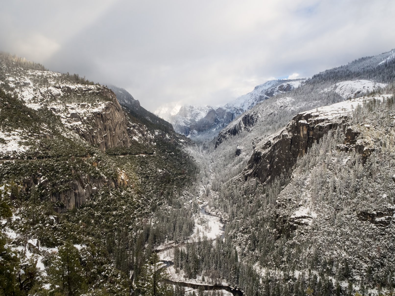
A snowy scenery photo of Merced River (center), Bridalveil Fall (in the distance in the center), granite mountains, snow, fog, clouds, and forest. The photo was shot on the side of Big Oak Flat Road.
Approximate GPS location (type into Google): 37° 43' 25" N 119° 43' 07" W
A snowy scenery photo of Merced River (center), Bridalveil Fall (in the distance in the center), granite mountains, snow, fog, clouds, and forest. The photo was shot on the side of Big Oak Flat Road.
Photo shot at the same spot as above.
A black and white process of the photo above.
A snowy scenery photo of Merced River, snow, and forest. The photo was shot on the side of Big Oak Flat Road.
Photo shot at the same spot as above.
A snowy scenery photo of Merced River (center bottom), Bridalveil Fall (in the distance in the center), granite mountains, snow, fog, clouds, and forest. The photo was shot on the side of Big Oak Flat Road.
Photo shot at the same spot as above.
After my dad and I finished our walk through the Long Tunnel, we drove around Foresta, CA (part of Yosemite National Park).
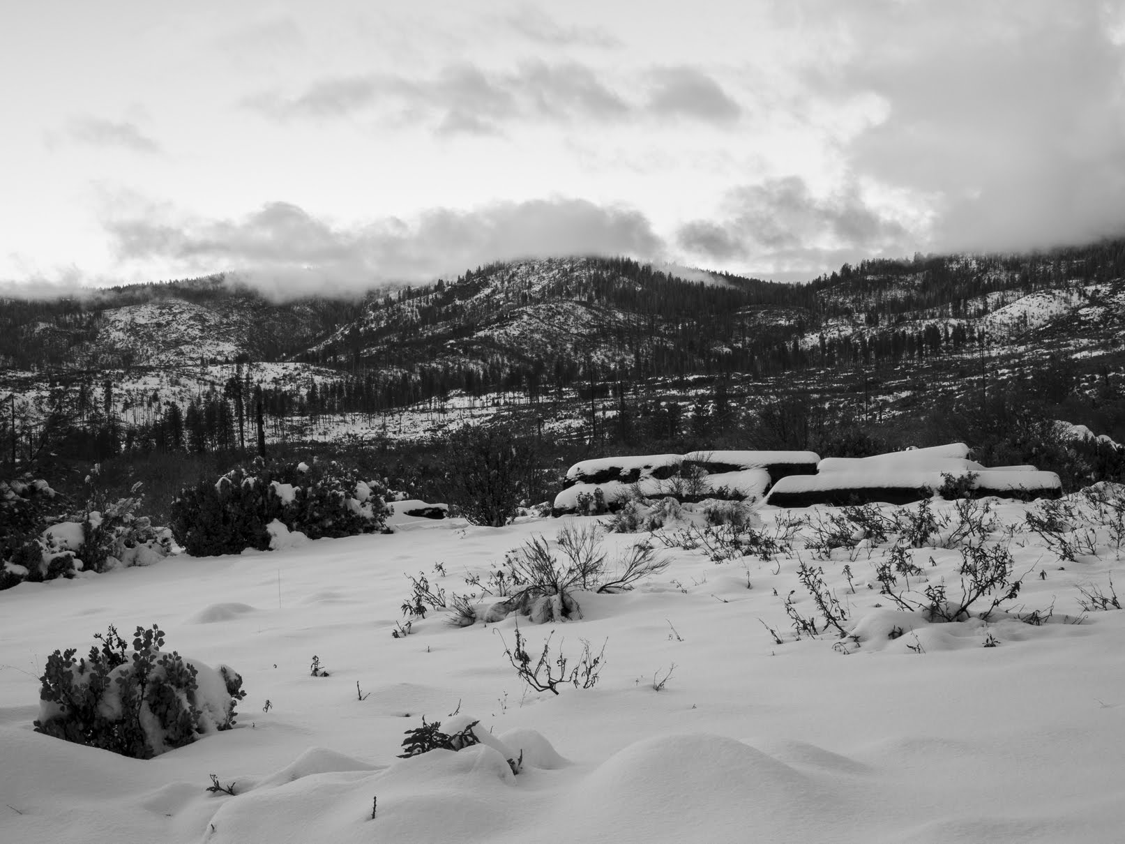
A snowy sunset scenery photo of mountains, snow, forest, and clouds. The photo was shot on Foresta Road.
Approximate GPS location (type into Google): 37° 42' 11" N 119° 44' 09" W
A black and white process of the photo above.
An abstract process of the photo above.
A snowy sunset scenery photo of mountains, snow, forest, fog, and clouds. The photo was shot on Foresta Road.
Approximate GPS location (type into Google): 37° 42' 23" N 119° 44' 06" W
A sunset scenery photo of mountains, snow, forest, fog, and clouds. The photo was shot on Foresta Road.
Photo shot at the same spot as above.
A snowy sunset scenery photo of mountains, snow, forest, fog, and clouds. The photo was shot on Foresta Road.
Photo shot at the same spot as above.
A snowy sunset scenery photo of mountains, snow, forest, fog, and clouds. The photo was shot on Foresta Road.
Approximate GPS location (type into Google): 37° 42' 30" N 119° 44' 10" W
This is all the photos for today. I hope you have enjoyed viewing the photos! Please don't forget to share the blog post with your friends and family members! Also, if you want to get notifications when I post up more photos, "Like" us on Facebook or follow me on Instagram. These links can also be found on the top of the right sidebar.
Parts: Cellphone Photos | Olympus Photos