Showing posts with label bixby creek bridge. Show all posts

Sunday, July 28, 2024

State Route 1 & Julia Pfeiffer Burns SP - Monterey County, CA

On 1st June 2024, my parents and I went for a drive along State Route 1 in Monterey County, CA. We visited Hurricane Point Vista Point, Seal Beach Overlook, and Julia Pfeiffer Burns State Park. I hope you enjoy viewing my photos!

High Resolution Photos: If you want to see high resolution photos of any of the photos you see here, use the following links. If you wish to purchase prints of any of the photos, please contact me here. To view my best State Route 1 photos from Monterey to Big Sur, use this link. To see all of my photos from this trip, use this link.

Since we were traveling really far south on State Route 1 this day, we didn't stop at any places before Bixby Creek Bridge. Our first stop was Hurricane Point Vista Point.

A scenery photo of Bixby Creek Bridge, mountains, clouds, and the Pacific Ocean. The photo was shot at Hurricane Point Vista Point next to State Route 1 in Monterey County, CA.
Approximate GPS location (type into Google): 36° 21' 28" N 121° 54' 09" W

A black and white process of the photo above.

A scenery photo of clouds, mountains, Pacific Ocean, and Pride of Madeira Flowers (Echium candicans) (bottom left). The photo was shot at Seal Beach Overlook in Monterey County, CA.
Approximate GPS location (type into Google): 36° 12' 05" N 121° 43' 42" W

A black and white process of the photo above.

Next, we arrive at Julia Pfeiffer Burns State Park in Monterey County, CA.

A scenery photo of clouds, mountains, and Pacific Ocean. The photo was shot at a turn out on the side of State Route 1 in Julia Pfeiffer Burns State Park in Monterey County, CA.
Approximate GPS location (type into Google): 36° 10' 24" N 121° 32' 00" W

A scenery photo of clouds, mountains, trees, and Pacific Ocean. The photo was shot at Julia Pfeiffer Burns State Park Vista Point on the side of State Route 1 in Julia Pfeiffer Burns State Park in Monterey County, CA.
Approximate GPS location (type into Google): 36° 10' 10" N 121° 41' 05" W

Next we arrive at McWay Falls in Julia Pfeiffer Burns State Park. The GPS coordinates for the photos taken there is at 36° 09' 34" N 121° 40' 18" W.

A scenery photo of McWay Falls, McWay Beach, McWay Cove, and Pacific Ocean. The photo was shot on Waterfall Overlook Trail in Julia Pfeiffer Burns State Park in Monterey County, CA.

A black and white process of the photo above.

A scenery photo of McWay Falls, McWay Beach, McWay Cove, and Pacific Ocean. The photo was shot on Waterfall Overlook Trail in Julia Pfeiffer Burns State Park in Monterey County, CA.

A long exposure scenery photo of McWay Falls, McWay Beach, McWay Cove, and Pacific Ocean. The long exposure effect was achieved using an ND filter. The photo was shot on Waterfall Overlook Trail in Julia Pfeiffer Burns State Park in Monterey County, CA.

A black and white process of the photo above.

A long exposure scenery photo of McWay Falls, McWay Beach, McWay Cove, and Pacific Ocean. The long exposure effect was achieved using an ND filter. The photo was shot on Waterfall Overlook Trail in Julia Pfeiffer Burns State Park in Monterey County, CA.

A long exposure scenery photo of McWay Falls, McWay Beach, McWay Cove, and Pacific Ocean. The long exposure effect was achieved using an ND filter. The photo was shot on Waterfall Overlook Trail in Julia Pfeiffer Burns State Park in Monterey County, CA.

A scenery photo of McWay Falls, McWay Beach, McWay Cove, and Pacific Ocean. The photo was shot on Waterfall Overlook Trail in Julia Pfeiffer Burns State Park in Monterey County, CA.

Next we started our drive home.

A scenery photo of Bixby Creek Bridge, mountains, clouds, and the Pacific Ocean. The photo was shot at Hurricane Point Vista Point next to State Route 1 in Monterey County, CA.
Approximate GPS location (type into Google): 36° 21' 27" N 121° 54' 10" W

A black and white process of the photo above.

This is all the photos for today. I hope you have enjoyed viewing the photos! Please don't forget to share the blog post with your friends and family members! Also, if you want to get notifications when I post up more photos, "Like" us on Facebook or follow me on Instagram. These links can also be found on the top of the right sidebar.

Saturday, July 6, 2024

State Route 1 - Monterey County, CA

On 24th May 2024, my parents and I went for a drive along State Route 1 in Monterey County, CA. We visited Garrapata State Park, Bixby Creek Bridge, and more. I hope you enjoy viewing my photos!

High Resolution Photos: If you want to see high resolution photos of any of the photos you see here, use the following links. If you wish to purchase prints of any of the photos, please contact me here. To view my best State Route 1 photos from Monterey to Big Sur, use this link. To see all of my photos from this trip, use this link.

A selfie I took on Soberanes Point Trail in Garrapata State Park in Monterey County, CA.
I did take this photo myself, with the built in WiFi function in my camera.
In the photo is Soberanes Creek and Soberanes Creek Falls.
Approximate GPS location (type into Google): 36° 27' 22" N 121° 55' 29" W

A selfie I took on Soberanes Point Trail in Garrapata State Park in Monterey County, CA.
I did take this photo myself, with the built in WiFi function in my camera.
In the photo is Soberanes Creek.
The photo was shot at the same spot as above.

A scenery photo of Bixby Creek Bridge, Bixby Creek, the Pacific Ocean, rocks, and clouds. The photo was shot on Coast Road in Monterey County, CA.
Approximate GPS location (type into Google): 36° 22' 21" N 121° 54' 06" W

A scenery photo of mountains, forest, and clouds. The photo was shot on Coast Road in Monterey County, CA.
Approximate GPS location (type into Google): 36° 22' 31" N 121° 53' 53" W

A scenery photo of Bixby Creek Bridge, Bixby Creek, the Pacific Ocean, rocks, and clouds. The photo was shot at Bixby Creek Bridge Vista Point on Coast Road in Monterey County, CA.
Approximate GPS location (type into Google): 36° 22' 31" N 121° 53' 58" W

A scenery photo of Bixby Creek Bridge, the Pacific Ocean, clouds, rocks, and mountains. The photo was shot at Hurricane Point Vista Point on the side of State Route 1 in Monterey County, CA.
Approximate GPS location (type into Google): 36° 21' 27" N 121° 54' 10" W

A black and white process of the photo above.

A scenery photo of Point Sur, Little Sur River Beach, rocks, clouds, and the Pacific Ocean. The photo was shot at Hurricane Point Vista Point on the side of State Route 1 in Monterey County, CA.
Approximate GPS location (type into Google): 36° 21' 25" N 121° 54' 11" W

A black and white process of the photo above.

A scenery photo of Point Sur, wild mustard flowers, beach, clouds, and the Pacific Ocean. The photo was shot on State Route 1 in Monterey County, CA.
Approximate GPS location (type into Google): 36° 19' 08" N 121° 53' 33" W

A black and white process of the photo above.

A scenery photo of State Route 1 (right), mountains, and clouds shot in Monterey County, CA.
Approximate GPS location (type into Google): 36° 17' 29" N 121° 51' 30" W

This is all the photos for today. I hope you have enjoyed viewing the photos! Please don't forget to share the blog post with your friends and family members! Also, if you want to get notifications when I post up more photos, "Like" us on Facebook or follow me on Instagram. These links can also be found on the top of the right sidebar.

Saturday, April 29, 2023

Bixby Creek Bridge & Coast Road (Part 2) - Monterey County, CA

On 18 April 2023, my mom and I drove along State Route 1 in Monterey County, CA. We visited Garrapata State Park and Bixby Creek Bridge. I took photos with my cellphones and mirrorless camera. The photos are split into 3 blog posts. I hope you enjoy viewing my photos!

High Resolution Photos: If you want to see high resolution photos of any of the photos you see here, use the following links. If you wish to purchase prints of any of the photos, please contact me here. To see my best photos from State Route 1, use this link. To see my best flower photos from 2019 to 2023, use this link. To see my best sunset, sunrise, and night photography photos from 2019 to 2023, use this link. To see all of my photos from this trip, use this link.

Parts: Cellphone Photos | Olympus Part 1 | Olympus Part 2

These photos were shot on my Olympus mirrorless camera. The photos are from Bixby Creek Bridge and Coast Road in Monterey County, CA. After Garrapata State Park, my mom and I drove towards Bixby Creek Bridge, which was the last stop for the day before we headed home. I also took a short walk on Coast Road (near Bixby Creek Bridge).

Please note Coast Road was closed on the day I went, and I did walk into the closed area. There was a small, but constant flow of sand, small pebbles, and small rocks coming down on parts of the rock face. This is risky, and the road is closed for a reason. If you walk onto the road, please assess the risks yourself before walking into a closed area. You access closed areas at your own risk. You could become trapped under a rockslide or your return path could be blocked off by a rockslide. You could die!

A scenery photo of the Bixby Creek Bridge (part of State Route 1), Coast Road (right), a valley, and the Pacific Ocean. This photo was shot at Bixby Creek Bridge Vista Point on the side of Coast Road in Monterey County, CA.
Approximate GPS location (type into Google): 36° 22' 31" N 121° 53' 54" W

A black and white process of the photo above.

A scenery photo of the Bixby Creek Bridge (part of State Route 1), Coast Road (right), a valley, and the Pacific Ocean. This photo was shot at Bixby Creek Bridge Vista Point on the side of Coast Road in Monterey County, CA.
Photo shot at the same spot as above.

A scenery photo of the Bixby Creek Bridge (part of State Route 1), Coast Road (right), wild flowers (bottom), a valley, and the Pacific Ocean. This photo was shot on Coast Road in Monterey County, CA.
Approximate GPS location (type into Google): 36° 22' 30" N 121° 53' 47" W

A scenery photo of the Bixby Creek Bridge (part of State Route 1), Coast Road (right), a valley, and the Pacific Ocean. This photo was shot on Coast Road in Monterey County, CA.
Photo shot at the same spot as above.

A black and white process of the photo above.

A scenery photo of the Bixby Creek Bridge (part of State Route 1), Coast Road (right), a valley, and the Pacific Ocean. This photo was shot on Coast Road in Monterey County, CA.
Approximate GPS location (type into Google): 36° 22' 30" N 121° 53' 48" W

A black and white process of the photo above.

A scenery photo of the Bixby Creek Bridge (part of State Route 1), Coast Road (right), a valley, and the Pacific Ocean. This photo was shot on Coast Road in Monterey County, CA.
Photo shot at the same spot as above.

Next, are a few photos shot during sunset near the Bixby Creek Bridge on the side of State Route 1.

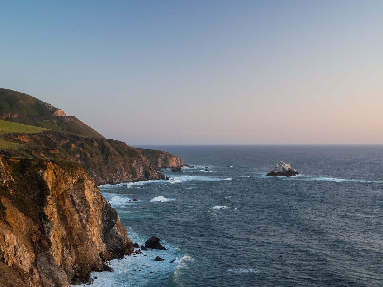
A sunset scenery photo of the Pacific Ocean, rocks, a hill, and cliffs. The photo was shot near the Bixby Creek Bridge on the side of State Route 1.
Approximate GPS location (type into Google): 36° 22' 21" N 121° 54' 10" W

An abstract long exposure photo of a beach, waves, rocks, and a cliff. The photo was shot during sunset near the Bixby Creek Bridge on the side of State Route 1.
Photo shot at the same spot as above.

A black and white process of the photo above.

An abstract long exposure photo of a beach, waves, rocks, and a cliff. The photo was shot during sunset near the Bixby Creek Bridge on the side of State Route 1.
Photo shot at the same spot as above.

This is all the photos for today. I hope you have enjoyed viewing the photos! Please don't forget to share the blog post with your friends and family members!Also, if you want to get notifications when I post up more photos, "Like" us on Facebook or follow me on Instagram. These links can also be found on the top of the right sidebar.

Parts: Cellphone Photos | Olympus Part 1 | Olympus Part 2

Wednesday, April 19, 2023

State Route 1 - Monterey County, CA (Cellphone Photos)

On 18 April 2023, my mom and I drove along State Route 1 in Monterey County, CA. We visited Garrapata State Park and Bixby Creek Bridge. I took photos with my cellphones and mirrorless camera. The photos are split into 3 blog posts. I hope you enjoy viewing my photos!

Parts: Cellphone Photos | Olympus Part 1 | Olympus Part 2

These photos were shot on my cellphones. The photos are from Garrapata State Park (Somberanes Point Trails and Calla Lily Valley), State Route 1, Notleys Landing, Bixby Creek Bridge, and Coast Road (near Bixby Creek Bridge).

The first main location we visited was Garrapata State Park along State Route 1.

Field Bindweed (Convolvulus arvensis)
The photo was shot near Gate 2 of Garrapata State Park.

A scenery photo of rocky cliffs, mountains, clouds, and the Pacific Ocean.
The photo was shot at Garrapata State Park Vista Point near Gate 4 in Garrapata State Park.

A scenery photo of rocky cliffs, mountains, clouds, and the Pacific Ocean.
The photo was shot on the Somberanes Point Trails in Garrapata State Park.

A scenery photo of yellow mustard flowers, the ocean, clouds, and high voltage power lines (left).
The photo was shot on the Somberanes Point Trails in Garrapata State Park.

Advertisement
Advertisement Place Holder APHAPHAPHAPHAPHAPH

Next we arrive at Calla Lily Valley which is also in Garrapata State Park.

A scenery photo of Calla Lily flowers (Zantedeschia aethiopica), hills, clouds, and high voltage power lines.
The photo was shot at Calla Lily Valley in Garrapata State Park.

Calla Lily Flowers (Zantedeschia aethiopica)
The photo was shot at Calla Lily Valley in Garrapata State Park.

A scenery photo of Calla Lily flowers (Zantedeschia aethiopica), Garrapata Beach, the Pacific Ocean, and the sun.
The photo was shot at Calla Lily Valley in Garrapata State Park.

Advertisement
Advertisement Place Holder APHAPHAPHAPHAPHAPH

Next we started driving towards Bixby Creek Bridge.

A scenery photo of Rocky Creek Bridge (in the distance), rocky cliffs, mountains, clouds, and the Pacific Ocean.
The photo was shot at Notleys Landing Vista Point.

Next we arrive at Bixby Creek Bridge.

A scenery photo of Bixby Creek Bridge (part of State Route 1), hills, and clouds.
The photo was shot on the side of State Route 1.

A scenery photo of rocky cliffs, mountains, clouds, and the Pacific Ocean.
The photo was shot on the side of State Route 1 near Bixby Creek Bridge.

Advertisement
Advertisement Place Holder APHAPHAPHAPHAPHAPH

Next, I look a walk along part of Coast Road near Bixby Creek Bridge. My mom was too cold so she stayed in the car here. We ended up communicating over the Midland GXT1050 Radio which worked flawlessly over the short distance. The max distance apart was approximately 1720 ft, with no obstruction (except for our car). There is only patchy cellphone service along State Route 1, and my mom and I had no AT&T signal around Bixby Creek Bridge. I recommend you bring radios if you are traveling in a group so you can communicate with each other.

Also please note Coast Road was closed on the day I went, and I did walk into the closed area. There was a small, but constant flow of sand, small pebbles, and small rocks coming down on parts of the rock face. This is risky, and the road is closed for a reason. If you walk onto the road, please assess the risks yourself before walking into a closed area. You access closed areas at your own risk. You could become trapped under a rockslide or your return path could be blocked off by a rockslide. You could die!

A scenery photo of Pride of Madeira flowers (Echium candicans), Coast Road, and mountains.

A photo of Pride of Madeira flowers (Echium candicans) growing on a rockface.
The photo was shot on Coast Road.

A scenery photo of the valley behind Bixby Creek Bridge, and clouds. If you look closely, you'll see several houses in the photo along with some high voltage powerlines.
The photo was shot on Coast Road.

A scenery photo of Bixby Creek Bridge, high voltage powerlines, Coast Road (right), and the Pacific Ocean.
The photo was shot at Bixby Creek Bridge Vista Point on Coast Road.

This is all the photos for today. I hope you have enjoyed viewing the photos! Please don't forget to share the blog post with your friends and family members! Also, if you want to get notifications when I post up more photos, "Like" us on Facebook or follow me on Instagram. These links can also be found on the top of the right sidebar.

Parts: Cellphone Photos | Olympus Part 1 | Olympus Part 2