Showing posts with label SR-108. Show all posts

Saturday, July 22, 2023

Stanislaus/Humboldt-Toiyabe NF - California

On 2 July 2023, my parents and I drove along State Route 108 in Stanislaus National Forest and Humboldt-Toiyabe National Forest in California. I took photos with my cellphones and mirrorless camera. The photos are split into 2 blog posts. I also took 2 videos on my phones as well of the creek (which is extremely fast this year due to the extra heavy snowfall), which can be viewed here. I hope you enjoy viewing my photos!

High Resolution Photos: If you want to see high resolution photos of any of the photos you see here, use the following links. If you wish to purchase prints of any of the photos, please contact me here. To view my best Stanislaus National Forest & Humboldt-Toiyabe National Forest photos from 2021 to 2023, use this link. To see all of my photos from this trip, use this link.

Parts: Cellphone Photos | Olympus Photos

These photos were shot on my Olympus mirrorless camera.

A scenery photo of Molo Mountain, Black Hawk Mountain, forest, snow, and clouds. The photo was shot near State Route 108 in Stanislaus National Forest.
Approximate GPS location (type into Google): 38° 18' 54" N 119° 44' 35" W

A scenery photo of mountains, forest, State Route 108, snow, and clouds. The photo was shot on Pacific Crest Trail near Sonora Pass in Humboldt-Toiyabe National Forest.
Approximate GPS location (type into Google): 38° 19' 41" N 119° 38' 11" W

A black and white process of the photo above.

A scenery photo of mountains, forest, State Route 108, snow, and clouds. The photo was shot on Pacific Crest Trail near Sonora Pass in Humboldt-Toiyabe National Forest.
Approximate GPS location (type into Google): 38° 19' 42" N 119° 38' 10" W

A black and white process of the photo above.

A scenery photo of mountains, forest, State Route 108, snow, and clouds. The photo was shot on Pacific Crest Trail near Sonora Pass in Humboldt-Toiyabe National Forest.
Approximate GPS location (type into Google): 38° 19' 44" N 119° 38' 04" W

A scenery photo of mountains, forest, State Route 108, snow, and clouds. The photo was shot on Pacific Crest Trail near Sonora Pass in Humboldt-Toiyabe National Forest.
Approximate GPS location (type into Google): 38° 19' 44" N 119° 38' 03" W

A black and white process of the photo above.

A scenery photo of Mt. Patterson, State Route 108, forest, snow, mountains, and clouds. The photo was shot near State Route 108 in Humboldt-Toiyabe National Forest.
Approximate GPS location (type into Google): 38° 18' 25" N 119° 35' 34" W

A scenery photo of mountains, forest, and snow. The photo was shot on Forest Service Route 077 in Humboldt-Toiyabe National Forest.
Approximate GPS location (type into Google): 38° 18' 04" N 119° 35' 52" W

A scenery photo of a meadow, mountains, forest, and snow. The photo was shot on Forest Service Route 077 in Humboldt-Toiyabe National Forest.
Approximate GPS location (type into Google): 38° 18' 09" N 119° 35' 45" W

A scenery photo of a mountain, a walking trail, and trees. The photo was shot on #22046 West Walker River Trail in Humboldt-Toiyabe National Forest.
Approximate GPS location (type into Google): 38° 19' 49" N 119° 32' 58" W

A black and white process of the photo above.

A scenery photo of mountains, forest, and snow. The photo was shot on #22046 West Walker River Trail in Humboldt-Toiyabe National Forest.
Approximate GPS location (type into Google): 38° 19' 45" N 119° 32' 59" W

A scenery photo of West Walker River, mountains, forest, and snow. The photo was shot near #22046 West Walker River Trail in Humboldt-Toiyabe National Forest.
Approximate GPS location (type into Google): 38° 19' 43" N 119° 33' 04" W

A black and white process of the photo above.

A scenery photo of West Walker River, Lost Cannon Peak (in the center in the distance), forest, and snow. The photo was shot near #22046 West Walker River Trail in Humboldt-Toiyabe National Forest.
Approximate GPS location (type into Google): 38° 19' 45" N 119° 33' 04" W

This is all the photos for today. I hope you have enjoyed viewing the photos! Please don't forget to share the blog post with your friends and family members! Also, if you want to get notifications when I post up more photos, "Like" us on Facebook or follow me on Instagram. These links can also be found on the top of the right sidebar.

Parts: Cellphone Photos | Olympus Photos

Monday, July 3, 2023

Stanislaus/Humboldt-Toiyabe NF (Cellphone Photos) - California

On 2 July 2023, my parents and I drove along State Route 108 in Stanislaus National Forest and Humboldt-Toiyabe National Forest in California. I took photos with my cellphones and mirrorless camera. The photos are split into 2 blog posts. I also took 2 videos on my phones as well of the creek (which is extremely fast this year due to the extra heavy snowfall), which can be viewed here. I hope you enjoy viewing my photos!

Parts: Cellphone Photos | Olympus Photos

These photos were shot on my cellphone.

A scenery photo of snow covered mountains, forest, and clouds. The photo was shot at a vista point on the side of State Route 108 in Stanislaus National Forest.

A photo of a small waterfall (part of Deadman Creek), and forest. The photo is shot on the side of State Route 108 in Stanislaus National Forest.

A photo of Deadman Creek, snow covered mountains, forest, and clouds. The photo is shot on the side of State Route 108 in Stanislaus National Forest.

A scenery photo of snow, snow covered mountains, forest, clouds, and State Route 108 (left). The photo was shot in Stanislaus National Forest.

A scenery photo of snow, mountains, forest, clouds, and State Route 108 (right). The photo was shot in Stanislaus National Forest.

A scenery photo of Sonora Pass, signs, State Route 108, snow covered mountains, forest, clouds, and Humboldt-Toiyabe National Forest. The photo was shot in Stanislaus National Forest.

A scenery photo of snow covered mountains, forest, clouds, and State Route 108. The photo was shot on Pacific Crest Trail near Sonora Pass in Humboldt-Toiyabe National Forest.

I took a selfie at Sonora Pass. Here is the sign for Sonora Pass. The photo was shot in Stanislaus National Forest.

A scenery photo of Mt. Emma, West Walker River, Leavitt Creek (left), clouds, and forest. The photo was shot at Leavitt Falls Vista Point in Humboldt-Toiyabe National Forest.

This is all the photos for today. I hope you have enjoyed viewing the photos! Please don't forget to share the blog post with your friends and family members! Also, if you want to get notifications when I post up more photos, "Like" us on Facebook or follow me on Instagram. These links can also be found on the top of the right sidebar.

Parts: Cellphone Photos | Olympus Photos

Friday, October 21, 2022

Autumn Foliage (Olympus Photos) - Humboldt-Toiyabe/Lee Vining

This blog post contains photos of Sierra Nevada aspen tree autumn foliage! On 15 October 2022, my parents and I went to Stanislaus National Forest, Humboldt Toiyabe National Forest, Lee Vining, Inyo National Forest, and Yosemite National Park in California. We drove on State Route 108, U.S. Route 395, and State Route 120 to look at autumn foliage. I took photos with my phone, my Olympus mirrorless camera, and my Canon EOS 5D Mark III camera. I hope you enjoy viewing my photos! 

High Resolution Photos: If you want to see high resolution photos of any of the photos you see here, use the following links. If you wish to purchase prints of any of the photos, please contact me here. To see all of my photos from this trip, use this link (Humboldt-Toiyabe National Forest) and this link (Lee Vining, CA).

Parts: Cellphone Photos | Olympus Photos | Canon Photos

These photos were shot on my Olympus mirrorless camera. In the photos are autumn foliage scenery, scenery from near State Route 108 (in Humboldt-Toiyabe National Forest), and scenery from Lee Vining, CA.

A scenery photo of the Marine Corps Mountain Warfare Training Center and Mt. Patterson. The photo was shot on the side of State Route 108 in Humboldt-Toiyabe National Forest.
Approximate GPS location (type into Google): 38° 19' 39" N 119° 33' 19" W

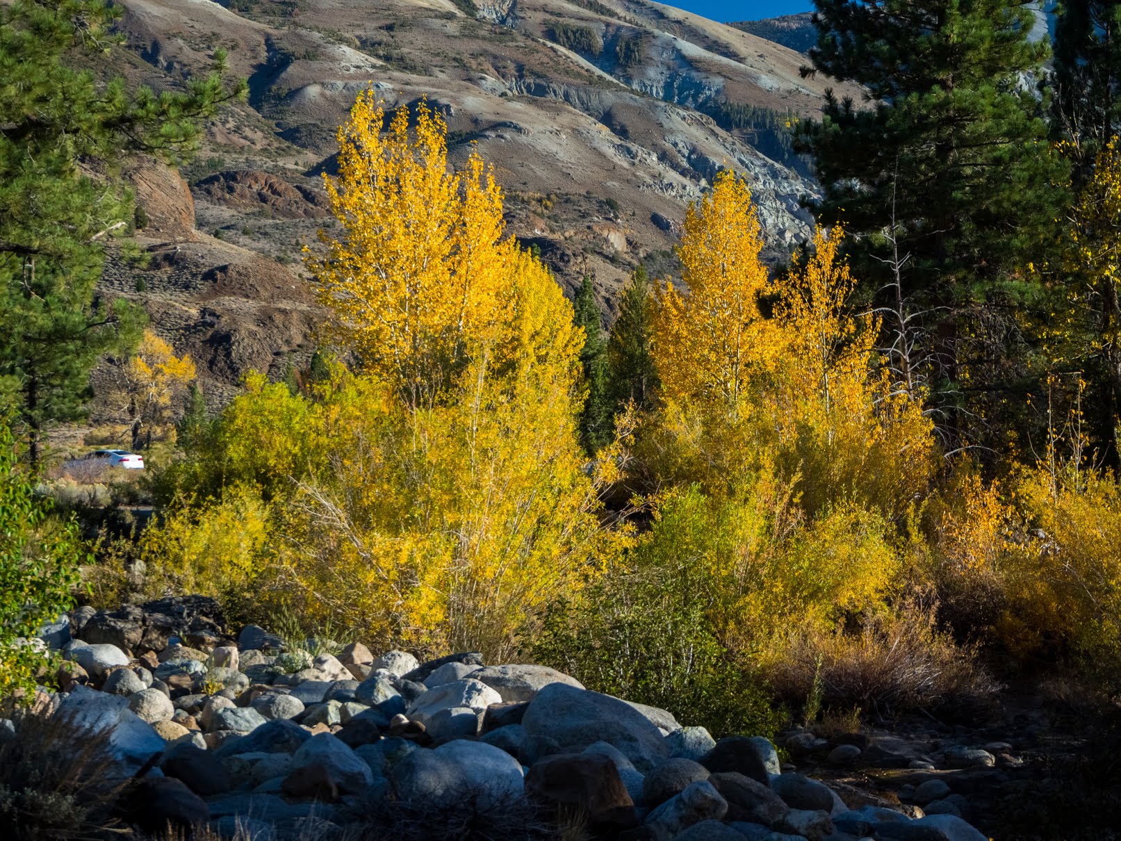
A scenery photo of autumn foliage on aspen trees and West Walker River (left). The photo was shot on the side of State Route 108 in Humboldt-Toiyabe National Forest.
Only after I got home, did I notice the road marker on the bottom of the photo. 😑
Photo shot near the same spot as above.

A scenery photo of autumn foliage on aspen trees. The photo was shot on the side of State Route 108 in Humboldt-Toiyabe National Forest.
Approximate GPS location (type into Google): 38° 21' 02" N 119° 32' 05" W

A scenery photo of autumn foliage on aspen trees. The photo was shot on the side of State Route 108 in Humboldt-Toiyabe National Forest.
Photo shot near the same spot as above.

A scenery photo of autumn foliage on aspen trees. The photo was shot on the side of State Route 108 in Humboldt-Toiyabe National Forest.
Photo shot near the same spot as above.

A scenery photo of autumn foliage on aspen trees. The photo was shot on the side of U.S. Route 395 near Conway Summit in Lee Vining, CA.
Approximate GPS location (type into Google): 38° 06' 46" N 119° 10' 41" W

Travel Tip: Do not speed on US-395 (and don't speed in general). California Highway Patrol frequently catch speeders this highway. My parents and I, when we visit Mono Lake and the Eastern Sierras, we'd always see cops pulling over speeders. I've also been told by other photographers and travelers that this is fairly common. Remember you are passing through rural towns out in the middle of nowhere... This is where the cops make their money. 😁 If your vehicle has cruise control, you can put it to good use on this highway (do so at your own risk, if you fall asleep with cruise control on, you can die).

A scenery photo of autumn foliage on aspen trees. The photo was shot on the side of U.S. Route 395 near Conway Summit in Lee Vining, CA.
Approximate GPS location (type into Google): 38° 06' 26" N 119° 10' 39" W

A scenery photo of autumn foliage on aspen trees. The photo was shot on the side of U.S. Route 395 near Conway Summit in Lee Vining, CA.
Photo shot near the same spot as above.

A scenery photo of autumn foliage on aspen trees. The photo was shot on the side of U.S. Route 395 near Conway Summit in Lee Vining, CA.
Photo shot near the same spot as above.

This is all the photos for today. I hope you have enjoyed viewing the photos! Please don't forget to share the blog post with your friends and family members! Also, if you want to get notifications when I post up more photos, "Like" us on Facebook or follow me on Twitter and Instagram. These links can also be found on the top of the right sidebar.

Parts: Cellphone Photos | Olympus Photos | Canon Photos

Saturday, May 29, 2021

Stanislaus National Forest & Carson Iceberg Wilderness, CA (Cellphone Photos)

Yesterday, I took a day trip to Stanislaus National Forest in California traveling along SR-108 (my parents drove, as I can't drive anymore). I also visited Carson Iceberg Wilderness on my hike. Here are the photos I took with my cellphone. You can see the photos I took on my mirrorless camera here.

The photos with snow in it are taken on my attempted hike from St. Mary's Pass Trail Head to Sonora Peak via St. Mary's Pass Trail. I hiked in both Stanislaus National Forest and Carson Iceberg Wilderness. I didn't end up being able to make it up Sonora Peak as the last bit of the trail was too steep for my liking (I've been visually impaired since August 2018), and I figured it's beyond my hiking skills. I still hiked up to almost 11,000 ft (3353 m) above sea level. The photos from this hike are taken near GPS coordinates 38° 21' 07.0" N 119° 38' 56.9" W. I hiked further than these coordinates, but I didn't take any photos.

If you do want to do this hike, note that if you head up there from the San Francisco Bay Area (sea level), you will get hit with altitude sickness! I mostly had no symptoms (until I tried to run around up there), my dad was a bit worse off than I was, and my mom got moderately sick from the altitude. Learn the symptoms of altitude sickness, sometimes people might feel a bit sleepy and euphoric, and do something stupid. Altitude sickness can slow down your brain, "dumb you down", and make performing simple tasks hard. Stay safe while hiking, know your limits, and don't push yourself over your limits. I do not recommend hiking this hike alone. I'm not a medical professional, so make sure you do your own research. The information here is just based on my own experience as a wilderness photographer for over a decade.

For this hike I also recommend you bring a physical compass and learn how to use it, as it is easy to lose sight of the trail or get lost on this trail (your phone can malfunction and/or run out of power). Also hiking poles are a necessity. 

The last bit of photos from the Giant Sequoia (Sequoiadendron giganteum) forest floor were shot near State Route 108 at GPS coordinates 38° 13' 35.8" N 119° 59' 54.6" W. 

A panorama shot in Carson Iceberg Wilderness on St. Mary's Pass Trail.
On the left are Bald Peak and Red Peak. On the right is Stanislaus Peak.

A photo of a sign marking the boundary of Carson Iceberg Wilderness and Stanislaus National Forest shot on St. Mary's Pass Trail.
To the left of the image is Stanislaus Peak.

A scenery photo of the Sierras shot from St. Mary's Pass Trail in Stanislaus National Forest.

A photo my mom took of me on St. Mary's Pass Trail in Carson Iceberg Wilderness.

Photos my mom took of me on St. Mary's Pass Trail in Carson Iceberg Wilderness.
On the left is Stanislaus Peak.

Photos my mom took of me on St. Mary's Pass Trail in Carson Iceberg Wilderness.

Sunset panorama shot from the Giant Sequoia (Sequoiadendron giganteum) forest floor. Photo shot close to State Route 108.

Sunset photos shot from the Giant Sequoia (Sequoiadendron giganteum) forest floor. Photo shot close to State Route 108.

This is all the photos for today. I hope you have enjoyed viewing the photos! Please don't forget to share the blog post with your friends and family members! Also, if you want to get notifications when I post up more photos, "Like" us on Facebook or follow me on Twitter and Instagram. These links can also be found on the top of the right sidebar.

Sunday, December 22, 2019

Leavitt Falls Vista Point & SR-108 (Part 12) - Stanislaus/Humboldt-Toiyabe National Forest

From July 5th, 2019 to July 7th, 2019, I took a trip to Mammoth Lakes, CA. I visited places such as Stanislaus National Forest, Lee Vining, Devils Postpile National Monument, Ansel Adams Wilderness, and more! The photos I took on this trip are split into 12 blog posts. I hope you enjoy viewing these photos.

Full Resolution Photos: If you want to see full resolution photos of any of the photos you see here, use the following links. If you wish to purchase prints of any of the photos, please contact me here. To see my best photos from Stanislaus National Forest, use this link. To see all of my photos from Stanislaus National Forest in 2019, use this link.

Parts: 1 | 2 | 3 | 4 | 5 | 6 | 7 | 8 | 9 | 10 | 11 | 12 | 

In this blog post, I have part 12 of my photos from the trip. The photos are shot on July 7th, 2019. Photos are from Leavitt Falls Vista Point in Humboldt-Toiyabe National Forest and State Route 108 in Stanislaus National Forest in California. These photos were all taken on my drive back home.

Message From The Photographer: If you've been following me on social media, you'd know I've been dealing with vision impairment and gradual vision loss since August 2018. The conditions are neurological, so my vision isn't impaired the same amount on a daily basis, but overall it seems to be going down hill. It has slowed down and made taking photos, processing photos, using computers, etc... very challenging and somewhat depressing. Some days it is impossible for me to take photos or process them. I know these photos are from a very long time ago, but I'm only just starting to get around in processing them as I'm only able to work on them at a very slow pace. I hope you can understand, and I I hope you enjoy viewing these photos.

Scenery of Leavitt Falls shot from Leavitt Falls Vista Point in Humboldt-Toiyabe National Forest.
Approximate GPS location (type into Google): 38° 19' 21" N 119° 33' 40" W

Black and white process of the photo above.

Scenery of Leavitt Falls shot from Leavitt Falls Vista Point in Humboldt-Toiyabe National Forest. Photo shot near the same spot as above.

Scenery of Mt. Emma, West Walker River, and Leavitt Creek (left) shot from Leavitt Falls Vista Point in Humboldt-Toiyabe National Forest. Photo shot near the same spot as above.

Black and white process of the photo above.

Scenery of Mt. Emma, West Walker River, and Leavitt Creek (left) shot from Leavitt Falls Vista Point in Humboldt-Toiyabe National Forest. Photo shot near the same spot as above.

Black and white process of the photo above.

Scenery of West Walker River (left) shot from Leavitt Falls Vista Point in Humboldt-Toiyabe National Forest. Photo shot near the same spot as above.

Black and white process of the photo above.

Scenery of Deadman Creek and State Route 108 in Stanislaus National Forest.
Approximate GPS location (type into Google): 38° 19' 02" N 119° 39' 59" W

Black and white process of the photo above.

Scenery of Deadman Creek shot near State Route 108 in Stanislaus National Forest. Photo shot near the same spot as above.

Black and white process of the photo above.

Scenery of Deadman Creek shot near State Route 108 in Stanislaus National Forest.
Approximate GPS location (type into Google): 38° 19' 34" N 119° 41' 11" W

Black and white process of the photo above.

Scenery of Deadman Creek shot near State Route 108 in Stanislaus National Forest. Photo shot near the same spot as above.

Black and white process of the photo above.

Scenery of State Route 108 in Stanislaus National Forest.
Approximate GPS location (type into Google): 38° 19' 34" N 119° 41' 13" W

Black and white process of the photo above.

This is all the photos for today and from this trip. I hope you have enjoyed viewing the photos! Also, if you want to get notifications when I post up more photos, "Like" us on Facebook or follow me on Twitter and Instagram. These links can also be found on the top of the right sidebar.

Parts: 1 | 2 | 3 | 4 | 5 | 6 | 7 | 8 | 9 | 10 | 11 | 12 |