Showing posts with label mount tamalpais state park. Show all posts

Saturday, January 28, 2023

Mt. Tamalpais East Peak (Part 2) - Marin County, CA

On 28 December 2022, my parents and I took a day trip to Mount Tamalpais State Park in Marin County, CA. We visited Trojan Point and Mt. Tamalpais East Peak. Recently, it has been raining quite heavily in the San Francisco Bay Area, and we took this trip on a day where there was a break from the storms. It was quite foggy and cloudy on the day we went. You'll see a lot of clouds and fog in the photos. The photos are split into 3 blog posts. I hope you enjoy viewing my photos!

High Resolution Photos: If you want to see high resolution photos of any of the photos you see here, use the following links. If you wish to purchase prints of any of the photos, please contact me here. To view my best Mt. Tamalpais State Park  photos, use this link. To see all of my photos from Mt. Tamalpais State Park & Bolinas, CA from 2016 to 2022, use this link.

Parts: Cellphone Photos | Olympus Part 1 | Olympus Part 2

This is part 2 of the photos I took with my Olympus mirrorless camera. The photos are of sunset and were shot on Verna Dunshee Trail at Mt. Tamalpais East Peak.

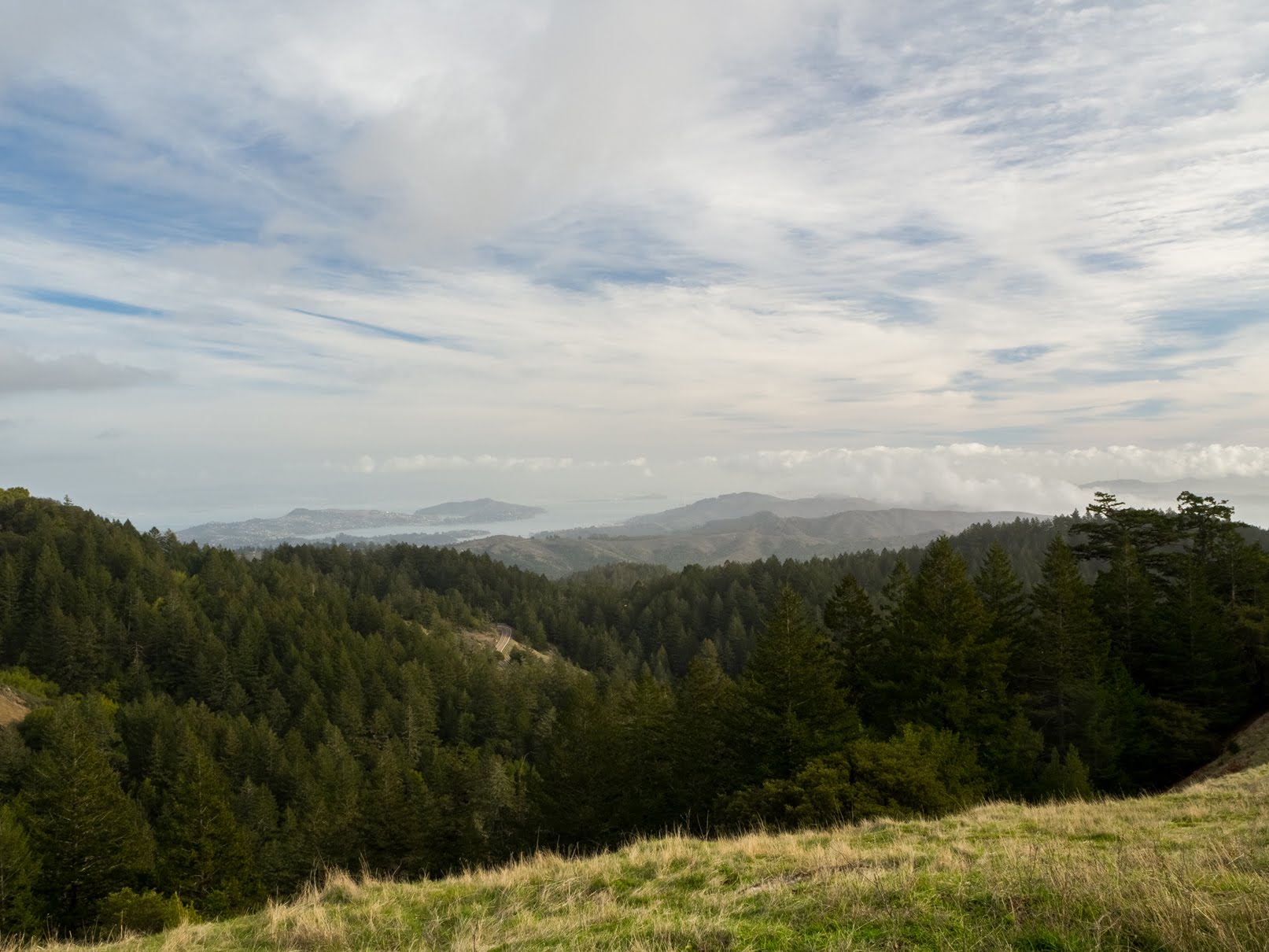
A scenery photo of Bon Tempe Lake (left), forest, clouds, and fog.
Approximate GPS location (type into Google): 37° 55' 47" N 122° 34' 44" W

A black and white process of the photo above.

An abstract process of the photo above.

A scenery photo of Bon Tempe Lake (left), forest, clouds, and fog.
Photo shot near the same spot as above.

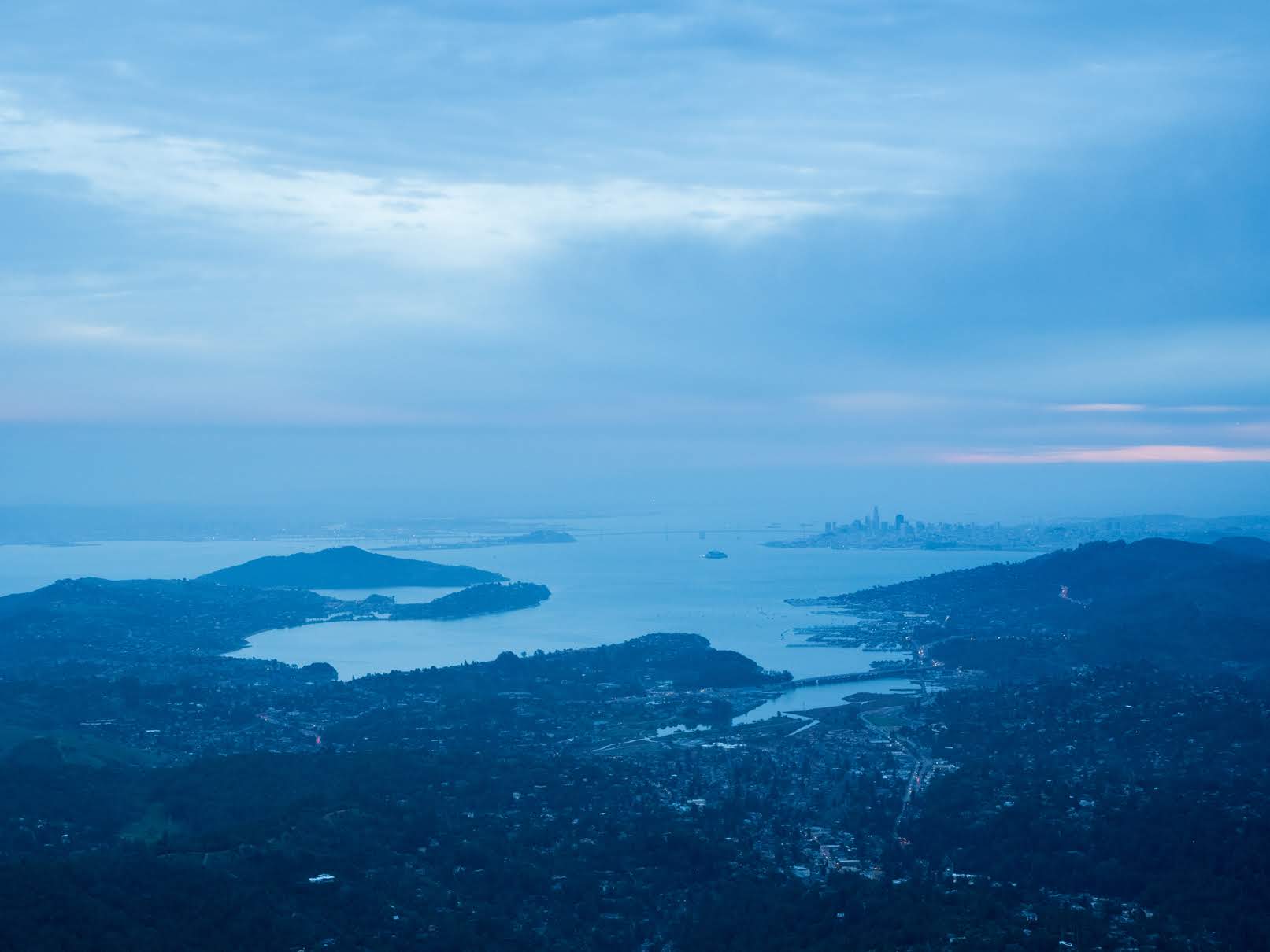
A scenery photo of the SF Bay Area, forest, clouds, and fog.
In the Photo: Angel Island (left), Sausalito (right), Treasure Island & Yerba Buena Island (in the distance on the left), Bay Bridge & Alcatraz Island (in the distance in the center), and San Francisco (in the distance on the right).
Approximate GPS location (type into Google): 37° 55' 45" N 122° 34' 35" W

An abstract process of the photo above.

A scenery photo of the SF Bay Area, forest, clouds, and fog.
In the Photo (foreground): Mill Valley, Angel Island, Marin City, and Sausalito.
In the Photo (in the distance): Richmond (left), Treasure Island, Yerba Buena Island, Bay Bridge (center), Alcatraz Island, San Francisco, and Golden Gate Bridge (right).
Approximate GPS location (type into Google): 37° 55' 38" N 122° 34' 35" W

A black and white process of the photo above.

An abstract process of the photo above.

A scenery photo of the SF Bay Area, forest, clouds, and fog.
In the Photo (foreground): San Rafael, Corte Madera Creek (left), and Corte Madera (center).
In the Photo (in the distance): Richmond-San Rafael Bridge, San Quentin State Prison, and Richmond.
Photo shot near the same spot as above.

A black and white process of the photo above.

An abstract process of the photo above.

This is all the photos for today. I hope you have enjoyed viewing the photos! Please don't forget to share the blog post with your friends and family members! Also, if you want to get notifications when I post up more photos, "Like" us on Facebook or follow me on Instagram. These links can also be found on the top of the right sidebar.

Parts: Cellphone Photos | Olympus Part 1 | Olympus Part 2

Sunday, January 22, 2023

Mt. Tamalpais State Park (Part 1) - Marin County, CA

On 28 December 2022, my parents and I took a day trip to Mount Tamalpais State Park in Marin County, CA. We visited Trojan Point and Mt. Tamalpais East Peak. Recently, it has been raining quite heavily in the San Francisco Bay Area, and we took this trip on a day where there was a break from the storms. It was quite foggy and cloudy on the day we went. You'll see a lot of clouds and fog in the photos. The photos are split into 3 blog posts. I hope you enjoy viewing my photos!

High Resolution Photos: If you want to see high resolution photos of any of the photos you see here, use the following links. If you wish to purchase prints of any of the photos, please contact me here. To view my best Mt. Tamalpais State Park  photos, use this link. To see all of my photos from Mt. Tamalpais State Park & Bolinas, CA from 2016 to 2022, use this link.

Parts: Cellphone Photos | Olympus Part 1 | Olympus Part 2

This is part 1 of the photos I took with my Olympus mirrorless camera. The photos were shot at Trojan Point and Mt. Tamalpais East Peak.

Our first stop on our trip was Trojan Point.

A scenery photo of the SF Bay Area, forest, fog, and clouds.
In the Photo (in the distance): Angel Island, Treasure Island, Yerba Buena Island, Bay Bridge, and San Francisco.
Approximate GPS location (type into Google): 37° 54' 20" N 122° 36' 51" W

A black and white process of the photo above.

A scenery photo of forest, ocean, fog, and clouds.
In the Photo: Ocean Beach & San Francisco (in the distance), and Sutro Tower & Twin Peaks (in the distance on the left).
Approximate GPS location (type into Google): 37° 54' 16" N 122° 36' 50" W

A scenery photo of ships (in the distance), ocean, fog, and clouds.
Approximate GPS location (type into Google): 37° 54' 17" N 122° 36' 51" W

A scenery photo of ships (in the distance on the left), ocean, forest, fog, and clouds. The photo was shot near Trojan Point.
In the Photo: Ocean Beach (in the distance on the left).
Approximate GPS location (type into Google): 37° 54' 21" N 122° 36' 57" W

A scenery photo of forest, ocean, fog, and clouds. The photo was shot near Trojan Point.
In the Photo: Ocean Beach & San Francisco (in the distance), Sutro Tower & Twin Peaks (in the distance on the left)
Photo shot at the same spot as above.

After we finished up at Trojan Point, our next stop was Mt. Tamalpais East Peak. We first headed up to Gardner Fire Lookout via Plankwalk Trail.

A scenery photo of the SF Bay Area, clouds, and fog.
In the Photo: Richmond-San Rafael Bridge (center), San Quentin State Prison (left), Corte Madera (foreground), and Richmond (in the distance).
Approximate GPS location (type into Google): 37° 55' 45" N 122° 34' 39" W

A scenery photo of the SF Bay Area, forest, rocks, clouds, and fog.
In the Photo: Richmond-San Rafael Bridge (slightly right from center), San Quentin State Prison (center), Corte Madera (foreground right), Corte Madera Creek (foreground left), San Rafael (foreground left), and Richmond (in the distance).
Photo shot near the same spot as above.

A scenery photo of the SF Bay Area, forest, clouds, and fog.
Photo shot near the same spot as above.

A scenery photo of the SF Bay Area, forest, clouds, and fog.
Photo shot near the same spot as above.

A scenery photo of Mt. Tamalpais Middle Peak, forest, and clouds.
Approximate GPS location (type into Google): 37° 55' 45" N 122° 34' 40" W

A scenery photo of the SF Bay Area, forest, clouds, and fog.
In the Photo: Angel Island (left), Sausalito (right), Treasure Island & Yerba Buena Island (in the distance on the left), Bay Bridge & Alcatraz Island (in the distance in the center), and San Francisco (in the distance on the right).
Photo shot near the same spot as above.

A scenery photo of the SF Bay Area, forest, clouds, and fog.
In the Photo: Angel Island (left), Sausalito (right), Treasure Island & Yerba Buena Island (in the distance on the left), Bay Bridge & Alcatraz Island (in the distance in the center), and San Francisco (in the distance on the right).
Approximate GPS location (type into Google): 37° 55' 44" N 122° 34' 40" W

A scenery photo of the SF Bay Area, forest, clouds, and fog.
In the Photo (foreground): Mill Valley (left), and Sausalito & Marin City (right).
In the Photo (in the distance): Yerba Buena Island (left), Bay Bridge & Alcatraz Island (slightly left), and San Francisco (right).
Photo shot near the same spot as above.

A scenery photo of the SF Bay Area, clouds, and fog.
In the Photo: Richmond-San Rafael Bridge (center), San Quentin State Prison (left), Corte Madera (foreground), and Richmond (in the distance).
Photo shot near the same spot as above.

A scenery photo of the SF Bay Area, forest, clouds, and fog.
In the Photo (foreground): Mill Valley and Angel Island.
In the Photo (in the distance): Treasure Island, Yerba Buena Island, Bay Bridge, and Alcatraz Island (right).
Photo shot near the same spot as above.

A scenery photo of Bon Tempe Lake, Lake Lagunitas, forest, clouds, and fog. 
Photo shot near the same spot as above.

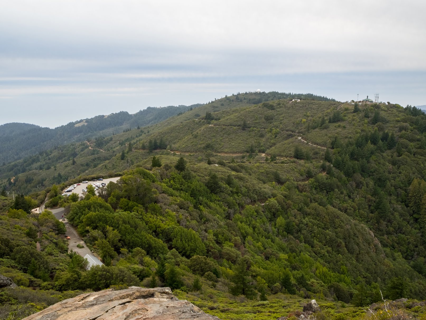
A scenery photo of Mt. Tamalpais Middle Peak (right), Mt. Tamalpais East Peak Parking Lot (left), forest, clouds, and fog.
Photo shot near the same spot as above.

After we were done exploring the area around the Gardner Fire Lookout (Plankwalk Trail), we headed down towards the parking lot for Verna Dunshee Trail. You are technically suppose to use Plankwalk Trail to get back down to the parking lot, but we and a few other tourists got a bit lost and went down a "different trail" which I think was formed by a rockslide. This "different trail" is not on the park map or Google Maps. It is chained off at the bottom of the "trail" but not at the top. We accidentally took that "trail". This "trail" really looks like the main trail from the top. It is very steep and slippery, so don't get lost up there! I think California State Parks need to add more clear signage up at the peak. It is a little hard to find your way back down from up there. This is the second time I have accidentally done this (the previous time was in August 2016 - photos from that trip here).

A scenery photo of Gardner Fire Lookout, forest, and clouds.
Approximate GPS location (type into Google): 37° 55' 42" N 122° 34' 39" W

A scenery photo of Gardner Fire Lookout, forest, and clouds.
Photo shot near the same spot as above.

This is all the photos for today. I hope you have enjoyed viewing the photos! Please don't forget to share the blog post with your friends and family members! Also, if you want to get notifications when I post up more photos, "Like" us on Facebook or follow me on Instagram. These links can also be found on the top of the right sidebar.

Parts: Cellphone Photos | Olympus Part 1 | Olympus Part 2

Thursday, December 29, 2022

Mt. Tamalpais East Peak (Cellphone Photos) - Marin County, CA

On 28 December 2022, my parents and I took a day trip to Mount Tamalpais State Park in Marin County, CA. We visited Trojan Point and Mt. Tamalpais East Peak. Recently, it has been raining quite heavily in the San Francisco Bay Area, and we took this trip on a day where there was a break from the storms. It was quite foggy and cloudy on the day we went. You'll see a lot of clouds and fog in the photos. The photos are split into 2 blog posts. I hope you enjoy viewing my photos!

Parts: Cellphone Photos | Olympus Part 1 | Olympus Part 2

These are the panoramas I took on my cellphone during sunset. The panoramas are from Verna Dunshee Trail at Mt. Tamalpais East Peak. All of the panoramas in this blog post are scenery photos of the San Francisco Bay Area.

In the distance in the panorama:
Right: Richmond-San Rafael Bridge

In the distance in the panorama:
Left: Richmond-San Rafael Bridge
Center: Angel Island & Treasure Island
Slightly Right From Center: San Francisco & Sausalito
Right: Ocean Beach

In the distance in the panorama:
Left: Richmond-San Rafael Bridge
Center: Angel Island, Treasure Island, San Francisco, Sausalito
Slightly Right From Center: Ocean Beach

This is all the photos for today. I hope you have enjoyed viewing the photos! Please don't forget to share the blog post with your friends and family members! Also, if you want to get notifications when I post up more photos, "Like" us on Facebook or follow me on Instagram. These links can also be found on the top of the right sidebar.

Parts: Cellphone Photos | Olympus Part 1 | Olympus Part 2

Thursday, September 19, 2013

Muir Woods National Monument (Part 1) - With On The Road Photos

I took a trip to both Muir Woods National Monument and Sausalito (pretty close together) a few month back. I took many photos at these 2 places and will be splitting the photos into several blog posts. If you want to see my Muir Woods National Monument and Sausalito photos from last year, you can do so here.

Muir Woods National Monument is a park located in Mill Valley, CA, 12 miles north of San Francisco. It is famous for its Coast Redwood (Sequoia sempervirens) trees. This forest of trees is one of the few forests of this type of tree still standing in the San Francisco Bay Area.

Full Resolution Photos and Prints: If you want to see full resolution photos or buy prints of any of the photos you see, they are up on my portfolio for viewing. To see my best Muir Woods National Monument photos for 2013, use this link. To see my best Mill Valley and Sausalito photos, use this link. To see all of my photos from this trip, use this link.

Parts:
Muir Woods National Monument: Part 1 | Part 2 | Part 3
Mill Valley, Sausalito, and San FranciscoPhotos

Today, I have part 1 of Muir Woods National Monument. I will have a few photos from my drive up to Muir Woods National Monument, and the rest of the photos are mostly of the redwood forest. The photos includes regular scenery, long exposures, and 1 HDR composition.

Photo of the Richmond-San Rafael Bridge taken from San Rafael, CA.
Approximate GPS location (type into Google) according to the Canon GP-E2 GPS Receiver: 37 56 38 N 122 28 48 W   

Photo of the pier from the same location. 

Now almost at Muir Woods National Monument, a photo on top of the mountain showing the heavy fog over Mill Valley, CA.
Approximate GPS location (type into Google) according to the Canon GP-E2 GPS Receiver: 37 53 40 N 122 33 30 W

If you have been to Muir Woods National Monument, you would know parking is always a pain there. I had to walk pretty far from where I parked to get to the park. This photo was shot in Mount Tamalpais State Park, a park bordering Muir Woods National Monument. 
Approximate GPS location (type into Google) according to the Canon GP-E2 GPS Receiver: 37 53 16 N 122 34 04 W  

A portrait of a giant Coast Redwood (Sequoia sempervirens) tree. 
Approximate GPS location (type into Google) according to the Canon GP-E2 GPS Receiver: 37 53 34 N 122 34 22 W  
Please do note the locations given in the blog post maybe inaccurate due to the dense vegetation in the park. 

HDR composition of several giant Coast Redwood (Sequoia sempervirens) trees. 
Approximate GPS location (type into Google) according to the Canon GP-E2 GPS Receiver: 38 50 35 N 123 16 04 W

The tall Coast Redwood (Sequoia sempervirens) trees.
Approximate GPS location (type into Google) according to the Canon GP-E2 GPS Receiver: 37 53 37 N 122 34 27 W  

Long exposure of the trail in the park. 
Approximate GPS location (type into Google) according to the Canon GP-E2 GPS Receiver: 37 53 38 N 122 34 31 W  

A portrait of a giant Coast Redwood (Sequoia sempervirens) tree. 
Approximate GPS location (type into Google) according to the Canon GP-E2 GPS Receiver: 37 53 41 N 122 34 31 W

A few photos of a giant Coast Redwood (Sequoia sempervirens) tree.
Approximate GPS location (type into Google) according to the Canon GP-E2 GPS Receiver: 37 53 42 N 122 34 31 W  

The other side of the fallen tree. The tree was actually blocking the trail, therefore, the rangers had to cut out the section that was blocking the trail. 

This is all the photos for today. I hope you have enjoyed them. Next time I have more photos from Muir Woods National Monument. Please don't forget to share the blog post with your friends and family members! Also, if you want to get notifications when I post up more photos, "Like" us on Facebook or follow me on Twitter and Google+. These links can also be found on the top of the right sidebar.

Parts:
Muir Woods National Monument: Part 1 | Part 2 | Part 3
Mill Valley, Sausalito, and San FranciscoPhotos