Showing posts with label duncans mills. Show all posts

Sunday, June 30, 2024

Valley Ford Rd/Duncans Mills - Sonoma County, CA

On 11 May 2024, my parents and I went to Sonoma Coast State Park in Sonoma County, CA, however it was extremely foggy that day and there were no photo opportunities by the coast. The photos in this blog post were shot on Valley Ford Road and in Duncans Mills, CA taken on my way to the state park and drive back home. I hope you enjoy viewing my photos!

High Resolution Photos: If you want to see high resolution photos of any of the photos you see here, use the following links. If you wish to purchase prints of any of the photos, please contact me here. To view my best Sonoma County, CA photos, use this link. To see all of my photos from this trip, use this link.

The first 2 photos was from our drive to Sonoma Coast State Park.

A scenery photo of clouds, pasture, and farm (left). The photo was shot on Valley Ford Road (near Bloomfield, CA) in Sonoma County, CA.
Approximate GPS location (type into Google): 38° 18' 47" N 122° 51' 57" W

A scenery photo of Valley Ford Road, clouds, and power lines. The photo was shot near Bloomfield, CA in Sonoma County, CA.
Approximate GPS location (type into Google): 38° 18' 46" N 122° 51' 58" W

We then drove along State Route 1 and visited Sonoma Coast State Park, but it was too foggy to see anything. We dropped by Duncans Mills, CA on the way home.

A photo of State Route 116, fog, stores, and forest. The photo was shot on Moscow Road in Duncans Mills, CA.
Approximate GPS location (type into Google): 38° 27' 12" N 123° 03' 14" W

A black and white process of the photo above.

A photo of a historic rail station, rail cars, fog, and flags. The photo was shot on Moscow Road in Duncans Mills, CA.
The photo was shot near the same spot as above.

A black and white process of the photo above.

A photo of fog, forest, and stores (right). The photo was shot on B Street in Duncans Mills, CA.
Approximate GPS location (type into Google): 38° 27' 14" N 123° 03' 16" W

A black and white process of the photo above.

A scenery photo of trees and fog. The photo was shot in a parking lot near B Street in Duncans Mills, CA.
Approximate GPS location (type into Google): 38° 27' 16" N 123° 03' 16" W

A scenery photo of fog, cows, pasture, Duncan House, forest, and hill. The photo was shot on State Route 116 in Duncans Mills, CA.
Approximate GPS location (type into Google): 38° 27' 19" N 123° 03' 11" W

A scenery photo of fog, cows, pasture, Duncan House, forest, and hill. The photo was shot on State Route 116 in Duncans Mills, CA.
The photo was shot at the same spot as above.

A scenery photo of fog, cows, pasture, forest, and house (left). The photo was shot on State Route 116 in Duncans Mills, CA.
The photo was shot at the same spot as above.

A black and white process of the photo above.

A scenery photo of pasture, stores, trees, and fog. The photo was shot on State Route 116 in Duncans Mills, CA.
The photo was shot near the same spot as above.

A photo of a bear statue in front of the California State Parks Office. The photo was shot on Steelhead Blvd in Duncans Mills, CA.
Approximate GPS location (type into Google): 38° 27' 10" N 123° 03' 14" W

A black and white process of the photo above.

A photo of a vintage Ford vehicle, signs, power lines, forest, fog, and Moscow Road (left). The photo was shot near the Blue Heron Restaurant and Tavern in Duncans Mills, CA.
Approximate GPS location (type into Google): 38° 27' 12" N 123° 03' 09" W

A black and white process of the photo above.

A scenery photo of Russian River, fog, forest, and cows (right). The photo was shot on Moscow Road in Duncans Mills, CA.
Approximate GPS location (type into Google): 38° 27' 15" N 123° 02' 57" W

A black and white process of the photo above.

A scenery photo of Russian River, fog, and forest. The photo was shot on Moscow Road in Duncans Mills, CA.
The photo was shot near the same spot as above.

A black and white process of the photo above.

This is all the photos for today. I hope you have enjoyed viewing the photos! Please don't forget to share the blog post with your friends and family members! Also, if you want to get notifications when I post up more photos, "Like" us on Facebook or follow me on Instagram. These links can also be found on the top of the right sidebar.

Copyright Warning: These photos are some of my best and most popular works of art. Unauthorized usage and reproductions are strictly prohibited. Please contact me here to purchase prints and negotiate photo licenses.

Saturday, May 27, 2023

Sonoma Coast SP, Jenner, Duncans Mills (Part 3) - Sonoma County, CA

On 7 May 2023, my mom and I took a day trip to Sonoma Coast State Park in Sonoma County, CA. We went to the various beaches in the state park, took a hike along Red Hill Trail, and visited Bodega Bay, Jenner, and Duncans Mills, CA. We saw the Russian River, harbor seals (Phoca vitulina), and lots of wild flowers. I took photos with my cellphone and mirrorless camera. The photos are split into 4 blog posts (I took most of the photos on my mirrorless camera). I hope you enjoy viewing my photos!

High Resolution Photos: If you want to see high resolution photos of any of the photos you see here, use the following links. If you wish to purchase prints of any of the photos, please contact me here. To see my best Sonoma Coast State Park photos and photos from surrounding areas, use this link. To see my best sunset and night photography photos from 2019 to 2023, use this link. To see all of my photos from this trip from Sonoma Coast State Park, use this link. To see all of my photos from Sonoma County, CA, use this link.

Parts: 1 | 2 | 3 | Cellphone Photos

This is part 3 of the photos shot on my Olympus mirrorless camera. The photos in this blog post were shot at Goat Rock Beach in Sonoma Coast State Park, at Russian River Vista Point in Jenner, CA, along State Route 1, and in Duncans Mills, CA.

After my mom and I finished the hike at Red Hill Trail, we went to Goat Rock Beach.

A scenery photo of Arched Rock, the Pacific Ocean, and rocks. The photo was shot at Goat Rock Beach Parking Lot in Sonoma Coast State Park.
Approximate GPS location (type into Google): 38° 26' 27" N 123° 07' 33" W

A scenery photo of Blind Beach (left), Arched Rock (right), the Pacific Ocean, rocks, and cliffs. The photo was shot at Goat Rock Beach Parking Lot in Sonoma Coast State Park.
Photo shot at the same spot as above.

A scenery photo of Russian River, Jenner, houses, clouds, and green hills. The photo was shot at Goat Rock Beach in Sonoma Coast State Park.
The flowers in the photo are Cow Parsnip (Heracleum maximum) and Pride of Madeira Flowers (Echium candicans).
Approximate GPS location (type into Google): 38° 26' 57" N 123° 07' 36" W

A scenery photo of Russian River, Jenner, houses, clouds, and green hills. The photo was shot at Goat Rock Beach in Sonoma Coast State Park.
The flowers in the photo are Calla Lily (Zantedeschia aethiopica) and Pride of Madeira Flowers (Echium candicans).
Photo shot at the same spot as above.

A scenery photo of Harbour Seals (Phoca vitulina), Russian River, State Route 1 (top), and clouds. The photo was shot at Goat Rock Beach in Sonoma Coast State Park.
The flowers in the photo are Cow Parsnip (Heracleum maximum) and Pride of Madeira Flowers (Echium candicans).
Approximate GPS location (type into Google): 38° 27' 01" N 123° 07' 44" W

A scenery photo of Goat Rock Beach, seagulls & driftwood (left), Goat Rock (right), rocks, and the Pacific Ocean. The photo was shot in Sonoma Coast State Park.
Approximate GPS location (type into Google): 38° 26' 58" N 123° 07' 42" W

A scenery photo of Goat Rock Beach, seagulls (left), rocks, clouds, and the Pacific Ocean. The photo was shot in Sonoma Coast State Park.
Approximate GPS location (type into Google): 38° 26' 54" N 123° 07' 39" W

A scenery photo of Goat Rock Beach, State Route 1, Russian River (right), Jenner (right), the Pacific Ocean, mountains, rocks, cliffs, and clouds. The photo was shot on the side of Goat Rock Road in Sonoma Coast State Park.
Approximate GPS location (type into Google): 38° 26' 31" N 123° 07' 29" W

A scenery photo of Blind Beach (left), Arched Rock (right), the Pacific Ocean, rocks, and cliffs. The photo was shot on the side of Goat Rock Road in Sonoma Coast State Park.
Photo shot at the same spot as above.

A scenery photo of Arched Rock, the Pacific Ocean, and rocks. The photo was shot on the side of Goat Rock Road in Sonoma Coast State Park.
Photo shot at the same spot as above.

A scenery photo of Arched Rock, the Pacific Ocean, clouds, and rocks. The photo was shot on the side of Goat Rock Road in Sonoma Coast State Park.
The flowers in this photo are Cow Parsnip (Heracleum maximum).
Approximate GPS location (type into Google): 38° 26' 17" N 123° 07' 16" W

It was getting close to sunset once my mom and I finished up at Goat Rock State Beach. We hit up a few more spots along State Route 1 for sunset.

A sunset scenery photo of Russian River Bridge (State Route 1), Russian River, RV park, houses, trees, cows, clouds, and mountains. The photo was shot at Russian River Vista Point on the side of State Route 1 in Jenner, CA.
The flowers in the photo are Cow Parsnip (Heracleum maximum).
Approximate GPS location (type into Google): 38° 25' 55" N 123° 06' 07" W

A black and white process of the photo above.

A scenery photo of sunset over the Pacific Ocean, with clouds. The photo was shot on the side of State Route 1 in Sonoma Coast State Park.
The flowers in the photo are Cow Parsnip (Heracleum maximum) and Yellow Mustard Flowers.
Approximate GPS location (type into Google): 38° 27' 30" N 123° 08' 30" W

A scenery photo of sunset over the Pacific Ocean, with clouds. The photo was shot on the side of State Route 1 in Sonoma Coast State Park.
The flowers in the photo are Cow Parsnip (Heracleum maximum).
Photo shot at the same spot as above.

A scenery photo of sunset over the Pacific Ocean, with clouds. The photo was shot on the side of State Route 1 in Sonoma Coast State Park.
The flowers in the photo are Cow Parsnip (Heracleum maximum).
Photo shot at the same spot as above.

A scenery photo of sunset over the Pacific Ocean, with clouds. The photo was shot on the side of State Route 1 in Sonoma Coast State Park.
The flowers in the photo are Cow Parsnip (Heracleum maximum).
Photo shot at the same spot as above.

After sunset, my mom and I started our trip back home. On our trip back home, we took State Route 116 and passed by Duncans Mills, CA. It was dusk by the time we got there.

A dusk long exposure scenery photo of the Historic Duncans Mills Railroad Station in Duncans Mills, CA. Also in the photo are a heavily forested hill, clouds, and a State Parks vehicle (right).
The trees in the photo are Coast Redwoods (Sequoia sempervirens).
Approximate GPS location (type into Google): 38° 27' 12" N 123° 03' 13" W

A black and white process of the photo above.

A dusk long exposure scenery photo of the Historic Duncans Mills Railroad Station in Duncans Mills, CA. Also in the photo are parking spaces and clouds.
The trees in the photo are Coast Redwoods (Sequoia sempervirens).
Approximate GPS location (type into Google): 38° 27' 12" N 123° 03' 12" W

This is all the photos for today. I hope you have enjoyed viewing the photos! Please don't forget to share the blog post with your friends and family members! Also, if you want to get notifications when I post up more photos, "Like" us on Facebook or follow me on Instagram. These links can also be found on the top of the right sidebar.

Parts: 1 | 2 | 3 | Cellphone Photos

Tuesday, November 19, 2013

Tomales, Bodega Bay, Duncans Mills, Jenner - California's Coast

From 7/17/2013 to 8/2/2013, I took a road trip from the SF Bay Area to Vancouver, BC, Canada. Half of the trip was spent driving up the west coast. On my trip, I visited many famous places such as Seattle, Butchart Gardens, Mount Rainier, and much more. Obviously I got many coastal shots and many places that isn't as famous. The reason I am posting it now is because the high amount of photos I took equaled a high amount of processing time. I took a bit over 2000 photos on the trip. After stitching the panoramas, compositing the HDRs, and picking out photos from the repeats, I have a bit over 1000 photos to show you guys. The photos will be split into parts. I will link you to the previous and next parts on each post just like I did with my Death Valley National Park photos and my Yellowstone/Grand Teton National Park photos. Hope you enjoy viewing this chain of posts!

Full Resolution Photos and Prints: If you want to see full resolution photos or buy prints of any of the photos you see, they are up on my portfolio for viewing. To view my best California photos from this trip, use this link. To view all of my day 1 photos, use this link.

Next Post >>
<< Previous Post

The photos for today are from California's coast. The blog post will include photos from Tomales, Bodega Bay, Duncans Mills, and Jenner. All the photos were shot near SR-1 as I drove up the coast.

A photo from Tomales, CA taken on the side of SR-1. That area was pretty cloudy. 
Approximate GPS location (type into Google) according to the Canon GP-E2 GPS Receiver: 38 12 53 N 122 55 29 W  

I decided to do a black and white process to bring out the details of the clouds a bit better.  

Another photo from Tomales, CA taken on the side of SR-1. I think this is one of the best shots I took on this trip. Reminds me of that song Country Roads by John Denver.  
Approximate GPS location (type into Google) according to the Canon GP-E2 GPS Receiver: 38 18 27 N 122 53 52 W  

A black and white process of the photo above.  

 A photo from Tomales, CA taken on the side of SR-1. It is of a farm on the side of the highway. 
Approximate GPS location (type into Google) according to the Canon GP-E2 GPS Receiver: 38 18 25 N 122 53 51 W  

 I move on from Tomales to Bodega Bay, CA. This was shot at a 76 gas station. I shot this photo while my parents was adding gas to the car. 
Approximate GPS location (type into Google) according to the Canon GP-E2 GPS Receiver: 38 19 45 N 123 02 38 W  

A photo of a worn down building in Bodega Bay, CA. Shot this near Harbor View Gifts. 
 Approximate GPS location (type into Google) according to the Canon GP-E2 GPS Receiver: 38 19 48 N 123 02 47 W  

A photo of Harbor View Gifts in Bodega Bay, CA. Shot at around the same location as the above photo. I shot a photo of it mainly because of their rainbow flag. Thank you so much for the support! 

Another photo of that worn down building in Bodega Bay, CA. Shot this near Harbor View Gifts.  

 Black and white process of the photo above. 

A photo of Marshall Gulch in Bodega Bay, CA. 
 Approximate GPS location (type into Google) according to the Canon GP-E2 GPS Receiver: 38 22 12 N 123 04 27 W  

A photo shot near Marshall Gulch of SR-1 in Bodega Bay, CA. Same location as above photo. 

 A photo of Carmet Beach in Bodega Bay, CA. 

 Black and white process of the above shot. 

Sign denoting Russian River in  Duncans Mills, CA. 
Approximate GPS location (type into Google) according to the Canon GP-E2 GPS Receiver: 38 26 09 N 123 06 10 W

 Here is a photo of Russian River.

 A photo of the bridge over Russian River. Shot this close to sunset. 

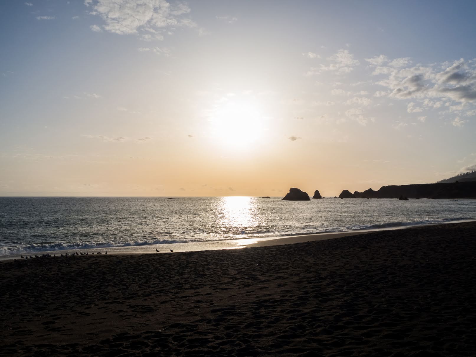
 HDR composition of sunset taken on SR-1. Photo from Jenner, CA. 
Approximate GPS location (type into Google) according to the Canon GP-E2 GPS Receiver: 39 14 43 N 123 59 48 W

 Sunset on the side of SR-1 in Jenner, CA.
Approximate GPS location (type into Google) according to the Canon GP-E2 GPS Receiver: 38 29 53 N 123 12 29 W

HDR composition of a sunset on the side of SR-1 in Jenner, CA. 

These are all the photos for today. I hope you have enjoyed viewing them. Next time I have more photos from California's Coast. Please don't forget to share with the blog post your friends and family members! Also, if you want to get notifications when I post up more photos, "Like" us on Facebook or follow me on Twitter and Google+. These links can also be found on the top of the right sidebar.

Next Post >>
<< Previous Post