Monday, May 31, 2010

More pictures from Arizona. 跟多 Arizona 照片。

"Petrified wood (from the Greek root petro meaning "rock" or "stone"; literally "wood turned into stone") is a type of fossil that consists of fossil wood in which all the organic materials have been replaced with minerals (most often a silicate, such as quartz), while retaining the original structure of the wood. The petrifaction process occurs underground, when wood becomes buried under sediment and is initially preserved due to a lack of oxygen. Mineral-rich water flowing through the sediment deposits minerals in the plant's cells and as the plant's lignin and cellulose decay away, a stone mould forms in its place. In general, wood takes less than 100 years to petrify. The organic matter needs to become petrified before it decomposes completely. A forest where the wood has petrified becomes known as a petrified forest." ~Petrified Wood Wikipedia page.

Before I get started, I would just like to remind you that I made a Facebook Fan page for this photography blog. You can "Like Us" here. I have also made Google+ and Twitter pages. If you follow or "Like" me on these, you can be updated whenever I post something new! :) Please invite your friends too! I'm trying to get more viewers on here. Anyways, as always, enjoy my photos!

Pictures of petrified wood and ancient drawings found in Petrified Forest National Park in Arizona.
在树林化石国家公园在 Arizona 拍的化石和很久以前画的画。

Full Resolution Photos and Prints: If you want to see full resolution photos or buy prints of any of the photos you see, they are up on my portfolio for viewing here.

Picture of a petrified wood
木头化石

Ancient Drawing
很久以前人画的画。

"A cactus is (plural: cacti) a member of the plant family Cactaceae, native to the Americas (with one exception, Rhipsalis baccifera, which is native to parts of the Old World). They are often used as ornamental plants, and some are also crop plants for fodder, forage, fruits, cochineal, and other uses. Numerous species have been used since ancient times by indigenous peoples for their psychedelic effects. Cacti are part of the plant order Caryophyllales, which also includes members like beets, gypsophila, spinach, amaranth, tumbleweeds, carnations, rhubarb, buckwheat, plumbago, bougainvillea, chickweed and knotgrass." ~Wikipedia Page.

The next image is of a cactus from Grand Canyon National Park.
下一个找片是一个大峡谷国家公园的仙人掌。


Clouds! 云!

Before I get started, I would just like to remind you that I made a Facebook Fan page for this photography blog. You can "Like Us" here. I have also made Google+ and Twitter pages. If you follow or "Like" me on these, you can be updated whenever I post something new! :) Please invite your friends too! I'm trying to get more viewers on here. Anyways, as always, enjoy my photos!

If you want to see newer cloud photos I've take, click here.

Full Resolution Photos and Prints: If you want to see full resolution photos or buy prints of any of the photos you see, they are up on my portfolio for viewing here.

Pictures of clouds!
云照片!


For me, clouds has always amused me because they take the shape of a lot of things which I find is very nice. They sometimes shield us from the strong sunlight, and even provide free water to us. I hope you have enjoyed the photos! Thank you for viewing them! Please don't forget to share them with your friends!

Sunday, May 30, 2010

National Parks in Arizona and Utah.

"What is Bryce Canyon? Words confound when no comparable exist. A cave without a ceiling? A forest of stone? Even 'canyon' is misleading since Bryce is carved by freeze-thaw cycles, not a river. Yet, 'world's largest pothole' is neither adequate nor flattering. Tour this Website, and you’ll be enticed to visit Bryce in person. Once here, perhaps you'll agree with those who say, 'Bryce is a Bryce!'" ~Quote from Bryce Canyon National Park Website.

Before I get started, I would just like to remind you that I made a Facebook Fan page for this photography blog. You can "Like Us" here. I have also made Google+ and Twitter pages. If you follow or "Like" me on these, you can be updated whenever I post something new! :) Please invite your friends too! I'm trying to get more viewers on here. Anyways, as always, enjoy my photos!

Full Resolution Photos and Prints: If you want to see full resolution photos or buy prints of any of the photos you see, they are up on my portfolio for viewing here.

The next few pictures are from Bryce Canyon National Park.

Fairview Point

Bryce Point

This point had no name.


"The oldest human artifacts found are nearly 12,000 years old and date to the Paleo-Indian period. There has been continuous use and occupation of the park since that time. The park has recorded over 4,800 archeological resources with an intensive survey of nearly 3% of the park area." ~Grand Canyon National Park Website.

The next photo is a panoramic shot of Grand Canyon Overview. 

"Petrified wood (from the Greek root petro meaning "rock" or "stone"; literally "wood turned into stone") is a type of fossil that consists of fossil wood in which all the organic materials have been replaced with minerals (most often a silicate, such as quartz), while retaining the original structure of the wood. The petrifaction process occurs underground, when wood becomes buried under sediment and is initially preserved due to a lack of oxygen. Mineral-rich water flowing through the sediment deposits minerals in the plant's cells and as the plant's lignin and cellulose decay away, a stone mould forms in its place. In general, wood takes less than 100 years to petrify. The organic matter needs to become petrified before it decomposes completely. A forest where the wood has petrified becomes known as a petrified forest." ~Petrified Wood Wikipedia page.

Next image is a panoramic shot of one of the scenes from Petrified Wood National Park in Arizona.


Saturday, May 29, 2010

Wildlife of Arizona. Arizona 的野生动物。

"Arizona is a state of the United States of America located in the southwestern region of the United States. The capital and largest city is Phoenix. The second largest city is Tucson, followed in size by the eight Phoenix metropolitan area cities of Mesa, Glendale, Chandler, Scottsdale, Gilbert, Tempe, Peoria, Surprise and then by Yuma in Yuma County." ~ Arizona Wikipedia Page.

I really suck at naming animals. So I don't really know the names. If you know please tell me in the below. Thanks! :D
我叫动物名字很不好。所以这些动物名字我不太知道。要是你知道的话请你在底下告诉我。谢谢!:D

Before I get started, I would just like to remind you that I made a Facebook Fan page for this photography blog. You can "Like Us" here. I have also made Google+ and Twitter pages. If you follow or "Like" me on these, you can be updated whenever I post something new! :) Please invite your friends too! I'm trying to get more viewers on here. Anyways, as always, enjoy my photos!

Full Resolution Photos and Prints: If you want to see full resolution photos or buy prints of any of the photos you see, they are up on my portfolio for viewing here. Best wildlife photos here.

I'm guessing this is a lizard. What you see on the ground are petrified wood.

"The Western Scrub-Jay (Aphelocoma californica), is a species of scrub-jay native to western North America. It ranges from southern Washington to central Texas and central Mexico. It comprises three distinct subspecies groups, all of which may be separate species. They are California Scrub-Jay (coastal), Woodhouse's Scrub-Jay (interior US and northern Mexico), and Sumichrast's Scrub-Jay (interior southern Mexico). The Western Scrub-Jay was once lumped with the Island Scrub-Jay and the Florida Scrub-Jay; the taxon was then called, simply, the Scrub Jay. The Western Scrub-Jay is nonmigratory and can be found in urban areas, where it can become tame and will come to bird feeders. While many refer to scrub-jays as "blue jays", the Blue Jay is a different species of bird entirely. In recent years, the California Scrub-Jay has expanded its range north into the Puget Sound region of Washington"  ~Wikipedia Page.

Blue birdy. :D I did some research, this bird seems to be called the Western Scrub Jay.
蓝色鸟。:D 我在网上做了一些研究,英文好像这个鸟叫 Western Scrub Jay。


Friday, May 28, 2010

Please don't spit your gum on the floor.

Here is why you  shouldn't spit your gum on the floor. It's disgusting. And wildlife do eat it! It's bad for them... So please spit your gum in a trash can next time. If it's in parks, in a wildlife proof one if it's available. This is why I don't chew gum. Comment below if you agree with me. :)

Full Resolution Photos and Prints: If you want to see full resolution photos or buy prints of any of the photos you see, they are up on my portfolio for viewing here. Best squirrel photos here.

Picture taken at Zion National Park in  Utah, USA


Please don't forget to share the blog post with your friends and family members! Also, if you want to get notifications when I post up more photos, "Like" us on Facebook or follow me on Twitter and Google+. These links can also be found on the top of the right sidebar.

Lakes, Oceans, and the Golden Gate Bridge. 湖、海、和金门桥。

“Horseshoe Bend is the name for a horseshoe-shaped meander of the Colorado River located near the town of Page, Arizona, in the United States. The bend is locally known as "King Bend." It is located slightly downstream from the Glen Canyon Dam and Lake Powell within Glen Canyon National Recreation Area, about four miles or 6 km south of Page. Accessible via a 3⁄4-mile (1.2 km) hike from U.S. Route 89, it can be viewed from the steep cliff above. According to Google terrain maps, the overlook is 4,200 feet above sea level and the Colorado River is at 3,200 feet above sea level making it a breathtaking 1,000 foot drop.” ~ from Horseshoe Bend Wikipedia Page.

The next picture is a panoramic shot of Horseshoe Bend in Arizona.
下一个照片是一个 Horseshoe Bend 全景照片。Horseshoe Bend 是在 Arizona。

Full Resolution Photos and Prints: If you want to see full resolution photos or buy prints of any of the photos you see, they are up on my portfolio for viewing here.


 "The Golden Gate Bridge is a suspension bridge spanning the Golden Gate, the opening of the San Francisco Bay into the Pacific Ocean. As part of both U.S. Route 101 and California State Route 1, it connects the city of San Francisco on the northern tip of the San Francisco Peninsula to Marin County. The Golden Gate Bridge was the longest suspension bridge span in the world when it was completed during the year 1937, and has become one of the most internationally recognized symbols of San Francisco, California, and of the United States. Since its completion, the span length has been surpassed by eight other bridges. It still has the second longest suspension bridge main span in the United States, after the Verrazano-Narrows Bridge in New York City. In 1999, it was ranked fifth on the List of America's Favorite Architecture by the American Institute of Architects." ~ From Golden Gate Bridge Wikipedia Page.

The first few pictures is going to be the Golden Gate Bridge!
前面这几张照片是金门桥!


"Natural Bridges State Beach is world-renowned for its yearly migration of monarch butterflies. Visitors can see thousands during the butterflies' peak season. The best time to see monarchs in the park is usually from mid-October to late January." ~ State Park Site.

The next image was taken at Natural Bridge, Santa Cruz, CA, USA.
下一个照片是在 Natural Bridge, Santa Cruz, CA, USA。


"History is everywhere in the area of Quarry Lakes Regional Recreation Area in Fremont. Native Americans inhabited the region for millennia before the arrival of Europeans, notably in the sites that are now preserved at Coyote Hills Regional Park west of Quarry Lakes. Quarry Lakes incorporates the historic boundaries of two Mexican ranchos and the former Mission San Jose lands. Alameda Creek was the original boundary between Contra Costa and Santa Clara Counties. Alameda County was carved out of these two counties in 1853 and was named after the creek that drains it..." ~ Quote from Quarry Lakes website. Read more about it here.

If you guessed right, the next picture was taken at Quarry Lakes. Quarry Lakes Regional Park is located in Fremont/Union City, California, USA.
这个照片是在 Quarry Lakes 拍的。Quarry Lakes 公园是在 Fremont/Union City, California, USA。


"Lake Tahoe is a large freshwater lake in the Sierra Nevada mountains of the United States. At a surface elevation of 6,225 ft (1,897 m), it is located along the border between California and Nevada, west of Carson City, Nevada. Lake Tahoe is the largest alpine lake in North America. Its depth is 1,645 feet (501 metres) making it America's second-deepest (the deepest is Crater Lake in Oregon, being 300 ft deeper, at 1,945 feet (594 m) deep).The lake was formed about 2 million years ago and is a part of the Lake Tahoe Basin with the modern lake being shaped during the ice ages. It is known for the clarity of its water and the panorama of surrounding mountains on all sides. The area surrounding the lake is also referred to as Lake Tahoe, or simply Tahoe.Lake Tahoe is a major tourist attraction in both California and Nevada. It is home to a number of ski resorts, summer outdoor recreation, and tourist attractions. Snow and skiing are a significant part of the area's economy and reputation. Mountain and lake scenery are attractions throughout the year. The Nevada side also includes large casinos. Highways provide year-round access from Reno, Carson City and Sacramento." ~ Lake Tahoe Wikipedia Page.

The next picture is of Lake Tahoe. Lake Tahoe is located at the border of California and Nevada in the USA.
下一个找片是 Tahoe 湖。Tahoe 湖是在 California 和 Nevada 交界的地方。


Next image is Half Moon Bay. Half Moon Bay is a coastal city in San Mateo County, California, USA.
下一个照片是 Half Moon Bay。Half Moon Bay 是一个海边上的一个城市在 San Mateo 区, California, USA。

Thursday, May 27, 2010

Trees! 树!

Trees provide us with oxygen while taking carbon dioxide out of the air. That is why we shouldn't cut them down. If you agree with me please tell me below. And below here are some pictures of the wonderful forests that keeps us alive. :)
树除了把二氧化碳从空气里拿掉,它还给我们氧气。这就是为什么我们不应该把它们砍下来。要是你跟我想的一样的话请你在底下告诉我一下。着地下是一些帮我们活者的树林照片。:)

Full Resolution Photos and Prints: If you want to see full resolution photos or buy prints of any of the photos you see, they are up on my portfolio for viewing here.

I know this picture is blurry because I took it in the car, but you have to agree, it looks awesome. :) Other than the colors were adjusted by Photoshop, the rest was the original image.
我知道这个照片不清粗因为我是在车里拍的,可是你因该可以说这个也看得蛮好的。:) 我用 Photoshop 把颜色改了几下,别的就是原来的照片。

This picture was taken at Natural Bridge, Santa Cruz, California, USA
这个照片是在 Natural Bridge, Santa Cruz, California, USA 拍的。

This picture was taken at Yosemite National Park.
这是在 Yosemite 国家公园拍的。

See how wonderful our forests are? Please help save it!
你可以看到我们的树林有多好看吗?请帮大家保护好它!

Sunsets 日落

"In 1776, the Spanish established a fort at the Golden Gate and a mission named for Francis of Assisi on the site. The California Gold Rush in 1848 propelled the city into a period of rapid growth, increasing the population in one year from 1,000 to 25,000, and thus transforming it into the largest city on the West Coast at the time. After three-quarters of the city was destroyed by the 1906 earthquake and fire, San Francisco was quickly rebuilt, hosting the Panama-Pacific International Exposition nine years later. During World War II, San Francisco was the port of embarkation for service members shipping out to the Pacific Theater. After the war, the confluence of returning servicemen, massive immigration, liberalizing attitudes, and other factors led to the Summer of Love and the gay rights movement, cementing San Francisco as a center of liberal activism in the United States." ~ Taken from San Francisco Wikipedia page.

Why the a quote about San Francisco? Because the city you see in the back is San Francisco! Picture taken from Treasure Island.
为什么写一个片段关于旧金山?因为着个照片后面就是旧金山!这个照片是从 Treasure Island 拍的。

Before I get started, I would just like to remind you that I made a Facebook Fan page for this photography blog. You can "Like Us" here. I have also made Google+ and Twitter pages. If you follow or "Like" me on these, you can be updated whenever I post something new! :) Please invite your friends too! I'm trying to get more viewers on here. Anyways, as always, enjoy my photos!

Full Resolution Photos and Prints: If you want to see full resolution photos or buy prints of any of the photos you see, they are up on my portfolio for viewing here. Best sunset and night photography photos here.

The palm tree makes this picture perfect. :)

A panoramic shot of San Francisco from Treasure Island. If you magnify the picture, you can see where the panoramic stitching software made errors. HAHA


"History is everywhere in the area of Quarry Lakes Regional Recreation Area in Fremont. Native Americans inhabited the region for millennia before the arrival of Europeans, notably in the sites that are now preserved at Coyote Hills Regional Park west of Quarry Lakes. Quarry Lakes incorporates the historic boundaries of two Mexican ranchos and the former Mission San Jose lands. Alameda Creek was the original boundary between Contra Costa and Santa Clara Counties. Alameda County was carved out of these two counties in 1853 and was named after the creek that drains it..." ~ Quote from Quarry Lakes website. Read more about it here.

If you guessed right, the next picture was taken at Quarry Lakes. Quarry Lakes Regional Park is located in Fremont/Union City, California, USA.
这个照片是在 Quarry Lakes 拍的。Quarry Lakes 公园是在 Fremont/Union City, California, USA。


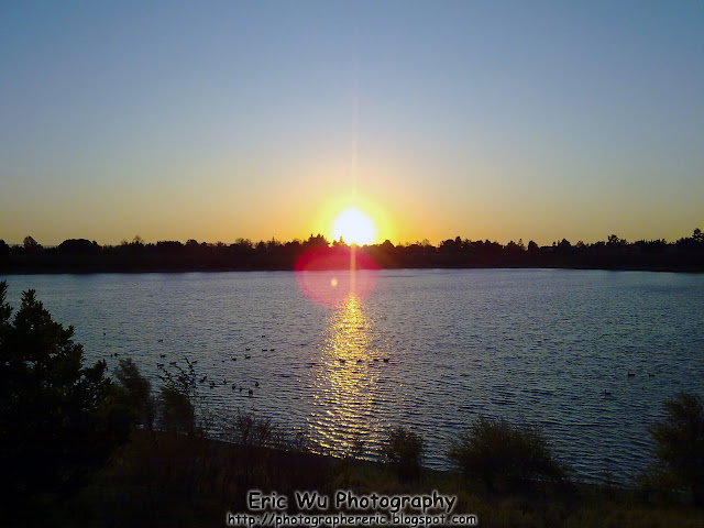
Not much history for Fremont Central Park because this lake is man made and was recently made, not much history. Central Park is located in Fremont, California, USA.
Fremont Central Park 没有什么历史因为他是最近人造的湖。Fremont Central Park 是在 Fremont, California, USA。


"When I admire the wonder of a sunset or the beauty of the moon, my soul expands in worship of the Creator" ~Mahatma Gandhi

I hope you have enjoyed today's post. Sunsets are as beautiful as sunrises, but a lot easier to catch. :D Please share this post with your friends and family.
我希望你喜欢今天的文章。日落跟日出一样漂亮,可是日落容易一点拍照。:D 请你把这个文章分享给你的朋友和家里人看。

Wednesday, May 26, 2010

I'm guessing these are mussels.

I'm guessing these are mussels. There sure are a lot of them. :D I wonder if they taste any good... LOL
很多贝壳,不知道它们好不好吃。。。 哈哈!

Full Resolution Photos and Prints: If you want to see full resolution photos or buy prints of any of the photos you see, they are up on my portfolio for viewing here. Best wildlife photos here.

I think this picture was taken at a pretty popular fishing spot in Half Moon Bay, CA, United States of America

Next time, if you go fishing, make sure you check out your surroundings too. You never know where you may find something interesting. Surprisingly, I thought I was walking on rocks until I looked down. :)

Japanese Tea Garden in San Francisco

"The Japanese Tea Garden in San Francisco, California is a historical Japanese-style garden originally built as the Japanese Village for the 1894 California Midwinter International Exposition. Japanese immigrant and gardener Makoto Hagiwara designed the bulk of the garden and was officially appointed caretaker in 1894 until the hysteria surrounding World War II. In the years to follow, many Hagiwara family treasures were liquidated from the gardens, but new additions were also made. Today, the Tea Garden is one of the most popular attractions in San Francisco, featuring beautiful monuments, bridges, native Japanese plants and ponds. Guests can also enjoy the service at the tea house and gift shop." ~ Taken from Japanese Tea Garden Website.

Full Resolution Photos and Prints: If you want to see full resolution photos or buy prints of any of the photos you see, they are up on my portfolio for viewing here. Best San Francisco photos here

Even thought the place is pretty small, but the place is exactly like a Japanese Garden. Here are a few pictures (the day I went was rainy, so not a lot of good pictures I can share):


If you guessed, the last image wasn't part of the Japanese Tea Garden, but I thought it would some how fit in. So hope you enjoyed it!

Tuesday, May 25, 2010

Yosemite National Park

"For tens of thousands of years, humans have changed, and have been changed by, this place we now call Yosemite. The Ahwahneechee lived here for generations, followed by the arrival of Europeans in the mid-1800s. The rugged terrain challenged many early travelers, with just a few—only 650 from the mid-1850s to mid-1860s—making the journey to Yosemite Valley by horseback or stagecoach. By 1907, construction of the Yosemite Valley Railroad from Merced to El Portal eased the journey, thereby, increasing visitation. Today, 3.5 million people enter the park’s gates to explore. We learn from the stories of those who walked Yosemite’s trails before us, allowing appreciation of their lasting footprints that led to conscious preservation." ~ From Yosemite National Park Website.

Before I get started, I would just like to remind you that I made a Facebook Fan page for this photography blog. You can "Like Us" here. I have also made Instagram and Twitter pages. If you follow or "Like" me on these, you can be updated whenever I post something new! :) Please invite your friends too! I'm trying to get more viewers on here. Anyways, as always, enjoy my photos!

Full Resolution Photos and Prints: If you want to see full resolution photos or buy prints of any of the photos you see, they are up on my portfolio for viewing. Best Yosemite National Park photos of 2009 and 2010 here. All photos from Yosemite National Park 2009 here.

Here are a few pictures of Yosemite National Park:

Sorry I forgot what point this is. But doesn't it look magnificent? First look, it's like your dreaming. The real view at Yosemite is as breath-taking as this Photoshop-touched-up picture here.


A giant waterfall in the background (name also forgotten) I know the background is a bit white, it was because of the heavy fog and smoke from the controlled fires in the park. I could have corrected it with Photoshop, but I'm not really that experienced with Photoshop yet.

And here is a panoramic view of Half Dome. It is named the half dome because of it's half dome shape! :) I do have a second panoramic shot with  a wider view, but the software stitched it up wrong by having a sideways waterfall and mountains in the sky. LOL

Next time you visit Yosemite National Park, make sure you check these out!
All the photos were slightly touched up on Photoshop, I edited the saturation and vibrance a little bit on these.


Copyright Warning: These photos are some of my best and most popular works of art. Unauthorized usage and reproductions are strictly prohibited. Please contact me here to purchase prints and negotiate photo licenses.