On 18 April 2023, my mom and I drove along State Route 1 in Monterey County, CA. We visited Garrapata State Park and Bixby Creek Bridge. I took photos with my cellphones and mirrorless camera. The photos are split into 3 blog posts. I hope you enjoy viewing my photos!
High Resolution Photos: If you want to see high resolution photos of any of the photos you see here, use the following links. If you wish to purchase prints of any of the photos, please contact me here. To see my best photos from State Route 1, use this link. To see my best flower photos from 2019 to 2023, use this link. To see all of my photos from this trip, use this link.
Parts: Cellphone Photos | Olympus Part 1 | Olympus Part 2
These photos were shot on my Olympus mirrorless camera. The photos are from Monastery Beach in Carmel-By-The-Sea, CA and Garrapata State Park in Monterey County, CA.
The first spot we stopped at was Monastery Beach in Carmel-By-The-Sea, CA. We mostly stopped here to eat lunch, take a bathroom break, and I quickly took 2 photos with my Olympus mirrorless camera here.
A scenery photo of Monastery Beach, the Pacific Ocean, Carmel-By-The-Sea, and clouds. The photo was shot at Monastery Beach in Carmel-By-The-Sea, CA.
Approximate GPS location (type into Google): 36° 31' 22" N 121° 55' 38" W
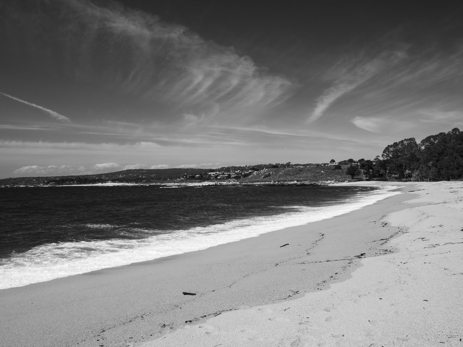
A scenery photo of Monastery Beach, the Pacific Ocean, Carmel-By-The-Sea, and clouds. The photo was shot at Monastery Beach in Carmel-By-The-Sea, CA.
Photo shot at the same spot as above.
A black and white process of the photo above.
Next, we continued our drive south on State Route 1 towards Garrapata State Park in Monterey County, CA.
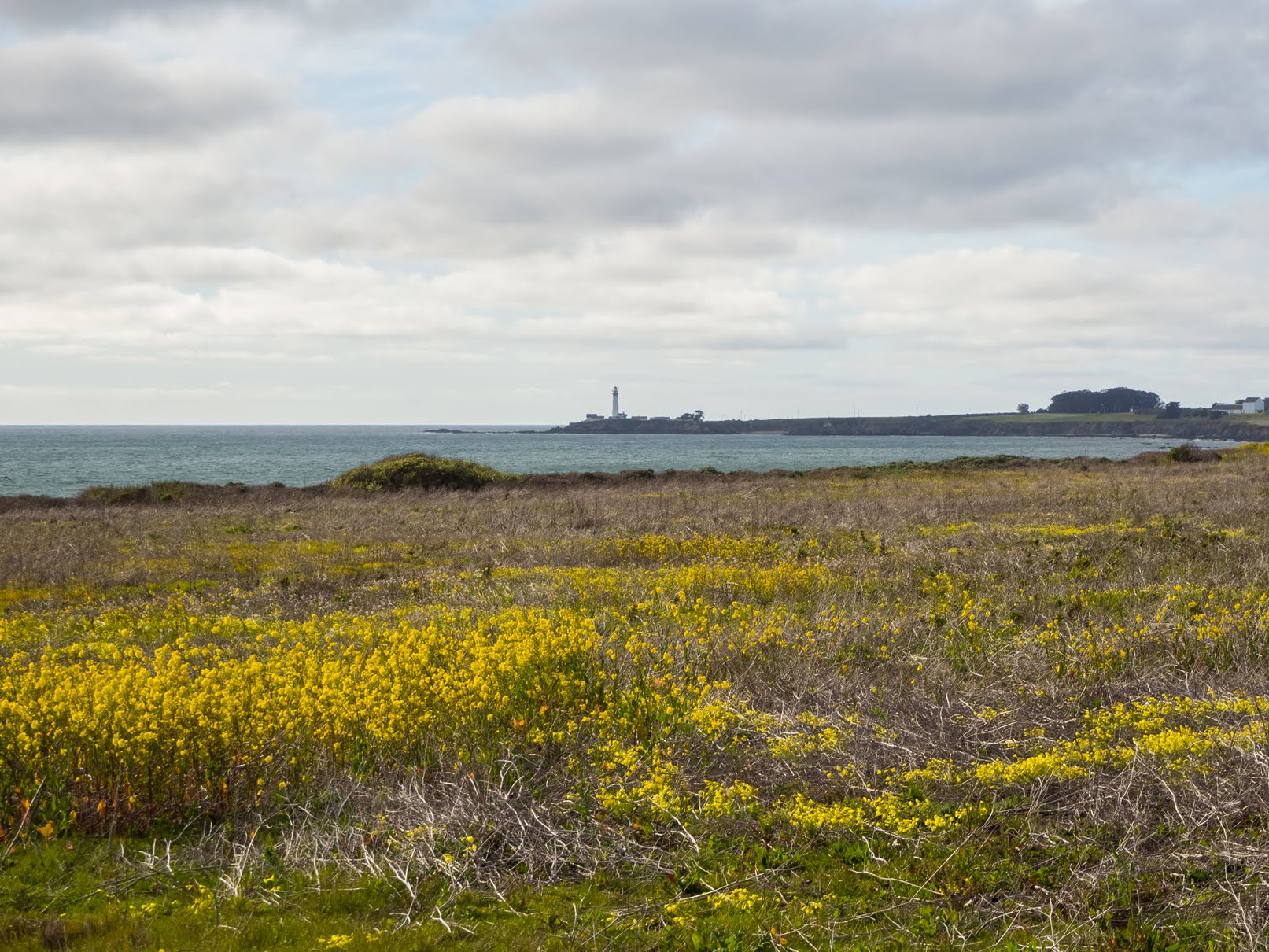
A scenery photo of yellow mustard flowers (left), the Pacific Ocean (right), clouds, rocks, mountains, and cliffs. The photo was shot near Gate 2 of Garrapata State Park.
Approximate GPS location (type into Google): 36° 28' 11" N 121° 55' 59" W
The coordinates of this GPS location is inaccurate because I forgot the phone I was using for geotagging in the car.
Next, my mom and I took a walk and hike on the Somberanes Point Trails in Garrapata State Park in Monterey County, CA.
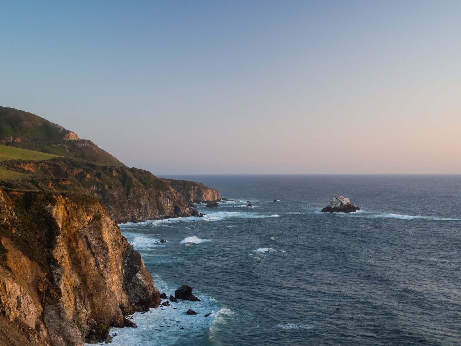
A scenery photo of the Pacific Ocean (left), clouds, rocks, mountains, and cliffs. The photo was shot on the Somberanes Point Trails in Garrapata State Park.
Approximate GPS location (type into Google): 36° 27' 25" N 121° 55' 29" W
A long exposure scenery photo of the Pacific Ocean, clouds, rocks, mountains, and cliffs. The photo was shot on the Somberanes Point Trails in Garrapata State Park.
The long exposure (6 seconds) was achieved using an ND filter.
Approximate GPS location (type into Google): 36° 27' 22" N 121° 55' 32" W
Photography Tip: ND filters cut light to your camera allowing you to achieve long exposures even during daylight hours. Each stop on an ND filter cuts the light by half. Please note cheap ND filters may leave a colour cast on your photos. Generally expensive ND filters are more "neutral" in colour. Please note, the darker an ND filter is, the harder it is for your camera to autofocus (this is more apparent during sunset on a non-full frame camera).
A photo of Yellow Bush Lupine (Lupinus arboreus). In the background (not in focus) are the Pacific Ocean (left), clouds, rocks, cliffs, and mountains. The photo was shot on the Somberanes Point Trails in Garrapata State Park.
Approximate GPS location (type into Google): 36° 27' 14" N 121° 55' 29" W
A photo of Yellow Bush Lupine (Lupinus arboreus). In the background (not in focus) are the Pacific Ocean, plants, bushes, and rocks. The photo was shot on the Somberanes Point Trails in Garrapata State Park.
Photo shot near the same spot as above.
A scenery photo of the Pacific Ocean, clouds, rocks, mountains, and cliffs. The photo was shot on the Somberanes Point Trails in Garrapata State Park.
Approximate GPS location (type into Google): 36° 27' 13" N 121° 55' 37" W
A long exposure scenery photo of the Pacific Ocean, clouds, rocks, mountains, and cliffs. The photo was shot on the Somberanes Point Trails in Garrapata State Park.
The long exposure (5 seconds) was achieved using an ND filter. Unfortunately there was some wind at this spot that vibrated my tripod, so there is slight motion blur on this photo.
Approximate GPS location (type into Google): 36° 27' 12" N 121° 55' 42" W
A long exposure scenery photo of the Pacific Ocean, clouds, rocks, mountains, and cliffs. The photo was shot on the Somberanes Point Trails in Garrapata State Park.
The long exposure (8 seconds) was achieved using an ND filter.
Photo shot near the same spot as above.
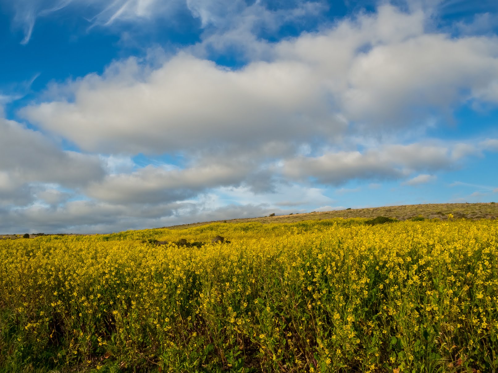
A scenery photo of State Route 1 (left & center), yellow mustard flowers (bottom), the Pacific Ocean (right), clouds, rocks, mountains, and cliffs. The photo was shot on the Somberanes Point Trails in Garrapata State Park.
Approximate GPS location (type into Google): 36° 27' 03" N 121° 55' 38" W
A scenery photo of the Pacific Ocean, clouds, rocks, mountains, and cliffs. The photo was shot on the Somberanes Point Trails in Garrapata State Park.
Photo shot near the same spot as above.
A long exposure scenery photo of the Pacific Ocean, clouds, rocks, mountains, and cliffs. The photo was shot at Whale Peak on the Somberanes Point Trails in Garrapata State Park.
The long exposure (8 seconds) was achieved using an ND filter.
Approximate GPS location (type into Google): 36° 27' 07" N 121° 55' 37" W
This is all the photos for today. I hope you have enjoyed viewing the photos! Please don't forget to share the blog post with your friends and family members! Also, if you want to get notifications when I post up more photos, "Like" us on Facebook or follow me on Instagram. These links can also be found on the top of the right sidebar.
Parts: Cellphone Photos | Olympus Part 1 | Olympus Part 2