Showing posts with label pleasanton ridge regional park. Show all posts

Sunday, April 16, 2023

Pleasanton Ridge Regional Park (Cellphone Photos) - Sunol, CA

Yesterday, on 15 April 2023, my parents and I went hiking in Pleasanton Ridge Regional Park in Sunol, CA. My mom and I hiked to Sunol Peak from Tyler Ranch Staging Area. My dad turned around part of the way up since he hasn't completely recovered from his leg injury a year ago. I took photos with my cellphones. I hope you enjoy viewing the photos.

Before I get started today, I just wanted to tell you about the Midland two way radios I used on this trip to communicate with my dad. I frequently use these radios on my trip because cellphone service isn't always available. On this hike, I used the Midland GXT1050 Radio and my dad used the Midland GXT1030 Radio. Like I said at the beginning, my dad turned back part of the way due to his injuries. There was a short section of trail where the communication came in broken and my mom ended up calling him on his cellphone (he was taking photos around the parking lot and Sunol Downtown). I think there was some interference coming in from other people transmitting, and from that section of trail, there was a severely obstructed line-of-sight (a lot of hills in the way) back to the parking lot. The furthest test my dad and I did was with him in the parking lot (Tyler Ranch Staging Area) and me at Sunol Peak (highest point in Pleasanton Ridge Regional Park). There was mild obstructions back to the parking lot from Sunol Peak (slight hills). The distance was approximately 2.6 miles apart, and we were able to communicate clearly. Please note that two way radios tend to work better when transmitting from mountain peak into a valley. I've used these radios for many years on my trips and I highly recommend them.

A scenery photo of cows, green hills, and the sky. The photo was shot on Sunol Ridge Trail.

A scenery photo of California Poppies (Eschscholzia californica), Long Beaked Filaree Flowers (Erodium botrys), rocks, a green hill, and the sky. The photo was shot on Sunol Ridge Trail.

A photo of California Poppies (Eschscholzia californica), Long Beaked Filaree Flowers (Erodium botrys), and grass. The photo was shot on Sunol Ridge Trail.

A panorama from Sunol Ridge Trail.
Left: Pleasanton, Livermore, Dublin
Center: Sunol, CA
Center Right: Mt. Allison & Mission Peak
Right: SF Bay Area

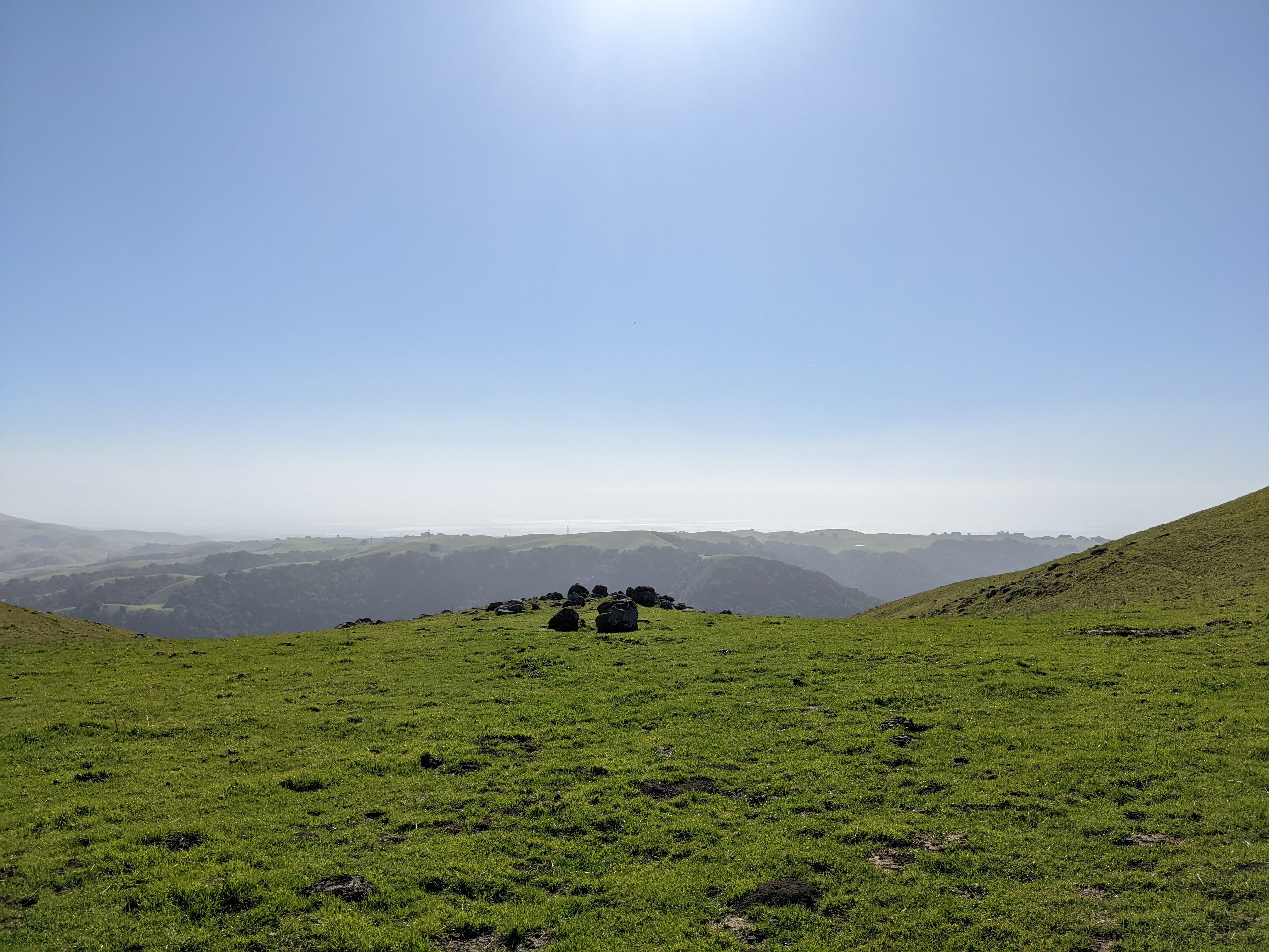
A scenery photo from Sunol Ridge Trail.
Left: Sunol, Mt. Allison, Mission Peak
Right: SF Bay Area

A scenery photo of State Route 84, Niles Canyon, and the SF Bay Area. The flowers in the photo are California Poppies (Eschscholzia californica) and Long Beaked Filaree Flowers (Erodium botrys). The photo was shot on Sunol Ridge Trail.

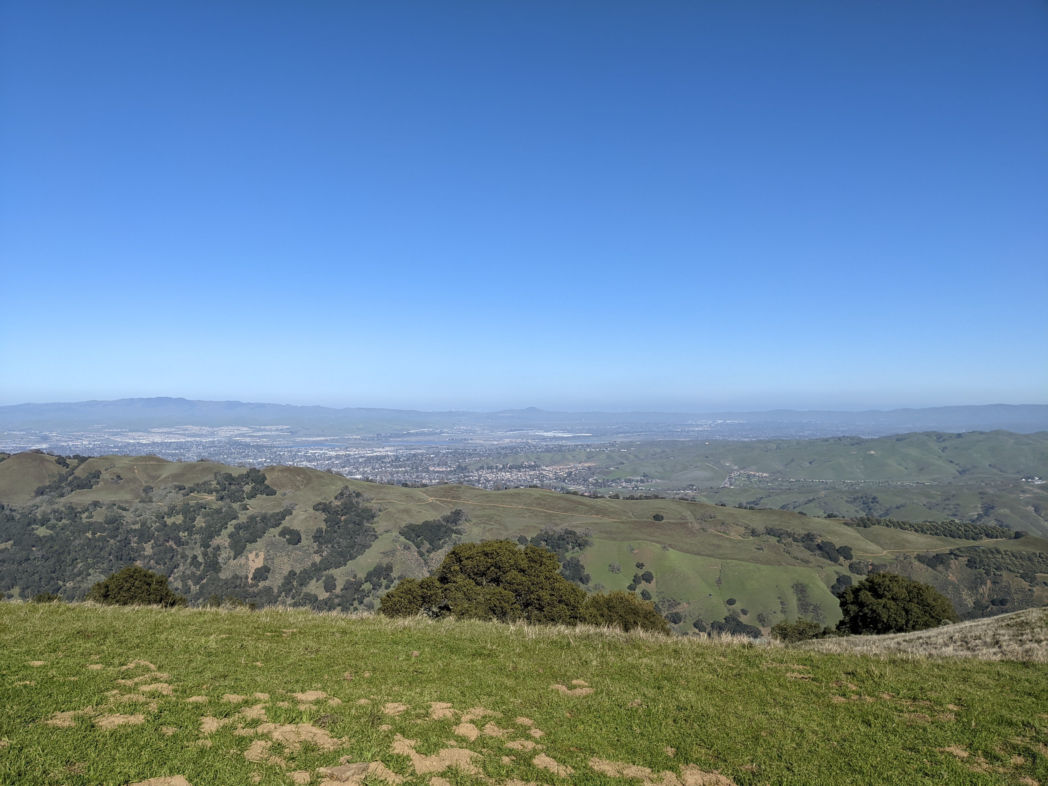
A scenery photo of Pleasanton, Livermore, and Dublin. The flowers in the photo are California Poppies (Eschscholzia californica) and Long Beaked Filaree Flowers (Erodium botrys). The photo was shot on Sunol Ridge Trail.

A scenery photo from Sunol Peak. In the distance are San Francisco (left), Mt. Tamalpais (center), and Oakland (right).

A scenery photo from Sunol Peak. In the distance are Union City, Hayward, and San Mateo Bridge (State Route 92).

A scenery photo from Sunol Peak. In the distance are Mt. Allison & Mission Peak (center), cows (bottom right), and SF Bay Area (right).

This is all the photos for today. I hope you have enjoyed viewing the photos! Please don't forget to share the blog post with your friends and family members! Also, if you want to get notifications when I post up more photos, "Like" us on Facebook or follow me on Instagram. These links can also be found on the top of the right sidebar.

Monday, February 13, 2023

Pleasanton Ridge Regional Park (Cellphone Photos) - Sunol, CA

Today, on 13 February 2023, my mom and I went hiking in Pleasanton Ridge Regional Park in Sunol, CA. Our original plan was to hike from Tyler Ranch Staging Area to Sunol Peak, but we turned back 1 km from Sunol Peak. Today, the heavy winds arrived a day early. When we were almost at the peak, we could barely even keep our balance, so we had no choice but to abandon the hike. In retrospect, we should have turned around half way up the mountain because the wind was already pretty strong, and it only got worse as we gained elevation. The wind speed at the peak probably hit 40+ km/h (25+ MPH). I took photos with my cellphones. I hope you enjoy viewing the photos.

At the beginning of the hike, a nursing calf was blocking the trail. All I could do was shout "DRINK FASTER DANG IT! (喝快点!)". 😂 I thought that was the worst thing to happen on the trail today. I was wrong. The wind was the worst thing to happen on the trail today. 😭

A scenery photo of Sunol, and Mt. Allison & Mission Peak (right). The photo was shot at Niles Canyon Overlook.

A scenery photo of Niles Canyon, State Route 84, and the SF Bay Area (in the distance). The photo was shot on Sunol Ridge Trail.

A scenery photo of Pleasanton, Dublin, and Livermore (in the distance). The photo was shot on Sunol Ridge Trail.

A scenery photo of the SF Bay Area (in the distance) shot on Sunol Ridge Trail.

Advertisement
Advertisement Place Holder APHAPHAPHAPHAPHAPH

A scenery photo of Mt. Diablo (left), Pleasanton, Dublin, and Livermore (in the distance). The photo was shot on Sunol Ridge Trail.

A scenery photo of Pleasanton, Dublin, and Livermore (in the distance). The photo was shot on Sunol Ridge Trail.

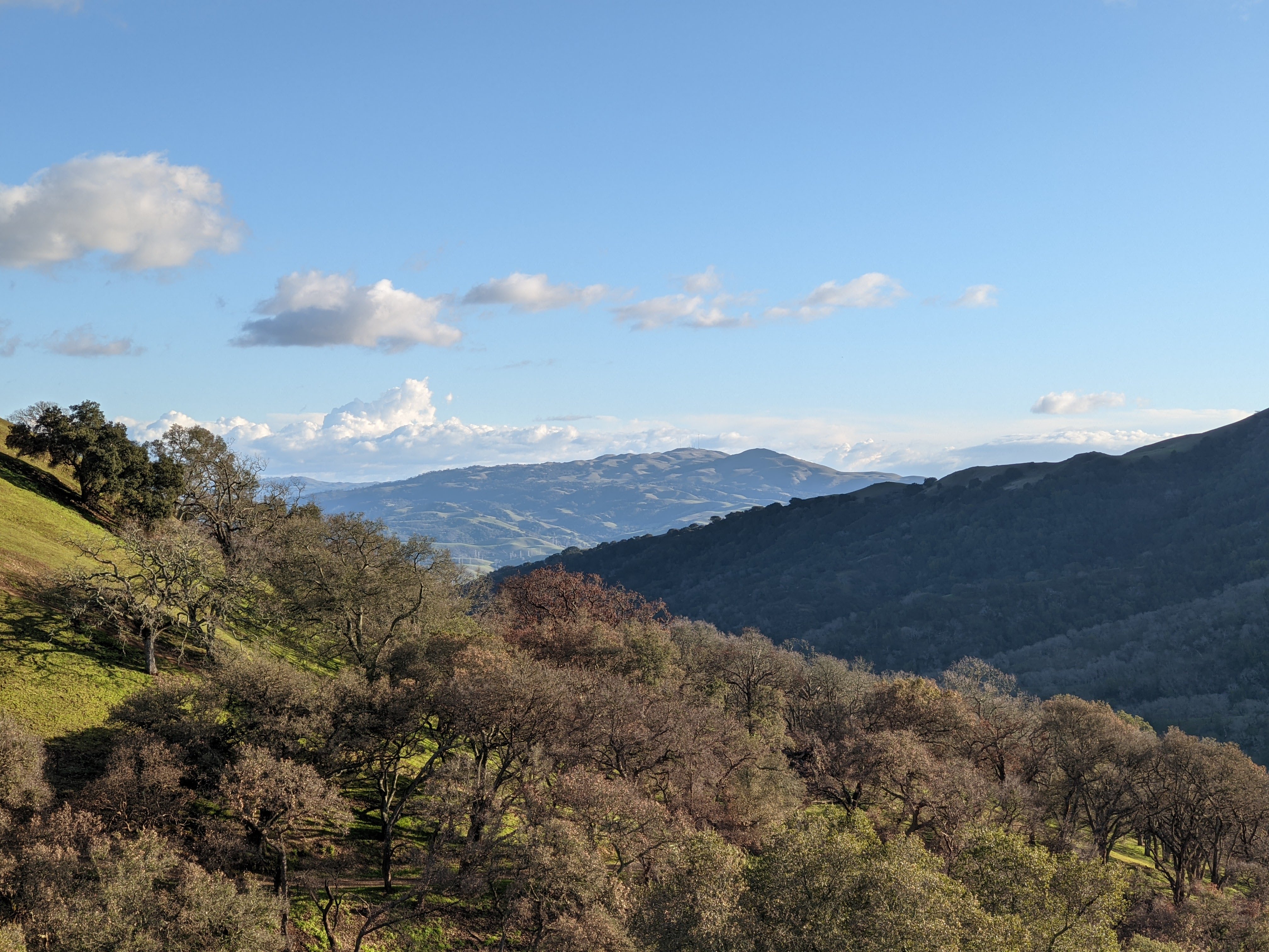
A scenery photo of Mt. Diablo and Dublin (in the distance). The photo was shot on Sunol Ridge Trail.

This is all the photos for today. I hope you have enjoyed viewing the photos! Please don't forget to share the blog post with your friends and family members! Also, if you want to get notifications when I post up more photos, "Like" us on Facebook or follow me on Instagram. These links can also be found on the top of the right sidebar.

Sunday, February 12, 2023

Augustin Bernal Park & Pleasanton Ridge (Cellphone Photos) - Pleasanton, CA

Yesterday, on 11 February 2023, my mom and I went hiking in Augustin Bernal Park and Pleasanton Ridge Regional Park in Pleasanton, CA. It finished raining at around 11 AM yesterday. The trail was actually pretty muddy, but my mom and I got to see a lot of clouds and newts. I took photos with my cellphone. I hope you enjoy viewing the photos.

A scenery photo of Mt. Allison & Mission Peak (in the distance), clouds, mountains, and forest. The photo was shot on Ridgeline Trail in Augustin Bernal Park.

A scenery photo of Sunol & I-680 (center), Mt. Allison & Mission Peak (right), clouds, mountains, and forest. The photo was shot near Ridgeline Trail in Pleasanton Ridge Regional Park.

A scenery photo of clouds and mountains shot near Ridgeline Trail in Pleasanton Ridge Regional Park.

A scenery photo of Mt Diablo, Dublin, and San Ramon (in the distance). Also in the photo are clouds. The photo was shot near Ridgeline Trail in Pleasanton Ridge Regional Park.

Photos of a newt shot on Valley Trail in Augustin Bernal Park. Next to the newt are decaying leaves, grass, twigs, and rocks.

This is all the photos for today. I hope you have enjoyed viewing the photos! Please don't forget to share the blog post with your friends and family members! Also, if you want to get notifications when I post up more photos, "Like" us on Facebook or follow me on Instagram. These links can also be found on the top of the right sidebar.

Tuesday, December 20, 2022

Pleasanton Ridge Regional Park - Sunol, CA (Cellphone Photos)

On 17 December 2022, My mom and I took a hike in Pleasanton Ridge Regional Park in Sunol, CA. We went to the new section of the park that probably opened in 2020. We started our hike at Tyler Ranch Staging Area. I took some photos with my phone. I hope you enjoy viewing the photos.

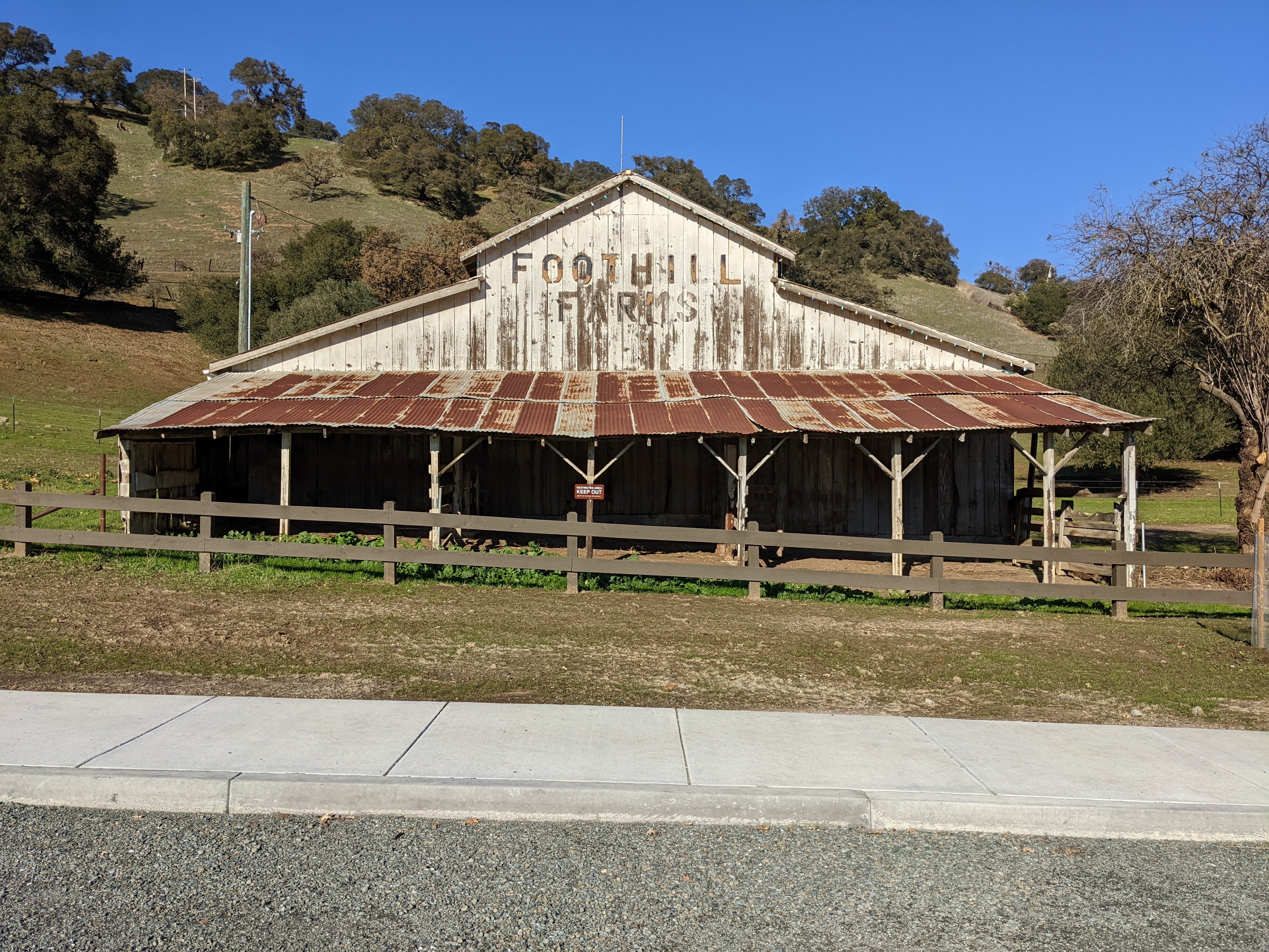
A photo of a barn. The photo was shot at Tyler Ranch Staging Area.

A photo of a barn. The photo was shot at Tyler Ranch Staging Area.

A scenery photo of smog and fog. In the photo are Sunol, and Mt. Allison & Mission Peak (right). The photo was shot on Sunol Ridge Trail.

A scenery photo of smog and fog. In the photo are Sunol, and Mt. Allison & Mission Peak (right). The photo was shot on Sunol Ridge Trail.

A scenery photo of smog and fog. In the photo are Sunol, and Mt. Allison & Mission Peak (right). The photo was shot at Niles Canyon Overlook.

A scenery photo of smog and fog. In the photo are Sunol, and Mt. Allison & Mission Peak (right). The photo was shot at Niles Canyon Overlook.

A scenery photo of smog and fog. In the photo are Niles Canyon, State Route 84, and the SF Bay Area (in the distance). The photo was shot on Sunol Ridge Trail.

A scenery photo of smog and fog. In the photo are the SF Bay Area (in the distance), and Mt. Allison & Mission Peak (right). The photo was shot on Sunol Ridge Trail.

A scenery photo of smog and fog. In the photo is the SF Bay Area (in the distance). The photo was shot on Sunol Ridge Trail.

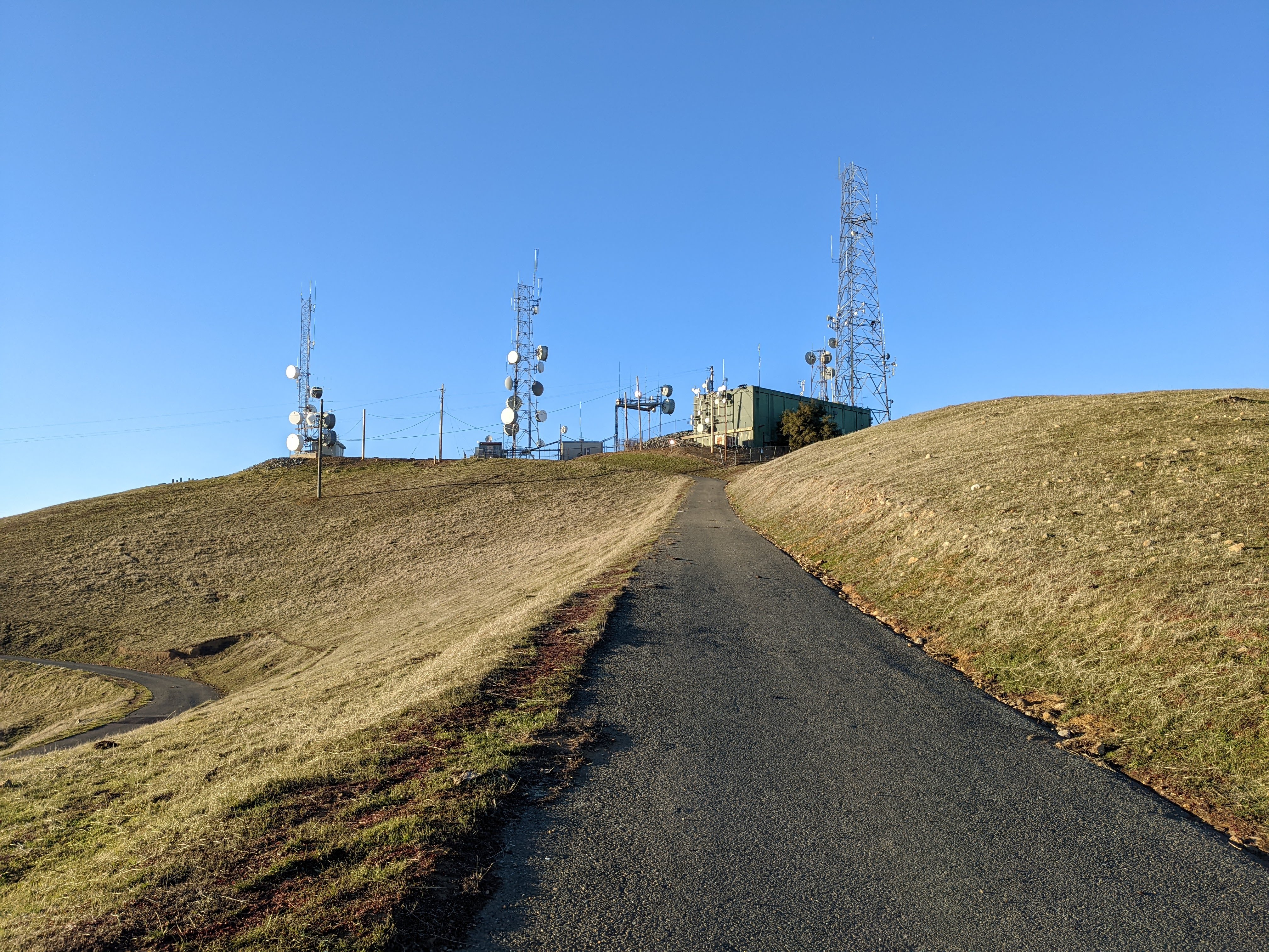
A scenery photo of Sunol Peak and radio antennas. The photo was shot on Sunol Ridge Trail.

A scenery photo of smog and fog. In the photo are Mt. Diablo (left), Pleasanton, Dublin, and Livermore (in the distance). The photo was shot on Sunol Ridge Trail.

A photo of radio antennas shot at Sunol Peak.

A photo of radio antennas shot at Sunol Peak.

A photo of radio antennas, smog, fog, and the SF Bay Area (in the distance) shot at Sunol Peak.

A scenery photo of smog and fog. In the photo is the SF Bay Area (in the distance). The photo was shot at Sunol Peak.

A scenery photo of smog and fog. In the photo are Mt. Allison & Mission Peak (center), and the SF Bay Area (in the distance on the right). The photo was shot at Sunol Peak.

A scenery photo of smog and fog. In the photo are Mt. Diablo, Dublin, Pleasanton, and Livermore (in the distance on the right). The photo was shot at Sunol Peak.

A scenery photo of smog and fog. The photo was shot at Sunol Peak.

A scenery panorama of smog and fog. In the panorama are the SF Bay Area (in the distance on the left), Mt. Diablo, Dublin, Pleasanton, and Livermore (in the distance on the right), and Radio Antennas (right). The photo was shot at Sunol Peak.

A scenery photo of smog and fog. In the photo are Dublin, Pleasanton, and Livermore (in the distance). The photo was shot at Sunol Peak.

A scenery photo of smog and fog. In the photo are Dublin, Pleasanton, and Livermore (in the distance). The photo was shot at Sunol Peak.

A sunset scenery photo of smog and fog. In the photo is the SF Bay Area (in the distance). The photo was shot on Sunol Ridge Trail.

A sunset scenery photo of smog and fog. In the photo is the SF Bay Area (in the distance). The photo was shot on Sunol Ridge Trail.

A sunset scenery photo of smog and fog. In the photo are Mt. Allison & Mission Peak (center), and the SF Bay Area (in the distance on the right). The photo was shot on Sunol Ridge Trail.

A sunset scenery photo of smog and fog. In the photo are Niles Canyon, State Route 84, and the SF Bay Area (in the distance). The photo was shot on Sunol Ridge Trail.

This is all the photos for today. I hope you have enjoyed viewing the photos! Please don't forget to share the blog post with your friends and family members! Also, if you want to get notifications when I post up more photos, "Like" us on Facebook or follow me on Instagram. These links can also be found on the top of the right sidebar.