On 5 March 2023, my parents and I took a trip to Point Reyes National Seashore in Marin County, CA to see elephant seals at Drakes Beach and scenery in the area. On the trip, I got pelted by hail for half an hour on the trail, but I got to witness the most beautiful sunset I have ever seen. You can view the short video I shot while I was getting pelted by hail here. I took photos with my cellphones and mirrorless camera. The photos are split into 2 blog posts. I hope you enjoy viewing my photos!
Parts: Cellphone Photos | Olympus Photos
These photos were shot on my cellphones. The photos are from Drakes Beach, Historic KPH Radio Station, Historic Life-Saving Service Cemetery, Sir Francis Drake Blvd, Abbotts Lagoon, and Kehoe Beach.
Our first stop on this trip was Drakes Beach. Since this was nearing the end of breeding and pupping season, there were only a few males left on the beach and a few weaning pups. All the females have already gone back into the ocean.
Travel Tip: You can't visit Drakes Beach during breeding and pupping season (December 15 through March 31). You can only take photos from the Drakes Beach parking lot during limited hours (10 AM to 4 PM which is when rangers are present). Bring a camera with a telephoto lens if you want good photos.
A photo of elephant seals (Mirounga angustirostris), the Pacific Ocean, clouds, and Drakes Beach. It was raining in the distance.
A photo of elephant seals (Mirounga angustirostris), the Pacific Ocean, clouds, and Drakes Beach. It was raining in the distance.
A photo of an elephant seal cub (Mirounga angustirostris) on Drakes Beach.
A scenery photo of seagulls, the Pacific Ocean, clouds, and Drakes Beach. It was raining in the distance.
A photo of elephant seals (Mirounga angustirostris), the Pacific Ocean, clouds, and Drakes Beach. It was raining in the distance.
Since there weren't that many elephant seals at Drakes Beach, I finished up there pretty quickly. My next stop was the Cypress Tree Tunnel and the Historic KPH Radio Station.
A photo of the Historic KPH Radio Station.
Next, I arrived at the Historic Life-Saving Service Cemetery. I didn't really know what was over here, but I saw a road on Google Maps and a hill (via the terrain view). I wanted to see if there was a view on the hill, and I ended up at the cemetery.
A photo from the Historic Life-Saving Service Cemetery.
Next, My parents and I start driving towards Abbotts Lagoon.
A scenery photo of mountains and clouds shot on the side of Sir Francis Drake Blvd.
Next up, I arrive at Abbotts Lagoon. I got pelted by hail for 30 minutes here. While the weather forecast in the morning said rain wasn't expected until 8 PM, the clouds did not look right to me. It was sunny on one side, and the other side looked like towering cumulonimbus clouds. I also got hit in the face by a few raindrops.
I immediately turned on the NOAA weather radio on my
Midland GXT1050 FRS Two-Way Radio. The NOAA weather forecast was a bit patchy from Abbotts Lagoon, but I was able to hear the important details. The most important detail being there were imminent thunderstorms that were about to begin in the North Bay along the coast, with the highest risk of them taking place in Point Reyes.
I immediately started my walk back to the parking lot. There was no shelter in the area, and I was really concerned about getting struck by lightning. After a minute, the hail started. It wasn't too bad at first, but after 8 minutes, I had to pull out the rain cover for my
Lowepro Backpack because the hailstorm got very heavy very fast.
I was not expecting this storm this early. In the morning, when my mom asked, "Why are you putting big umbrellas in the car when the storms don't start until 8 PM?", I jokingly told her, "What if the storms came 3 hours early?". Who knew I was spot on. Unfortunately, I still forgot my collapsible umbrellas in the car, because I didn't think I would need to use them. Luckily, I was wearing a very thick waterproof down jacket, so the only thing the hail managed to hurt were my hands. The hail really stun my hands, but the rest of me was fine.
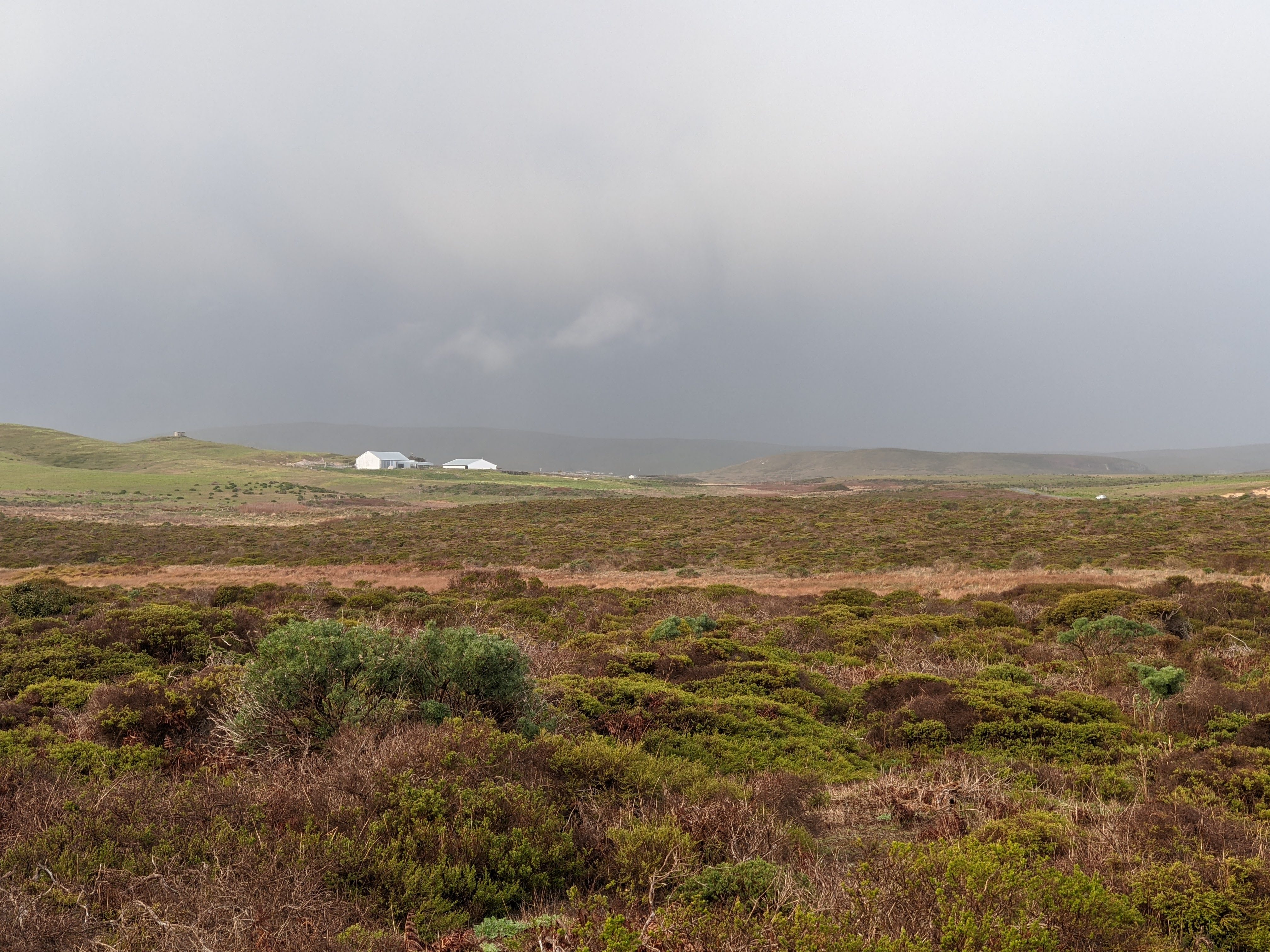
An overcast scenery photo of a rainbow and Abbotts Lagoon. The photo was shot on Abbotts Lagoon Trail.
An overcast scenery photo of a rainbow. The photo was shot on Abbotts Lagoon Trail.
A scenery photo of clouds, Abbotts Lagoon, and the Pacific Ocean. The photo was shot on Abbotts Lagoon Trail.
An overcast scenery photo shot on Abbotts Lagoon Trail.
A photo of clouds shot on Abbotts Lagoon Trail.
A scenery photo of clouds, Abbotts Lagoon, and the Pacific Ocean. The photo was shot on Abbotts Lagoon Trail Head.
A scenery photo of clouds, Abbotts Lagoon, and the Pacific Ocean. The photo was shot on Abbotts Lagoon Trail Head.
A scenery photo of clouds, Abbotts Lagoon, and the Pacific Ocean. The photo was shot on Abbotts Lagoon Trail Head.
A scenery photo of clouds, Abbotts Lagoon, and the Pacific Ocean. The photo was shot on Abbotts Lagoon Trail Head.
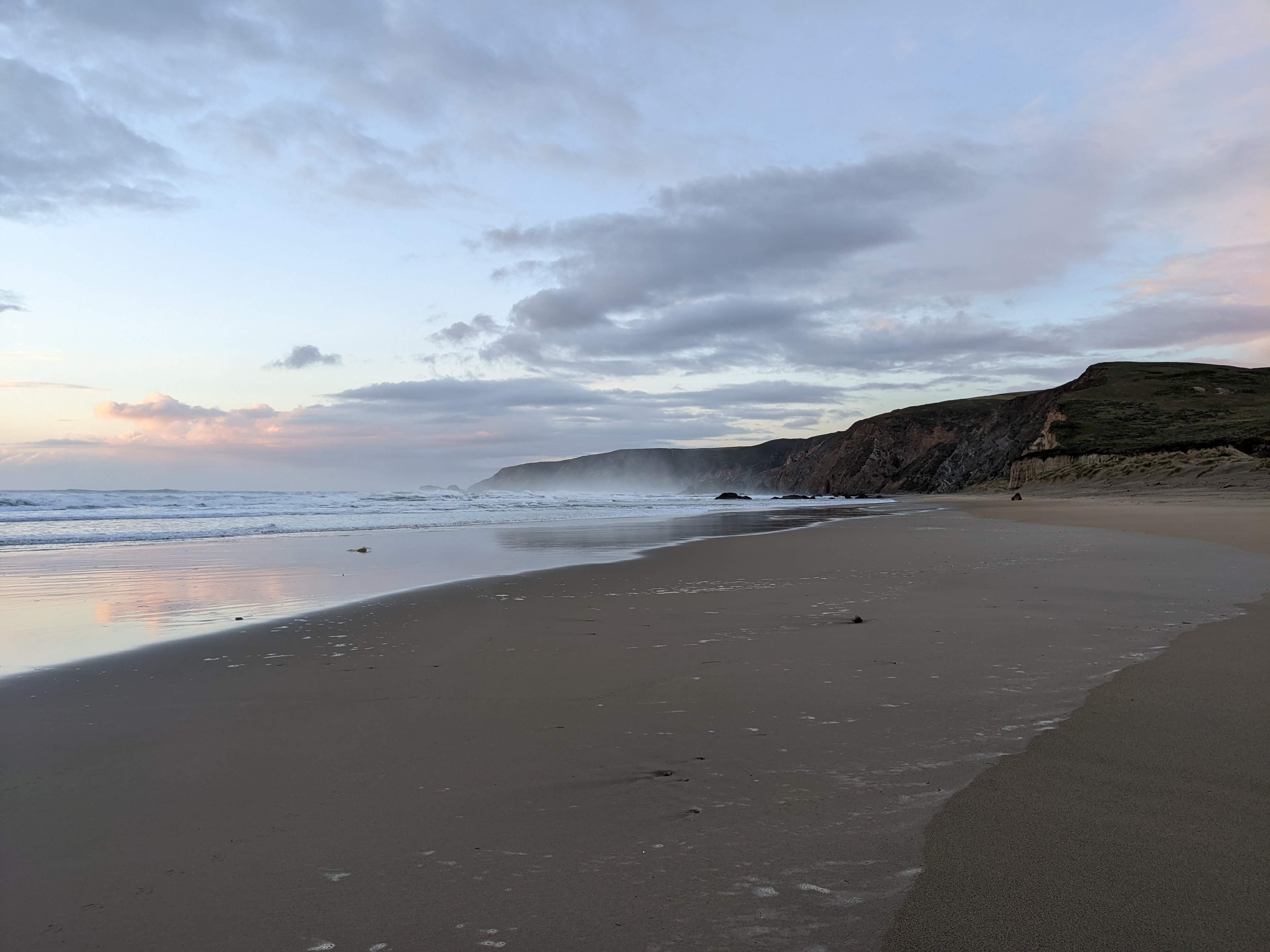
After Abbotts Lagoon, I went to Kehoe Beach to see the sunset. It was one of the most beautiful sunsets I have ever seen.
A sunset scenery photo of clouds, Kehoe Beach, and the Pacific Ocean.
A sunset scenery photo of clouds, Kehoe Beach, and the Pacific Ocean.
A sunset scenery photo of clouds, Kehoe Beach, and the Pacific Ocean.
Advertisement
Advertisement Place Holder APHAPHAPHAPHAPHAPH
A sunset scenery photo of clouds, Kehoe Beach, and the Pacific Ocean.
A sunset scenery photo of clouds and Kehoe Beach.
A sunset scenery photo of clouds, Kehoe Beach, and the Pacific Ocean.
This is all the photos for today. I hope you have enjoyed viewing the photos! Please don't forget to share the blog post with your friends and family members! Also, if you want to get notifications when I post up more photos, "Like" us on Facebook or follow me on Instagram. These links can also be found on the top of the right sidebar.
Parts: Cellphone Photos | Olympus Photos