On November 19th, 2018, I took a day trip to the Stanislaus National Forest and Humboldt-Toiyabe National Forest in California. I traveled to places along State Route 108. I visited the Donnell Fire burn scar, walked along Forest Service Route 077 towards Leavitt Lake, drove down towards Mountain Warfare Training Center, and dropped by Leavitt Falls Vista Point. I split the photos into 5 parts. I hope you enjoy the photos.
Full Resolution Photos: If you want to see full resolution photos of any of the photos you see here, use the following links. If you wish to purchase prints of any of the photos, please contact me
here. To see my best photos from these 2 national forests, use this
link. To see all of my photos from this trip, use this
link.
Parts: 1 | 2 | 3 | 4 | 5 |
This is part 5 of my photos. The photos for today are from Humboldt-Toiyabe Forest. After Forest Service Route 077, I drove down towards Marine Corps Mountain Warfare Training Center along State Route 108. I took photos along State Route 108 and at Leavitt Falls Vista Point.
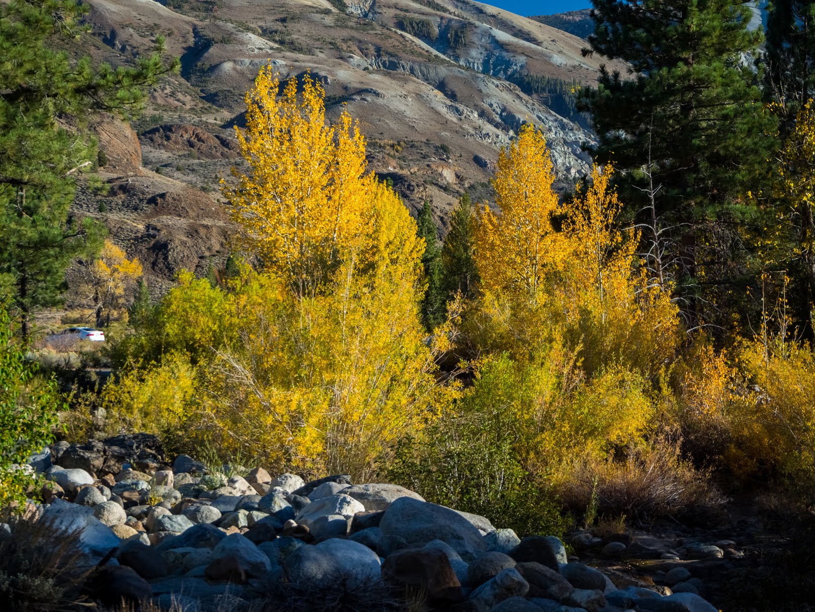
Dusk along State Route 108.
Approximate GPS location (type into Google): 38° 21' 02" N 119° 31' 53" W
Black and white process of the photo above.
Dusk scenery of Mt. Emma shot near State Route 108. Photo shot near the same spot as above.
Black and white process of the photo above.
Dusk along State Route 108.
Approximate GPS location (type into Google): 38° 21' 02" N 119° 31' 54" W
Black and white process of the photo above.
Dusk scenery of Marine Corps Mountain Warfare Training Center (left) and Mt. Patterson (off in the distance). Photo shot near the same spot as above.
Black and white process of the photo above.
Dusk scenery of Marine Corps Mountain Warfare Training Center (left) and Mt. Patterson (off in the distance). Photo shot near the same spot as above.
Black and white process of the photo above.
Dusk scenery of Leavitt Falls shot from Leavitt Falls Vista Point.
Approximate GPS location (type into Google): 38° 19' 21" N 119° 33' 39" W
Black and white process of the photo above.
Dusk scenery of Leavitt Falls shot from Leavitt Falls Vista Point. Photo shot near the same spot as above.
Dusk scenery of Mt. Emma, West Walker River, and Leavitt Creek (left) shot from Leavitt Falls Vista Point.
Approximate GPS location (type into Google): 38° 19' 21" N 119° 33' 40" W
Black and white process of the photo above.
Dusk scenery of Mt. Emma, West Walker River, and Leavitt Creek (center) shot from Leavitt Falls Vista Point.
Approximate GPS location (type into Google): 38° 19' 21" N 119° 33' 39" W
Black and white process of the photo above.
Dusk scenery of Mt. Emma, West Walker River, and Leavitt Creek (center) shot from Leavitt Falls Vista Point. Photo shot near the same spot as above.
Black and white process of the photo above.
Dusk scenery of Leavitt Falls and West Walker River (left) shot from Leavitt Falls Vista Point. Photo shot near the same spot as above.
Black and white process of the photo above.
This is all the photos for today and from this trip! I hope you have enjoyed viewing the photos! Please don't forget to share the blog post with your friends and family members! Also, if you want to get notifications when I post up more photos, "Like" us on
Facebook or follow me on
Twitter and
Instagram. These links can also be found on the top of the right sidebar.
Parts: 1 | 2 | 3 | 4 | 5 |