Showing posts with label milky way. Show all posts

Saturday, December 3, 2022

Lee Vining, Inyo NF, Mono County (Canon Pt. 1) - Mammoth Lakes Trip

My parents and I spent 2 nights at Mammoth Lakes, CA between October 21 to October 23 in 2022. We explored Yosemite National Park, Inyo National Forest, Mono County, and Humboldt-Toiyabe National Forest in California enjoying the scenery and autumn foliage. I took photos with my phone, my Olympus mirrorless camera, and my Canon EOS 5D Mark III camera. The photos will be split into several blog posts. I hope you enjoy viewing my photos! 

High Resolution Photos: If you want to see high resolution photos of any of the photos you see here, use the following links. If you wish to purchase prints of any of the photos, please contact me here. To view my best Inyo National Forest & Mono County photos from 2019 to 2022, use this link. To view my best sunset and night photography photos from 2019 to 2022, use this link. To see all of my photos from Inyo National Forest & Mono County on this trip, use this link.

Parts: 

Cellphone: Part 1Part 2 | Part 3

Olympus: Part 1 | Part 2

Canon: Part 1 | Part 2

This is part 1 of the photos that were shot on my Canon DSLR. The photos are from Lee Vining, CA, Inyo National Forest in California, and Mono County, CA. The photos are from Mono Lake Vista Point, Hot Creek Geological Site, Lake Crowley, and more. 

This blog post contains photos I took on day 1 and 2. On day 1, we drove to Mammoth Lakes, CA from the SF Bay Area via State Route 120 through Yosemite National Park.

I only took photos in Yosemite National Park with my cellphone and my Olympus mirrorless camera, so I first start off this blog post (Canon DSLR photos) with night time high ISO long exposure photos from Mono Lake Vista Point in Lee Vining, CA. If you have been following me, you'll know my vision has been partially fixed by an experimental treatment (Visual Imagery Project by the Visual Snow Initiative). I have recovered around 50% of my night vision, and my day time vision is mostly back to normal. I still can't drive at night, and my parents do assist me somewhat with these night photography photos. I'm very happy to be able to start back up on night photography somewhat. I really hope you enjoy viewing these photos because it is still quite a hassle for me (needing my parents' assistance, along with a lot of trial and error) to take these photos as I still can't see very well at night.

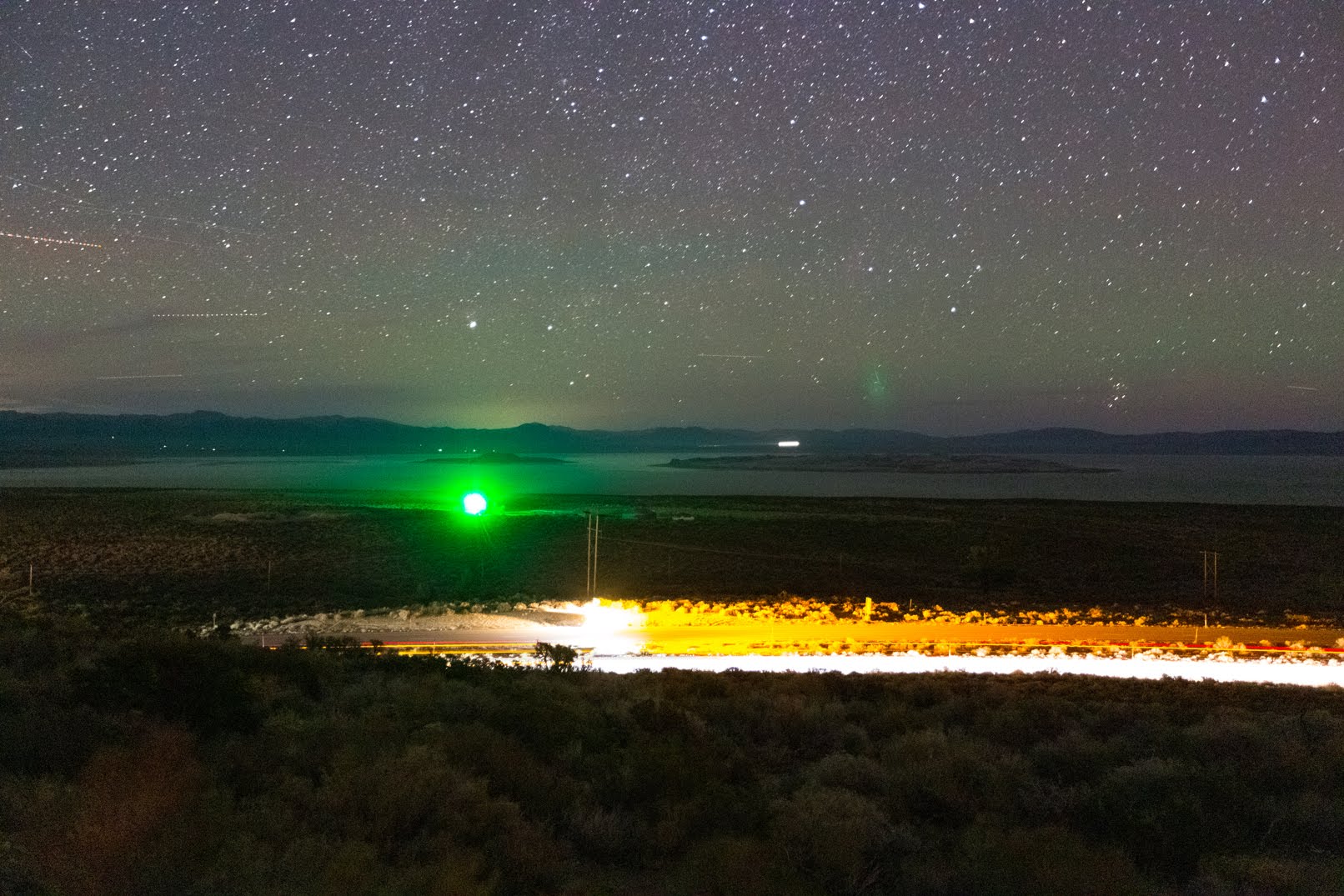
Two high ISO long exposure scenery photos of stars, Mono Lake, Negit Island (left), Paoha Island (right), and US-395 (bottom). I think the green dot on the left was from a lighthouse. The photo was shot at Mono Lake Vista Point in Lee Vining, CA.
Approximate GPS location (type into Google): 37° 56' 53" N 119° 06' 37" W

Two high ISO long exposure scenery photos of the Milky Way. The photo was shot at Mono Lake Vista Point in Lee Vining, CA. Unfortunately due to how sensitive the camera sensor is, it picked up some of the green light from that lighthouse at Mono Lake.
Approximate GPS location (type into Google): 37° 56' 53" N 119° 06' 37" W

Next up are the day 2 photos. On day 2 we explored Mammoth Lakes, CA (cellphone photos only), Hot Creek Geologic Site (Olympus Mirrorless & cellphone photos only), Wild Willy's Hot Springs, Lake Crowley, and Convict Lake.

It was snowing quite heavily in Mammoth Lakes, CA on day 2 of our trip, so our family traveled out into the desert. The next few photos are from our drive to Hot Creek Geologic Site in the Inyo National Forest.

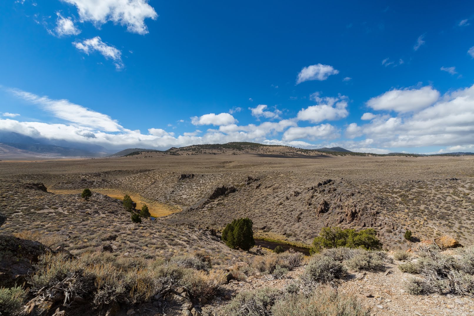
A scenery photo of clouds, desert, Hot Creek, and the Eastern Sierras (left). The photo was shot near Hot Creek Hatchery Road in the Inyo National Forest.
Approximate GPS location (type into Google): 37° 39' 11" N 118° 50' 15" W

A scenery photo of clouds, desert, Glass Mountain Ridge (in the distance), and Hot creek Hatchery Road. The photo was shot in the Inyo National Forest.
Photo shot near the same spot as above.

A black and white process of the photo above.

After we explored Hot Creek Geologic Site (Olympus Mirrorless & cellphone photos only), we went to Wild Willy's Hot Springs in Mono County, CA.

A scenery photo of clouds, desert, Eastern Sierras (in the distance on the left), and Glass Mountain Ridge (right). The photo was shot on Wild Willy's Hot Springs Trail in Mono County, CA.
Approximate GPS location (type into Google): 37° 39' 35" N 118° 46' 07" W

A black and white process of the photo above.

After Wild Willy's Hot Springs, we dropped by Benton Crossing/Owens River Bridge (Olympus Mirrorless photos only), and then went to Lake Crowley in Mono County, CA.

A scenery photo of clouds, desert, Lake Crowley (in the distance), and Eastern Sierras & Owens Gorge Road (left). The photo was shot in the Inyo National Forest.
Approximate GPS location (type into Google): 37° 35' 34" N 118° 41' 15" W

A black and white process of the photo above.

A scenery photo of clouds, desert, Eastern Sierras (in the distance), and Lake Crowley (right). The photo was shot near Owens Gorge Road in the Inyo National Forest.
Approximate GPS location (type into Google): 37° 35' 33" N 118° 41' 15" W

A black and white process of the photo above.

A scenery photo of clouds, desert, dirt roads, Lake Crowley, and Eastern Sierras. The photo was shot near Lake Crowley Eastsid in Mono County, CA.
Approximate GPS location (type into Google): 37° 35' 22" N 118° 42' 22" W

A black and white process of the photo above.

After we finished up at Lake Crowley, we headed to Convict Lake in the Inyo National Forest. We got there just in time for sunset.

A sunset scenery photo of clouds, Convict Lake, and Laurel Mountain. The photo was shot at Brook Trout Lookout in the Inyo National Forest.
Approximate GPS location (type into Google): 37° 35' 37" N 118° 51' 05" W

A black and white process of the photo above.

A sunset scenery photo of clouds, Convict Lake, and Laurel Mountain. The photo was shot on Lakeshore Trail in the Inyo National Forest.
Approximate GPS location (type into Google): 37° 35' 36" N 118° 51' 05" W

A black and white process of the photo above.

A sunset scenery photo of clouds, Convict Lake, and Laurel Mountain. The photo was shot on Fisherman's Trail in the Inyo National Forest.
Approximate GPS location (type into Google): 37° 35' 21" N 118° 51' 18" W

A black and white process of the photo above.

This is all the photos for today. I hope you have enjoyed viewing the photos! Please don't forget to share the blog post with your friends and family members! Also, if you want to get notifications when I post up more photos, "Like" us on Facebook or follow me on Instagram. These links can also be found on the top of the right sidebar.

Parts: 

Cellphone: Part 1Part 2 | Part 3

Olympus: Part 1 | Part 2

Canon: Part 1 | Part 2

Copyright Warning: These photos are some of my best and most popular works of art. Unauthorized usage and reproductions are strictly prohibited. Please contact me here to purchase prints and negotiate photo licenses.

Saturday, October 22, 2022

Autumn Foliage/Milky Way (Canon Photos) - Yosemite/Stanislaus/Humboldt-Toiyabe

This blog post contains photos of Sierra Nevada aspen tree autumn foliage! On 15 October 2022, my parents and I went to Stanislaus National Forest, Humboldt Toiyabe National Forest, Lee Vining, Inyo National Forest, and Yosemite National Park in California. We drove on State Route 108, U.S. Route 395, and State Route 120 to look at autumn foliage. I took photos with my phone, my Olympus mirrorless camera, and my Canon EOS 5D Mark III camera. I hope you enjoy viewing my photos! 

High Resolution Photos: If you want to see high resolution photos of any of the photos you see here, use the following links. If you wish to purchase prints of any of the photos, please contact me here. To view my best autumn foliage photos from 2015 to 2022, use this link. To view my best Stanislaus National Forest photos from 2021 to 2022, use this link. To see all of my photos from this trip, use this link (Stanislaus/Humboldt-Toiyabe National Forest) and this link (Yosemite National Park).

Parts: Cellphone Photos | Olympus Photos | Canon Photos

These photos were shot on my Canon EOS 5D Mark III DSLR. In the photos are autumn foliage scenery along State Route 108 in Stanislaus National Forest, Leavitt Falls Vista Point, milky way photos from Tioga Road (SR-120) in Yosemite National Park, and night scenery of stars from Rim of the World Vista Point in Stanislaus National Forest. More information about the night photography later in the post, and how I took those photos despite my partial night blindness (caused by Visual Snow Syndrome).

A scenery photo of autumn foliage on aspen trees. The photo was shot near State Route 108 in Stanislaus National Forest.
Approximate GPS location (type into Google): 38° 19' 28" N 119° 41' 39" W

A scenery photo of autumn foliage on aspen trees. The photo was shot near State Route 108 in Stanislaus National Forest.
Approximate GPS location (type into Google): 38° 19' 25" N 119° 41' 42" W

A scenery photo of autumn foliage on aspen trees and Deadman Creek. The photo was shot near State Route 108 in Stanislaus National Forest.
Approximate GPS location (type into Google): 38° 19' 26" N 119° 41' 38" W

A scenery photo of autumn foliage on aspen trees. The photo was shot near State Route 108 in Stanislaus National Forest.
Approximate GPS location (type into Google): 38° 19' 28" N 119° 41' 39" W

A scenery photo of autumn foliage on aspen trees. The photo was shot near State Route 108 in Stanislaus National Forest.
Approximate GPS location (type into Google): 38° 19' 15" N 119° 40' 21" W

A scenery photo of autumn foliage on aspen trees and State Route 108. The photo was shot in Stanislaus National Forest.
Approximate GPS location (type into Google): 38° 19' 18" N 119° 40' 23" W

A scenery photo of autumn foliage on aspen trees and State Route 108. The photo was shot in Stanislaus National Forest.
Approximate GPS location (type into Google): 38° 19' 18" N 119° 40' 25" W

A scenery photo from Leavitt Falls Vista Point in Humboldt-Toiyabe National Forest.
In the photo is Mt. Emma, West Walker River, and Leavitt Creek (left).
Approximate GPS location (type into Google): 38° 19' 21" N 119° 33' 39" W

A scenery photo from Leavitt Falls Vista Point in Humboldt-Toiyabe National Forest.
In the photo is Mt. Emma, West Walker River, and Leavitt Creek (left).
Photo shot at the same spot as above.

My parents and I took State Route 120 home driving through Yosemite National Park (with my dad driving). I took some high ISO long exposure photos of the Milky Way and stars on the way home. All of you might be wondering, "I thought you were night blind from Visual Snow Syndrome, how did you manage?" Here is a wonderful story from my trip.

If you have been following me on social media (or even here on the blog), you'd know my Visual Snow Syndrome has been partially treated by an experimental treatment (Visual Imagery Project) created by the Visual Snow Initiative. My day time vision is almost normal, and I recovered around 50% of my night vision. I still can't drive at night, I still can't drive alone (one of my parents always supervises and can take over if I no longer feel comfortable to continue), and I need a semi-bright flashlight to take walks at night, but now, if I stand very still at night and look very hard, I can somewhat see through the noise and distortions now.

As my dad was driving down State Route 120, I was looking out the window to see if I can see anything. In the distance, I saw what looked like lights. I thought maybe they were houses, because even during the worst of my night blindness, I was still able to see light sources from homes and street lamps (but they were very dim in my vision). After a while it hit me, those aren't houses, they are stars, we're in Yosemite National Park, it's all forest and no ones living there. I asked my dad if what I was looking at are stars, and he said yes. I was very excited as this was when I realized to what extent the Visual Imagery Project worked on my Visual Snow Syndrome. My dad pulled over so we can all enjoy looking at the stars. I got off the car, stood very still, and looked up very hard. After a while I started seeing a ton of stars through the noise and distortions. I almost cried. I was extremely happy and it got pretty emotional. 2 years ago, I could have never imagined this happening, my vision was getting worse and worse, and I was very depressed and sad (even though my doctor assured me I won't go completely blind). I have not seen this many stars in years. For many years, I occasionally saw a few very bright stars in the sky (enough to count on my hands). This is still not normal night vision as I've been to Yosemite National Park and did stargazing before Visual Snow Syndrome took off, but I think I was able to see around 50% of what you can see with the naked eye.

Now I move onto taking photos. My parents actually assisted me somewhat telling me what is around me, the general direction of where things are, pointing me in the general direction of the Milky Way, and assisting me in framing the shot. That, combined with my partially recovered vision, a lot of trial and error, and my years of experience in photography, I managed to take some night time high ISO long exposure photos of the Milky Way and stars. I'm amazed at how well the photos turned out despite my partial night blindness.

The GPS coordinates for the Yosemite National Park milky way photos are 37° 46' 19" N 119° 45' 42" W.

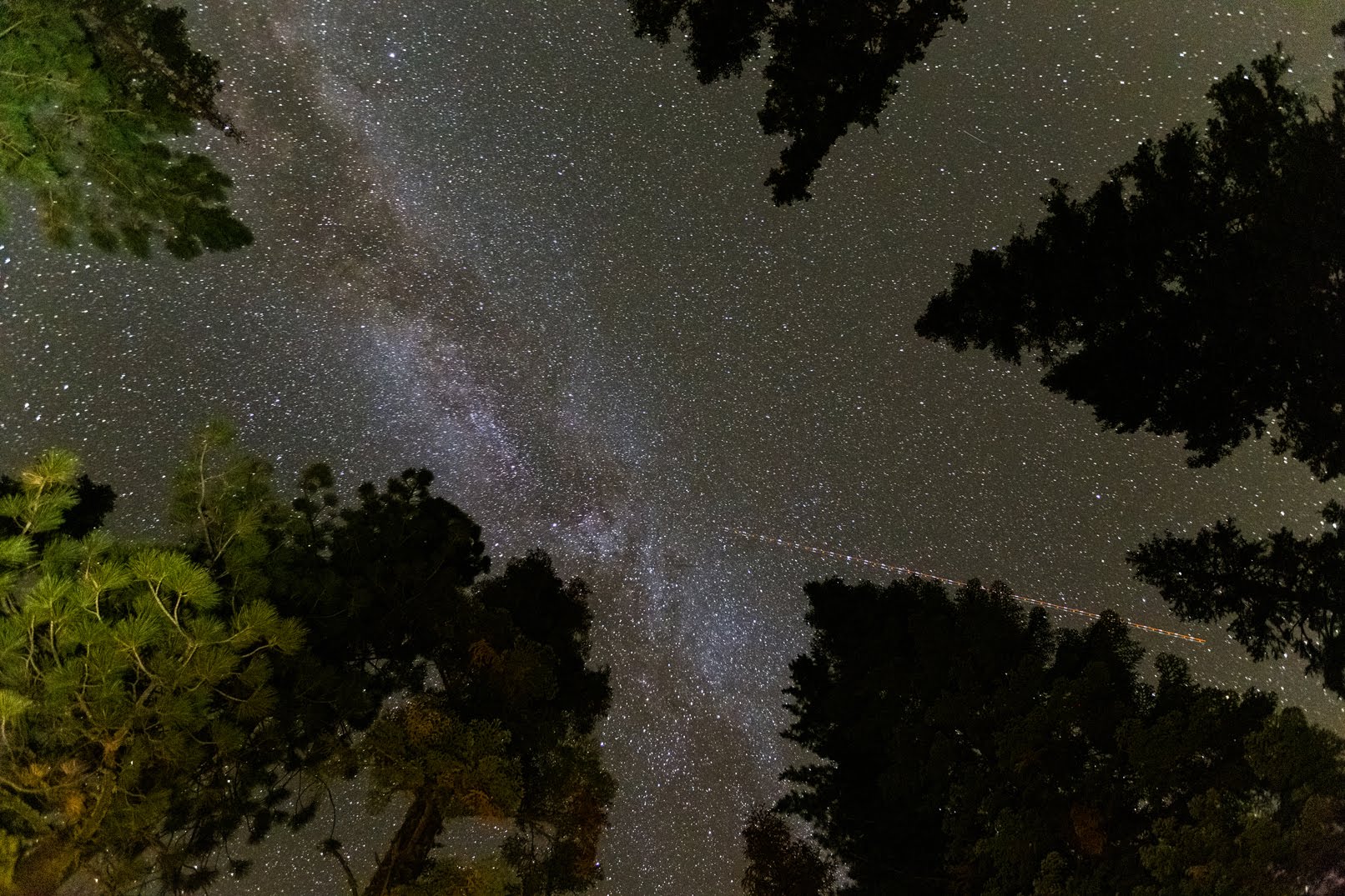
High ISO long exposure photos of the Milky Way, stars, and trees. The photos were shot on the side of Tioga Road (State Route 120) in Yosemite National Park.

High ISO long exposure photos of the Milky Way, stars, and trees. The photos were shot on the side of Tioga Road (State Route 120) in Yosemite National Park.

My parents and I were a little disappointed at the spot we stopped at in Yosemite National Park. There was a limited view of the sky as there were a ton of trees. As we kept driving, I decided to stop at the Rim of the World Vista Point in Stanislaus National Forest. My vision kind of works now, so why not? 😁 Unfortunately once we got out of the park, the light pollution got pretty bad so the photos didn't turn out as good as I had hoped either.

The GPS coordinates for the Rim of the World Vista Point night scenery photos in Stanislaus National Forest are 37° 49' 19" N 120° 02' 20" W.

High ISO long exposure photos of stars and mountains. The photos were shot at Rim of the World Vista Point in Stanislaus National Forest.

This is all the photos for today. I hope you have enjoyed viewing the photos! Please don't forget to share the blog post with your friends and family members! Also, if you want to get notifications when I post up more photos, "Like" us on Facebook or follow me on Twitter and Instagram. These links can also be found on the top of the right sidebar.

Parts: Cellphone Photos | Olympus Photos | Canon Photos