Showing posts with label shadow. Show all posts

Tuesday, March 14, 2023

Yellow Mustard Flowers & Deer (Cellphone Photos) - Contra Costa County, CA

Yesterday, on 13 March 2023, my mom and I drove along Highland Road in unincorporated Pleasanton, CA and Livermore, CA (Contra Costa County, CA). We saw a lot of yellow mustard flowers and a few deer. I took photos with my cellphones. I hope you enjoy viewing the photos.

A scenery photo of yellow mustard flowers, green hills, clouds, farm, a barbed wire fence, high voltage power lines, my shadow, and Highland Road. The photo was shot in unincorporated Pleasanton, CA.

A scenery photo of yellow mustard flowers, green hills, clouds, a barbed wire fence, and my shadow. The photo was shot on the side of Highland Road in unincorporated Pleasanton, CA.

A scenery photo of yellow mustard flowers, green hills, and clouds. The photo was shot on the side of Highland Road in unincorporated Pleasanton, CA.

A scenery photo of yellow mustard flowers, green hills, and clouds. The photo was shot on the side of Highland Road in unincorporated Pleasanton, CA.
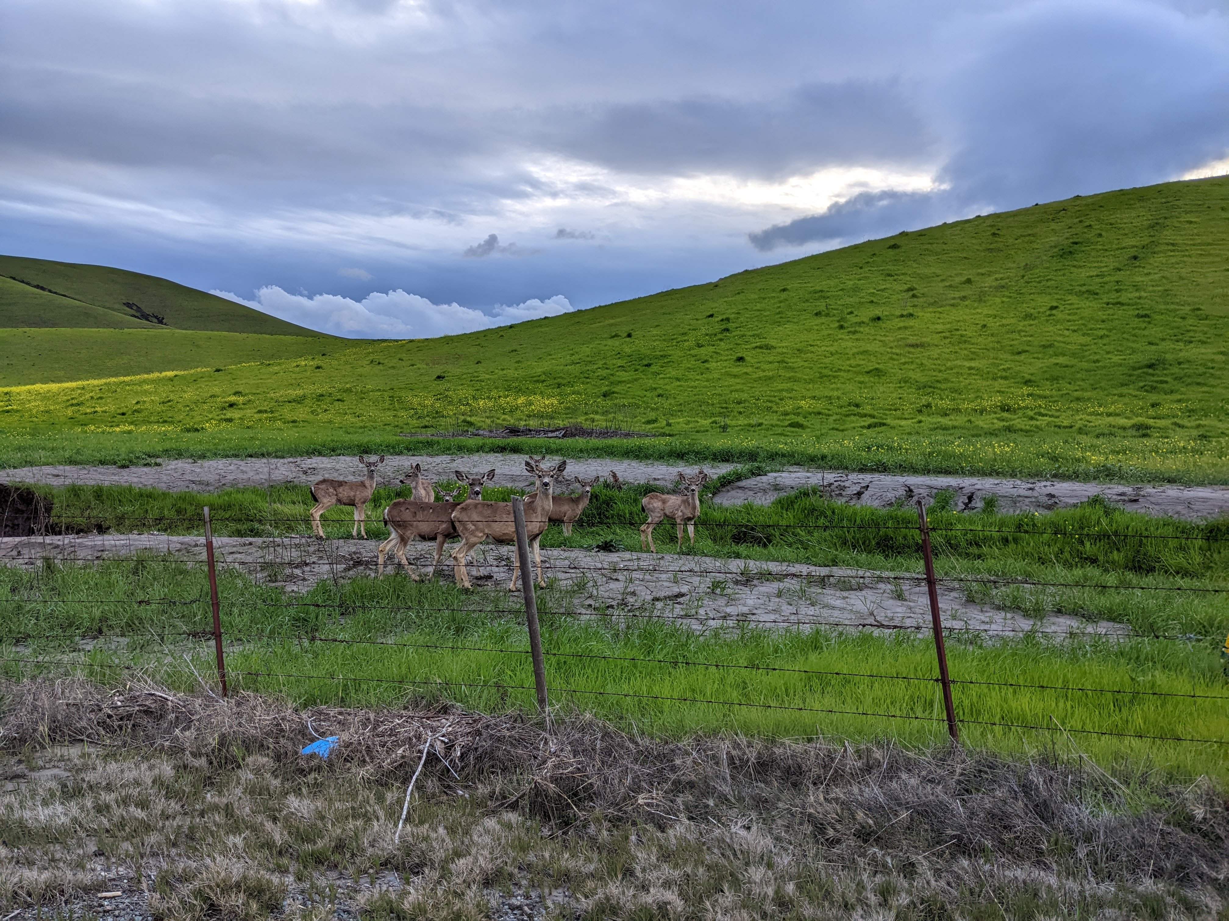
A scenery photo of deer, yellow mustard flowers, green hills, clouds, and a barbed wire fence. The photo was shot on the side of Highland Road in unincorporated Livermore, CA.

A scenery photo of deer, yellow mustard flowers, green hills, clouds, and a barbed wire fence. The photo was shot on the side of Highland Road in unincorporated Livermore, CA.

A scenery photo of deer, yellow mustard flowers, green hills, clouds, and a barbed wire fence. The photo was shot on the side of Highland Road in unincorporated Livermore, CA.

This is all the photos for today. I hope you have enjoyed viewing the photos! Please don't forget to share the blog post with your friends and family members! Also, if you want to get notifications when I post up more photos, "Like" us on Facebook or follow me on Instagram. These links can also be found on the top of the right sidebar.

Tuesday, June 17, 2014

Pleasanton Ridge Regional Park (Part 4) - Sunol, CA

Another hiking trail pretty close to my house is Pleasanton Ridge Regional Park which is somehow not in Pleasanton, CA but in the bordering town of Sunol, CA. Unlike Augustin Bernal Park, this park is less shady but the scenery is even more wonderful and the trail is less steep. I recently sprained my foot a bit while hiking Augustin Bernal Park so after several days to let it heal up a bit, I decided I'd work back into hiking with a slightly less steep trail at Pleasanton Ridge Regional Park. After going there, I fell in love. While a bit more sunny, this park is a lot bigger and has much more scenic views as it is further in the wilderness here in the valley. I hope you enjoy viewing this series of photos. This series will have photos from several days, not just one day.

Full Resolution Photos and Prints: If you want to see full resolution photos or buy prints of any of the photos you see, they are up on my portfolio for viewing. To view my best Pleasanton Ridge Regional Park photos, use this link. To see all of my 2014 Pleasanton Ridge Regional Park photos, use this link.

Parts: 1 | 2 | 3 | 4 |  

The photos for today are from 6/7.

 Sunset view from the mountain. 
Approximate GPS location (type into Google) according to the Canon GP-E2 GPS Receiver: 37 36 44 N 121 53 26 W  

A patch of grass on the mountain. 
 Approximate GPS location (type into Google) according to the Canon GP-E2 GPS Receiver: 37 36 46 N 121 53 29 W  

 Sunset on the mountain. As the sun gets lower, the shadows get longer. 
 Approximate GPS location (type into Google) according to the Canon GP-E2 GPS Receiver: 37 36 53 N 121 53 31 W

 If you visit my personal Google+, you'll see I have a shadow for my profile picture. I decided I'd get a new one. Here are three shadow photos I took. 
 Approximate GPS location (type into Google) according to the Canon GP-E2 GPS Receiver: 37 36 59 N 121 53 40 W

Sunset on the mountain. 
 Approximate GPS location (type into Google) according to the Canon GP-E2 GPS Receiver: 37 37 02 N 121 53 50 W  

HDR composition of the sunset.  

 A sunset photo of trees. 

 I felt this tree would make a great silhouette contrasted against the setting sun.

A tree with golden yellow leaves. I just thought it was weird seeing a tree like this during spring so I got a photo of it.  

HDR composition of the sunset. 
 Approximate GPS location (type into Google) according to the Canon GP-E2 GPS Receiver: 37 37 16 N 121 53 58 W  

HDR composition of the trail during sunset. 
Approximate GPS location (type into Google) according to the Canon GP-E2 GPS Receiver: 37 37 00 N 121 53 43 W   

 I thought the one lone tree on a hill would make a nice composition. 
Approximate GPS location (type into Google) according to the Canon GP-E2 GPS Receiver: 37 36 59 N 121 53 39 W

 The sun has set behind the mountain. 
Approximate GPS location (type into Google) according to the Canon GP-E2 GPS Receiver: 37 36 46 N 121 53 28 W   

Another sunset scenery shot. 
Approximate GPS location (type into Google) according to the Canon GP-E2 GPS Receiver: 37 36 44 N 121 53 29 W    

Another photo of sunset. 
Approximate GPS location (type into Google) according to the Canon GP-E2 GPS Receiver: 37 36 50 N 121 53 23 W   

These are all the photos for today. I hope you have enjoyed viewing them. Please don't forget to share the blog post with your friends and family members! Also, if you want to get notifications when I post up more photos, "Like" us on Facebook or follow me on Twitter and Instagram. These links can also be found on the top of the right sidebar.

Parts: 1 | 2 | 3 | 4 |