On 3 October 2022, my parents and I spent a day in Eldorado National Forest and Humboldt-Toiyabe National Forest in California. We drove on State Route 88 and visited some of the side roads along the highway. We went to Lower Bear River Reservoir, Peddler Hill Scenic Viewpoint, Mormon Emigrant Trail, Strawberry Creek Barn, Lower Blue Lake, Alpine County, CA, and Minden, NV (for petrol). I took photos with my phone and with my mirrorless camera. I hope you enjoy viewing my photos!
Parts: Cellphone Photos | Mirrorless Photos
These photos were shot on my cellphone. The photos are scenery from the Lower Bear River Reservoir and surrounding areas, scenery near Forest Route 08N03, scenery from the Peddler Hill Scenic Viewpoint, scenery near Forest Route 10N50G, scenery near State Route 4, Strawberry Creek Barn, scenery near Forest Route 10N13, scenery of Red Lake, scenery from the side of Blue Lakes Road, scenery of Lower Blue Lake, and Burnside Lake Road. Later we went to Minden, NV to get some cheap petrol (compared to California). We also stopped on the side of the road in Alpine County, CA to get a sunset scenery photo of a ranch.
A scenery photo of Lower Bear River Reservoir. The photo was shot on top of the Lower Bear River Reservoir Dam on Bear River Road. Photo from Eldorado National Forest.
A scenery photo shot on top of the Lower Bear River Reservoir Dam on Bear River Road. Photo from Eldorado National Forest.
A scenery photo of the forest shot near Forest Route 08N03. Photo from Eldorado National Forest.
A scenery photo of the forest shot near Forest Route 08N03 and South Bear River Road. Photo from Eldorado National Forest.
A scenery photo of Lower Bear River Reservoir. The photo was shot on Bear River Road. Photo from Eldorado National Forest.
A scenery photo of Lower Bear River Reservoir. The photo was shot on Bear River Road. Photo from Eldorado National Forest.
A scenery photo of Lower Bear River Reservoir. The photo was shot on Bear River Road. Photo from Eldorado National Forest.
A panorama of Lower Bear River Reservoir. The photo was shot on Bear River Road. Photo from Eldorado National Forest.
A scenery photo from Peddler Hill Scenic Viewpoint on the side of State Route 88. Photo from Eldorado National Forest.
A scenery photo of Lower Bear River Reservoir shot at Peddler Hill Scenic Viewpoint on the side of State Route 88. Photo from Eldorado National Forest.
A scenery photo shot on Forest Route 10N50G near Mormon Emigrant Trail (Forest Route 10N50). Photo from Eldorado National Forest.
"New Growth After Fire"
A photo of a young pine tree with dead burned trees in the background. I thought the baby tree makes a nice contrast against the dead burned trees in the background.
The photo is shot on Forest Route 10N50G near Mormon Emigrant Trail (Forest Route 10N50). Photo from Eldorado National Forest.
A scenery photo of the burned forest. The photo is shot on Forest Route 10N50G near Mormon Emigrant Trail (Forest Route 10N50). Photo from Eldorado National Forest.
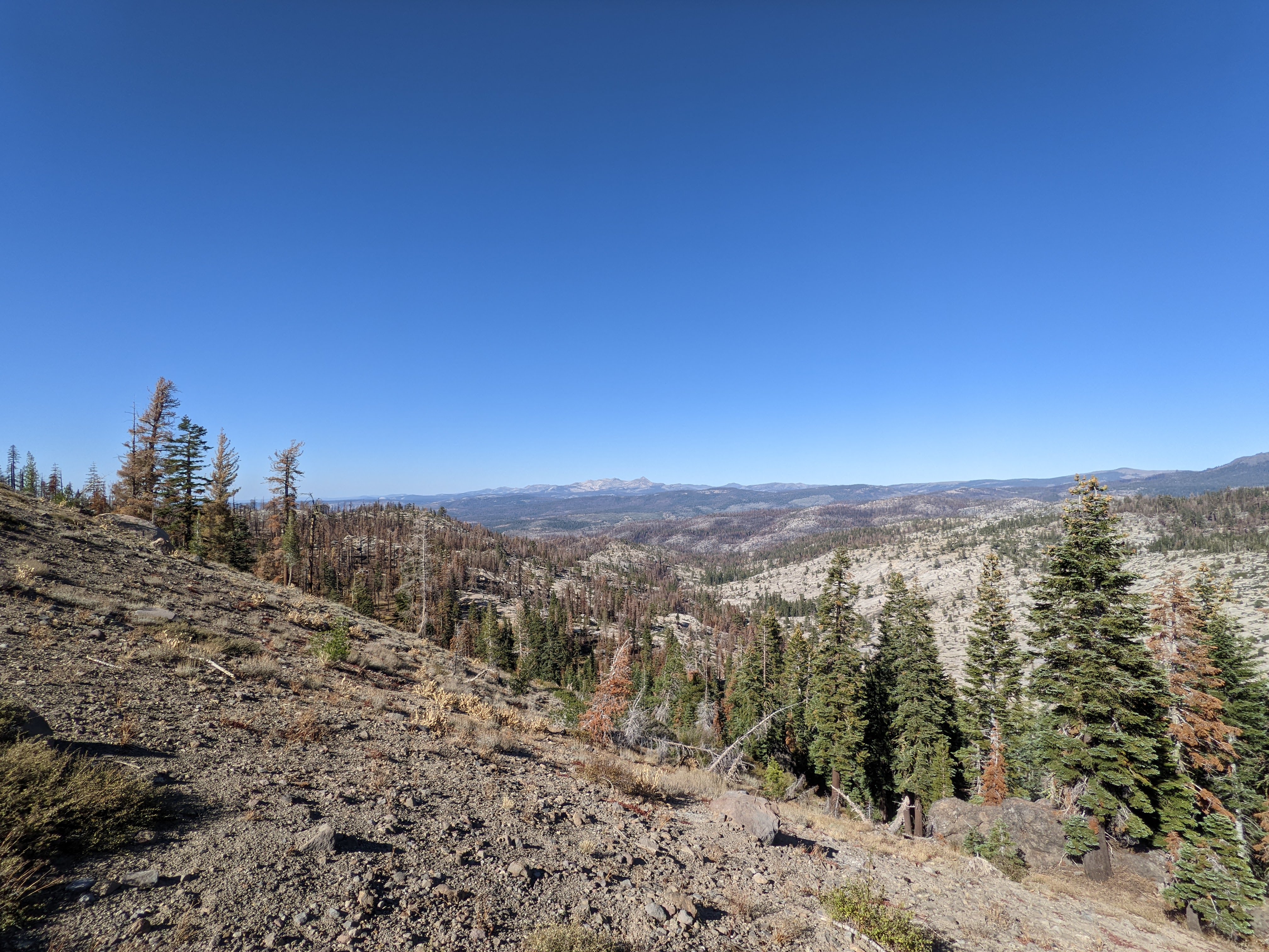
A scenery photo shot near State Route 88. Photo from Eldorado National Forest.
A scenery photo shot near State Route 88. Photo from Eldorado National Forest.
A scenery photo of Strawberry Creek Barn. The photo was shot near Strawberry Creek Road in Eldorado National Forest.
A scenery photo shot on Schneider Cow Camp Road (Forest Route 10N13). Photo from Eldorado National Forest.
A scenery photo of Red Lake & Hawkins Peak (in the distance). Photo shot at Red Lake Vista Point near State Route 88. Photo from Humboldt-Toiyabe National Forest.
A panorama of Elephants Back (far right), and Red Lake & Hawkins Peak (in the distance on the left). Photo shot at Red Lake Vista Point near State Route 88. Photo from Humboldt-Toiyabe National Forest.
A scenery photo shot on the side of Blue Lakes Road. Photo from Humboldt-Toiyabe National Forest.
A scenery photo of Lower Blue Lake. Photo from Humboldt-Toiyabe National Forest.
A scenery photo shot on Burnside Lake Road. Photo from Humboldt-Toiyabe National Forest.
A scenery photo shot on Burnside Lake Road. Photo from Humboldt-Toiyabe National Forest.
A scenery photo shot on Burnside Lake Road. Photo from Humboldt-Toiyabe National Forest.
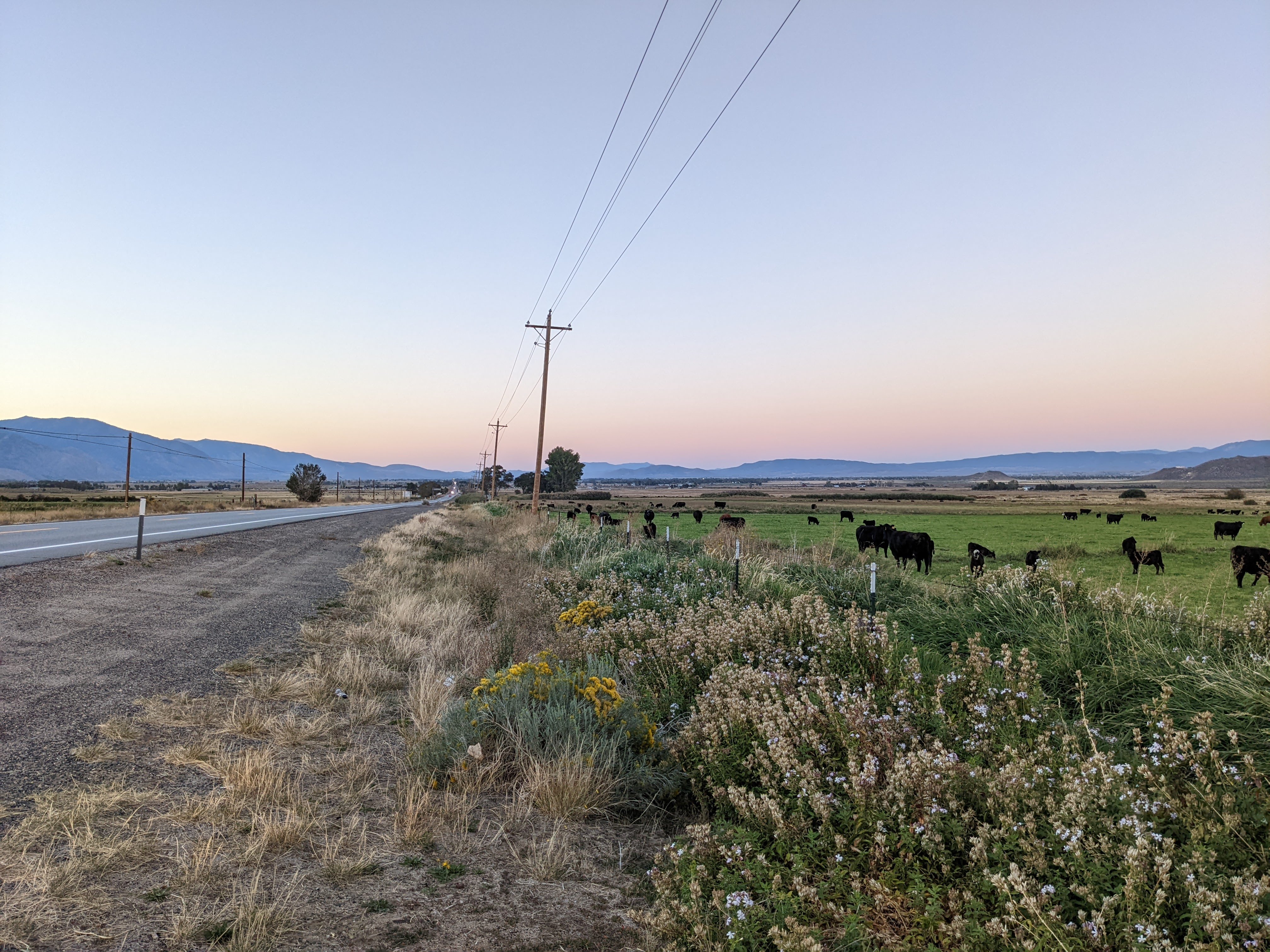
A sunset scenery photo of cows and a ranch. Photo shot on the side of State Route 88 in Alpine County, CA.
A sunset scenery photo of cows, a ranch, and State Route 88. Photo shot in Alpine County, CA.
A photo of the prices of petrol from Maverik Adventure's First Stop in Minden, NV.
Address: 1651 NV-88, Minden, NV 89423
At the end of the trip, we stopped in Minden, NV for some petrol. We needed some for the trip home and Nevada prices are a lot cheaper compared to California. We drove approximately an extra 10 miles than if we went to South Lake Tahoe, CA for petrol. We saved money, and we got to see a beautiful sunset at the end of the day and a tiny bit of autumn foliage.
This is all the photos for today. I hope you have enjoyed viewing the photos! Please don't forget to share the blog post with your friends and family members! Also, if you want to get notifications when I post up more photos, "Like" us on Facebook or follow me on Twitter and Instagram. These links can also be found on the top of the right sidebar.
Parts: Cellphone Photos | Mirrorless Photos