Showing posts with label monterey county. Show all posts

Saturday, August 10, 2024

State Route 1, Point Sur, Andrew Molera SP - Monterey County, CA

On 11th June 2024, my mom and I went for a drive along State Route 1 in Monterey County, CA. Our original plan was visiting Point Lobos State Natural Reserve, but unfortunately the park was closed that day due to parking lot and road repair. We ended up visiting Andrew Molera State Park. I hope you enjoy viewing my photos!

High Resolution Photos: If you want to see high resolution photos of any of the photos you see here, use the following links. If you wish to purchase prints of any of the photos, please contact me here. To view my best State Route 1 photos from Monterey to Big Sur, use this link. To see all of my photos from this trip, use this link.

Our first stop on the trip was originally Point Lobos, but once I got there, I realized the park was closed! Upon checking the park website, it turns out they were repairing the road and parking lot that day and the day before. This is probably a mistake I won't make again! Always remember to check the conditions of the park you plan to visit! We ended up going to Andrew Molera State Park, a park which I haven't been to since 2015. 

I remember this was one of the most beautiful parks I've visited in the past, but this time, Andrew Molera ended up being a huge disappointment. The day we went, the river crossing bridge wasn't set up yet, so we couldn't go that way. We went down the trail we did many years ago, but it turns out there is a new "End of Trail" sign right past the walk-in campground (which I don't think was there the last time we visited) and Cooper Cabin. There was barely anything to see and the park was mostly a ghost town. You used to be able to go down to the river from the trail to play around in the water, but now it's fenced off. The trail past the sign is unmaintained and is totally overgrown with many trees fallen over. You will not get very far, trust me, I tried. I also don't know why the campground is walk-in only as there is a wide service road to the campground and the camping area is huge and flat! This park is no longer worth going to in my opinion, and management need to do a better job fixing the park up.

A scenery photo of eucalyptus tree forest. The photo was shot near Cooper Cabin in Andrew Molera State Park in Monterey County, CA.
Approximate GPS location (type into Google): 36° 17' 10" N 121° 51' 10" W

A scenery photo of Big Sur River and trees. The photo was shot past the trail closure, and it was near impossible to continue past this point. The photo was shot in Andrew Molera State Park in Monterey County, CA.
Approximate GPS location (type into Google): 36° 16' 58" N 121° 51' 33" W

After the failed trip to both Point Lobos and Andrew Molera, we started our drive home.

A scenery photo of Point Sur, Point Sur State Historic Park, clouds, fog, and Pacific Ocean. The photo was shot at the entrance gate to Point Sur State Historic Park on the side of State Route 1 in Monterey County, CA.
Approximate GPS location (type into Google): 36° 18' 35" N 121° 53' 10" W

A scenery photo of Point Sur, Point Sur State Historic Park, clouds, fog, and Pacific Ocean. The photo was shot at the entrance gate to Point Sur State Historic Park on the side of State Route 1 in Monterey County, CA.
The photo was shot at the same spot as above.

A scenery photo of Little Sur River, Little Sur River Beach, clouds, fog, and mountains. The photo was shot on the side of State Route 1 in Monterey County, CA.
Approximate GPS location (type into Google): 36° 19' 51" N 121° 53' 30" W

This is all the photos for today. I hope you have enjoyed viewing the photos! Please don't forget to share the blog post with your friends and family members! Also, if you want to get notifications when I post up more photos, "Like" us on Facebook or follow me on Instagram. These links can also be found on the top of the right sidebar.

Sunday, July 28, 2024

State Route 1 & Julia Pfeiffer Burns SP - Monterey County, CA

On 1st June 2024, my parents and I went for a drive along State Route 1 in Monterey County, CA. We visited Hurricane Point Vista Point, Seal Beach Overlook, and Julia Pfeiffer Burns State Park. I hope you enjoy viewing my photos!

High Resolution Photos: If you want to see high resolution photos of any of the photos you see here, use the following links. If you wish to purchase prints of any of the photos, please contact me here. To view my best State Route 1 photos from Monterey to Big Sur, use this link. To see all of my photos from this trip, use this link.

Since we were traveling really far south on State Route 1 this day, we didn't stop at any places before Bixby Creek Bridge. Our first stop was Hurricane Point Vista Point.

A scenery photo of Bixby Creek Bridge, mountains, clouds, and the Pacific Ocean. The photo was shot at Hurricane Point Vista Point next to State Route 1 in Monterey County, CA.
Approximate GPS location (type into Google): 36° 21' 28" N 121° 54' 09" W

A black and white process of the photo above.

A scenery photo of clouds, mountains, Pacific Ocean, and Pride of Madeira Flowers (Echium candicans) (bottom left). The photo was shot at Seal Beach Overlook in Monterey County, CA.
Approximate GPS location (type into Google): 36° 12' 05" N 121° 43' 42" W

A black and white process of the photo above.

Next, we arrive at Julia Pfeiffer Burns State Park in Monterey County, CA.

A scenery photo of clouds, mountains, and Pacific Ocean. The photo was shot at a turn out on the side of State Route 1 in Julia Pfeiffer Burns State Park in Monterey County, CA.
Approximate GPS location (type into Google): 36° 10' 24" N 121° 32' 00" W

A scenery photo of clouds, mountains, trees, and Pacific Ocean. The photo was shot at Julia Pfeiffer Burns State Park Vista Point on the side of State Route 1 in Julia Pfeiffer Burns State Park in Monterey County, CA.
Approximate GPS location (type into Google): 36° 10' 10" N 121° 41' 05" W

Next we arrive at McWay Falls in Julia Pfeiffer Burns State Park. The GPS coordinates for the photos taken there is at 36° 09' 34" N 121° 40' 18" W.

A scenery photo of McWay Falls, McWay Beach, McWay Cove, and Pacific Ocean. The photo was shot on Waterfall Overlook Trail in Julia Pfeiffer Burns State Park in Monterey County, CA.

A black and white process of the photo above.

A scenery photo of McWay Falls, McWay Beach, McWay Cove, and Pacific Ocean. The photo was shot on Waterfall Overlook Trail in Julia Pfeiffer Burns State Park in Monterey County, CA.

A long exposure scenery photo of McWay Falls, McWay Beach, McWay Cove, and Pacific Ocean. The long exposure effect was achieved using an ND filter. The photo was shot on Waterfall Overlook Trail in Julia Pfeiffer Burns State Park in Monterey County, CA.

A black and white process of the photo above.

A long exposure scenery photo of McWay Falls, McWay Beach, McWay Cove, and Pacific Ocean. The long exposure effect was achieved using an ND filter. The photo was shot on Waterfall Overlook Trail in Julia Pfeiffer Burns State Park in Monterey County, CA.

A long exposure scenery photo of McWay Falls, McWay Beach, McWay Cove, and Pacific Ocean. The long exposure effect was achieved using an ND filter. The photo was shot on Waterfall Overlook Trail in Julia Pfeiffer Burns State Park in Monterey County, CA.

A scenery photo of McWay Falls, McWay Beach, McWay Cove, and Pacific Ocean. The photo was shot on Waterfall Overlook Trail in Julia Pfeiffer Burns State Park in Monterey County, CA.

Next we started our drive home.

A scenery photo of Bixby Creek Bridge, mountains, clouds, and the Pacific Ocean. The photo was shot at Hurricane Point Vista Point next to State Route 1 in Monterey County, CA.
Approximate GPS location (type into Google): 36° 21' 27" N 121° 54' 10" W

A black and white process of the photo above.

This is all the photos for today. I hope you have enjoyed viewing the photos! Please don't forget to share the blog post with your friends and family members! Also, if you want to get notifications when I post up more photos, "Like" us on Facebook or follow me on Instagram. These links can also be found on the top of the right sidebar.

Saturday, July 6, 2024

State Route 1 - Monterey County, CA

On 24th May 2024, my parents and I went for a drive along State Route 1 in Monterey County, CA. We visited Garrapata State Park, Bixby Creek Bridge, and more. I hope you enjoy viewing my photos!

High Resolution Photos: If you want to see high resolution photos of any of the photos you see here, use the following links. If you wish to purchase prints of any of the photos, please contact me here. To view my best State Route 1 photos from Monterey to Big Sur, use this link. To see all of my photos from this trip, use this link.

A selfie I took on Soberanes Point Trail in Garrapata State Park in Monterey County, CA.
I did take this photo myself, with the built in WiFi function in my camera.
In the photo is Soberanes Creek and Soberanes Creek Falls.
Approximate GPS location (type into Google): 36° 27' 22" N 121° 55' 29" W

A selfie I took on Soberanes Point Trail in Garrapata State Park in Monterey County, CA.
I did take this photo myself, with the built in WiFi function in my camera.
In the photo is Soberanes Creek.
The photo was shot at the same spot as above.

A scenery photo of Bixby Creek Bridge, Bixby Creek, the Pacific Ocean, rocks, and clouds. The photo was shot on Coast Road in Monterey County, CA.
Approximate GPS location (type into Google): 36° 22' 21" N 121° 54' 06" W

A scenery photo of mountains, forest, and clouds. The photo was shot on Coast Road in Monterey County, CA.
Approximate GPS location (type into Google): 36° 22' 31" N 121° 53' 53" W

A scenery photo of Bixby Creek Bridge, Bixby Creek, the Pacific Ocean, rocks, and clouds. The photo was shot at Bixby Creek Bridge Vista Point on Coast Road in Monterey County, CA.
Approximate GPS location (type into Google): 36° 22' 31" N 121° 53' 58" W

A scenery photo of Bixby Creek Bridge, the Pacific Ocean, clouds, rocks, and mountains. The photo was shot at Hurricane Point Vista Point on the side of State Route 1 in Monterey County, CA.
Approximate GPS location (type into Google): 36° 21' 27" N 121° 54' 10" W

A black and white process of the photo above.

A scenery photo of Point Sur, Little Sur River Beach, rocks, clouds, and the Pacific Ocean. The photo was shot at Hurricane Point Vista Point on the side of State Route 1 in Monterey County, CA.
Approximate GPS location (type into Google): 36° 21' 25" N 121° 54' 11" W

A black and white process of the photo above.

A scenery photo of Point Sur, wild mustard flowers, beach, clouds, and the Pacific Ocean. The photo was shot on State Route 1 in Monterey County, CA.
Approximate GPS location (type into Google): 36° 19' 08" N 121° 53' 33" W

A black and white process of the photo above.

A scenery photo of State Route 1 (right), mountains, and clouds shot in Monterey County, CA.
Approximate GPS location (type into Google): 36° 17' 29" N 121° 51' 30" W

This is all the photos for today. I hope you have enjoyed viewing the photos! Please don't forget to share the blog post with your friends and family members! Also, if you want to get notifications when I post up more photos, "Like" us on Facebook or follow me on Instagram. These links can also be found on the top of the right sidebar.

Sunday, June 23, 2024

Point Lobos State Reserve - Carmel, CA

On 10 May 2024, my dad and I went to Point Lobos State Natural Reserve in Carmel-By-The-Sea, CA for photos! I'm still dealing with the after effects of COVID (after the infection at the end of November last year) so I only did a tiny bit of hiking (having chronic fatigue problems). I hope you enjoy viewing my photos!

High Resolution Photos: If you want to see high resolution photos of any of the photos you see here, use the following links. If you wish to purchase prints of any of the photos, please contact me here. To view my best State Route 1 from Monterey to Big Sur photos, use this link. To see all of my photos from this trip, use this link.

A scenery photo of Whalers Cove and cypress trees shot on Granite Point Trail.
Approximate GPS location (type into Google): 36° 31' 08" N 121° 56' 16" W

A scenery photo overlooking Whalers Cove, Coal Chute Point, and cypress trees (right) shot at Cannery Point.
Approximate GPS location (type into Google): 36° 31' 15" N 121° 56' 25" W

A scenery photo of Carmel, CA (in the distance) and Coal Chute Point (right) shot near North Shore Trail.
Approximate GPS location (type into Google): 36° 31' 17" N 121° 56' 30" W

A scenery photo of cypress trees, Bluefish Cove, and rocks shot on North Shore Trail.
Approximate GPS location (type into Google): 36° 31' 14" N 121° 56' 31" W

A black and white process of the photo above.

This is all the photos for today. I hope you have enjoyed viewing the photos! Please don't forget to share the blog post with your friends and family members! Also, if you want to get notifications when I post up more photos, "Like" us on Facebook or follow me on Instagram. These links can also be found on the top of the right sidebar.

Sunday, February 4, 2024

State Route 1 (Sand City, Carmel, Garrapata SP) - California

On 13 January 2024, my parents and I took a drive along State Route 1 traveling to Bixby Creek Bridge in Monterey County, CA. It was overcast that day and the lighting wasn't too good for photos, so I didn't take much. I hope you enjoy viewing my photos!

High Resolution Photos: If you want to see high resolution photos of any of the photos you see here, use the following links. If you wish to purchase prints of any of the photos, please contact me here. To see all of my photos from this trip, use this link.

A scenery photo of Sand City Beach, the Pacific Ocean, mountains (in the distance), and clouds. The photo was shot at the end of Tioga Avenue in Sand City, CA.
Approximate GPS location (type into Google): 36° 37' 08" N 121° 51' 03" W

A scenery photo of waves, the Pacific Ocean, and clouds. The photo was shot at the end of Tioga Avenue in Sand City, CA.
The photo was shot near the same spot as above.

A scenery photo of waves, the Pacific Ocean, and clouds. The photo was shot at the end of Tioga Avenue in Sand City, CA.
Approximate GPS location (type into Google): 36° 37' 08" N 121° 51' 02" W

A black and white process of the photo above.

A scenery photo of Carmel-By-The-Sea, CA, clouds, the Pacific Ocean, and hills. The photo was shot at Monastery Beach.
Approximate GPS location (type into Google): 36° 31' 21" N 121° 55' 47" W

A black and white process of the photo above.

A scenery photo of the Pacific Ocean and clouds. The photo was shot on the side of State Route 1 near Gate 1 of Garrapata State Park in Monterey County, CA.
Approximate GPS location (type into Google): 36° 28' 15" N 121° 56' 04" W

A black and white process of the photo above.

A scenery photo of the Pacific Ocean, clouds, and a rock. The photo was shot on the side of State Route 1 near Gate 3 of Garrapata State Park in Monterey County, CA.
Approximate GPS location (type into Google): 36° 28' 09" N 121° 55' 57" W

A scenery photo of rocks, the Pacific Ocean, clouds, and bushes. The photo was shot on the side of State Route 1 near Gate 3 of Garrapata State Park in Monterey County, CA.
The photo was shot near the same spot as above.

A black and white process of the photo above.

This is all the photos for today. I hope you have enjoyed viewing the photos! Please don't forget to share the blog post with your friends and family members! Also, if you want to get notifications when I post up more photos, "Like" us on Facebook or follow me on Instagram. These links can also be found on the top of the right sidebar.

Saturday, April 29, 2023

Bixby Creek Bridge & Coast Road (Part 2) - Monterey County, CA

On 18 April 2023, my mom and I drove along State Route 1 in Monterey County, CA. We visited Garrapata State Park and Bixby Creek Bridge. I took photos with my cellphones and mirrorless camera. The photos are split into 3 blog posts. I hope you enjoy viewing my photos!

High Resolution Photos: If you want to see high resolution photos of any of the photos you see here, use the following links. If you wish to purchase prints of any of the photos, please contact me here. To see my best photos from State Route 1, use this link. To see my best flower photos from 2019 to 2023, use this link. To see my best sunset, sunrise, and night photography photos from 2019 to 2023, use this link. To see all of my photos from this trip, use this link.

Parts: Cellphone Photos | Olympus Part 1 | Olympus Part 2

These photos were shot on my Olympus mirrorless camera. The photos are from Bixby Creek Bridge and Coast Road in Monterey County, CA. After Garrapata State Park, my mom and I drove towards Bixby Creek Bridge, which was the last stop for the day before we headed home. I also took a short walk on Coast Road (near Bixby Creek Bridge).

Please note Coast Road was closed on the day I went, and I did walk into the closed area. There was a small, but constant flow of sand, small pebbles, and small rocks coming down on parts of the rock face. This is risky, and the road is closed for a reason. If you walk onto the road, please assess the risks yourself before walking into a closed area. You access closed areas at your own risk. You could become trapped under a rockslide or your return path could be blocked off by a rockslide. You could die!

A scenery photo of the Bixby Creek Bridge (part of State Route 1), Coast Road (right), a valley, and the Pacific Ocean. This photo was shot at Bixby Creek Bridge Vista Point on the side of Coast Road in Monterey County, CA.
Approximate GPS location (type into Google): 36° 22' 31" N 121° 53' 54" W

A black and white process of the photo above.

A scenery photo of the Bixby Creek Bridge (part of State Route 1), Coast Road (right), a valley, and the Pacific Ocean. This photo was shot at Bixby Creek Bridge Vista Point on the side of Coast Road in Monterey County, CA.
Photo shot at the same spot as above.

A scenery photo of the Bixby Creek Bridge (part of State Route 1), Coast Road (right), wild flowers (bottom), a valley, and the Pacific Ocean. This photo was shot on Coast Road in Monterey County, CA.
Approximate GPS location (type into Google): 36° 22' 30" N 121° 53' 47" W

A scenery photo of the Bixby Creek Bridge (part of State Route 1), Coast Road (right), a valley, and the Pacific Ocean. This photo was shot on Coast Road in Monterey County, CA.
Photo shot at the same spot as above.

A black and white process of the photo above.

A scenery photo of the Bixby Creek Bridge (part of State Route 1), Coast Road (right), a valley, and the Pacific Ocean. This photo was shot on Coast Road in Monterey County, CA.
Approximate GPS location (type into Google): 36° 22' 30" N 121° 53' 48" W

A black and white process of the photo above.

A scenery photo of the Bixby Creek Bridge (part of State Route 1), Coast Road (right), a valley, and the Pacific Ocean. This photo was shot on Coast Road in Monterey County, CA.
Photo shot at the same spot as above.

Next, are a few photos shot during sunset near the Bixby Creek Bridge on the side of State Route 1.

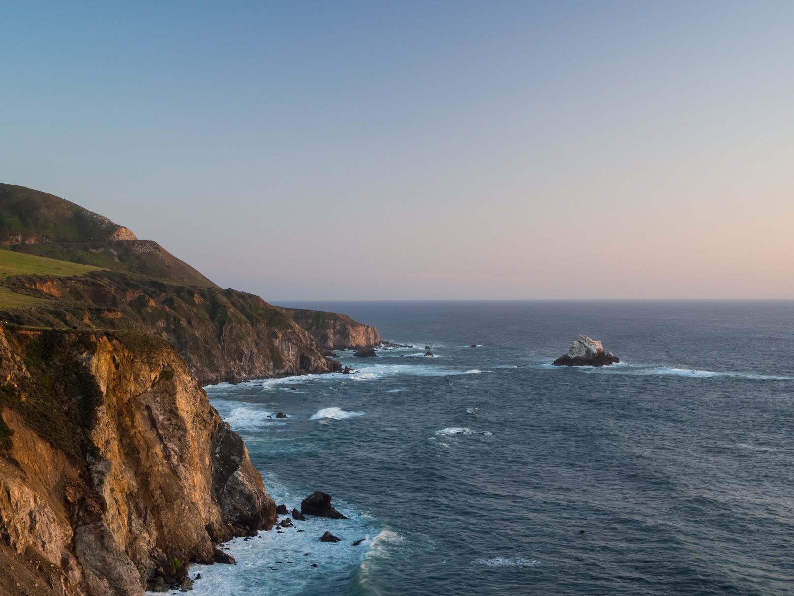
A sunset scenery photo of the Pacific Ocean, rocks, a hill, and cliffs. The photo was shot near the Bixby Creek Bridge on the side of State Route 1.
Approximate GPS location (type into Google): 36° 22' 21" N 121° 54' 10" W

An abstract long exposure photo of a beach, waves, rocks, and a cliff. The photo was shot during sunset near the Bixby Creek Bridge on the side of State Route 1.
Photo shot at the same spot as above.

A black and white process of the photo above.

An abstract long exposure photo of a beach, waves, rocks, and a cliff. The photo was shot during sunset near the Bixby Creek Bridge on the side of State Route 1.
Photo shot at the same spot as above.

This is all the photos for today. I hope you have enjoyed viewing the photos! Please don't forget to share the blog post with your friends and family members!Also, if you want to get notifications when I post up more photos, "Like" us on Facebook or follow me on Instagram. These links can also be found on the top of the right sidebar.

Parts: Cellphone Photos | Olympus Part 1 | Olympus Part 2