On 17 December 2022, My mom and I took a hike in Pleasanton Ridge Regional Park in Sunol, CA. We went to the new section of the park that probably opened in 2020. We started our hike at Tyler Ranch Staging Area. I took some photos with my phone. I hope you enjoy viewing the photos.
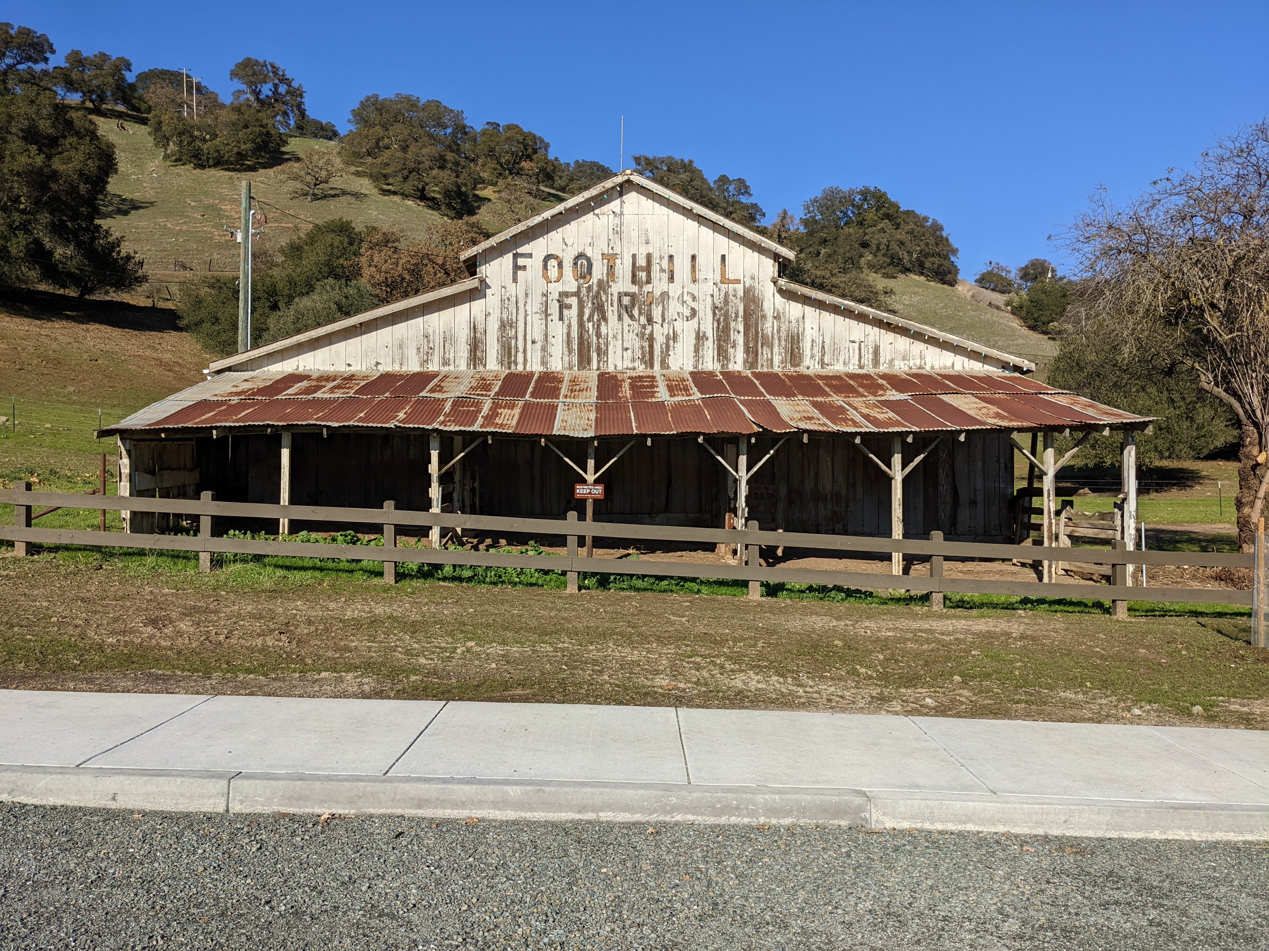
A photo of a barn. The photo was shot at Tyler Ranch Staging Area.

A photo of a barn. The photo was shot at Tyler Ranch Staging Area.

A scenery photo of smog and fog. In the photo are Sunol, and Mt. Allison & Mission Peak (right). The photo was shot on Sunol Ridge Trail.

A scenery photo of smog and fog. In the photo are Sunol, and Mt. Allison & Mission Peak (right). The photo was shot on Sunol Ridge Trail.

A scenery photo of smog and fog. In the photo are Sunol, and Mt. Allison & Mission Peak (right). The photo was shot at Niles Canyon Overlook.

A scenery photo of smog and fog. In the photo are Sunol, and Mt. Allison & Mission Peak (right). The photo was shot at Niles Canyon Overlook.

A scenery photo of smog and fog. In the photo are Niles Canyon, State Route 84, and the SF Bay Area (in the distance). The photo was shot on Sunol Ridge Trail.

A scenery photo of smog and fog. In the photo are the SF Bay Area (in the distance), and Mt. Allison & Mission Peak (right). The photo was shot on Sunol Ridge Trail.

A scenery photo of smog and fog. In the photo is the SF Bay Area (in the distance). The photo was shot on Sunol Ridge Trail.

A scenery photo of Sunol Peak and radio antennas. The photo was shot on Sunol Ridge Trail.

A scenery photo of smog and fog. In the photo are Mt. Diablo (left), Pleasanton, Dublin, and Livermore (in the distance). The photo was shot on Sunol Ridge Trail.
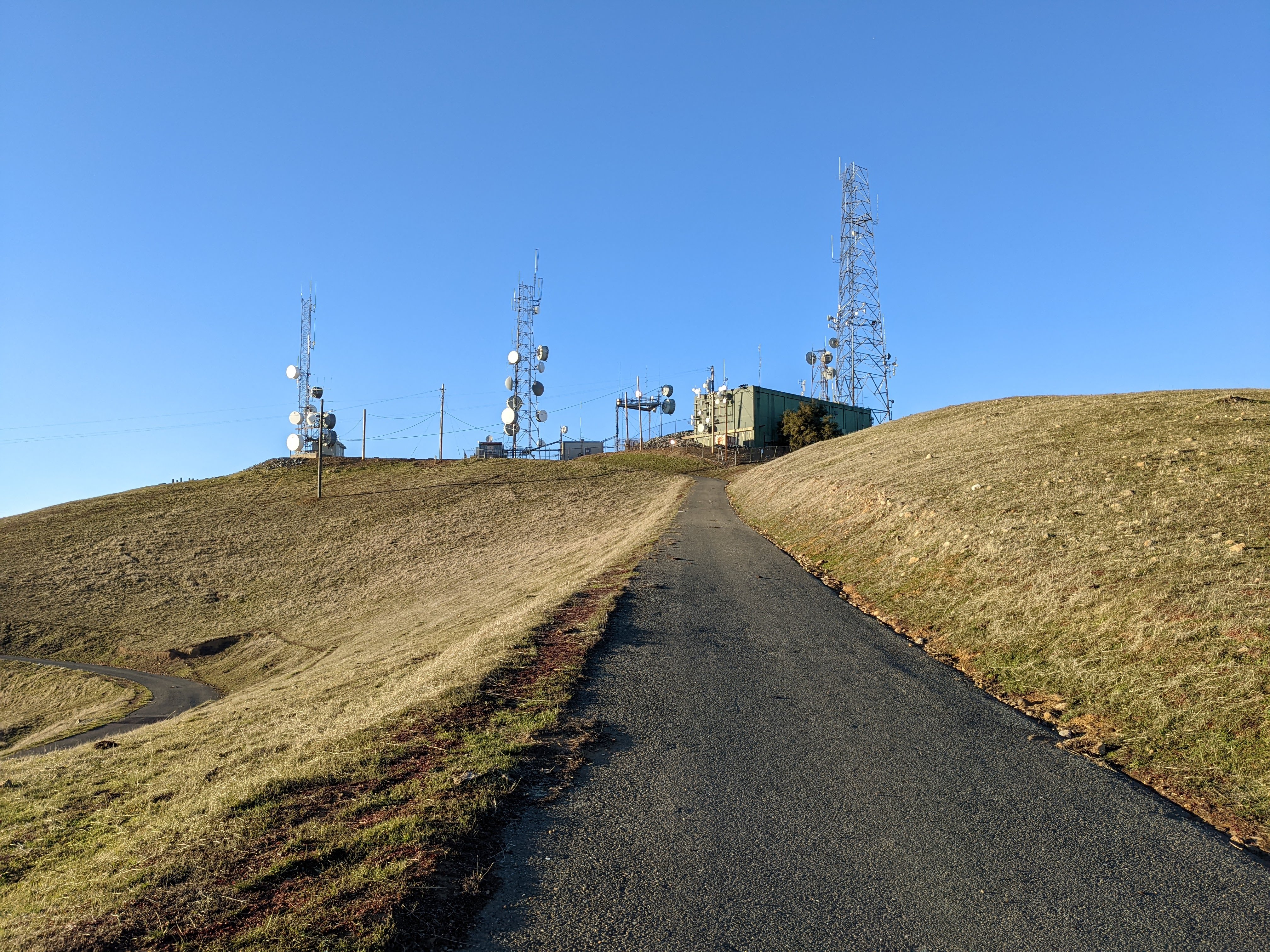
A photo of radio antennas shot at Sunol Peak.

A photo of radio antennas shot at Sunol Peak.

A photo of radio antennas, smog, fog, and the SF Bay Area (in the distance) shot at Sunol Peak.

A scenery photo of smog and fog. In the photo is the SF Bay Area (in the distance). The photo was shot at Sunol Peak.

A scenery photo of smog and fog. In the photo are Mt. Allison & Mission Peak (center), and the SF Bay Area (in the distance on the right). The photo was shot at Sunol Peak.

A scenery photo of smog and fog. In the photo are Mt. Diablo, Dublin, Pleasanton, and Livermore (in the distance on the right). The photo was shot at Sunol Peak.

A scenery photo of smog and fog. The photo was shot at Sunol Peak.

A scenery panorama of smog and fog. In the panorama are the SF Bay Area (in the distance on the left), Mt. Diablo, Dublin, Pleasanton, and Livermore (in the distance on the right), and Radio Antennas (right). The photo was shot at Sunol Peak.

A scenery photo of smog and fog. In the photo are Dublin, Pleasanton, and Livermore (in the distance). The photo was shot at Sunol Peak.

A scenery photo of smog and fog. In the photo are Dublin, Pleasanton, and Livermore (in the distance). The photo was shot at Sunol Peak.

A sunset scenery photo of smog and fog. In the photo is the SF Bay Area (in the distance). The photo was shot on Sunol Ridge Trail.

A sunset scenery photo of smog and fog. In the photo is the SF Bay Area (in the distance). The photo was shot on Sunol Ridge Trail.

A sunset scenery photo of smog and fog. In the photo are Mt. Allison & Mission Peak (center), and the SF Bay Area (in the distance on the right). The photo was shot on Sunol Ridge Trail.

A sunset scenery photo of smog and fog. In the photo are Niles Canyon, State Route 84, and the SF Bay Area (in the distance). The photo was shot on Sunol Ridge Trail.
This is all the photos for today. I hope you have enjoyed viewing the photos! Please don't forget to share the blog post with your friends and family members! Also, if you want to get notifications when I post up more photos, "Like" us on Facebook or follow me on Instagram. These links can also be found on the top of the right sidebar.