Showing posts with label sunol peak. Show all posts

Thursday, March 2, 2023

Mt. Diablo & Mission Peak Snow (Day 2) - San Ramon/Danville, CA

It is very rare to see snow in the San Francisco Bay Area, but the weather recently has been very weird. It snowed like crazy in the San Francisco Bay Area. On February 23 and 24, 2023, my mom and I went to several locations in San Ramon, CA and Danville, CA to go see snow on Mt. Diablo, Mission Peak, Mt. Allison, and more. The places we visited are Forest Home Farms Historic Park (I went to this park mainly to see the sheep and use the bathroom 😅), Bishop Ranch Regional Preserve, Memorial Park, and Sycamore Valley Regional Preserve. I took photos with my cellphones and mirrorless camera. The photos are split into 3 blog posts. I hope you enjoy viewing my photos!

Full Resolution Photos: If you want to see full resolution photos of any of the photos you see here, use the following links. If you wish to purchase prints of any of the photos, please contact me here. To see all of my photos from this trip, use this link.

Parts: Cellphone Photos | Olympus Photos (Day 1) | Olympus Photos (Day 2)

These are photos I shot on my Olympus mirrorless camera on Day 2 (February 24, 2023). The photos were shot on Morgan Drive in San Ramon, Memorial Park in San Ramon, and Sycamore Valley Regional Preserve in Danville. The second round of snow and rainstorms definitely hit the Tri-Valley area much harder compared to the first round. I had to abandon my second hike in Bishop Ranch Regional Preserve because the trails were way too steep and muddy for my comfort. The trails at Sycamore Valley Regional Preserve were almost impossible to walk on. I kept sinking in the mud, and the mud caked on my mom and I's shoes and hiking poles. You can see photos of that in my Cellphone Photos blog post (link). That Sycamore Valley hike was arduous, and I feel like my photos didn't even turn out that great.

A scenery photo of Mt. Diablo covered with snow and partially obstructed by clouds, San Ramon, trees, green hills, clouds, and houses. The photo was shot on Morgan Drive in San Ramon, CA.
Approximate GPS location (type into Google): 37° 45' 00" N 121° 57' 50" W

A scenery photo of Mt. Diablo covered with snow and partially obstructed by clouds, San Ramon, trees, clouds, and green hills. The photo was shot at Memorial Park in San Ramon, CA.
Approximate GPS location (type into Google): 37° 45' 28" N 121° 58' 12" W

A black and white process of the photo above.

A scenery photo of Mt. Diablo covered with snow and partially obstructed by clouds, San Ramon, trees, clouds, and green hills. The photo was shot at Memorial Park in San Ramon, CA.
Photo shot at the same spot as above.

A scenery photo of snow covered mountains, San Ramon, trees, clouds, and green hills. The photo was shot towards Morgan Territory Regional Preserve. The photo was shot at Memorial Park in San Ramon, CA.
Photo shot at the same spot as above.

After San Ramon, my mom and I traveled to Sycamore Valley Regional Preserve in Danville, CA. The rest of my photos in this blog post are from Sycamore Valley Regional Preserve and were all shot on Short Ridge Trail.

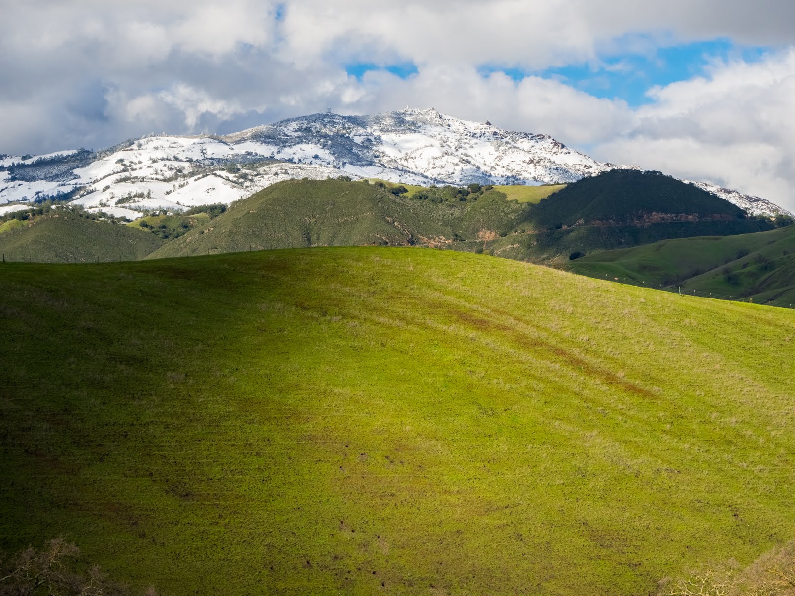
A scenery photo of Mt. Diablo covered with snow and partially obstructed by clouds, clouds, trees, and green hills.
Approximate GPS location (type into Google): 37° 48' 49" N 121° 56' 13" W

A scenery photo of Mission Peak and Mt. Allison (center) covered with snow, Sunol Peak (right) covered with snow, cows, clouds, mountains, and green hills.
Photo shot near the same spot as above.

A scenery photo of snow covered mountains, trees, clouds, and green hills. The photo was shot towards Morgan Territory Regional Preserve.
Photo shot near the same spot as above.

A scenery photo of Mt. Diablo covered with snow and partially obstructed by clouds, clouds, trees, and green hills.
Approximate GPS location (type into Google): 37° 48' 48" N 121° 56' 13" W

A scenery photo of Mt. Diablo covered with snow, clouds, trees, and green hills.
Approximate GPS location (type into Google): 37° 48' 49" N 121° 56' 13" W

A scenery photo of Mt. Diablo covered with snow, clouds, trees, and green hills.
Photo shot near the same spot as above.

A scenery photo of Mt. Diablo covered with snow, clouds, and green hills.
Photo shot near the same spot as above.

A scenery photo of Mt. Diablo covered with snow, clouds, trees, and green hills.
Photo shot near the same spot as above.

A scenery photo of Mt. Diablo covered with snow, clouds, and green hills.
Photo shot near the same spot as above.

A scenery photo of Mt. Diablo covered with snow, clouds, trees, and green hills.
Photo shot near the same spot as above.

A scenery photo of Mt. Diablo covered with snow, clouds, and green hills.
Photo shot near the same spot as above.

A scenery photo of Mt. Diablo covered with snow, Danville, clouds, trees, and green hills.
Approximate GPS location (type into Google): 37° 48' 43" N 121° 56' 04" W

A scenery photo of Mt. Diablo covered with snow, Danville, clouds, trees, and green hills.
Photo shot near the same spot as above.

A scenery photo of Mt. Diablo covered with snow, Danville, clouds, trees, and green hills.
Photo shot near the same spot as above.

A scenery photo of Mission Peak and Mt. Allison (center) covered with snow, Sunol Peak (right) covered with snow, Danville (foreground), San Ramon (in the distance), Dublin (in the distance), Pleasanton (in the distance), clouds, trees, mountains, and green hills.
Photo shot near the same spot as above.

This is all the photos for today. I hope you have enjoyed viewing the photos! Please don't forget to share the blog post with your friends and family members! Also, if you want to get notifications when I post up more photos, "Like" us on Facebook or follow me on Instagram. These links can also be found on the top of the right sidebar.

Parts: Cellphone Photos | Olympus Photos (Day 1) | Olympus Photos (Day 2)

Monday, February 13, 2023

Pleasanton Ridge Regional Park (Cellphone Photos) - Sunol, CA

Today, on 13 February 2023, my mom and I went hiking in Pleasanton Ridge Regional Park in Sunol, CA. Our original plan was to hike from Tyler Ranch Staging Area to Sunol Peak, but we turned back 1 km from Sunol Peak. Today, the heavy winds arrived a day early. When we were almost at the peak, we could barely even keep our balance, so we had no choice but to abandon the hike. In retrospect, we should have turned around half way up the mountain because the wind was already pretty strong, and it only got worse as we gained elevation. The wind speed at the peak probably hit 40+ km/h (25+ MPH). I took photos with my cellphones. I hope you enjoy viewing the photos.

At the beginning of the hike, a nursing calf was blocking the trail. All I could do was shout "DRINK FASTER DANG IT! (喝快点!)". 😂 I thought that was the worst thing to happen on the trail today. I was wrong. The wind was the worst thing to happen on the trail today. 😭

A scenery photo of Sunol, and Mt. Allison & Mission Peak (right). The photo was shot at Niles Canyon Overlook.

A scenery photo of Niles Canyon, State Route 84, and the SF Bay Area (in the distance). The photo was shot on Sunol Ridge Trail.

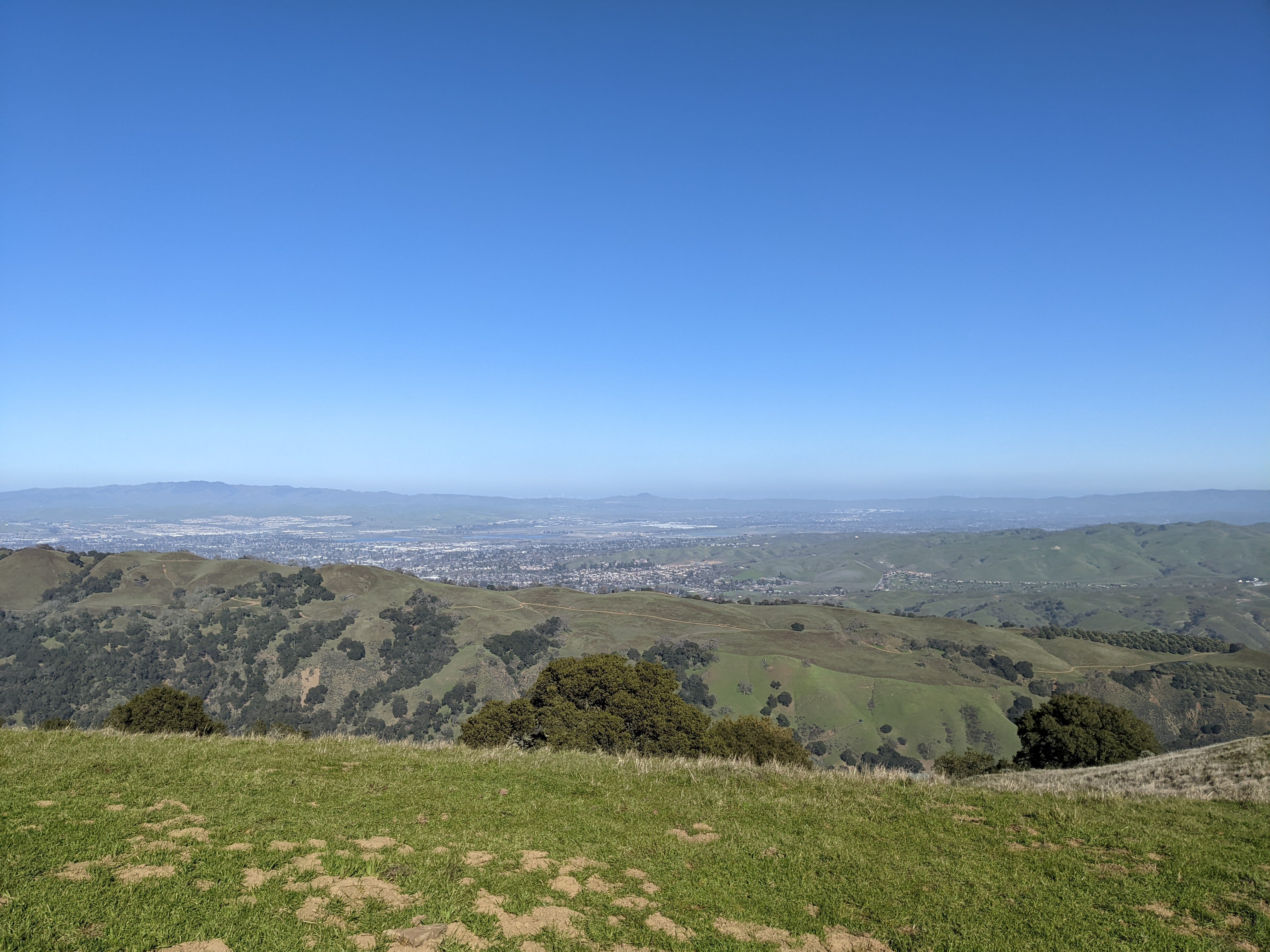
A scenery photo of Pleasanton, Dublin, and Livermore (in the distance). The photo was shot on Sunol Ridge Trail.

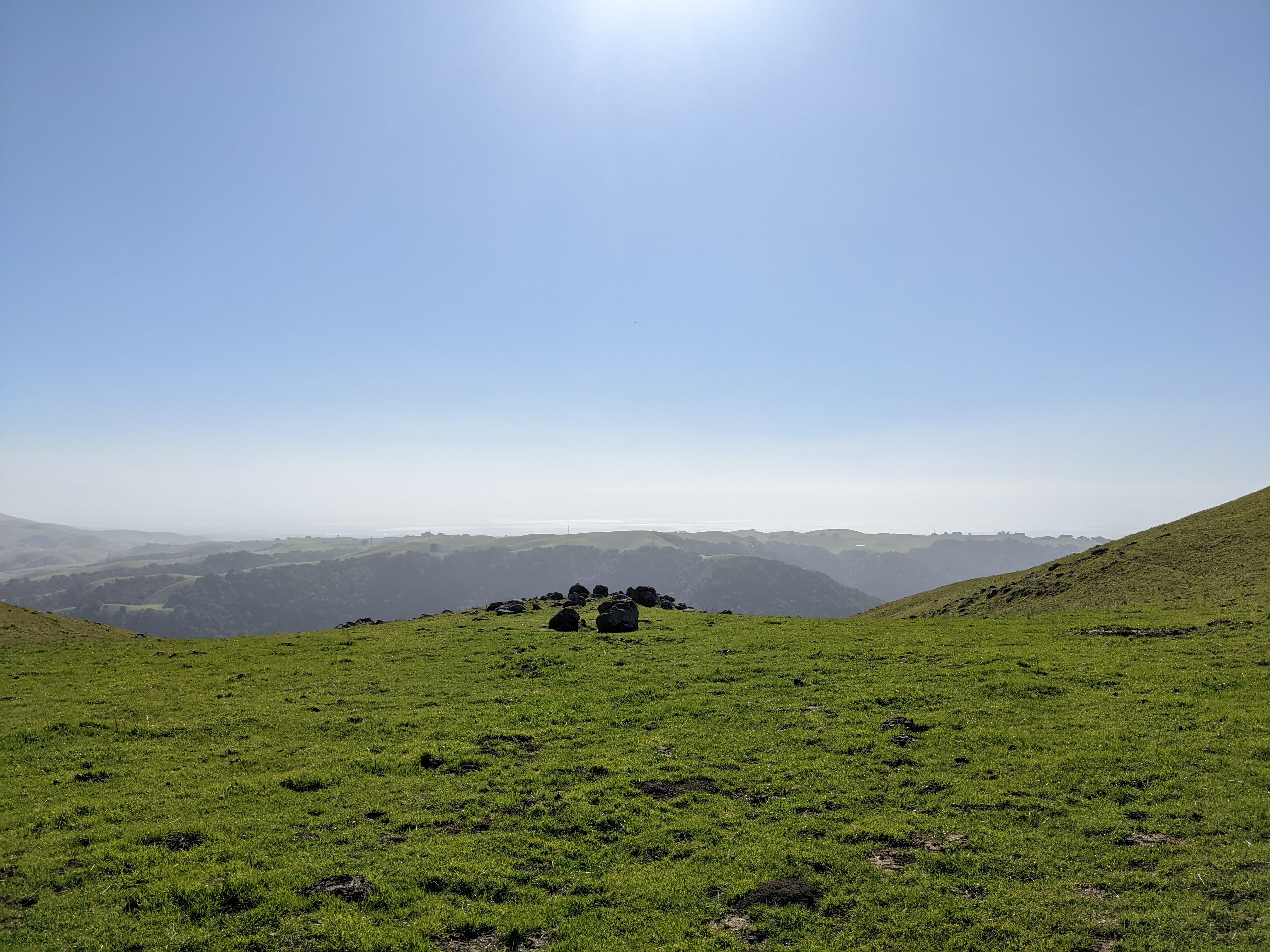
A scenery photo of the SF Bay Area (in the distance) shot on Sunol Ridge Trail.

Advertisement
Advertisement Place Holder APHAPHAPHAPHAPHAPH

A scenery photo of Mt. Diablo (left), Pleasanton, Dublin, and Livermore (in the distance). The photo was shot on Sunol Ridge Trail.

A scenery photo of Pleasanton, Dublin, and Livermore (in the distance). The photo was shot on Sunol Ridge Trail.

A scenery photo of Mt. Diablo and Dublin (in the distance). The photo was shot on Sunol Ridge Trail.

This is all the photos for today. I hope you have enjoyed viewing the photos! Please don't forget to share the blog post with your friends and family members! Also, if you want to get notifications when I post up more photos, "Like" us on Facebook or follow me on Instagram. These links can also be found on the top of the right sidebar.

Tuesday, December 20, 2022

Pleasanton Ridge Regional Park - Sunol, CA (Cellphone Photos)

On 17 December 2022, My mom and I took a hike in Pleasanton Ridge Regional Park in Sunol, CA. We went to the new section of the park that probably opened in 2020. We started our hike at Tyler Ranch Staging Area. I took some photos with my phone. I hope you enjoy viewing the photos.

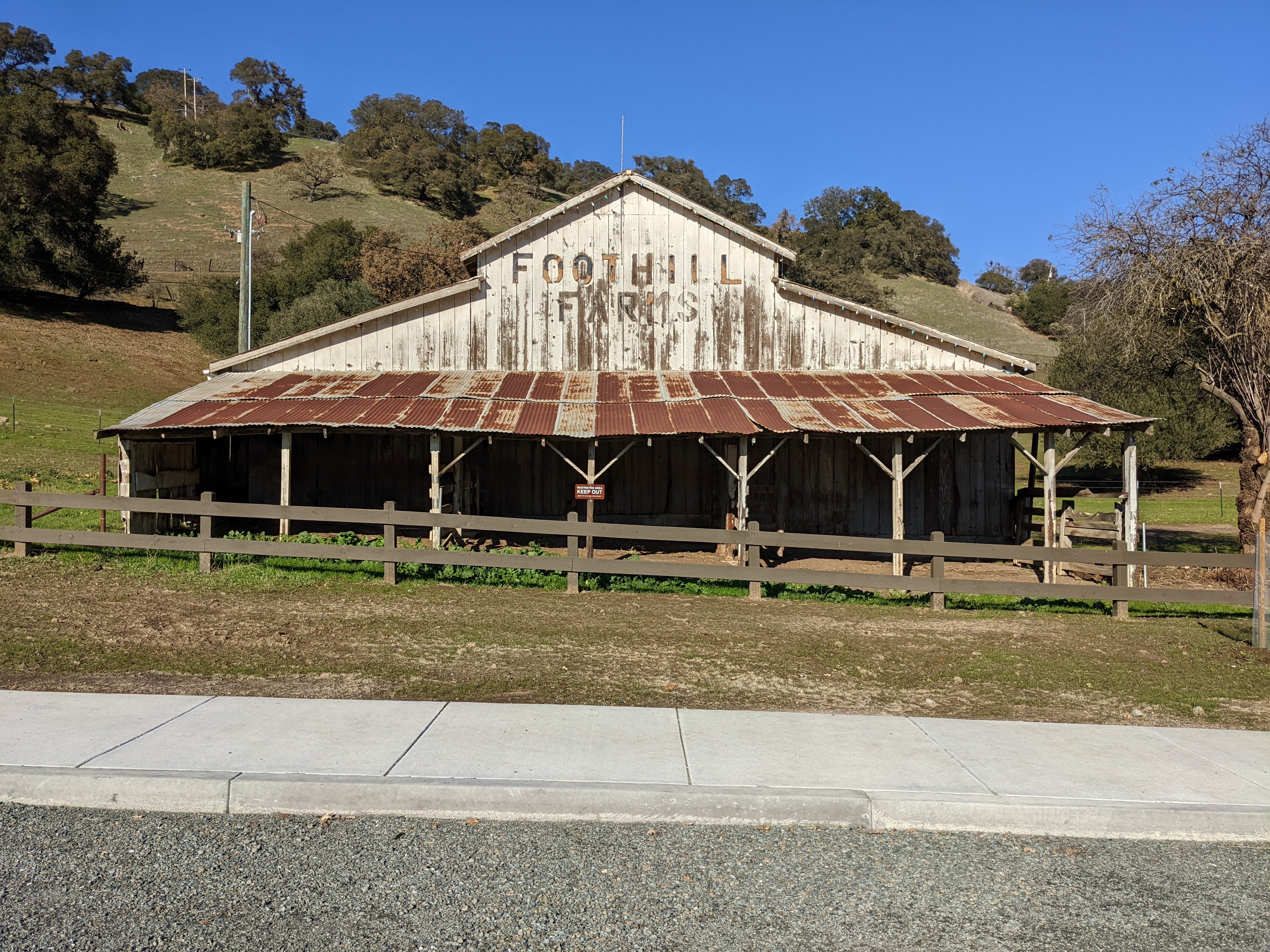
A photo of a barn. The photo was shot at Tyler Ranch Staging Area.

A photo of a barn. The photo was shot at Tyler Ranch Staging Area.

A scenery photo of smog and fog. In the photo are Sunol, and Mt. Allison & Mission Peak (right). The photo was shot on Sunol Ridge Trail.

A scenery photo of smog and fog. In the photo are Sunol, and Mt. Allison & Mission Peak (right). The photo was shot on Sunol Ridge Trail.

A scenery photo of smog and fog. In the photo are Sunol, and Mt. Allison & Mission Peak (right). The photo was shot at Niles Canyon Overlook.

A scenery photo of smog and fog. In the photo are Sunol, and Mt. Allison & Mission Peak (right). The photo was shot at Niles Canyon Overlook.

A scenery photo of smog and fog. In the photo are Niles Canyon, State Route 84, and the SF Bay Area (in the distance). The photo was shot on Sunol Ridge Trail.

A scenery photo of smog and fog. In the photo are the SF Bay Area (in the distance), and Mt. Allison & Mission Peak (right). The photo was shot on Sunol Ridge Trail.

A scenery photo of smog and fog. In the photo is the SF Bay Area (in the distance). The photo was shot on Sunol Ridge Trail.

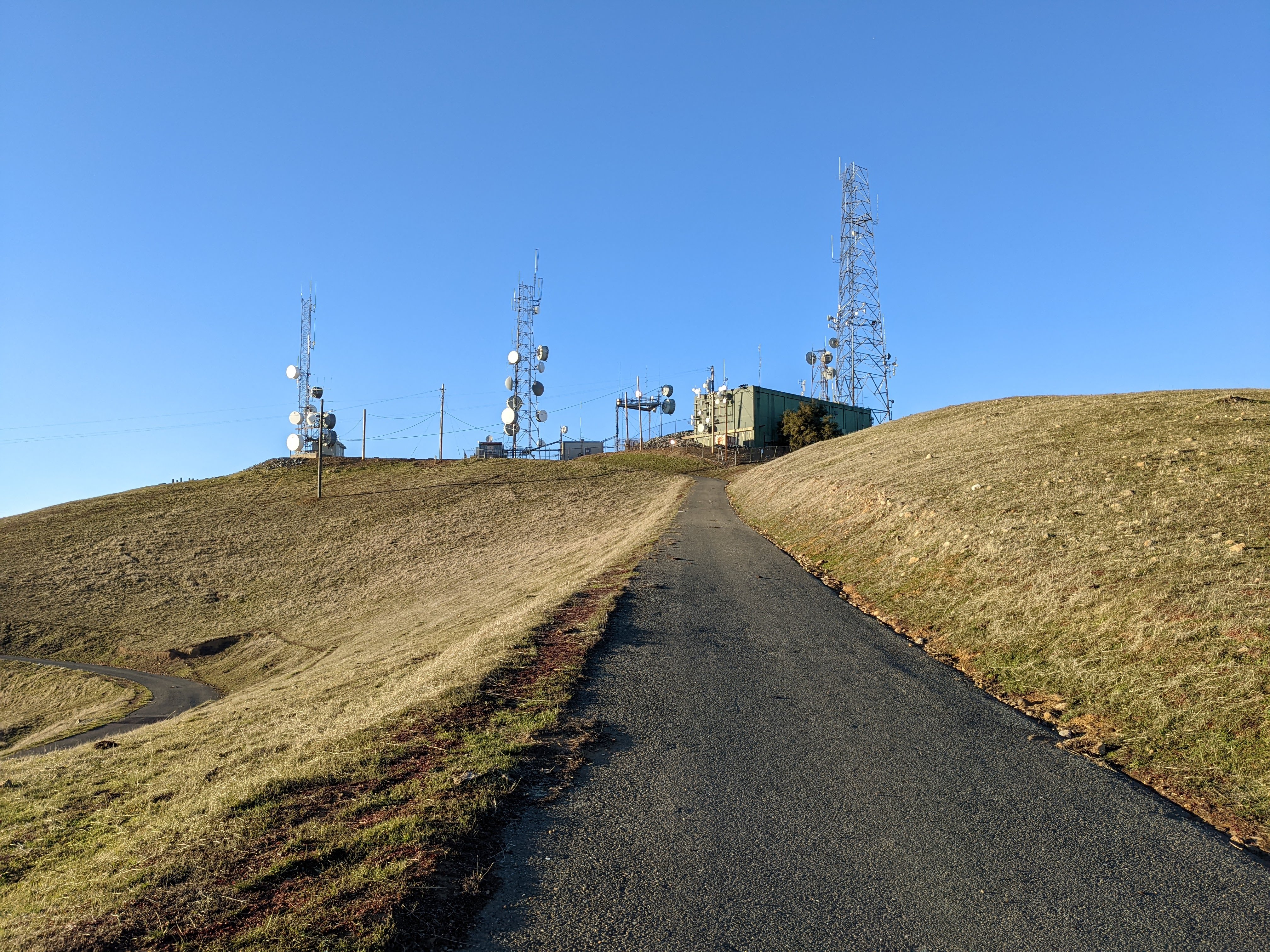
A scenery photo of Sunol Peak and radio antennas. The photo was shot on Sunol Ridge Trail.

A scenery photo of smog and fog. In the photo are Mt. Diablo (left), Pleasanton, Dublin, and Livermore (in the distance). The photo was shot on Sunol Ridge Trail.

A photo of radio antennas shot at Sunol Peak.

A photo of radio antennas shot at Sunol Peak.

A photo of radio antennas, smog, fog, and the SF Bay Area (in the distance) shot at Sunol Peak.

A scenery photo of smog and fog. In the photo is the SF Bay Area (in the distance). The photo was shot at Sunol Peak.

A scenery photo of smog and fog. In the photo are Mt. Allison & Mission Peak (center), and the SF Bay Area (in the distance on the right). The photo was shot at Sunol Peak.

A scenery photo of smog and fog. In the photo are Mt. Diablo, Dublin, Pleasanton, and Livermore (in the distance on the right). The photo was shot at Sunol Peak.

A scenery photo of smog and fog. The photo was shot at Sunol Peak.

A scenery panorama of smog and fog. In the panorama are the SF Bay Area (in the distance on the left), Mt. Diablo, Dublin, Pleasanton, and Livermore (in the distance on the right), and Radio Antennas (right). The photo was shot at Sunol Peak.

A scenery photo of smog and fog. In the photo are Dublin, Pleasanton, and Livermore (in the distance). The photo was shot at Sunol Peak.

A scenery photo of smog and fog. In the photo are Dublin, Pleasanton, and Livermore (in the distance). The photo was shot at Sunol Peak.

A sunset scenery photo of smog and fog. In the photo is the SF Bay Area (in the distance). The photo was shot on Sunol Ridge Trail.

A sunset scenery photo of smog and fog. In the photo is the SF Bay Area (in the distance). The photo was shot on Sunol Ridge Trail.

A sunset scenery photo of smog and fog. In the photo are Mt. Allison & Mission Peak (center), and the SF Bay Area (in the distance on the right). The photo was shot on Sunol Ridge Trail.

A sunset scenery photo of smog and fog. In the photo are Niles Canyon, State Route 84, and the SF Bay Area (in the distance). The photo was shot on Sunol Ridge Trail.

This is all the photos for today. I hope you have enjoyed viewing the photos! Please don't forget to share the blog post with your friends and family members! Also, if you want to get notifications when I post up more photos, "Like" us on Facebook or follow me on Instagram. These links can also be found on the top of the right sidebar.