Showing posts with label cervus canadensis nannodes. Show all posts

Sunday, January 11, 2026

Point Reyes National Seashore (Cellphone Photos) - Marin County, CA

On the 9th January 2026, my parents and I took a trip to Point Reyes National Seashore in Marin County, CA to see elephant seals. I took photos with my cellphone. I hope you enjoy viewing my photos!

Our first stop on the trip was Drakes Beach to see the Elephant Seals (Mirounga angustirostris).

A scenery photo of Elephant Seals (Mirounga angustirostris), Drakes Beach, Pacific Ocean, mountains, and clouds.

A photo of an Elephant Seal (Mirounga angustirostris) taken at Drakes Beach.

A photo of an Elephant Seal (Mirounga angustirostris) taken at Drakes Beach.

Next we head towards Chimney Rock Trail Head. I took a few photos along the route.

A scenery photo of ocean, clouds, and ship (in the distance in the center). The photo was shot on Sir Francis Drake Blvd.

A scenery photo of a farm, clouds, and Sir Francis Drake Blvd.

A photo of Tule Elk (Cervus canadensis nannodes) and hill. The photo was shot on Chimney Rock Road.

A photo of Tule Elk (Cervus canadensis nannodes), hill, clouds, and power lines. The photo was shot on Chimney Rock Road.

Next we went to Point Reyes Beach South.

A scenery photo of Pacific Ocean, waves, clouds, and Point Reyes Beach South.

A scenery photo of Pacific Ocean, waves, clouds, and Point Reyes Beach South.

Our last stop of the day was Cypress Tree Tunnel for sunset.

A sunset scenery photo of Cypress Tree Tunnel and KPH Marine Radio Station (in the distance).

A sunset scenery photo of Cypress Tree Tunnel and KPH Marine Radio Station (in the distance).

A sunset scenery photo of Cypress Tree Tunnel.

A sunset scenery photo of clouds shot on Sir Francis Drake Blvd near Cypress Tree Tunnel.

This is all the photos for today. I hope you have enjoyed viewing the photos! Please don't forget to share the blog post with your friends and family members! Also, if you want to get notifications when I post up more photos, "Like" us on Facebook or follow me on Instagram. These links can also be found on the top of the right sidebar.

Sunday, May 14, 2023

Tomales Point Trail (Part 4) - Point Reyes National Seashore

On 26 April 2023, my mom and I drove to Point Reyes National Seashore in Marin County, CA to walk and hike along Tomales Point Trail. We saw a ton of Tule Elk (Cervus canadensis nannodes) and wild flowers on the walk and hike. I took photos with my cellphone and mirrorless camera. The photos are split into 5 blog posts (I took most of the photos on my mirrorless camera). I hope you enjoy viewing my photos!

High Resolution Photos: If you want to see high resolution photos of any of the photos you see here, use the following links. If you wish to purchase prints of any of the photos, please contact me here. To see my best Point Reyes National Seashore photos, use this link. To see my best deer and elk photos, use this link. To see my best sunset and night photography photos from 2019 to 2023, use this link. To see my best black and white and abstract photos from 2020 to 2023, use this link. To see all of my photos from this trip, use this link.

Travel Tip #1: Weather by the coast could be a lot colder than inland. On this trip, it was 77°F (25°C) at Bear Valley Visitor Center, but at the trail head for Tomales Point, it was 55°F (12.8°C) with heavy fog. The fog drifted in and out on our walk and hike. I'm guessing, when the fog cleared, it was around 63°F (17.2°C). The weather forecast for nearby towns (Dillon Beach, Inverness, Bodega Bay) on this day, called for a high of 66°F (18.9°C). Also I got "rained on" a tiny bit when the fog was extremely dense. I've done this trail twice, and I've gotten "rained on" twice. The first time I got "rained on" was quite heavy.

Travel Tip #2: Tomales Point Trail is an out and back trail, and is approximately 9.5 miles (15.3 km) long. If you explore some of the side trails, you can easily reach over 10 miles (16 km). Bring plenty of water as there are no drinking fountains on the trail. You can probably filter water from the lake, but I wouldn't recommend it. You should also pack lunch. The trail took my mom and I 8 hours to complete, which was 3 hours over my original estimate.

Parts: 1 | 2 | 3 | 4 | Cellphone Photos

These are part 4 of the photos shot on my Olympus mirrorless camera. The photos are of fog, clouds, cypress trees, Tule Elk (Cervus canadensis nannodes), and sunset, and were shot on or near Tomales Point Trail and at Pierce Point Ranch.

A scenery photo of clouds and mountains. The photo was shot near Tomales Point Trail.
Approximate GPS location (type into Google): 38° 12' 40" N 122° 58' 14" W

A scenery photo of clouds and mountains. The photo was shot near Tomales Point Trail.
The flowers in the photo are California Poppy (Eschscholzia californica) and Cow Parsnip (Heracleum maximum).
Photo shot at the same spot as above.

A scenery photo of Toms Point, Tomales Bay, clouds, and green hills. The photo was shot near Tomales Point Trail.
The flowers in the photo are Cow Parsnip (Heracleum maximum) and Douglas Iris (Iris douglasiana).
Approximate GPS location (type into Google): 38° 12' 35" N 122° 58' 05" W

A photo of Tule Elk (Cervus canadensis nannodes). The photo was shot on Tomales Point Trail.
The flowers in the photo are California Poppy (Eschscholzia californica).
Approximate GPS location (type into Google): 38° 12' 14" N 122° 57' 56" W

A photo of Tule Elk (Cervus canadensis nannodes). The photo was shot on Tomales Point Trail.
The flowers in the photo are California Poppy (Eschscholzia californica).
Photo shot near the same spot as above.

A photo of Tule Elk (Cervus canadensis nannodes). The photo was shot on Tomales Point Trail.
The flowers in the photo are California Poppy (Eschscholzia californica) and Cow Parsnip (Heracleum maximum).
Photo shot near the same spot as above.

A photo of Tule Elk (Cervus canadensis nannodes) and fog. The photo was shot on Tomales Point Trail.
The flowers in the photo are California Goldfields (Lasthenia californica), California Poppy (Eschscholzia californica), Cow Parsnip (Heracleum maximum), Douglas Iris (Iris douglasiana), and Sky Lupine (Lupinus nanus).
Approximate GPS location (type into Google): 38° 11' 59" N 122° 57' 45" W

A black and white process of the photo above.

A photo of Tule Elk (Cervus canadensis nannodes) and fog. The photo was shot on Tomales Point Trail.
The flowers in the photo are California Goldfields (Lasthenia californica), California Poppy (Eschscholzia californica), and Douglas Iris (Iris douglasiana).
Approximate GPS location (type into Google): 38° 11' 58" N 122° 57' 44" W

A black and white process of the photo above.

A photo of Tule Elk (Cervus canadensis nannodes) and fog. The photo was shot on Tomales Point Trail.
The flowers in the photo are California Goldfields (Lasthenia californica), California Poppy (Eschscholzia californica), and Douglas Iris (Iris douglasiana).
Photo shot at the same spot as above.

A black and white process of the photo above.

A foggy sunset scenery photo of cypress trees, Pierce Point Ranch, hills, and the trail (bottom). The photo was shot on Tomales Point Trail.
The flowers in the photo are Cow Parsnip (Heracleum maximum) and Yellow Bush Lupine (Lupinus arboreus).
Approximate GPS location (type into Google): 38° 11' 26" N 122° 57' 22" W

A black and white process of the photo above.

A foggy sunset scenery photo of Pierce Point Ranch, cypress trees, hills, and the trail (right). The photo was shot on Tomales Point Trail.
The flowers in the photo are Wild Radish (Raphanus raphanistrum).
Approximate GPS location (type into Google): 38° 11' 24" N 122° 57' 20" W

A black and white process of the photo above.

A sunset scenery photo of fog, clouds, and hills. The photo was shot at Pierce Point Ranch.
The flowers in the photo are Cow Parsnip (Heracleum maximum) and Wild Radish (Raphanus raphanistrum).
The plants in the photo are cypress trees in fog (in the distance).
Approximate GPS location (type into Google): 38° 11' 25" N 122° 57' 15" W

A black and white process of the photo above.

A sunset scenery photo of fog, clouds, and hills. The photo was shot at Pierce Point Ranch.
The flowers in the photo are Cow Parsnip (Heracleum maximum) and Wild Radish (Raphanus raphanistrum).
The plants in the photo are cypress trees in fog (in the distance).
Photo shot at the same spot as above.

This is all the photos for today. I hope you have enjoyed viewing the photos! Please don't forget to share the blog post with your friends and family members! Also, if you want to get notifications when I post up more photos, "Like" us on Facebook or follow me on Instagram. These links can also be found on the top of the right sidebar.

Parts: 1 | 2 | 3 | 4 | Cellphone Photos

Saturday, May 13, 2023

Tomales Point Trail (Part 3) - Point Reyes National Seashore

On 26 April 2023, my mom and I drove to Point Reyes National Seashore in Marin County, CA to walk and hike along Tomales Point Trail. We saw a ton of Tule Elk (Cervus canadensis nannodes) and wild flowers on the walk and hike. I took photos with my cellphone and mirrorless camera. The photos are split into 5 blog posts (I took most of the photos on my mirrorless camera). I hope you enjoy viewing my photos!

High Resolution Photos: If you want to see high resolution photos of any of the photos you see here, use the following links. If you wish to purchase prints of any of the photos, please contact me here. To see my best Point Reyes National Seashore photos, use this link. To see my best deer and elk photos, use this link. To see my best black and white and abstract photos from 2020 to 2023, use this link. To see all of my photos from this trip, use this link.

Travel Tip #1: Weather by the coast could be a lot colder than inland. On this trip, it was 77°F (25°C) at Bear Valley Visitor Center, but at the trail head for Tomales Point, it was 55°F (12.8°C) with heavy fog. The fog drifted in and out on our walk and hike. I'm guessing, when the fog cleared, it was around 63°F (17.2°C). The weather forecast for nearby towns (Dillon Beach, Inverness, Bodega Bay) on this day, called for a high of 66°F (18.9°C). Also I got "rained on" a tiny bit when the fog was extremely dense. I've done this trail twice, and I've gotten "rained on" twice. The first time I got "rained on" was quite heavy.

Travel Tip #2: Tomales Point Trail is an out and back trail, and is approximately 9.5 miles (15.3 km) long. If you explore some of the side trails, you can easily reach over 10 miles (16 km). Bring plenty of water as there are no drinking fountains on the trail. You can probably filter water from the lake, but I wouldn't recommend it. You should also pack lunch. The trail took my mom and I 8 hours to complete, which was 3 hours over my original estimate.

Parts: 1 | 2 | 3 | 4 | Cellphone Photos

These are part 3 of the photos shot on my Olympus mirrorless camera. The photos are of fog, cypress trees, and Tule Elk (Cervus canadensis nannodes), and were shot on Tomales Point Trail.

A scenery photo of cypress trees in fog.
The flowers in the photo are Cow Parsnip (Heracleum maximum), Douglas Iris (Iris douglasiana), and Yellow Bush Lupine (Lupinus arboreus).
Approximate GPS location (type into Google): 38° 13' 29" N 122° 58' 49" W

A scenery photo of cypress trees in fog.
The flowers in the photo are Cow Parsnip (Heracleum maximum) and Douglas Iris (Iris douglasiana).
Approximate GPS location (type into Google): 38° 13' 29" N 122° 58' 48" W

A black and white process of the photo above.

A scenery photo of cypress trees in fog.
The flowers in the photo are Cow Parsnip (Heracleum maximum).
Approximate GPS location (type into Google): 38° 13' 28" N 122° 58' 46" W

A black and white process of the photo above.

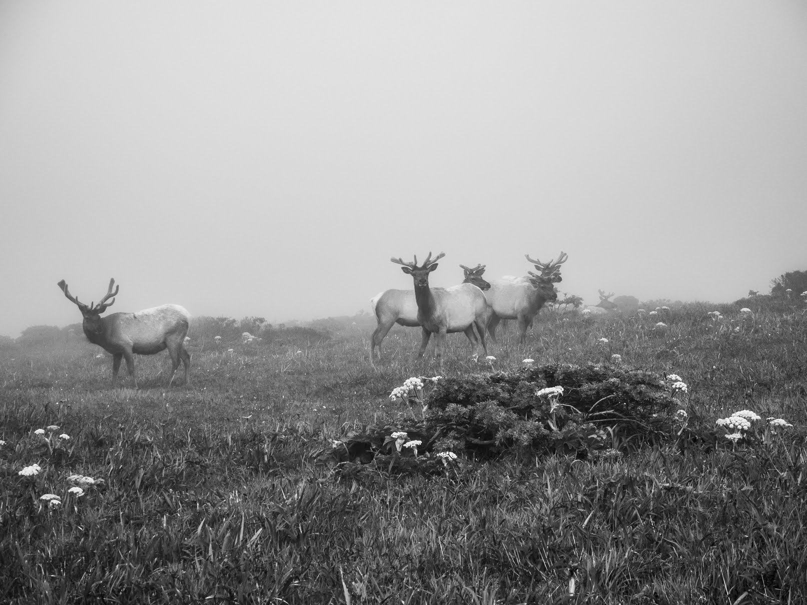
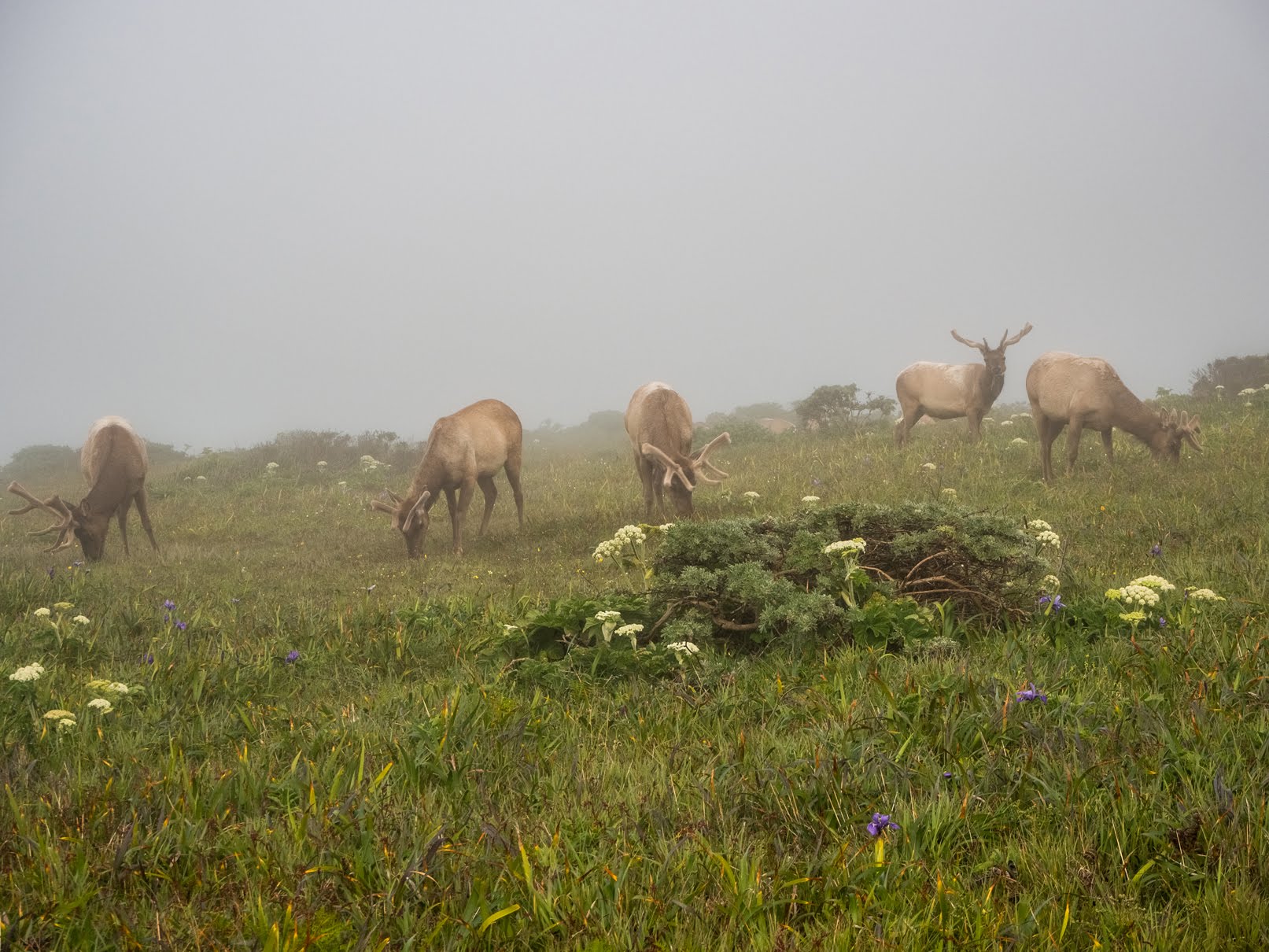
A photo of Tule Elk (Cervus canadensis nannodes) and fog.
The flowers in the photo are California Goldfields (Lasthenia californica), California Poppy (Eschscholzia californica), Cow Parsnip (Heracleum maximum), Douglas Iris (Iris douglasiana), and Yellow Bush Lupine (Lupinus arboreus).
Approximate GPS location (type into Google): 38° 13' 07" N 122° 58' 36" W

A black and white process of the photo above.

A photo of Tule Elk (Cervus canadensis nannodes) and fog.
The flowers in the photo are California Goldfields (Lasthenia californica), California Poppy (Eschscholzia californica), Cow Parsnip (Heracleum maximum), Douglas Iris (Iris douglasiana), and Yellow Bush Lupine (Lupinus arboreus).
Photo shot at the same spot as above.

A black and white process of the photo above.

A photo of Tule Elk (Cervus canadensis nannodes) and fog.
The flowers in the photo are California Goldfields (Lasthenia californica), California Poppy (Eschscholzia californica), Cow Parsnip (Heracleum maximum), Douglas Iris (Iris douglasiana), and Yellow Bush Lupine (Lupinus arboreus).
Photo shot at the same spot as above.

A black and white process of the photo above.

A photo of Tule Elk (Cervus canadensis nannodes) and fog.
The flowers in the photo are California Goldfields (Lasthenia californica), California Poppy (Eschscholzia californica), Cow Parsnip (Heracleum maximum), Douglas Iris (Iris douglasiana), and Yellow Bush Lupine (Lupinus arboreus).
Photo shot at the same spot as above.

A photo of Tule Elk (Cervus canadensis nannodes) and fog.
The flowers in the photo are California Goldfields (Lasthenia californica), California Poppy (Eschscholzia californica), Cow Parsnip (Heracleum maximum), Douglas Iris (Iris douglasiana), and Yellow Bush Lupine (Lupinus arboreus).
Photo shot at the same spot as above.

A photo of Tule Elk (Cervus canadensis nannodes) and fog.
The flowers in the photo are California Goldfields (Lasthenia californica), California Poppy (Eschscholzia californica), Cow Parsnip (Heracleum maximum), Douglas Iris (Iris douglasiana), and Yellow Bush Lupine (Lupinus arboreus).
Photo shot at the same spot as above.

A photo of Tule Elk (Cervus canadensis nannodes) and fog.
The flowers in the photo are California Goldfields (Lasthenia californica), California Poppy (Eschscholzia californica), Cow Parsnip (Heracleum maximum), and Douglas Iris (Iris douglasiana).
Photo shot at the same spot as above.

A black and white process of the photo above.

A photo of Tule Elk (Cervus canadensis nannodes) and fog.
The flowers in the photo are California Goldfields (Lasthenia californica), California Poppy (Eschscholzia californica), Cow Parsnip (Heracleum maximum), and Douglas Iris (Iris douglasiana).
Photo shot at the same spot as above.

A black and white process of the photo above.

This is all the photos for today. I hope you have enjoyed viewing the photos! Please don't forget to share the blog post with your friends and family members! Also, if you want to get notifications when I post up more photos, "Like" us on Facebook or follow me on Instagram. These links can also be found on the top of the right sidebar.

Parts: 1 | 2 | 3 | 4 | Cellphone Photos