Showing posts with label los vaqueros watershed. Show all posts

Friday, May 12, 2023

Morgan Territory & Los Vaqueros Reservoir (Cellphone Photos)

Yesterday, on 11 May 2023, my mom and I took short hike through Morgan Territory Regional Preserve in Livermore, CA and walked a short distance into Los Vaqueros Watershed in Contra Costa County, CA. I took photos with my cellphone. I hope you enjoy viewing my photos!

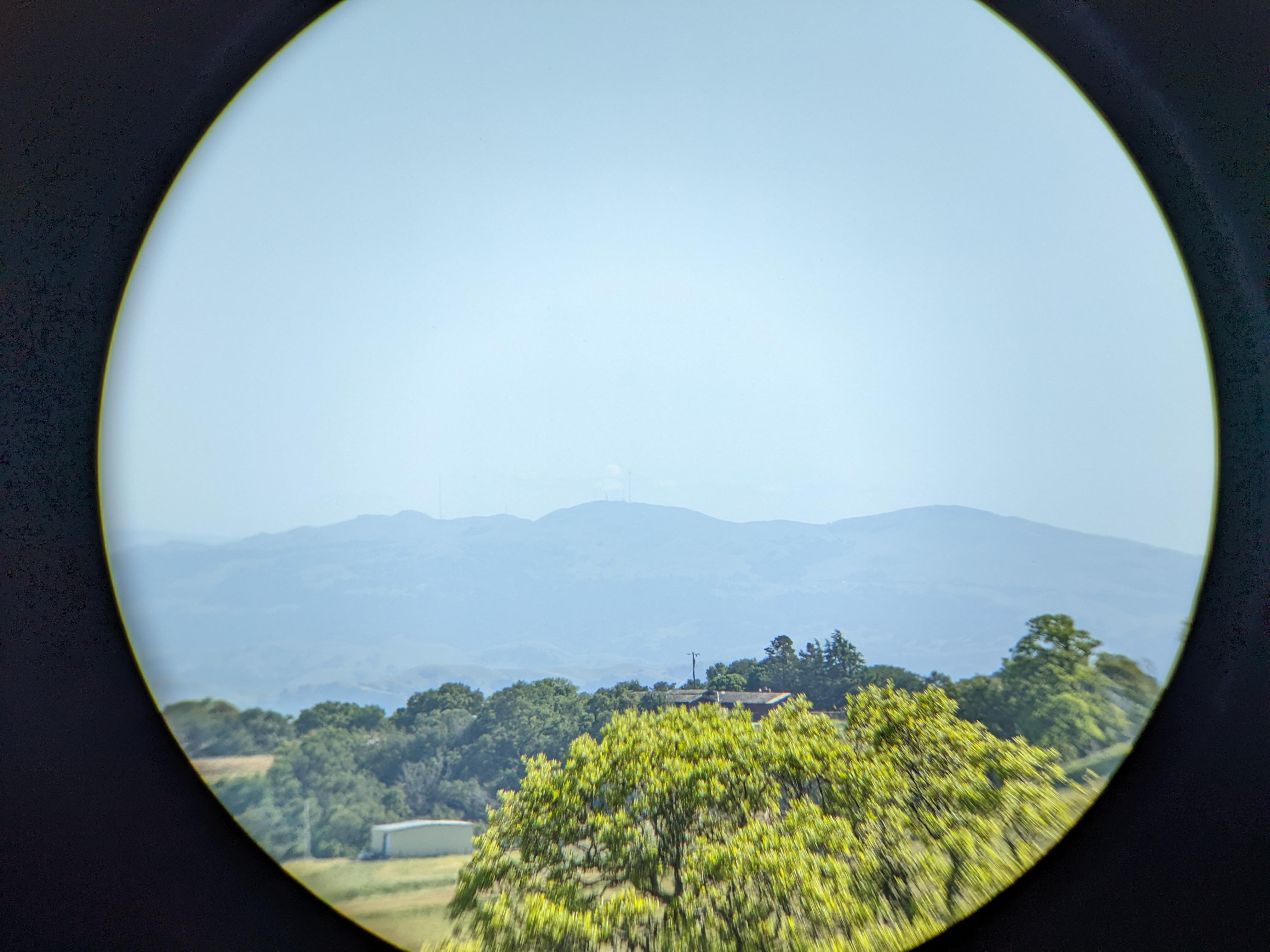
One of the main purposes of my trip today was to test my new Vanguard BA-195 Binocular Tripod Adapter (Product Link - Affiliate Link). The binoculars I used was the Bushnell Engage X 10x42mm Binoculars (Product Link - Affiliate Link). The Vanguard binocular tripod adapter performed very well and the set up didn't wobble at all. The most issue I had was with my binoculars rotating a tiny bit on the mount, but you really can't blame it as it is mounted by a screw. This is way better than the first binocular tripod adapter I got (which I had returned), the Staoptics Binocular Tripod Adapter with Quick Release (Product Link - Affiliate Link). Not only did the Staoptics adapter have an extra long screw which was too long for my Bushnell binoculars, my binoculars just kept rotating and wobbling on the mount. I used the Staoptics one for a little over a week before I returned it. If you're looking for a quality binocular tripod adapter, go with the Vanguard BA-195 Binocular Tripod Adapter (Product Link - Affiliate Link). I used Vanguard tripods for many years for my photography, and they are a brand I trust. If I had known Vanguard makes binocular tripod mounts, I would have went directly with theirs instead of messing around with other brands.

A photo shot through my binoculars.
A photo of Mt. Allison (center), Mission Peak (right), trees, a house, and a storage shed. The photo was shot on Whipsnake Trail in Morgan Territory Regional Preserve in Livermore, CA.
Binoculars Used: Bushnell Engage X 10x42mm Binoculars (Product Link - Affiliate Link)

A photo shot through my binoculars.
A photo of Sunol Peak (center), a green hill, and trees. The photo was shot on Whipsnake Loop Trail in Los Vaqueros Watershed in Contra Costa County, CA.
Binoculars Used: Bushnell Engage X 10x42mm Binoculars (Product Link - Affiliate Link)

A photo shot through my binoculars.
A photo of Stockton, CA and farms. The photo was shot near Whipsnake Loop Trail in Los Vaqueros Watershed in Contra Costa County, CA.
Binoculars Used: Bushnell Engage X 10x42mm Binoculars (Product Link - Affiliate Link)

A photo shot through my binoculars.
A photo of Stockton, CA and farms. The photo was shot near Whipsnake Loop Trail in Los Vaqueros Watershed in Contra Costa County, CA.
Binoculars Used: Bushnell Engage X 10x42mm Binoculars (Product Link - Affiliate Link)

A scenery photo of Los Vaqueros Reservoir (foreground), Clifton Court Forebay (in the distance on the left), windmills & Tracy, CA (right), and trees. The photo was shot near Whipsnake Loop Trail in Los Vaqueros Watershed in Contra Costa County, CA.

A photo shot through my binoculars.
A photo of two black tailed deer, green hill, and trees. The photo was shot near Whipsnake Trail in Morgan Territory Regional Preserve in Livermore, CA.
Binoculars Used: Bushnell Engage X 10x42mm Binoculars (Product Link - Affiliate Link)

A photo shot through my binoculars.
A photo of a black tailed deer, green hill, and trees. The photo was shot near Whipsnake Trail in Morgan Territory Regional Preserve in Livermore, CA.
Binoculars Used: Bushnell Engage X 10x42mm Binoculars (Product Link - Affiliate Link)

A photo shot through my binoculars.
A photo of two black tailed deer, green hill, and trees. The photo was shot near Whipsnake Trail in Morgan Territory Regional Preserve in Livermore, CA.
Binoculars Used: Bushnell Engage X 10x42mm Binoculars (Product Link - Affiliate Link)

A photo shot through my binoculars.
A photo of two black tailed deer, green hill, and trees. The photo was shot near Whipsnake Trail in Morgan Territory Regional Preserve in Livermore, CA.
Binoculars Used: Bushnell Engage X 10x42mm Binoculars (Product Link - Affiliate Link)

A photo shot through my binoculars.
A photo of a squirrel and grass. The photo was shot near Whipsnake Trail in Morgan Territory Regional Preserve in Livermore, CA.
Binoculars Used: Bushnell Engage X 10x42mm Binoculars (Product Link - Affiliate Link)

A photo shot through my binoculars.
A photo of a squirrel and grass. The photo was shot near Whipsnake Trail in Morgan Territory Regional Preserve in Livermore, CA.
Binoculars Used: Bushnell Engage X 10x42mm Binoculars (Product Link - Affiliate Link)

This is all the photos for today. I hope you have enjoyed viewing the photos! Please don't forget to share the blog post with your friends and family members! Also, if you want to get notifications when I post up more photos, "Like" us on Facebook or follow me on Instagram. These links can also be found on the top of the right sidebar.

Thursday, March 3, 2022

Round Valley Regional Preserve & Los Vaqueros Reservoir (Cellphone Photos)

Yesterday, on 2 March 2022, my mom and I took a walk and hike in Round Valley Regional Preserve in Brentwood, CA and Los Vaqueros Reservoir in Contra Costa County, CA. I took 4 photos with my cellphone while I was there. I hope you enjoy viewing my photos! Surprising story at the end, so make sure you keep reading until the very last photo.

A scenery photo from Miwok Trail in Round Valley Regional Preserve in Brentwood, CA.

A scenery photo from Miwok Trail in Round Valley Regional Preserve in Brentwood, CA. In the distance is Los Vaqueros Reservoir.

A scenery photo from Adobe Trail in Los Vaqueros Reservoir in Contra Costa County, CA.

A scenery photo from Adobe Trail in Los Vaqueros Reservoir in Contra Costa County, CA. The photo was shot near the intersection of Adobe Trail and Oak Savannah Trail. In the photo are cows and Los Vaqueros Reservoir (in the distance).

You are probably wondering where is the surprising story? See those cows in the last photo I took? My mom and I were quite some distance away from them, and we've been hiking for many years now. We are usually very careful around cows, keeping our distance, checking for calves, and talking and making noise so they know we are there. We usually wait a while for them to clear the trail, and if they don't, we'll keep our distance by walking around them. We are always on guard because we're scared the cows might charge at us. We didn't do anything to aggravate the cows, we waited for them to clear the trail, but they made us U-turn on Adobe Trail by aggressively chasing us for around a third of a mile. The entire herd of cows closed in on us from 3 sides and began chasing us. They were clearly not happy people were there. Out of the years we've hiked, this was the first time we've been aggressively attacked by a herd of cows.

This is all the photos for today. I hope you have enjoyed viewing the photos! Please don't forget to share the blog post with your friends and family members! Also, if you want to get notifications when I post up more photos, "Like" us on Facebook or follow me on Twitter and Instagram. These links can also be found on the top of the right sidebar.

Saturday, February 29, 2020

Los Vaqueros Watershed - Contra Costa County, CA

On January 26th, 2020, I went to Morgan Territory Regional Preserve for a hike through the preserve along with Los Vaqueros Watershed. I parked at Morgan Territory Road Staging Area. I'm telling you that so you can get a general idea of where I was in the preserve as it is huge.

High Resolution Photos: If you want to see full resolution photos of any of the photos you see here, use the following links. If you wish to purchase prints of any of the photos, please contact me here. To view my best Morgan Territory Regional Preserve and Los Vaqueros Watershed photos, use this link. To see all of my photos from this trip, use this link.

In this blog post, I have photos from Los Vaqueros Watershed in Contra Costa County, CA. Photos from Morgan Territory Regional Preserve can be viewed here.

Photo from Whipsnake Loop Trail. Photo of Los Vaqueros Reservoir, Discovery Bay (left), Clifton Court Forebay (slightly left from center), and Tracy (right).
Approximate GPS location (type into Google): 37° 49' 06" N 121° 46' 42" W

A black and white process of the photo above.

Photo from Whipsnake Loop Trail. Photo of Discovery Bay and Los Vaqueros Reservoir (bottom right). Photo shot at the same spot as above.

A black and white process of the photo above.

Photo from Whipsnake Loop Trail. Photo of windmills, Tracy, and Los Vaqueros Reservoir (bottom left). Photo shot at the same spot as above.

A black and white process of the photo above.

Photo from Whipsnake Loop Trail. Photo of Los Vaqueros Reservoir, Discovery Bay (left), Clifton Court Forebay (right), Stockton (in the distance). Photo shot at the same spot as above.

A black and white process of the photo above.

Photo from near Whipsnake Loop Trail. Photo of Discovery Bay, Brentwood (left), and Los Vaqueros Reservoir and Clifton Court Forebay (right).
Approximate GPS location (type into Google): 37° 49' 07" N 121° 46' 36" W

A black and white process of the photo above.

Photo from near Whipsnake Loop Trail. Photo of Discovery Bay and Los Vaqueros Reservoir (bottom right). Photo shot at the same spot as above.

A black and white process of the photo above.

Photo from near Whipsnake Loop Trail. Photo of windmills, Tracy, and Los Vaqueros Reservoir (left). Photo shot at the same spot as above.

A black and white process of the photo above.

Photo from Whipsnake Loop Trail. Photo of windmills, Los Vaqueros Reservoir, Clifton Court Forebay, Discovery Bay (left), and Tracy (right).
Approximate GPS location (type into Google): 37° 49' 05" N 121° 46' 42" W

A black and white process of the photo above.

This is all the photos for today. I hope you have enjoyed the photos! The photos from Morgan Territory Regional Preserve can be viewed here. Also, if you want to get notifications when I post up more photos, "Like" us on Facebook or follow me on Twitter and Instagram. These links can also be found on the top of the right sidebar.

Friday, April 26, 2019

Los Vaqueros Watershed - Contra Costa County, CA

On February 18th, 2019, I drove to Morgan Territory Regional Preserve for a hike through the preserve along with Los Vaqueros Watershed. I parked at Morgan Territory Road Staging Area. I'm telling you that so you can get a general idea of where I was in the preserve as it is huge. On my hike, I also got a small glimpse of the extremely rare San Francisco Bay Area. There is one photo of the snow in the blog posts. I hope you enjoy the photos.

Full Resolution Photos: If you want to see full resolution photos of any of the photos you see here, use the following links. If you wish to purchase prints of any of the photos, please contact me here. To view my best Morgan Territory Regional Preserve and Los Vaqueros Watershed photos, use this link. To see all of my photos from this trip, use this link.

In this blog post, I have photos from Los Vaqueros Watershed in Contra Costa County, CA. Photos from Morgan Territory Regional Preserve can be viewed here.

Scenery from Whipsnake Loop Trail. Photo is of windmills, Los Vaqueros Reservoir, Discovery Bay (left), Clifton Court Forebay (slightly left from center), and Tracy (right).
Approximate GPS location (type into Google): 37° 49' 06" N 121° 46' 42" W

Black and white process of the photo above.

Scenery from Whipsnake Loop Trail. Photo is of Los Vaqueros Reservoir (foreground) and Clifton Court Forebay (in the distance). Photo shot near the same spot as above.

 Black and white process of the photo above.

Scenery from Whipsnake Loop Trail. Photo is of Discovery Bay and Los Vaqueros Reservoir (bottom right). Photo shot near the same spot as above.

 Black and white process of the photo above.

Scenery from Whipsnake Loop Trail. Photo is of windmills, Tracy and Los Vaqueros Reservoir (bottom left). Photo shot near the same spot as above.

Black and white process of the photo above.

 Panorama scenery from Whipsnake Loop Trail. Photo is of Los Vaqueros Reservoir, Discovery Bay (left), Clifton Court Forebay (slightly left from center), and Tracy (right). Photo shot near the same spot as above. Full resolution panorama can be found here.

Photo of a tree on Whipsnake Loop Trail.
Approximate GPS location (type into Google): 37° 49' 09" N 121° 46' 49" W

Black and white process of the photo above.

Scenery of rare San Francisco Bay Area snow. Photo is of Livermore, CA shot from Whipsnake Loop Trail. Photo shot near the same spot as above.

Black and white process of the photo above.

This is all the photos for today. I hope you have enjoyed the photos! The photos from Morgan Territory Regional Preserve can be viewed here. Also, if you want to get notifications when I post up more photos, "Like" us on Facebook or follow me on Twitter and Instagram. These links can also be found on the top of the right sidebar.