Showing posts with label north dome. Show all posts

Saturday, February 4, 2023

Yosemite Valley - Yosemite National Park

On 17 January 2023, my parents and I took a day trip to Yosemite National Park in California to see snow. We drove along Big Oak Flat Road, and visited Yosemite Valley. The photos are split into 2 blog posts. I hope you enjoy viewing my photos!

High Resolution Photos: If you want to see high resolution photos of any of the photos you see here, use the following links. If you wish to purchase prints of any of the photos, please contact me here. To see all of my photos from Yosemite National Park in 2022 to 2023, use this link.

Parts: Cellphone Photos | Olympus Photos

These are the photos I took on my Olympus mirrorless camera. The photos are from Yosemite Valley.

Once we got to Yosemite Valley, we parked our car at the Yosemite Valley Chapel. My dad and I walked through Cook's Meadow to get to Lower Yosemite Fall Trail.

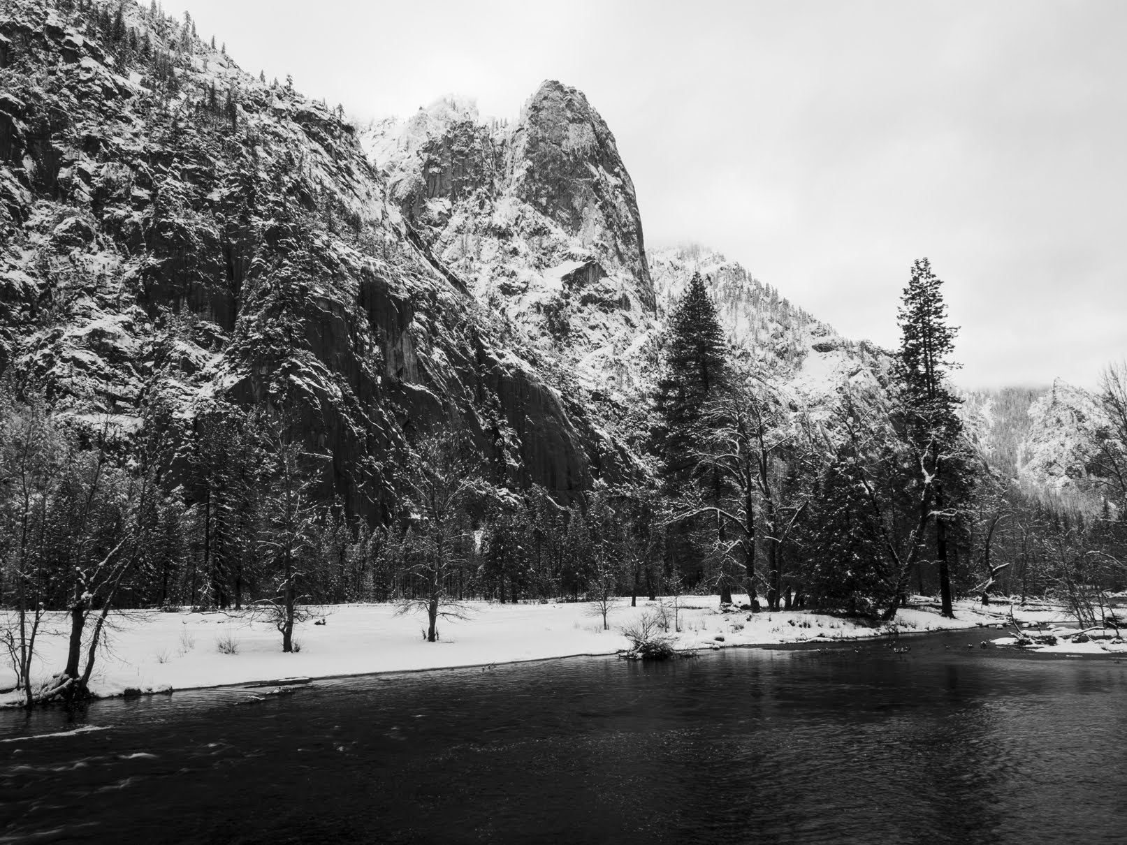
A snowy scenery photo of North Dome, Merced River, Half Dome (behind the trees on the right), snow covered trees, forest, granite mountains, and clouds. The photo was shot on Berg Bridge/Superintendents Bridge.
Approximate GPS location (type into Google): 37° 44' 35" N 119° 35' 35" W

A long exposure snowy scenery photo of Lower and Upper Yosemite Falls, snow covered trees, forest, granite mountains, and clouds. The photo was shot on Lower Yosemite Fall Trail.
Approximate GPS location (type into Google): 37° 44' 49" N 119° 35' 47" W

A long exposure snowy scenery photo of Lower Yosemite Fall, snow covered trees, granite mountains, and clouds. The photo was shot at Lower Yosemite Fall Vista Point on Lower Yosemite Fall Trail.
Approximate GPS location (type into Google): 37° 45' 00" N 119° 35' 45" W

A black and white process of the photo above.

A snowy long exposure photo of Yosemite Creek, snow covered rocks, snow covered trees, and forest. The photo was shot at Lower Yosemite Fall Footbridge on Lower Yosemite Fall Trail.
Approximate GPS location (type into Google): 37° 45' 00" N 119° 35' 44" W

A black and white process of the photo above.

After I was done at Yosemite Falls, I walked through Cook's Meadow to get back to the car.

A snowy scenery photo of Half Dome, snow covered trees, forest, granite mountains, and clouds. The photo was shot at Cook's Meadow.
Approximate GPS location (type into Google): 37° 44' 40" N 119° 35' 35" W

A black and white process of the photo above.

A snowy scenery photo of Cathedral Rocks, Merced River, snow covered trees, forest, granite mountains, and clouds. The photo was shot on Berg Bridge/Superintendents Bridge.
Approximate GPS location (type into Google): 37° 44' 36" N 119° 35' 35" W

A black and white process of the photo above.

A snowy sunset scenery photo of Upper and Lower Yosemite Falls, Cook's Meadow, clouds, fog, snow covered trees, forest, and granite mountains. The photo was shot at Cook's Meadow on Cook's Meadow Loop Trail.
Approximate GPS location (type into Google): 37° 44' 38" N 119° 35' 27" W

A black and white process of the photo above.

This is all the photos for today. I hope you have enjoyed viewing the photos! Please don't forget to share the blog post with your friends and family members! Also, if you want to get notifications when I post up more photos, "Like" us on Facebook or follow me on Instagram. These links can also be found on the top of the right sidebar.

Parts: Cellphone Photos | Olympus Photos

Saturday, January 14, 2023

Cook's Meadow (Part 1) - Yosemite National Park

On 5 December 2022, my parents and I took a day trip to Yosemite National Park in California to see snow. On the way, we also stopped for a short while at Red Hills Recreation Area in Tuolumne County, CA. The photos are split into 3 blog posts. I hope you enjoy viewing my photos!

High Resolution Photos: If you want to see full resolution photos of any of the photos you see here, use the following links. If you wish to purchase prints of any of the photos, please contact me here. To view my best Yosemite National Park photos from 2020 to 2022, use this link. To see all of my photos from Yosemite National Park in 2022, use this link.

Parts: Cellphone Photos | Olympus Part 1 | Olympus Part 2

These are part 1 of the photos I took on my Olympus mirrorless camera. The photos are from Cook's Meadow in Yosemite National Park in California.

The approximate GPS coordinate (type into Google) for the photo of Upper Yosemite Fall is at 37° 44' 39" N 119° 35' 31" W.

A snowy scenery photo of Upper Yosemite Fall, Cook's Meadow, granite mountains, snow, clouds, and forest. The photo was shot on Cook's Meadow Loop Trail.

A black and white process of the photo above.

The approximate GPS coordinates (type into Google) for the next 3 photos of Half Dome are at 37° 44' 47" N 119° 35' 23" W.

A snowy scenery photo of Half Dome, North Dome (left), Cook's Meadow, granite mountains, snow, fog, clouds, and forest. The photo was shot on Cook's Meadow Loop Trail.

A snowy scenery photo of Half Dome, North Dome (left), Cook's Meadow, granite mountains, snow, clouds, and forest. The photo was shot on Cook's Meadow Loop Trail.

A snowy scenery photo of Half Dome, North Dome (left), Cook's Meadow, granite mountains, snow, clouds, and forest. The photo was shot on Cook's Meadow Loop Trail.

The approximate GPS coordinates (type into Google) for the rest of the photos of Half Dome in this blog post are at 37° 44' 44" N 119° 35' 33" W.

A snowy scenery photo of Half Dome, North Dome (left), Cook's Meadow, granite mountains, snow, fog, clouds, and forest.

A black and white process of the photo above.

A snowy scenery photo of Half Dome, North Dome (left), Cook's Meadow, granite mountains, snow, fog, clouds, and forest.

A black and white process of the photo above.

A snowy scenery photo of Half Dome, North Dome (left), Cook's Meadow, granite mountains, snow, fog, clouds, and forest.

A black and white process of the photo above.

A snowy scenery photo of Half Dome, North Dome (left), Cook's Meadow, granite mountains, snow, fog, clouds, and forest.

A snowy scenery photo of Half Dome, Cook's Meadow, granite mountains, snow, fog, clouds, and forest.

A snowy scenery photo of Half Dome, North Dome (left), Cook's Meadow, granite mountains, snow, fog, clouds, and forest.

A black and white process of the photo above.

A snowy scenery photo of Half Dome, North Dome (left), Cook's Meadow, granite mountains, snow, fog, clouds, and forest.

A snowy scenery photo of Half Dome, North Dome (left), Cook's Meadow, granite mountains, snow, fog, clouds, and forest.

A black and white process of the photo above.

A snowy scenery photo of Half Dome, North Dome (left), Cook's Meadow, granite mountains, snow, fog, clouds, and forest.

A snowy scenery photo of Half Dome, North Dome (left), Cook's Meadow, granite mountains, snow, fog, clouds, and forest.

This is all the photos for today. I hope you have enjoyed viewing the photos! Please don't forget to share the blog post with your friends and family members! Also, if you want to get notifications when I post up more photos, "Like" us on Facebook or follow me on Instagram. These links can also be found on the top of the right sidebar.

Parts: Cellphone Photos | Olympus Part 1 | Olympus Part 2

Sunday, September 16, 2018

Yosemite Valley (Part 1) - Yosemite National Park, CA

From June 30th, 2018 to July 1st, 2018, I took a trip to Yosemite National Park. I took photos in Yosemite Valley, Glacier Point, and along Tioga Road. The photos are split into 5 parts. I hope you enjoy viewing the photos.

Full Resolution Photos: If you want to see full resolution photos of any of the photos you see here, use the following links. If you wish to purchase prints of any of the photos, please contact me here. To view my best Yosemite National Park photos for 2018, use this link. To see all of my photos from this trip, use this link.

Parts: 1 | 2 | 3 | 4 | 5 | 

This is part 1 of my photos from Yosemite National Park in California. Photos are from Yosemite Valley. The photos in this blog post is shot on June 30th, 2018.

Scenery of El Capitan and Merced River shot near Southside Drive.
Approximate GPS location (type into Google): 37° 43' 17" N 119° 38' 50" W 

Scenery of Yosemite Falls and Cook's Meadow shot from Cook's Meadow Loop Trail.
Approximate GPS location (type into Google): 37° 44' 39" N 119° 35' 24" W 

Scenery of Half Dome and Merced River shot from Sentinel Bridge.
Approximate GPS location (type into Google): 37° 44' 36" N 119° 35' 23" W 

 Showy Milkweed (Asclepias Speciosa)
Photo shot on Cook's Meadow Loop Trail.


Scenery of Lower Yosemite Fall shot from Lower Yosemite Fall Vista Point.
Approximate GPS location (type into Google): 37° 44' 60" N 119° 35' 45" W 

Photo of a tree shot on Lower Yosemite Fall Trail. 

 Scenery of Half Dome, North Dome (left), and Cook's Meadow shot on Cook's Meadow Loop Trail.
Approximate GPS location (type into Google): 37° 44' 40" N 119° 35' 37" W 

Showy Milkweed (Asclepias Speciosa)
Photo shot on Cook's Meadow Loop Trail.

This is all the photos for today. I hope you have enjoyed the photos! Next time I have photos of sunset and night photography from Glacier Point. Please don't forget to share the blog post with your friends and family members! Also, if you want to get notifications when I post up more photos, "Like" us on Facebook or follow me on Twitter and Instagram. These links can also be found on the top of the right sidebar.

Parts: 1 | 2 | 3 | 4 | 5 | 

Saturday, July 7, 2018

Swinging Bridge (Part 2) - Yosemite National Park, CA

During March of 2018, I spent 3 days in Yosemite National Park in California taking photos. This was my first ever trip to Yosemite National Park during winter. It was amazing! I don't think I have ever experienced that much snow out in the forest. I visited the valley, went snowshoeing on Glacier Point Road, went snowshoeing on Tioga Road, and shot many photos at Tunnel View. My photos will be split into 14 parts. I hope you enjoy viewing these photos! If you ever get a chance to visit Yosemite National Park during the winter, I highly recommend it. It is a very different experience than a spring or summer trip. My cellphone photos from the trip can be viewed here.

Full Resolution Photos: If you want to see full resolution photos of any of the photos you see here, use the following links. If you wish to purchase prints of any of the photos, please contact me here. To view my best Yosemite National Park photos for 2018, use this link. To see all of my photos from this trip, use this link.

<< Previous Part | Next Post >>

This is part 2 of my photos in Yosemite National Park. The photos in this post were shot on March 18th, 2018. Photos are from Swinging Bridge and near Swinging Bridge.

Scenery of Merced River and Cathedral Rocks shot from Swinging Bridge.
Approximate GPS location (type into Google): 37° 44' 13" N 119° 35' 60" W

Long exposure of Upper Yosemite Fall shot near Swinging Bridge. I went snowshoeing a little in the meadow near Swinging Bridge.
Approximate GPS location (type into Google): 37° 44' 15" N 119° 35' 58" W

 Black and white process of the photo above.


Scenery of North Dome shot in the meadow near Swinging Bridge.
Approximate GPS location (type into Google): 37° 44' 16" N 119° 35' 58" W

Black and white process of the photo above. 

Scenery photo of Swinging Bridge. You can see my snowshoe prints in the snow.

 Black and white process of the photo above.


Scenery of Upper Yosemite Fall (right) shot in the meadow near Swinging Bridge.

Black and white process of the photo above. 

Scenery photo of Swinging Bridge. You can see my snowshoe prints in the snow.

Black and white process of the photo above.

This is all the photos for today. I hope you have enjoyed viewing the photos! Next time I have photos from Sentinel Bridge, Lower Yosemite Fall Trail, Lower Yosemite Fall Vista Point, and Happy Isle Loop Road. Please don't forget to share the blog post with your friends and family members! Also, if you want to get notifications when I post up more photos, "Like" us on Facebook or follow me on Twitter and Instagram. These links can also be found on the top of the right sidebar.

<< Previous Part | Next Post >>