On 5 April 2023, my parents and I drove along State Route 1 in search of flower viewing opportunities. We drove from Santa Cruz to Half Moon Bay (the last of my photos are from Pescadero State Beach). I took photos with my cellphones and mirrorless camera. The photos are split into 2 blog posts. I hope you enjoy viewing my photos!
High Resolution Photos: If you want to see high resolution photos of any of the photos you see here, use the following links. If you wish to purchase prints of any of the photos, please contact me here. To see my best photos from State Route 1 (from Pescadero to Big Sur), use this link. To see my best flower photos from 2019 to 2023, use this link. To see all of my photos from this trip, use this link.
Parts: Cellphone Photos | Olympus Photos
These photos were shot on my Olympus mirrorless camera. The photos are from Gazos Creek State Beach, Pigeon Point Light Station State Historic Park, and Pescadero State Beach in Pescadero, CA.
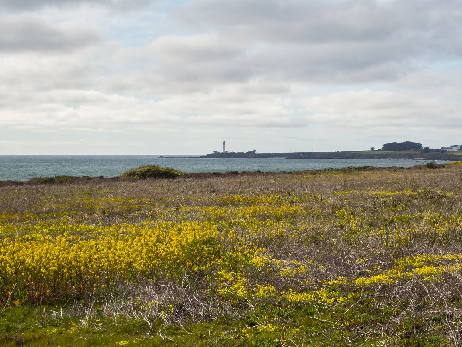
A scenery photo of Pigeon Point Lighthouse (center), yellow mustard flowers, the Pacific Ocean, and clouds. The photo was shot at Gazos Creek State Beach.
Approximate GPS location (type into Google): 37° 10' 00" N 122° 21' 43" W
A scenery photo of seagulls, clouds, the Pacific Ocean, and Gazos Creek State Beach.
Approximate GPS location (type into Google): 37° 09' 52" N 122° 21' 47" W
A black and white process of the photo above.
A scenery photo of clouds, green hills, trees, the Pacific Ocean (left), Gazos Creek State Beach, and yellow mustard flowers (in the distance).
Approximate GPS location (type into Google): 37° 09' 54" N 122° 21' 48" W
A scenery photo of yellow mustard flowers, grass, mountains, clouds, and the Pacific Ocean (right). The photo is from Pigeon Point Bluffs on the side of State Route 1.
Approximate GPS location (type into Google): 37° 11' 00" N 122° 23' 05" W
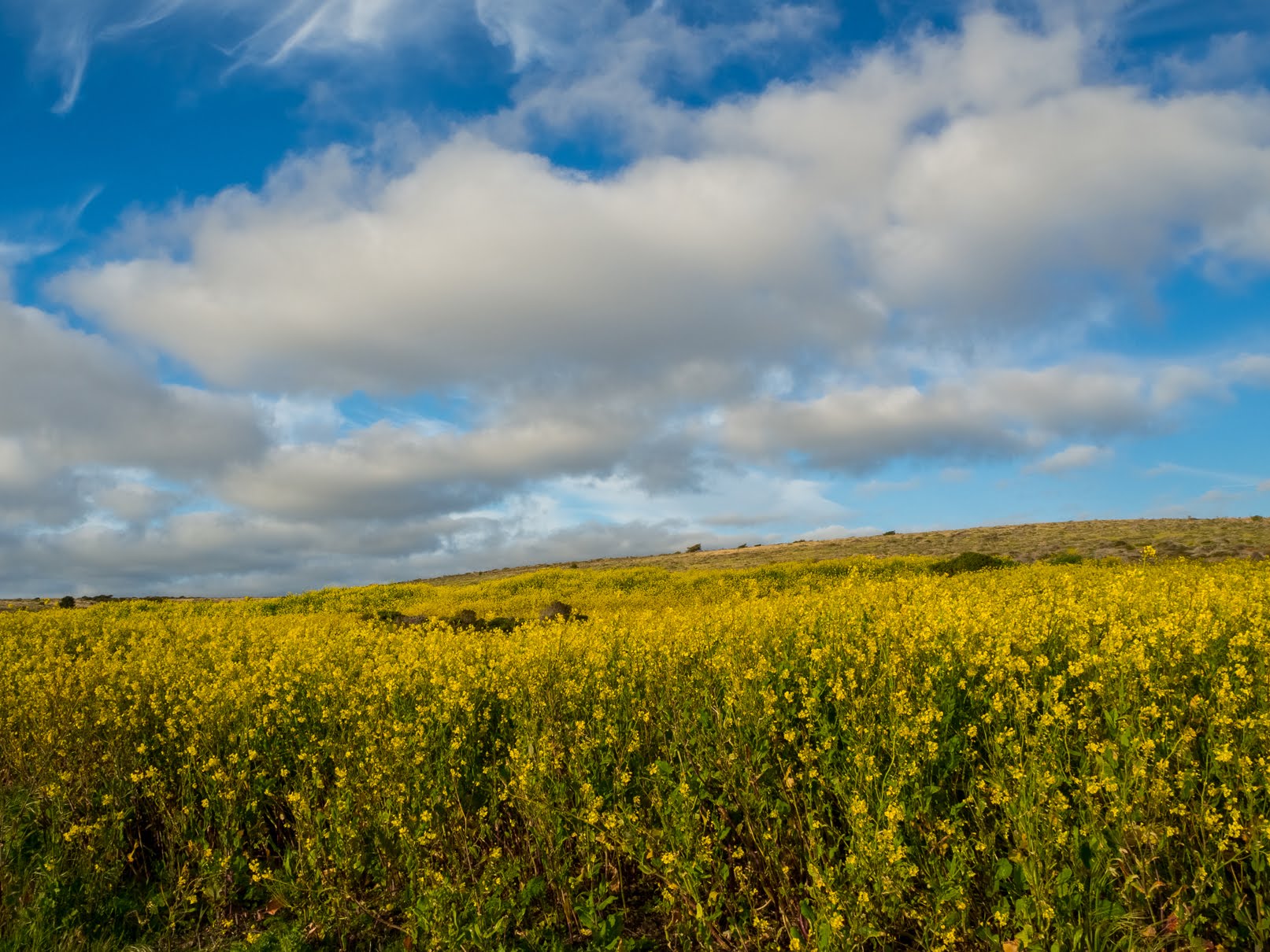
A scenery photo of yellow mustard flowers, grass, mountains, and clouds. The photo is from Pigeon Point Bluffs on the side of State Route 1.
Photo shot at the same spot as above.
A scenery photo of Wild Radish Flowers (Raphanus raphanistrum), yellow mustard flowers, grass, mountains, clouds, and the Pacific Ocean (right). The photo is from Pigeon Point Bluffs on the side of State Route 1.
Approximate GPS location (type into Google): 37° 10' 59" N 122° 23' 06" W
A scenery photo of yellow mustard flowers, Wild Radish Flowers (Raphanus raphanistrum), and clouds. The photo is from Pigeon Point Light Station State Historic Park.
Approximate GPS location (type into Google): 37° 11' 04" N 122° 23' 43" W
A scenery photo of yellow mustard flowers, Wild Radish Flowers (Raphanus raphanistrum), and clouds. The photo is from Pigeon Point Light Station State Historic Park.
Photo shot at the same spot as above.
A scenery photo of Pigeon Point Lighthouse, Sea Figs (Carpobrotus chilensis), yellow mustard flowers (in the distance on the left), a beach (right), the Pacific Ocean (right), high voltage powerlines (left), and clouds. The photo is from Pigeon Point Light Station State Historic Park.
Approximate GPS location (type into Google): 37° 11' 00" N 122° 23' 41" W
A black and white process of the photo above.
A scenery photo of yellow mustard flowers, Wild Radish Flowers (Raphanus raphanistrum), and clouds. The photo is from Pigeon Point Light Station State Historic Park.
Approximate GPS location (type into Google): 37° 11' 25" N 122° 23' 49" W
A scenery photo of yellow mustard flowers and clouds. The photo is from Pigeon Point Light Station State Historic Park.
Photo shot near the same spot as above.
A scenery photo of yellow mustard flowers and clouds. The photo is from Pigeon Point Light Station State Historic Park.
Photo shot near the same spot as above.
A scenery photo of Pigeon Point Lighthouse (center), yellow mustard flowers, Sea Figs (Carpobrotus chilensis), the Pacific Ocean (right), high voltage power lines (right), and clouds. The photo is from Pigeon Point Light Station State Historic Park.
Approximate GPS location (type into Google): 37° 11' 30" N 122° 23' 50" W
A black and white process of the photo above.
A scenery photo of Pigeon Point Lighthouse (center), yellow mustard flowers, Sea Figs (Carpobrotus chilensis), the Pacific Ocean (right), high voltage power lines (right), and clouds. The photo is from Pigeon Point Light Station State Historic Park.
Approximate GPS location (type into Google): 37° 11' 29" N 122° 23' 49" W
A scenery photo of Pigeon Point Lighthouse (center), yellow mustard flowers, Sea Figs (Carpobrotus chilensis), the Pacific Ocean (right), high voltage power lines (right), and clouds. The photo is from Pigeon Point Light Station State Historic Park.
Photo shot at the same spot as above.
A black and white process of the photo above.
A sunset scenery photo of Pescadero Marsh, mountains, and clouds. The photo was shot on North Pond Trail (on the bridge) at Pescadero Marsh in Pescadero State Beach.
Approximate GPS location (type into Google): 37° 16' 08" N 122° 24' 35" W
A black and white process of the photo above.
A sunset scenery photo of a rock with a hole in it, clouds, and the Pacific Ocean. The photo was shot at Pescadero State Beach.
Approximate GPS location (type into Google): 37° 16' 01" N 122° 24' 43" W
A black and white process of the photo above.
This is all the photos for today. I hope you have enjoyed viewing the photos! Please don't forget to share the blog post with your friends and family members! Also, if you want to get notifications when I post up more photos, "Like" us on Facebook or follow me on Instagram. These links can also be found on the top of the right sidebar.
Parts: Cellphone Photos | Olympus Photos
Copyright Warning: These photos are some of my best and most popular works of art. Unauthorized usage and reproductions are strictly prohibited. Please contact me here to purchase prints and negotiate photo licenses.