Showing posts with label pigeon point bluffs. Show all posts

Sunday, March 17, 2024

Pigeon Point Lighthouse Star Trails (Part 2) - Pescadero, CA

On 10 February 2024, my parents and I took night time trip to Shark Fin Cove and Waddell Beach in Davenport, CA and Pigeon Point Lighthouse in Pescadero, CA traveling along State Route 1. I took a lot of night time long exposures while I was there! The photos are split into 2 blog posts. I hope you enjoy viewing the photos.

High Resolution Photos: If you want to see high resolution photos of any of the photos you see here, use the following links. If you wish to purchase prints of any of the photos, please contact me here. To see my best photos from Santa Cruz to Pescadero, CA, use this link. To see my best sunset and night photos, use this link. To see all of my photos from this trip, use this link.

<< Previous Part

This is part 2 of my photos from the trip. The photos in this post were shot at Pigeon Point Bluffs and Pigeon Point Light Station State Historic Park in Pescadero, CA.

Message from the Photographer: Recently, my dad has taken up photography again, so I was teaching him how to do long exposures at night. I still can't see very well at night due to Visual Snow Syndrome, and the experimental treatment didn't completely fix it. These were all places I have been to during the day so I pretty much know what direction to shoot in. My dad did assist me as well, and I was able to compose by taking a ton of high ISO test shots (despite not being able to see much). I'm sure some of you are wondering how I'm able to do this despite my half night blindness.

After Waddell Beach in Davenport, CA, we made our way to Pigeon Point Lighthouse in Pescadero, CA. I took 1 photo at Pigeon Point Bluffs, but the lighthouse was a bit too far for my wide angle lens, so after that 1 shot, we went closer to the lighthouse.

A long exposure scenery photo with star trails, clouds, Pigeon Point Lighthouse, and the Pacific Ocean. The photo was shot at Pigeon Point Bluffs in Pescadero, CA.
EXIF Data: 34mm | f/2.8 | ISO 100 | 21 minutes 6 seconds
Approximate GPS location (type into Google): 37° 10' 59" N 122° 23' 06" W

You probably noticed the exposure at Pigeon Point Bluffs was 21 minutes long. You might be wondering what I was doing the entire time my camera was taking the photo. I play Tetris on my laptop to pass the time. 😁

We then arrive at Pigeon Point Light Station State Historic Park in Pescadero, CA. The following Pigeon Point Lighthouse photos were shot at the GPS coordinates of 37° 10' 55" N 122° 23' 34" W. Unfortunately there was no where close for me to sit down and play Tetris at this location, so I ended up just waiting boringly while the camera took the photos.

A long exposure scenery photo with star trails, clouds, Pigeon Point Lighthouse, and the Pacific Ocean (left). The photo was shot at Pigeon Point Light Station State Historic Park in Pescadero, CA.
EXIF Data: 34mm | f/2.8 | ISO 100 | 16 minutes 6 seconds

A black and white process of the photo above.

A long exposure scenery photo with star trails, clouds, Pigeon Point Lighthouse, and the Pacific Ocean (left). The photo was shot at Pigeon Point Light Station State Historic Park in Pescadero, CA.
EXIF Data: 27mm | f/2.8 | ISO 100 | 16 minutes 6 seconds

A black and white process of the photo above.

A high ISO long exposure scenery photo with stars, clouds, Pigeon Point Lighthouse, and the Pacific Ocean (left). The photo was shot at Pigeon Point Light Station State Historic Park in Pescadero, CA.
EXIF Data: 16mm | f/2.8 | ISO 1600 | 1 minute 5 seconds

A black and white process of the photo above.

A high ISO long exposure scenery photo with stars, clouds, Pigeon Point Lighthouse, and the Pacific Ocean (left). The photo was shot at Pigeon Point Light Station State Historic Park in Pescadero, CA.
EXIF Data: 16mm | f/2.8 | ISO 3200 | 30 seconds

A black and white process of the photo above.

A long exposure scenery photo with star trails, clouds, Pigeon Point Lighthouse, and the Pacific Ocean (left). The photo was shot at Pigeon Point Light Station State Historic Park in Pescadero, CA.
EXIF Data: 16mm | f/2.8 | ISO 100 | 16 minutes 6 seconds

A black and white process of the photo above.

A long exposure scenery photo with star trails, clouds, Pigeon Point Bluffs, State Route 1, and the Pacific Ocean. The photo was shot at Pigeon Point Light Station State Historic Park in Pescadero, CA.
EXIF Data: 34mm | f/2.8 | ISO 100 | 14 minutes 1 second
Approximate GPS location (type into Google): 37° 10' 56" N 122° 23' 34" W

Next, my dad and I decided to switch to a different spot in Pigeon Point Light Station State Historic Park. The following photos were shot near Pigeon Point Road.

A high ISO long exposure scenery photo with stars, clouds, Pigeon Point Lighthouse, high voltage powerlines (left), and the Pacific Ocean (right). The photo was shot near Pigeon Point Road at Pigeon Point Light Station State Historic Park in Pescadero, CA.
EXIF Data: 34mm | f/2.8 | ISO 2500 | 30 seconds
Approximate GPS location (type into Google): 37° 11' 00" N 122° 23' 41" W

A black and white process of the photo above.

A high ISO long exposure scenery photo with stars, clouds, Pigeon Point Lighthouse, high voltage powerlines (left), and the Pacific Ocean (right). I lit up the foreground a little bit using my headlamp. The photo was shot near Pigeon Point Road at Pigeon Point Light Station State Historic Park in Pescadero, CA.
EXIF Data: 34mm | f/2.8 | ISO 2500 | 30 seconds
The photo was shot at the same spot as above.

This is all the photos for today. I hope you have enjoyed viewing the photos! Please don't forget to share the blog post with your friends and family members! Also, if you want to get notifications when I post up more photos, "Like" us on Facebook or follow me on Instagram. These links can also be found on the top of the right sidebar.

<< Previous Part

Saturday, April 22, 2023

Flowers Along State Route 1 (Pescadero, CA)

On 5 April 2023, my parents and I drove along State Route 1 in search of flower viewing opportunities. We drove from Santa Cruz to Half Moon Bay (the last of my photos are from Pescadero State Beach). I took photos with my cellphones and mirrorless camera. The photos are split into 2 blog posts. I hope you enjoy viewing my photos!

High Resolution Photos: If you want to see high resolution photos of any of the photos you see here, use the following links. If you wish to purchase prints of any of the photos, please contact me here. To see my best photos from State Route 1 (from Pescadero to Big Sur), use this link. To see my best flower photos from 2019 to 2023, use this link. To see all of my photos from this trip, use this link.

Parts: Cellphone Photos | Olympus Photos

These photos were shot on my Olympus mirrorless camera. The photos are from Gazos Creek State Beach, Pigeon Point Light Station State Historic Park, and Pescadero State Beach in Pescadero, CA.

A scenery photo of Pigeon Point Lighthouse (center), yellow mustard flowers, the Pacific Ocean, and clouds. The photo was shot at Gazos Creek State Beach.
Approximate GPS location (type into Google): 37° 10' 00" N 122° 21' 43" W

A scenery photo of seagulls, clouds, the Pacific Ocean, and Gazos Creek State Beach.
Approximate GPS location (type into Google): 37° 09' 52" N 122° 21' 47" W

A black and white process of the photo above.

A scenery photo of clouds, green hills, trees, the Pacific Ocean (left), Gazos Creek State Beach, and yellow mustard flowers (in the distance).
Approximate GPS location (type into Google): 37° 09' 54" N 122° 21' 48" W

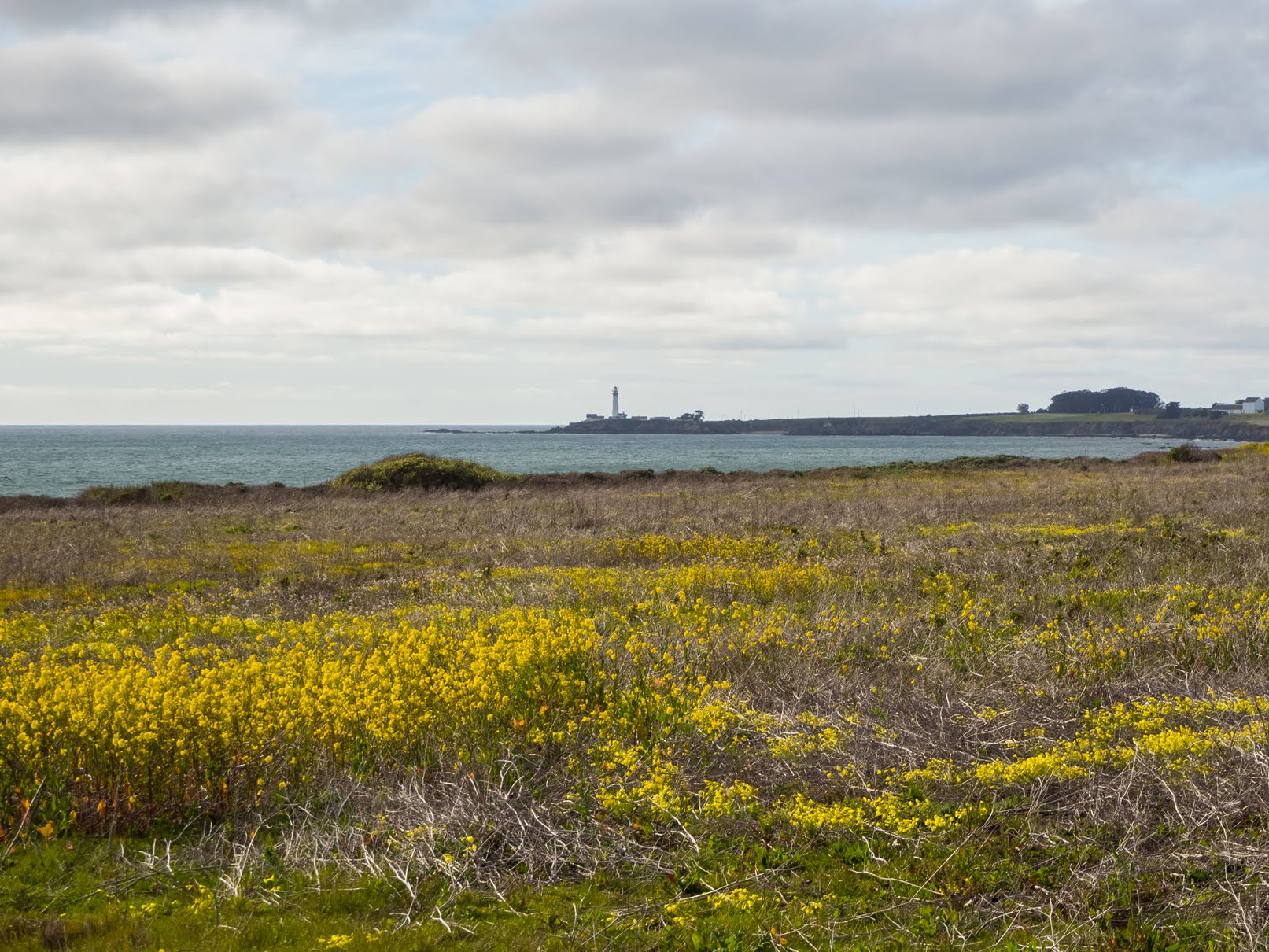
A scenery photo of yellow mustard flowers, grass, mountains, clouds, and the Pacific Ocean (right). The photo is from Pigeon Point Bluffs on the side of State Route 1.
Approximate GPS location (type into Google): 37° 11' 00" N 122° 23' 05" W

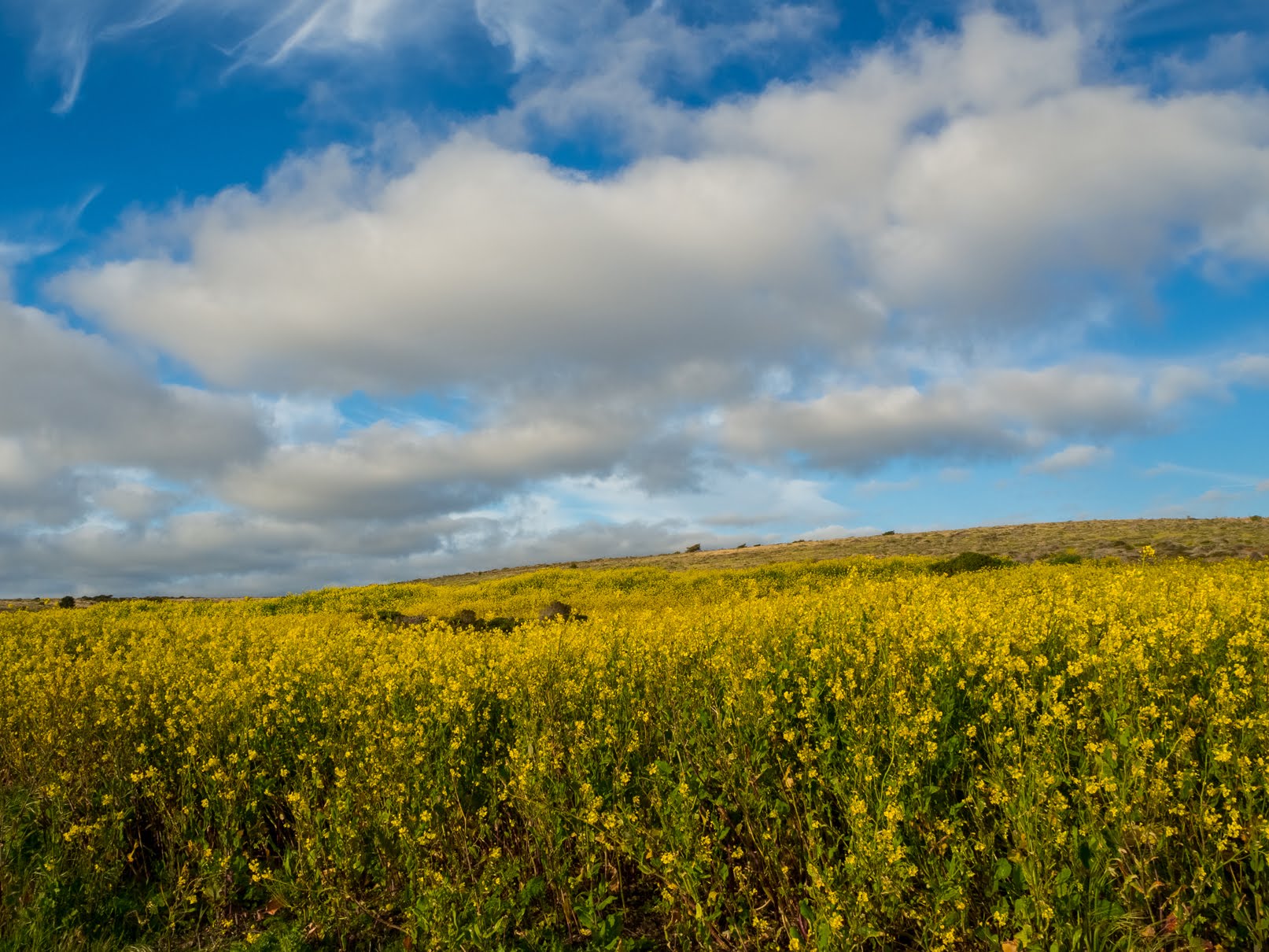
A scenery photo of yellow mustard flowers, grass, mountains, and clouds. The photo is from Pigeon Point Bluffs on the side of State Route 1.
Photo shot at the same spot as above.

A scenery photo of Wild Radish Flowers (Raphanus raphanistrum), yellow mustard flowers, grass, mountains, clouds, and the Pacific Ocean (right). The photo is from Pigeon Point Bluffs on the side of State Route 1.
Approximate GPS location (type into Google): 37° 10' 59" N 122° 23' 06" W

A scenery photo of yellow mustard flowers, Wild Radish Flowers (Raphanus raphanistrum), and clouds. The photo is from Pigeon Point Light Station State Historic Park.
Approximate GPS location (type into Google): 37° 11' 04" N 122° 23' 43" W

A scenery photo of yellow mustard flowers, Wild Radish Flowers (Raphanus raphanistrum), and clouds. The photo is from Pigeon Point Light Station State Historic Park.
Photo shot at the same spot as above.

A scenery photo of Pigeon Point Lighthouse, Sea Figs (Carpobrotus chilensis), yellow mustard flowers (in the distance on the left), a beach (right), the Pacific Ocean (right), high voltage powerlines (left), and clouds. The photo is from Pigeon Point Light Station State Historic Park.
Approximate GPS location (type into Google): 37° 11' 00" N 122° 23' 41" W

A black and white process of the photo above.

A scenery photo of yellow mustard flowers, Wild Radish Flowers (Raphanus raphanistrum), and clouds. The photo is from Pigeon Point Light Station State Historic Park.
Approximate GPS location (type into Google): 37° 11' 25" N 122° 23' 49" W

A scenery photo of yellow mustard flowers and clouds. The photo is from Pigeon Point Light Station State Historic Park.
Photo shot near the same spot as above.

A scenery photo of yellow mustard flowers and clouds. The photo is from Pigeon Point Light Station State Historic Park.
Photo shot near the same spot as above.

A scenery photo of Pigeon Point Lighthouse (center), yellow mustard flowers, Sea Figs (Carpobrotus chilensis), the Pacific Ocean (right), high voltage power lines (right), and clouds. The photo is from Pigeon Point Light Station State Historic Park.
Approximate GPS location (type into Google): 37° 11' 30" N 122° 23' 50" W

A black and white process of the photo above.

A scenery photo of Pigeon Point Lighthouse (center), yellow mustard flowers, Sea Figs (Carpobrotus chilensis), the Pacific Ocean (right), high voltage power lines (right), and clouds. The photo is from Pigeon Point Light Station State Historic Park.
Approximate GPS location (type into Google): 37° 11' 29" N 122° 23' 49" W

A scenery photo of Pigeon Point Lighthouse (center), yellow mustard flowers, Sea Figs (Carpobrotus chilensis), the Pacific Ocean (right), high voltage power lines (right), and clouds. The photo is from Pigeon Point Light Station State Historic Park.
Photo shot at the same spot as above.

A black and white process of the photo above.

A sunset scenery photo of Pescadero Marsh, mountains, and clouds. The photo was shot on North Pond Trail (on the bridge) at Pescadero Marsh in Pescadero State Beach.
Approximate GPS location (type into Google): 37° 16' 08" N 122° 24' 35" W

A black and white process of the photo above.

A sunset scenery photo of a rock with a hole in it, clouds, and the Pacific Ocean. The photo was shot at Pescadero State Beach.
Approximate GPS location (type into Google): 37° 16' 01" N 122° 24' 43" W

A black and white process of the photo above.

This is all the photos for today. I hope you have enjoyed viewing the photos! Please don't forget to share the blog post with your friends and family members! Also, if you want to get notifications when I post up more photos, "Like" us on Facebook or follow me on Instagram. These links can also be found on the top of the right sidebar.

Parts: Cellphone Photos | Olympus Photos

Copyright Warning: These photos are some of my best and most popular works of art. Unauthorized usage and reproductions are strictly prohibited. Please contact me here to purchase prints and negotiate photo licenses.

Friday, August 18, 2017

August Cellphone Photos

If you follow me here a lot, you probably noticed I've became pretty quiet on this blog and my social media pages. That is because I have been extremely busy this past couple months with travel, photography, videos, and most of the time, with some other things I've also been working on. I haven't had much time to write blog posts or interact on my social media pages. With that said, I finally found some time to do some blogging and posting. I hope you enjoy viewing the photos.

In this blog post, I will be showing you cellphone photos from my travels in August.

Once I have the DSLR photos, drone photos, drone videos from my trips posted, I'll link the blog posts here. As you probably guessed, processing them also got pushed back from how busy I have been.

Blog Posts & Videos:
Photo shot at Pigeon Point Bluffs on the side of State Route 1 in Pescadero, CA on August 1st, 2017.

Pigeon Point Lightouse in fog.
Photo shot at Pigeon Point Bluffs on the side of State Route 1 in Pescadero, CA on August 1st, 2017. 

Photo shot at Pigeon Point Bluffs on the side of State Route 1 in Pescadero, CA on August 1st, 2017. 

 Photo shot at Pigeon Point Bluffs on the side of State Route 1 in Pescadero, CA on August 1st, 2017.

Lotus corniculatus Flowers
Photo shot at Pigeon Point Bluffs on the side of State Route 1 in Pescadero, CA on August 1st, 2017. 

Photo shot at Pigeon Point Bluffs on the side of State Route 1 in Pescadero, CA on August 1st, 2017. 

Pigeon Point Lightouse in fog.
Photo shot at Pigeon Point Bluffs on the side of State Route 1 in Pescadero, CA on August 1st, 2017. 

 Photo shot on the side of State Route 1 in Monterey County, CA on August 10th, 2017.

Photo shot in Alviso Adobe Community Park in Pleasanton, CA on August 14th, 2017.

 The park contains the oldest house in Pleasanton, CA.
Photo shot in Alviso Adobe Community Park in Pleasanton, CA on August 14th, 2017.

 The park contains the oldest house in Pleasanton, CA.
Photo shot in Alviso Adobe Community Park in Pleasanton, CA on August 14th, 2017.

 A selfie under a tree in the park.
Photo shot in Alviso Adobe Community Park in Pleasanton, CA on August 14th, 2017.

The wind messed up my hair. :(
Photo shot in Alviso Adobe Community Park in Pleasanton, CA on August 14th, 2017. 

 Photo shot in Alviso Adobe Community Park in Pleasanton, CA on August 14th, 2017.

 Pumpkins in the vegetable garden in the park.
Photo shot in Alviso Adobe Community Park in Pleasanton, CA on August 14th, 2017.

 Cacti in the park.
Photo shot in Alviso Adobe Community Park in Pleasanton, CA on August 14th, 2017.

The park contains the oldest house in Pleasanton, CA.
Photo shot in Alviso Adobe Community Park in Pleasanton, CA on August 14th, 2017. 

Cacti in the park.
Photo shot in Alviso Adobe Community Park in Pleasanton, CA on August 14th, 2017. 

Photo shot in Alviso Adobe Community Park in Pleasanton, CA on August 14th, 2017.

This is all the photos for today. I hope you have enjoyed viewing the photos! Please don't forget to share the blog post with your friends and family members! Also, if you want to get notifications when I post up more photos, "Like" us on Facebook or follow me on Twitter and Instagram. These links can also be found on the top of the right sidebar.