Showing posts with label waves. Show all posts

Sunday, February 4, 2024

State Route 1 (Sand City, Carmel, Garrapata SP) - California

On 13 January 2024, my parents and I took a drive along State Route 1 traveling to Bixby Creek Bridge in Monterey County, CA. It was overcast that day and the lighting wasn't too good for photos, so I didn't take much. I hope you enjoy viewing my photos!

High Resolution Photos: If you want to see high resolution photos of any of the photos you see here, use the following links. If you wish to purchase prints of any of the photos, please contact me here. To see all of my photos from this trip, use this link.

A scenery photo of Sand City Beach, the Pacific Ocean, mountains (in the distance), and clouds. The photo was shot at the end of Tioga Avenue in Sand City, CA.
Approximate GPS location (type into Google): 36° 37' 08" N 121° 51' 03" W

A scenery photo of waves, the Pacific Ocean, and clouds. The photo was shot at the end of Tioga Avenue in Sand City, CA.
The photo was shot near the same spot as above.

A scenery photo of waves, the Pacific Ocean, and clouds. The photo was shot at the end of Tioga Avenue in Sand City, CA.
Approximate GPS location (type into Google): 36° 37' 08" N 121° 51' 02" W

A black and white process of the photo above.

A scenery photo of Carmel-By-The-Sea, CA, clouds, the Pacific Ocean, and hills. The photo was shot at Monastery Beach.
Approximate GPS location (type into Google): 36° 31' 21" N 121° 55' 47" W

A black and white process of the photo above.

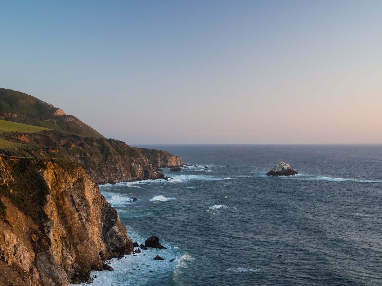
A scenery photo of the Pacific Ocean and clouds. The photo was shot on the side of State Route 1 near Gate 1 of Garrapata State Park in Monterey County, CA.
Approximate GPS location (type into Google): 36° 28' 15" N 121° 56' 04" W

A black and white process of the photo above.

A scenery photo of the Pacific Ocean, clouds, and a rock. The photo was shot on the side of State Route 1 near Gate 3 of Garrapata State Park in Monterey County, CA.
Approximate GPS location (type into Google): 36° 28' 09" N 121° 55' 57" W

A scenery photo of rocks, the Pacific Ocean, clouds, and bushes. The photo was shot on the side of State Route 1 near Gate 3 of Garrapata State Park in Monterey County, CA.
The photo was shot near the same spot as above.

A black and white process of the photo above.

This is all the photos for today. I hope you have enjoyed viewing the photos! Please don't forget to share the blog post with your friends and family members! Also, if you want to get notifications when I post up more photos, "Like" us on Facebook or follow me on Instagram. These links can also be found on the top of the right sidebar.

Saturday, April 29, 2023

Bixby Creek Bridge & Coast Road (Part 2) - Monterey County, CA

On 18 April 2023, my mom and I drove along State Route 1 in Monterey County, CA. We visited Garrapata State Park and Bixby Creek Bridge. I took photos with my cellphones and mirrorless camera. The photos are split into 3 blog posts. I hope you enjoy viewing my photos!

High Resolution Photos: If you want to see high resolution photos of any of the photos you see here, use the following links. If you wish to purchase prints of any of the photos, please contact me here. To see my best photos from State Route 1, use this link. To see my best flower photos from 2019 to 2023, use this link. To see my best sunset, sunrise, and night photography photos from 2019 to 2023, use this link. To see all of my photos from this trip, use this link.

Parts: Cellphone Photos | Olympus Part 1 | Olympus Part 2

These photos were shot on my Olympus mirrorless camera. The photos are from Bixby Creek Bridge and Coast Road in Monterey County, CA. After Garrapata State Park, my mom and I drove towards Bixby Creek Bridge, which was the last stop for the day before we headed home. I also took a short walk on Coast Road (near Bixby Creek Bridge).

Please note Coast Road was closed on the day I went, and I did walk into the closed area. There was a small, but constant flow of sand, small pebbles, and small rocks coming down on parts of the rock face. This is risky, and the road is closed for a reason. If you walk onto the road, please assess the risks yourself before walking into a closed area. You access closed areas at your own risk. You could become trapped under a rockslide or your return path could be blocked off by a rockslide. You could die!

A scenery photo of the Bixby Creek Bridge (part of State Route 1), Coast Road (right), a valley, and the Pacific Ocean. This photo was shot at Bixby Creek Bridge Vista Point on the side of Coast Road in Monterey County, CA.
Approximate GPS location (type into Google): 36° 22' 31" N 121° 53' 54" W

A black and white process of the photo above.

A scenery photo of the Bixby Creek Bridge (part of State Route 1), Coast Road (right), a valley, and the Pacific Ocean. This photo was shot at Bixby Creek Bridge Vista Point on the side of Coast Road in Monterey County, CA.
Photo shot at the same spot as above.

A scenery photo of the Bixby Creek Bridge (part of State Route 1), Coast Road (right), wild flowers (bottom), a valley, and the Pacific Ocean. This photo was shot on Coast Road in Monterey County, CA.
Approximate GPS location (type into Google): 36° 22' 30" N 121° 53' 47" W

A scenery photo of the Bixby Creek Bridge (part of State Route 1), Coast Road (right), a valley, and the Pacific Ocean. This photo was shot on Coast Road in Monterey County, CA.
Photo shot at the same spot as above.

A black and white process of the photo above.

A scenery photo of the Bixby Creek Bridge (part of State Route 1), Coast Road (right), a valley, and the Pacific Ocean. This photo was shot on Coast Road in Monterey County, CA.
Approximate GPS location (type into Google): 36° 22' 30" N 121° 53' 48" W

A black and white process of the photo above.

A scenery photo of the Bixby Creek Bridge (part of State Route 1), Coast Road (right), a valley, and the Pacific Ocean. This photo was shot on Coast Road in Monterey County, CA.
Photo shot at the same spot as above.

Next, are a few photos shot during sunset near the Bixby Creek Bridge on the side of State Route 1.

A sunset scenery photo of the Pacific Ocean, rocks, a hill, and cliffs. The photo was shot near the Bixby Creek Bridge on the side of State Route 1.
Approximate GPS location (type into Google): 36° 22' 21" N 121° 54' 10" W

An abstract long exposure photo of a beach, waves, rocks, and a cliff. The photo was shot during sunset near the Bixby Creek Bridge on the side of State Route 1.
Photo shot at the same spot as above.

A black and white process of the photo above.

An abstract long exposure photo of a beach, waves, rocks, and a cliff. The photo was shot during sunset near the Bixby Creek Bridge on the side of State Route 1.
Photo shot at the same spot as above.

This is all the photos for today. I hope you have enjoyed viewing the photos! Please don't forget to share the blog post with your friends and family members!Also, if you want to get notifications when I post up more photos, "Like" us on Facebook or follow me on Instagram. These links can also be found on the top of the right sidebar.

Parts: Cellphone Photos | Olympus Part 1 | Olympus Part 2

Monday, July 16, 2012

Point Lobos State Reserve (HDR Scenery)

I recently visited Monterey and went south a bit more also visiting Carmel-by-the-Sea, Point Lobos State Reserve, and Big Sur. This trip along California's beautiful coastline has lead me take many many beautiful photos! I am here to share them with you spread over several blog posts. I hope you enjoy viewing the photos!

Before I get started, I would just like to remind you that I made a Facebook Fan page for this photography blog. You can "Like Us" here. I have also made Google+ and Twitter pages. If you follow or "Like" me on these, you can be updated whenever I post something new! :) Please invite your friends too! I'm trying to get more viewers on here. Anyways, as always, enjoy my photos!

Full Resolution Photos and Prints: If you want to see full resolution photos or buy prints of any of the photos you see, they are up on my portfolio for viewing. To view the best photos from this trip, use this link. To view all of the photos from this trip, use this link.

Parts
Point Lobos: Birds and Seals | Squirrels | Flowers and Misc | HDR Scenery | Regular Scenery
Fisherman's Wharf - Monterey, CA: George's Birds | Sapporo Sushi & Steakhouse | Scenery | Birds/Misc Seagulls
Carmel-By-The-Sea: Photos
The photos today are the HDR sceneries I did at Point Lobos State Reserve. The HDR compositions were combined using Adobe Photoshop. About half of my HDR sequences were ruined because the waves moved too fast so the photos had too much of a difference to be combined, but I did have a few good ones. I hope you enjoy viewing these! I have also put a few photography tips in this post, make sure you read them! :)

Thought the rock formations and flowers looked cool. 

Photography Tip: The best places to take HDR photos is when there are a lot of colors around. See how in in the above photos there are blue, white, yellow, green, and some oranges? When choosing where to take an HDR sequence, you want to choose a place with lot's of colors. 

Rocks and ocean. the reason the water looks so transparent is because I used a polarizing filter on the photos. 

Photography Tip: I know I've gave this tip on a previous post of mine, but here it is again. Polarizing filters can help remove glare from water and shiny surfaces (like glass). The filters can also help saturate the colors in your photos especially blue skies. If you take a lot of scenery photos, a polarizer filter is highly recommended. Please note that that like most filters (except UV) cut out light, which means you must compensate with either: longer exposures, higher ISO, or wider apertures. Polarizing filters usually cut about 1-3 steps of light. It is also recommended that you aim for the filters that cost over $60 as cheaper filters may cause unwanted glare or uneven filtering. Remember, you get what you pay for! My favorite brands are B+W and Hoya. Both companies make very high quality optics. Please also pay close attention to the filter size of your lens if you are purchasing one.


 Not a lot of comments today about the photos. LOL


I hope you have enjoyed viewing these HDR compositions! Next time I will post the regular scenery photos I took at Point Lobos so please check back soon! Please don't forget to share my blog posts with your friends! If you would like to get notifications next time I post, you can "Like" me on Facebook or follow me on Twitter and Google+. These links can also be found on the top of the right sidebar.

Parts
Point Lobos: Birds and Seals | Squirrels | Flowers and Misc | HDR Scenery | Regular Scenery
Fisherman's Wharf - Monterey, CA: George's Birds | Sapporo Sushi & Steakhouse | Scenery | Birds/Misc Seagulls
Carmel-By-The-Sea: Photos