Showing posts with label pillar point. Show all posts

Sunday, April 27, 2025

El Granada King Tide Event (Part 2)

On the 15th December 2024, my parents and I went to the King Tide event in El Granada, CA near Half Moon Bay, CA. We viewed the event from Maverick's Beach in El Granada, CA. I was able to take many photos of sunset, dusk, the extreme low tide, and the tide pools. I took photos with my Olympus mirrorless camera, and the photos are split into 2 posts. I hope you enjoy viewing my photos!

High Resolution Photos: If you want to see high resolution photos of any of the photos you see here, use the following links. If you wish to purchase prints of any of the photos, please contact me here. To view my best Half Moon Bay & El Granada photos, use this link. To see my best sunset and night photography photos, use this link. To see all of my photos from this trip, use this link.

<< Previous Post

This is part 2 of the photos. The photos are of dusk and night time long exposures. All of the photos are from Mavericks Beach in El Granada, CA.

Message from the Photographer: Long COVID really slowed my photo processing, but I'm glad I can finally post these photos!

A dusk scenery photo with clouds, tidepools, Pillar Point (right), people, and rocks.
Approximate GPS location (type into Google): 37° 29' 41" N 122° 29' 52" W

A black and white process of the photo above.

A dusk scenery photo with clouds, tidepools, Pillar Point, and people.
The photo was shot at the same spot as above.

A dusk scenery photo with tidepools, mountains, breakwater (left), people (right), and clouds.
Approximate GPS location (type into Google): 37° 29' 40" N 122° 29' 52" W

A dusk scenery photo with tidepools, mountains, breakwater (right), Pillar Point (left), people, El Granada (in the distance in the center), and clouds.
Approximate GPS location (type into Google): 37° 29' 41" N 122° 29' 52" W

A dusk scenery photo with clouds, tidepools, rocks, and people.
The photo was shot at the same spot as above.

A black and white process of the photo above.

A dusk scenery photo with clouds, tidepools, rocks, and people.
The photo was shot at the same spot as above.

A dusk scenery photo with clouds, tidepools, people, and rocks.
Approximate GPS location (type into Google): 37° 29' 43" N 122° 29' 49" W

A dusk scenery photo with clouds, tidepools, people, and rocks.
The photo was shot at the same spot as above.

A night time long exposure of moon rise over El Granada, clouds, boats, mountains, and breakwater.
Approximate GPS location (type into Google): 37° 29' 45" N 122° 29' 42" W

A night time long exposure of moon rise over El Granada, clouds, boats, mountains, and breakwater.
Approximate GPS location (type into Google): 37° 29' 46" N 122° 29' 42" W

A night time long exposure of moon rise over El Granada, clouds, boats, mountains, breakwater, and rocks (bottom).
Approximate GPS location (type into Google): 37° 29' 46" N 122° 29' 41" W

A black and white process of the photo above.

This is all the photos for today. I hope you have enjoyed viewing the photos! Please don't forget to share the blog post with your friends and family members! Also, if you want to get notifications when I post up more photos, "Like" us on Facebook or follow me on Instagram. These links can also be found on the top of the right sidebar.

<< Previous Post

Sunday, October 6, 2024

Half Moon Bay, CA (Cellphone Photos)

Yesterday, on 5th October 2024, my parents and I went for on a trip to Half Moon Bay, CA, spending most of our time at Francis Beach in Half Moon Bay State Beach. We had a heat wave inland, plus I needed some outdoors time due to claustrophobia. I hope you enjoy viewing my photos!

Message from the Photographer: I have been struggling with long COVID since November 2023, and I have been dealing with chronic fatigue and many other health problems. I'm mostly house bound and frequently bedridden these days. Unfortunately, claustrophobia hits hard quite frequently. Yesterday, I had a little bit more energy than usual so I decided to go for a trip to Half Moon Bay, plus it was way too hot inland due to the heat wave. I didn't bring any camera equipment with me (I have too little energy for that), but was able to take a few photos with my phone.

The destination for this trip was Francis Beach in Half Moon Bay State Beach. We weren't the only ones with the idea to go to the beach to escape the heat wave inland. There were so many people and the beach was crowded!

A scenery photo of Francis Beach, people, and Pacific Ocean (right).

A scenery photo of Francis Beach, people, Pillar Point & El Granada (in the distance), and Pacific Ocean.

A scenery photo of the volleyball courts at Francis Beach, people, and Pacific Ocean (right).

A scenery photo of Francis Beach, people, El Granada (in the distance on the left), mountains (in the distance), and Pacific Ocean (left).

A scenery photo of mountains, trees, and houses shot on Half Moon Bay Coastal Trail near Francis Beach.

A scenery photo of mountains, trees, and houses shot on Half Moon Bay Coastal Trail near Francis Beach.

A scenery photo of Francis Beach, volleyball courts, people, Pillar Point & El Granada (in the distance), mountains (in the distance on the right), and Pacific Ocean.

Next, I was hungry, so my parents and I walked over to Taqueria Tres Amigos at the intersection of Kelly Avenue and State Route 1 for dinner. We didn't drive because we didn't want to lose our parking space. The food was delicious, and they had a number of vegetarian options available. It was sunset by the time I finished my meal, and I took a few photos on the side of State Route 1 of the town of Half Moon Bay.

A sunset scenery photo of the town of Half Moon Bay, mountains, trees, and State Route 1.

A sunset scenery photo of the town of Half Moon Bay, buildings, trees, and State Route 1.

We then walked back to Francis Beach in Half Moon Bay State Beach to see the sunset over the Pacific Ocean.

A sunset scenery photo of Francis Beach, people, Pillar Point & El Granada (in the distance), mountains (in the distance on the right), and Pacific Ocean.

A sunset scenery photo of mountains, trees, and houses shot on near Francis Beach.

A sunset scenery photo of fog, mountains, trees, houses, Francis Beach (right), and Pacific Ocean (right).

A sunset scenery photo of fog, Francis Beach, people, Pillar Point & El Granada (in the distance), mountains (in the distance on the right), and Pacific Ocean.

This is all the photos for today. I hope you have enjoyed viewing the photos! Please don't forget to share the blog post with your friends and family members! Also, if you want to get notifications when I post up more photos, "Like" us on Facebook or follow me on Instagram. These links can also be found on the top of the right sidebar.

Saturday, June 4, 2022

El Granada, CA (Cellphone Photos)

On 24 May 2022, my mom and I took a day trip to El Granada, CA. We went to Pillar Point Bluff, Pillar Point, and West Shoreline Access. I took a few cellphone photos which I will show you in this blog post. I hope you enjoy viewing the photos.

A scenery photo of Ross Cove and Pillar Point Air Force Station (in the distance). Photo shot at Pillar Point Bluff.

A scenery photo of Ross Cove and Pillar Point Air Force Station. Photo shot at Pillar Point Bluff.

A scenery photo of Pillar Point Air Force Station. Photo shot at Pillar Point Bluff.

A scenery photo of Ross Cove. Photo shot at Pillar Point Bluff.

A scenery photo of Ross Cove and Pillar Point Air Force Station. Photo shot at Pillar Point Bluff.

A photo of California Brown Pelicans (Pelecanus occidentalis californicus) from Ross Cove. Photo shot at Pillar Point Bluff.

A scenery photo of Pillar Point Marsh and El Granada, CA shot near Pillar Point Air Force Station.

A scenery photo of Pillar Point Marsh and El Granada, CA shot near Pillar Point Air Force Station.

A scenery photo of El Granada, CA shot near Pillar Point Air Force Station.

A scenery photo of Pillar Point Air Force Station.

A scenery photo of El Granada, CA shot at West Shoreline Access.

This is all the photos for today. I hope you have enjoyed viewing the photos! Please don't forget to share the blog post with your friends and family members! Also, if you want to get notifications when I post up more photos, "Like" us on Facebook or follow me on Twitter and Instagram. These links can also be found on the top of the right sidebar.

Saturday, May 28, 2022

Moss Beach, CA (Cellphone Photos)

On 22 May 2022, my parents and I took a day trip to Moss Beach, CA. We went to Pillar Point Bluff and Fitzgerald Marine Reserve. I took a few cellphone photos which I will show you in this blog post. I hope you enjoy viewing the photos.

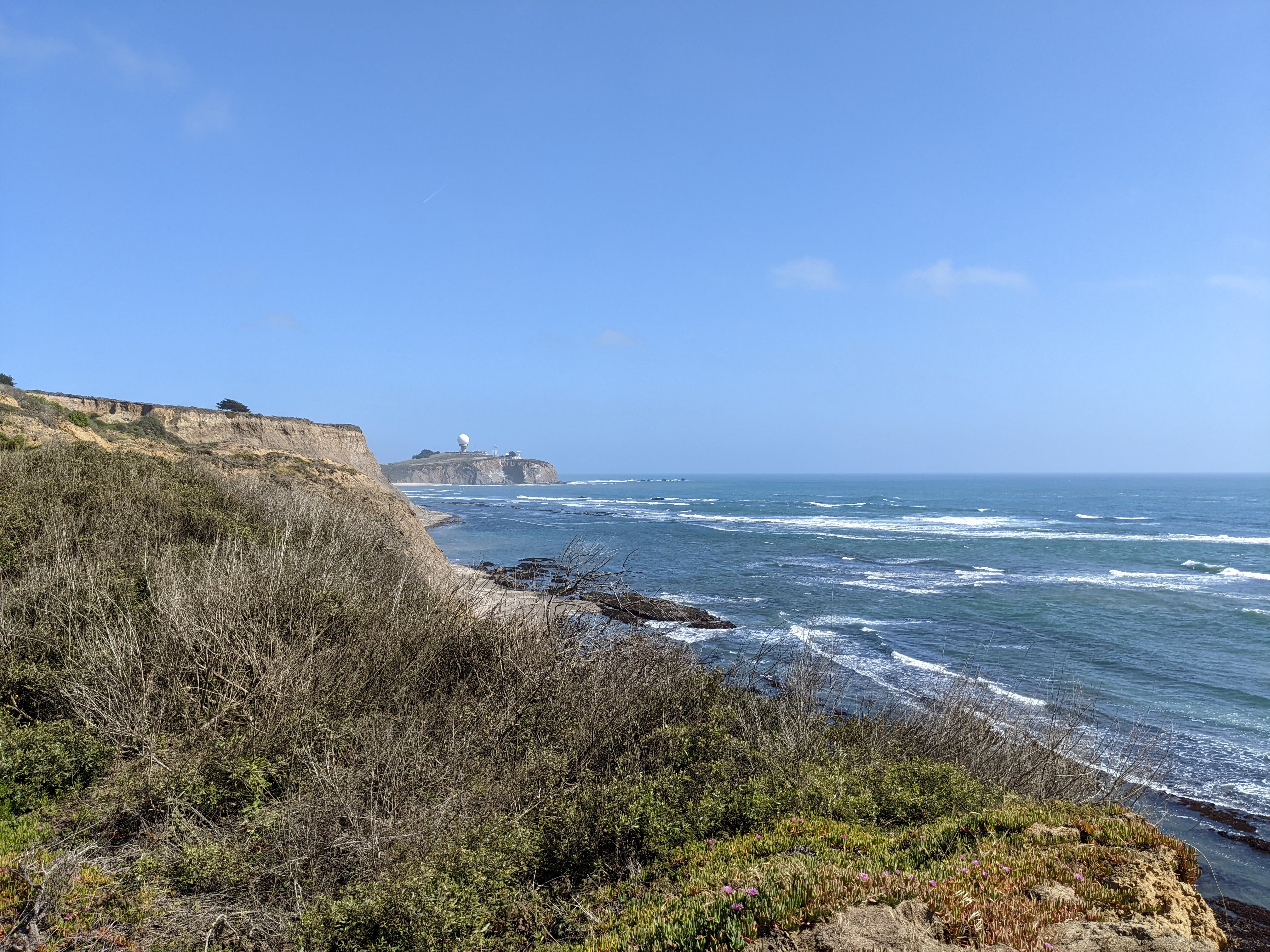
A scenery photo from Pillar Point Bluff. In the distance is the Pillar Point Air Force Station.

A scenery photo from Pillar Point Bluff. In the distance on the left is the Pillar Point Air Force Station.

Two scenery photos from the Fitzgerald Marine Reserve. The beach is Seal Cove.

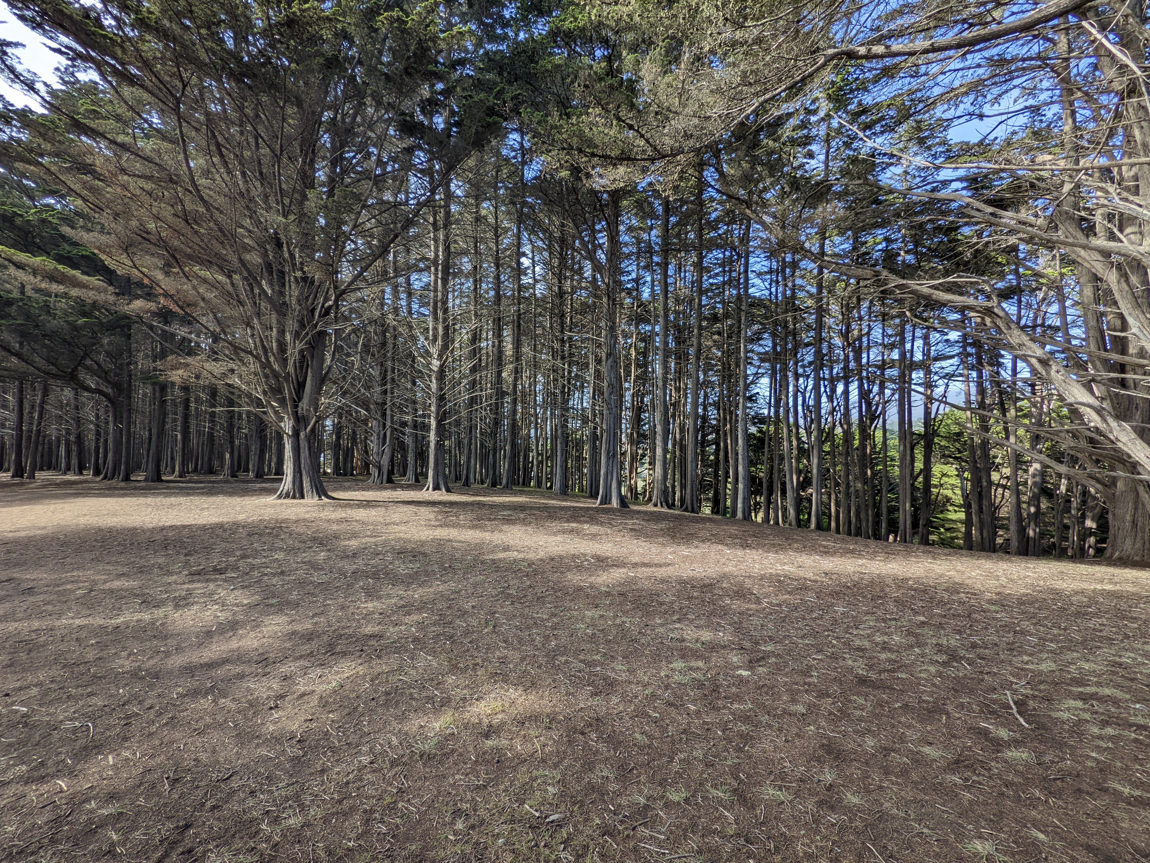
A scenery photo from the Fitzgerald Marine Reserve. Photo is of the Seal Cove Cypress Tree Tunnel.

The view of Moss Beach, CA from Fitzgerald Marine Reserve.

A scenery photo from the Fitzgerald Marine Reserve. Photo is of the Seal Cove Cypress Tree Tunnel.

A scenery photo from the Fitzgerald Marine Reserve. Someone made a chair from one of the cypress trees.

A scenery photo from Pillar Point Bluff. In the distance is the Pillar Point Air Force Station.

The view of Half Moon Bay Airport from Pillar Point Bluff.

A scenery photo from Pillar Point Bluff. In the distance on the left is El Granada, CA.

This is all the photos for today. I hope you have enjoyed viewing the photos! Please don't forget to share the blog post with your friends and family members! Also, if you want to get notifications when I post up more photos, "Like" us on Facebook or follow me on Twitter and Instagram. These links can also be found on the top of the right sidebar.

Monday, November 25, 2019

Half Moon Bay, CA

On July 27th, 2019, I took a trip to Half Moon Bay, CA. I hope you enjoy viewing the photos.

Full Resolution Photos: If you want to see full resolution photos of any of the photos you see here, use the following links. If you wish to purchase prints of any of the photos, please contact me here. To view my best Half Moon Bay photos, use this link. To view all of my photos from this trip, use this link.

Message From The Photographer: If you've been following me on social media, you'd know I've been dealing with vision impairment and gradual vision loss since August 2018. The conditions are neurological, so my vision isn't impaired the same amount on a daily basis, but overall it seems to be going down hill. It has slowed down and made taking photos, processing photos, using computers, etc... very challenging and somewhat depressing. Some days it is impossible for me to take photos or process them. I know these photos are from a very long time ago, but I'm only just starting to get around in processing them as I'm only able to work on them at a very slow pace. I hope you can understand, and I hope you enjoy viewing the photos.

Scenery of Half Moon Bay and Pillar Point Harbor (right) shot near Pillar Point.
Approximate GPS location (type into Google): 37° 30' 01" N 122° 29' 44" W

Black and white process of the photo above.

Scenery shot near Pillar Point. Photo shot near the same spot as above.

Black and white process of the photo above.

Scenery of Half Moon Bay and Pillar Point Harbor (right) shot near Pillar Point.
Approximate GPS location (type into Google): 37° 29' 57" N 122° 29' 45" W

Black and white process of the photo above.

Scenery of Mavericks Beach shot near Pillar Point.
Approximate GPS location (type into Google): 37° 29' 44" N 122° 29' 43" W

Black and white process of the photo above.

Scenery of Mavericks Beach shot near Pillar Point.
Approximate GPS location (type into Google): 37° 29' 44" N 122° 29' 55" W

Black and white process of the photo above.

Scenery from Mavericks Beach shot near Pillar Point. Photo shot near the same spot as above.

Black and white process of the photo above.

Scenery of Mavericks Beach shot near Pillar Point. Photo shot near the same spot as above.

Black and white process of the photo above.

Scenery of boats and yachts from Pillar Point Harbor.
Approximate GPS location (type into Google): 37° 30' 09" N 122° 28' 55" W

Black and white process of the photo above.

This is all the photos for today. I hope you have enjoyed viewing the photos! Also, if you want to get notifications when I post up more photos, "Like" us on Facebook or follow me on Twitter and Instagram. These links can also be found on the top of the right sidebar.