Showing posts with label san ramon. Show all posts

Thursday, February 19, 2026

Mount Diablo SP Snow & Clouds - Contra Costa County, CA (Cellphone Photos)

During night of the 17th February 2026, the San Francisco Bay Area got some very rare snow on top of the mountain peaks. On the 18th of February 2026, my mom and I went to Mount Diablo State Park in Contra Costa County, CA to see the snow. Unfortunately the road to the summit was closed at Juniper Campground. While I did get to see the snow, I did not hike the remaining 2 miles to the summit due to health complications of Long COVID. I took photos with my cellphone. I hope you enjoy viewing my photos!

Message from the Photographer: I learned the hard way how intolerant of the cold I am now with Long COVID. That was a sucky experience at Diablo Valley Overlook. I brought my winter Lake Tahoe and Yosemite clothes and gloves, and it was not enough. That amount of clothes used to be enough even in below freezing weather. This disease continues surprising me in new ways. I still stayed near the summit for close to 5 hours though, warming up in the car as needed. It snowed for around an hour while I was there, which was so fun to watch because I haven't seen snowing for years now due to this disease. I can no longer tolerate altitudes above 1500m (≈ 5000 feet).

A scenery photo of South Gate Road (left), trees, fog, clouds, mountains, and Danville (in the distance on the right).

A scenery photo of clouds, trees, mountains, and Walnut Creek & Concord (in the distance). The photo was shot from South Gate Road.

A scenery photo of clouds, fog, mountains, trees, and fog. The photo was shot from South Gate Road.

A scenery photo of picnic tables and fog. The photo was shot at Livermore Valley Overlook on Summit Road.

Next, we arrive at Diablo Valley Overlook and Juniper Campground, where Summit Road was closed due to snow. It snowed for around an hour for the 5 hours I was up there.

A scenery photo of fog, snow, Summit Road closure (left), and trees. The photo was shot at Diablo Valley Overlook.

A scenery photo of fog, snow, Summit Road closure (left), and trees. The photo was taken at Diablo Valley Overlook.

A scenery photo of fog, snow, trees, grill, picnic table (right), cars (background), car park (background). The photo taken shot at Juniper Campground.

A scenery photo of fog, snow, trees, grill (left), picnic table (right), cars (on the left in the background), car park (on the left in the background). The photo taken shot at Juniper Campground.

This photo was taken early in the day but there were still quite a lot of people there seeing the snow as well. Later in the day as people got off work, the area became even more packed.
A scenery photo of fog, cars, car park, people, trees, and Summit Road (left). The photo was taken at Diablo Valley Overlook.

A scenery photo of fog, snow, trees, and Summit Road closure (right). The photo was taken at Diablo Valley Overlook.

A scenery photo of clouds, fog, snow, mountains, and trees. The photo was taken at Diablo Valley Overlook.

A scenery photo of fog, snow, trees, and Summit Road. The photo was taken at Diablo Valley Overlook.

A scenery photo of fog, snow, Summit Road closure (left), trees, and people. The photo was shot at Diablo Valley Overlook.

A scenery photo of clouds, trees, mountains, snow, Danville (in the distance on the left), Alamo (in the distance in the center), Walnut Creek (in the distance on the right), San Francisco Bay (in the distance), and San Francisco (in the distance in the center). The photo was shot at Diablo Valley Overlook.

A scenery photo of clouds, mountains, trees, Tri-Valley Area (in the distance), and Summit Road (left). The photo was shot at Diablo Valley Overlook.

A scenery photo of clouds, mountains, trees, Alamo (in the distance on the right), Danville (in the distance in the center), San Ramon (in the distance on the left), San Francisco Bay (in the distance), and San Francisco (in the distance on the right). The photo was shot at Diablo Valley Overlook.

This is all the photos for today. I hope you have enjoyed viewing the photos! Please don't forget to share the blog post with your friends and family members! Also, if you want to get notifications when I post up more photos, "Like" us on Facebook or follow me on Instagram. These links can also be found on the top of the right sidebar.

Sunday, March 31, 2024

Glass House Museum - Forest Home Farms Historic Park (San Ramon, CA)

On 12 February 2024, my dad and I went to Dublin Hills Regional Open Space Preserve in Dublin, CA at around sunset so we can do night time long exposures of the Tri-Valley area at night. Photography here was not challenging at all even for me with my half night blindness from Visual Snow Syndrome because of how bright the city lights are! I did have to navigate the trails at night using a very powerful flashlight though. After we were done there, we also dropped by Glass House Museum at Forest Home Farms Historic Park in San Ramon, CA. On 13 February 2024, I returned again with my mom, because I didn't bring my telephoto lens the previous day. I hope you enjoy viewing my photos!

High Resolution Photos: If you want to see high resolution photos of any of the photos you see here, use the following links. If you wish to purchase prints of any of the photos, please contact me here. To see all of my photos from San Ramon, use this link.

Parts: Dublin Hills (Part 1) | Forest Home Farms Historic Park | Dublin Hills (Part 2)

This is my photo of the Glass House Museum at night. The photo was shot at Forest Home Farms Historic Park in San Ramon, CA. We dropped by after my dad and I finished taking photos at Dublin Hills Regional Preserve. The photos were shot on 12 February 2024. 

A night time long exposure of Glass House Museum achieved using light painting with a flashlight. The photo was shot at Forest Home Farms Historic Park in San Ramon, CA.
EXIF Data: 27mm | f/16 | ISO 100 | 30 seconds
Approximate GPS location (type into Google): 37° 44' 03" N 121° 56' 59" W

This is all the photos for today. I hope you have enjoyed viewing the photos! Please don't forget to share the blog post with your friends and family members! Also, if you want to get notifications when I post up more photos, "Like" us on Facebook or follow me on Instagram. These links can also be found on the top of the right sidebar.

Parts: Dublin Hills (Part 1) | Forest Home Farms Historic Park | Dublin Hills (Part 2)

Sunday, March 12, 2023

Forest Home Farms, Memorial Park, and Hidden Valley Park (Cellphone Photos) - San Ramon, CA

Yesterday, on 12 March 2023, my parents and I went to several parks in San Ramon, CA. We went to Forest Home Farms Historic Park and saw a lot of antiques. We also visited Memorial Park and Hidden Valley Park. We wanted to go see yellow mustard flowers, but they don't seem to have bloomed yet. I took photos with my cellphones. I hope you enjoy viewing the photos.

Our first stop was Forest Home Farms Historic Park in San Ramon, CA. The address of the park is at 19953 San Ramon Valley Blvd, San Ramon, CA 94583. I already went twice on week days and the Tractor Museum was closed. It was open on the weekend, so I went in to check out the vintage equipment they have housed in there as well.

A photo of vintage John Deere & McCormick-Deering Farmall farming equipment. The photo was shot in the Tractor Museum.

A photo of the San Ramon General Store Store Front (center). Also in the photo is a 1880's Surrey Horse Drawn Carriage (left). The photo was shot in the Tractor Museum.

A photo of the 1880's Surrey Horse Drawn Carriage (center). Also in the photo are vintage John Deere Farming Equipment (left) and San Ramon General Store Store Front (right). The photo was shot in the Tractor Museum.

A photo of an antique rotary payphone. The photo was shot at the San Ramon General Store Store Front in the Tractor Museum.

A photo of an antique McCaskey Cash Register. The photo was shot at the San Ramon General Store Store Front in the Tractor Museum.

A photo of an antique Coca Cola Dispenser. The photo was shot at the San Ramon General Store Store Front in the Tractor Museum.

A photo of a kerosene gas lamp. The photo was shot in the Tractor Museum.

A photo of an antique telephone. The photo was shot in the Tractor Museum.

A photo of vintage John Deere & McCormick-Deering Farmall farming equipment. The photo was shot in the Tractor Museum.

A photo of vintage McCormick-Deering Farmall farming equipment. This photo was taken in a barn in the park.

After Forest Home Farms Historic Park, my parents and I went to 4 other spots I have scouted out where you might be able to see yellow mustard flower blooms. Unfortunately, I think we were too early. We barely saw any. The next 2 photos were taken at Memorial Park and Hidden Valley Park.

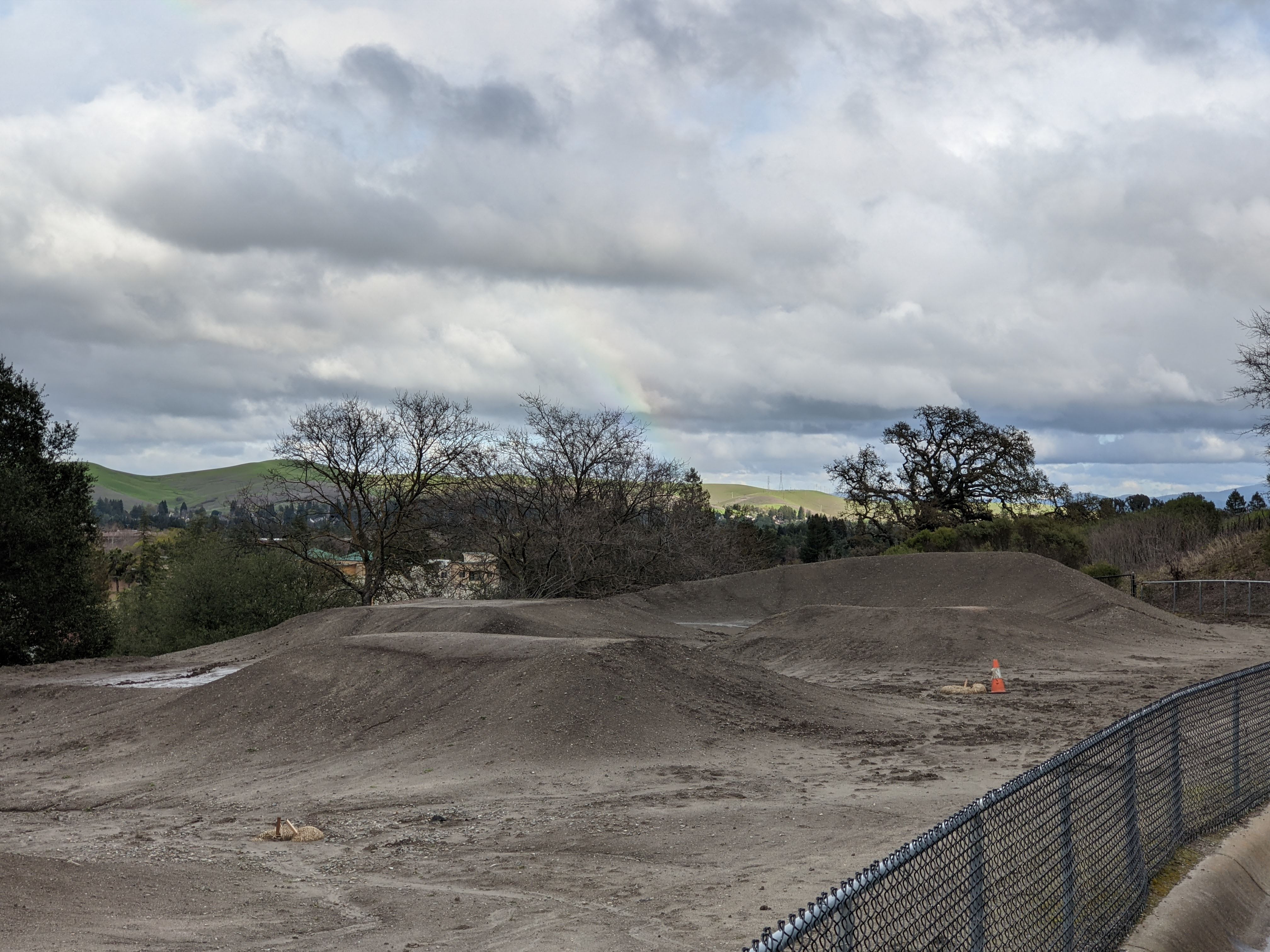
A scenery photo of a rainbow, clouds, trees, and green hills. The photo was shot at Memorial Park.

A scenery photo of clouds, cows, trees, and green hills. The photo was shot at Hidden Valley Park. The photo was shot around sunset, but it was so heavily overcast, you couldn't see it.

While on the subject of antiques and vintage equipment, look what I found in the attic! These 3 floppy disks 💾 are from my childhood. 

I had such a great time taking a trip down memory lane, because recently I got a Dell USB floppy disk drive, so I can read the information out of these things again. 😂 I haven't had a floppy drive on my computer since my old computer broke in 2016 and I replaced it. That was really fun. Yes, I am a bit of a computer geek. 🤓 You can see that I strategically placed 2 of the floppy disks with the label side down. One of those floppy disks contains Pokémon pictures I found on Google when I was a child. 😁 Too embarrassing to show. 😆

This is all the photos for today. I hope you have enjoyed viewing the photos! Please don't forget to share the blog post with your friends and family members! Also, if you want to get notifications when I post up more photos, "Like" us on Facebook or follow me on Instagram. These links can also be found on the top of the right sidebar.

Thursday, March 2, 2023

Mt. Diablo & Mission Peak Snow (Day 2) - San Ramon/Danville, CA

It is very rare to see snow in the San Francisco Bay Area, but the weather recently has been very weird. It snowed like crazy in the San Francisco Bay Area. On February 23 and 24, 2023, my mom and I went to several locations in San Ramon, CA and Danville, CA to go see snow on Mt. Diablo, Mission Peak, Mt. Allison, and more. The places we visited are Forest Home Farms Historic Park (I went to this park mainly to see the sheep and use the bathroom 😅), Bishop Ranch Regional Preserve, Memorial Park, and Sycamore Valley Regional Preserve. I took photos with my cellphones and mirrorless camera. The photos are split into 3 blog posts. I hope you enjoy viewing my photos!

Full Resolution Photos: If you want to see full resolution photos of any of the photos you see here, use the following links. If you wish to purchase prints of any of the photos, please contact me here. To see all of my photos from this trip, use this link.

Parts: Cellphone Photos | Olympus Photos (Day 1) | Olympus Photos (Day 2)

These are photos I shot on my Olympus mirrorless camera on Day 2 (February 24, 2023). The photos were shot on Morgan Drive in San Ramon, Memorial Park in San Ramon, and Sycamore Valley Regional Preserve in Danville. The second round of snow and rainstorms definitely hit the Tri-Valley area much harder compared to the first round. I had to abandon my second hike in Bishop Ranch Regional Preserve because the trails were way too steep and muddy for my comfort. The trails at Sycamore Valley Regional Preserve were almost impossible to walk on. I kept sinking in the mud, and the mud caked on my mom and I's shoes and hiking poles. You can see photos of that in my Cellphone Photos blog post (link). That Sycamore Valley hike was arduous, and I feel like my photos didn't even turn out that great.

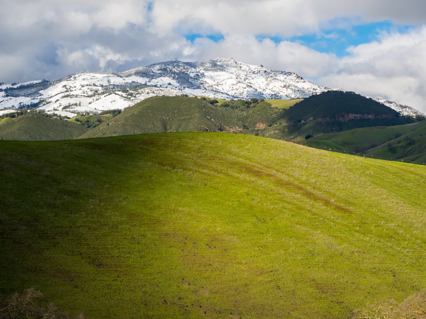
A scenery photo of Mt. Diablo covered with snow and partially obstructed by clouds, San Ramon, trees, green hills, clouds, and houses. The photo was shot on Morgan Drive in San Ramon, CA.
Approximate GPS location (type into Google): 37° 45' 00" N 121° 57' 50" W

A scenery photo of Mt. Diablo covered with snow and partially obstructed by clouds, San Ramon, trees, clouds, and green hills. The photo was shot at Memorial Park in San Ramon, CA.
Approximate GPS location (type into Google): 37° 45' 28" N 121° 58' 12" W

A black and white process of the photo above.

A scenery photo of Mt. Diablo covered with snow and partially obstructed by clouds, San Ramon, trees, clouds, and green hills. The photo was shot at Memorial Park in San Ramon, CA.
Photo shot at the same spot as above.

A scenery photo of snow covered mountains, San Ramon, trees, clouds, and green hills. The photo was shot towards Morgan Territory Regional Preserve. The photo was shot at Memorial Park in San Ramon, CA.
Photo shot at the same spot as above.

After San Ramon, my mom and I traveled to Sycamore Valley Regional Preserve in Danville, CA. The rest of my photos in this blog post are from Sycamore Valley Regional Preserve and were all shot on Short Ridge Trail.

A scenery photo of Mt. Diablo covered with snow and partially obstructed by clouds, clouds, trees, and green hills.
Approximate GPS location (type into Google): 37° 48' 49" N 121° 56' 13" W

A scenery photo of Mission Peak and Mt. Allison (center) covered with snow, Sunol Peak (right) covered with snow, cows, clouds, mountains, and green hills.
Photo shot near the same spot as above.

A scenery photo of snow covered mountains, trees, clouds, and green hills. The photo was shot towards Morgan Territory Regional Preserve.
Photo shot near the same spot as above.

A scenery photo of Mt. Diablo covered with snow and partially obstructed by clouds, clouds, trees, and green hills.
Approximate GPS location (type into Google): 37° 48' 48" N 121° 56' 13" W

A scenery photo of Mt. Diablo covered with snow, clouds, trees, and green hills.
Approximate GPS location (type into Google): 37° 48' 49" N 121° 56' 13" W

A scenery photo of Mt. Diablo covered with snow, clouds, trees, and green hills.
Photo shot near the same spot as above.

A scenery photo of Mt. Diablo covered with snow, clouds, and green hills.
Photo shot near the same spot as above.

A scenery photo of Mt. Diablo covered with snow, clouds, trees, and green hills.
Photo shot near the same spot as above.

A scenery photo of Mt. Diablo covered with snow, clouds, and green hills.
Photo shot near the same spot as above.

A scenery photo of Mt. Diablo covered with snow, clouds, trees, and green hills.
Photo shot near the same spot as above.

A scenery photo of Mt. Diablo covered with snow, clouds, and green hills.
Photo shot near the same spot as above.

A scenery photo of Mt. Diablo covered with snow, Danville, clouds, trees, and green hills.
Approximate GPS location (type into Google): 37° 48' 43" N 121° 56' 04" W

A scenery photo of Mt. Diablo covered with snow, Danville, clouds, trees, and green hills.
Photo shot near the same spot as above.

A scenery photo of Mt. Diablo covered with snow, Danville, clouds, trees, and green hills.
Photo shot near the same spot as above.

A scenery photo of Mission Peak and Mt. Allison (center) covered with snow, Sunol Peak (right) covered with snow, Danville (foreground), San Ramon (in the distance), Dublin (in the distance), Pleasanton (in the distance), clouds, trees, mountains, and green hills.
Photo shot near the same spot as above.

This is all the photos for today. I hope you have enjoyed viewing the photos! Please don't forget to share the blog post with your friends and family members! Also, if you want to get notifications when I post up more photos, "Like" us on Facebook or follow me on Instagram. These links can also be found on the top of the right sidebar.

Parts: Cellphone Photos | Olympus Photos (Day 1) | Olympus Photos (Day 2)