Showing posts with label state route 4. Show all posts

Saturday, October 29, 2022

Stanislaus National Forest - California

On 27 September 2022, my parents and I spent a day in Stanislaus National Forest and Humboldt-Toiyabe National Forest in California. We drove on State Route 4 and visited some of the side roads along the highway. We went to Mt. Folger Trail, Highland Lakes, Silver Mountain City Ghost Town, and Mosquito Lake. I took photos with my phone and with my mirrorless camera. I hope you enjoy viewing my photos! 

High Resolution Photos: If you want to see high resolution photos of any of the photos you see here, use the following links. If you wish to purchase prints of any of the photos, please contact me here. To view my best Stanislaus National Forest photos from 2021 to 2022, use this link. To see all of my photos from this trip, use this link.

Parts: Cellphone Photos | Mirrorless Photos

These photos were shot on my Olympus mirrorless camera. The photos are from Stanislaus National Forest and are scenery from Mosquito Lake, Pacific Grade Summit, Highland Lakes Road, Highland Lakes, and Mt. Folger Trail.

A scenery photo of cabins on the side of Mosquito Lake.

A scenery photo of cabins on the side of Mosquito Lake.

A scenery photo of mountains and forest shot at Pacific Grade Summit.

A scenery photo of cabins on the side of Mosquito Lake.

A scenery photo of Hiram Peak and Highland Lakes. The photo is shot near Highland Lakes Road.
Approximate GPS location (type into Google): 38° 29' 39" N 119° 48' 10" W

A scenery photo of Highland Lakes shot near Highland Lakes Road.
Photo shot near the same spot as above.

A scenery photo of Highland Lakes and Tryon Peak (left). The photo is shot on Mt. Folger Trail.
Approximate GPS location (type into Google): 38° 29' 20" N 119° 48' 50" W

A scenery photo of Highland Lakes shot on Mt. Folger Trail.
Photo shot at the same spot as above.

A scenery photo of Airola Peak (left) and Iceberg Peak (center). The photo is shot on Mt. Folger Trail.
Photo shot near the same spot as above.

A scenery photo of Folger Peak shot on Mt. Folger Trail.
Approximate GPS location (type into Google): 38° 29' 19" N 119° 48' 51" W

A scenery photo of Hiram Peak, Highland Lakes (bottom left), and Airola Peak & Iceberg Peak (right). The photo is shot on Mt. Folger Trail.
Photo shot near the same spot as above.

A scenery photo of Hiram Peak and Highland Lakes. The photo is shot near Highland Lakes Road.

A scenery photo of Hiram Peak and Highland Lakes. The photo is shot near Highland Lakes Road.

This is all the photos for today. I hope you have enjoyed viewing the photos! Please don't forget to share the blog post with your friends and family members! Also, if you want to get notifications when I post up more photos, "Like" us on Facebook or follow me on Twitter and Instagram. These links can also be found on the top of the right sidebar.

Parts: Cellphone Photos | Mirrorless Photos

Copyright Warning: These photos are some of my best and most popular works of art. Unauthorized usage and reproductions are strictly prohibited. Please contact me here to purchase prints and negotiate photo licenses.

Saturday, October 1, 2022

Stanislaus/Humboldt-Toiyabe NF (Cellphone Photos)

On 27 September 2022, my parents and I spent a day in Stanislaus National Forest and Humboldt-Toiyabe National Forest in California. We drove on State Route 4 and visited some of the side roads along the highway. We went to Mt. Folger Trail, Highland Lakes, Silver Mountain City Ghost Town, and Mosquito Lake. I took photos with my phone and with my mirrorless camera. I hope you enjoy viewing my photos! 

Parts: Cellphone Photos | Mirrorless Photos

These photos were shot on my cellphone. The photos are from Highland Lakes Road, the side of State Route 4, Silver Mountain City Ghost Town, and Mosquito Lake.

A photo of horses shot along Highland Lakes Road in Stanislaus National Forest.

A scenery photo from Highland Lakes Road in Stanislaus National Forest.

 A photo of a cabin shot on Highland Lakes Road in Stanislaus National Forest.

A scenery photo shot on the side of State Route 4 in Humboldt-Toiyabe National Forest.

A photo from Silver Mountain City Ghost Town in Humboldt-Toiyabe National Forest. This is the remains of the jailhouse. 

A photo from Silver Mountain City Ghost Town in Humboldt-Toiyabe National Forest. This is the remains of the jailhouse. 

A sunset scenery photo from Mosquito Lake in Stanislaus National Forest.

A sunset scenery photo from Mosquito Lake in Stanislaus National Forest.

This is all the photos for today. I hope you have enjoyed viewing the photos! Please don't forget to share the blog post with your friends and family members! Also, if you want to get notifications when I post up more photos, "Like" us on Facebook or follow me on Twitter and Instagram. These links can also be found on the top of the right sidebar.

Parts: Cellphone Photos | Mirrorless Photos

Saturday, September 17, 2022

Spicer Meadow Reservoir & Ebbetts Peak - Stanislaus National Forest

On 27 August 2022, my parents and I spent a day in Stanislaus National Forest in California. We drove on State Route 4 and visited some of the side roads along the highway. We went to Hells Kitchen Overlook, Spicer Meadow Reservoir, Elephant Rock Lake, Union Reservoir, Utica Reservoir, Slick Rock Jeep Trail Trailhead, Lake Alpine, Mosquito Lake, and Ebbetts Pass. I took photos with my phone and with my mirrorless camera. I hope you enjoy viewing my photos! 

High Resolution Photos: If you want to see high resolution photos of any of the photos you see here, use the following links. If you wish to purchase prints of any of the photos, please contact me here. To view my best Stanislaus National Forest photos from 2021 to 2022, use this link. To see all of my photos from this trip, use this link.

Parts: Cellphone Photos | Mirrorless Photos

These photos were shot on my mirrorless camera. The photos are from Spicer Meadow Reservoir and near Ebbetts Peak.

Scenery photos of Spicer Meadow Reservoir. The photos were shot near Forest Service Road 7N01.

A sunset scenery photo shot near Ebbetts Peak and near Ebbetts Pass (State Route 4).
Approximate GPS location (type into Google): 38° 32' 43" N 119° 48' 57" W

Black and white process of the photo above.

A sunset scenery photo of Ebbetts Peak shot near Ebbetts Pass (State Route 4).
Approximate GPS location (type into Google): 38° 32' 44" N 119° 48' 56" W

A sunset scenery photo shot near Ebbetts Peak and near Ebbetts Pass (State Route 4).
Approximate GPS location (type into Google): 38° 32' 44" N 119° 48' 54" W

Black and white process of the photo above.

A sunset scenery photo shot near Ebbetts Peak and near Ebbetts Pass (State Route 4).
Photo shot near the same position as above.

A sunset scenery photo shot near Ebbetts Peak and near Ebbetts Pass (State Route 4).
Photo shot near the same position as above.

Travel Tip: The hiking trail up to the top of Ebbetts Peak is fenced off. You can still get some nice photos and panoramic views even with the partial hike (up to the fence) though.

This is all the photos for today. I hope you have enjoyed viewing the photos! Please don't forget to share the blog post with your friends and family members! Also, if you want to get notifications when I post up more photos, "Like" us on Facebook or follow me on Twitter and Instagram. These links can also be found on the top of the right sidebar.

Parts: Cellphone Photos | Mirrorless Photos

Friday, September 2, 2022

Stanislaus National Forest, CA (Cellphone Photos)

On 27 August 2022, my parents and I spent a day in Stanislaus National Forest in California. We drove on State Route 4 and visited some of the side roads along the highway. We went to Hells Kitchen Overlook, Spicer Meadow Reservoir, Elephant Rock Lake, Union Reservoir, Utica Reservoir, Slick Rock Jeep Trail Trailhead, Lake Alpine, Mosquito Lake, and Ebbetts Pass. I took photos with my phone and with my mirrorless camera. I hope you enjoy viewing my photos! 

Parts: Cellphone Photos | Mirrorless Photos

These photos were shot on my cellphone. The photos are from Hells Kitchen Overlook, Elephant Rock Lake, Union Reservoir, Utica Reservoir, Slick Rock Jeep Trail Trailhead, Lake Alpine, Mosquito Lake, and near Ebbetts Peak.

A scenery photo from Hells Kitchen Overlook. This overlook is located on the side of State Route 4.
I almost always drop by Hells Kitchen Overlook when I head into Stanislaus National Forest on State Route 4.

Scenery photos of Elephant Rock Lake. 

Travel Tip: This lake is accessible via a dirt road. The road condition is very good, and most vehicles should be able to access this, but unless you have a vehicle with high clearance and all terrain tires, I'd recommend you drive slowly. You don't want to be stuck in the forest with a punctured tire!

A panorama of Elephant Rock Lake.

A panorama of Union Reservoir.

Travel Tip: This reservoir is also only accessible via a dirt road. Same tips as the first tip I've wrote.

Scenery photos of Union Reservoir.

A scenery photo of Utica Reservoir.

Travel Tip: The road to Spicer Meadow Reservoir is paved. If you want to visit Elephant Rock Lake, Union Reservoir, and Utica Reservoir, the stuff I wrote in my first tip will still be my recommendation. I recommend you plan extra time for visiting these areas as it isn't recommended you drive very fast. We were driving around 15 MPH to 20 MPH between these destinations.

A scenery photo from Slick Rock Jeep Trail Trailhead. Photo shot on Forest Route 7N17.

Funny story. I thought I found a short cut to Lake Alpine from Utica Reservoir despite Google Maps continuing to tell us to U-turn and take the long route. It did end up recalculating once we reached the trailhead parking lot though. Unfortunately we had to make that U-turn anyways as our 2006 Honda Pilot is not going to make it on the Slick Rock Trail. 😂 The area looks like it will be nice for some off trail hiking and rock climbing, so my family will probably be back sooner or later once my dads leg recovers.

A scenery photo of Lake Alpine from Marmot Day Use Alternative Beach.

A scenery photo from Mosquito Lake. This lake is on the side of State Route 4.

At first the lake didn't look like much. I was a little disappointed I even made it as one of the stops on our day trip.

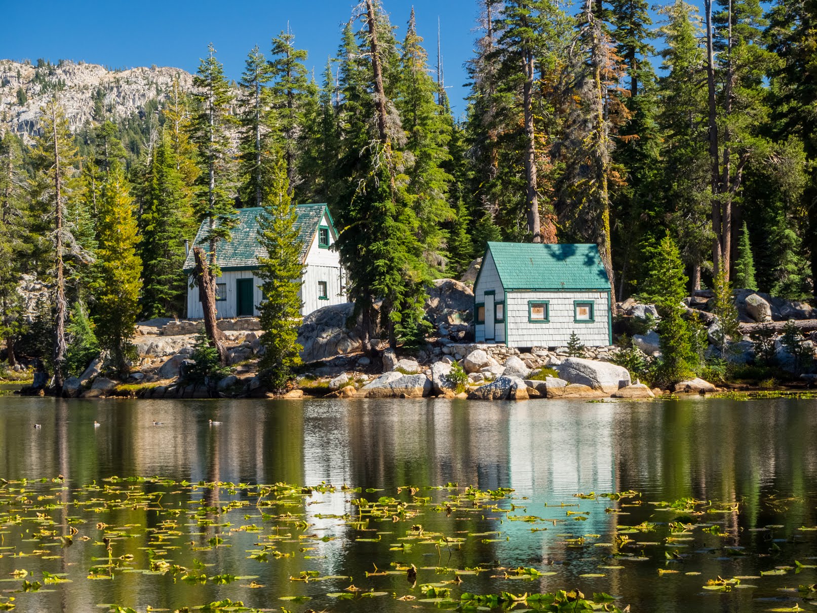
A scenery photo of cabins on the side of Mosquito Lake.

Then as we drove a bit further down State Route 4, I saw the cabins. The cabins made the stop worth it. This was probably one of the best photos I shot on this day trip.

A scenery photo of cabins on the side of Mosquito Lake.

The lighting, and the position of the cabins right next to the lake was so beautiful! One of the best landscapes I have ever seen on my many years of travel and photography.

A sunset scenery photo of Ebbetts Peak. Photo was shot near Ebbetts Pass near State Route 4.

Travel Tip: The hiking trail up to the top of Ebbetts Peak is fenced off. You can still get some nice photos and panoramic views even with the partial hike (up to the fence) though.

This is all the photos for today. I hope you have enjoyed viewing the photos! Please don't forget to share the blog post with your friends and family members! Also, if you want to get notifications when I post up more photos, "Like" us on Facebook or follow me on Twitter and Instagram. These links can also be found on the top of the right sidebar.

Parts: Cellphone Photos | Mirrorless Photos
Friday, April 29, 2022

Stanislaus National Forest, CA (Cellphone Photos)

On 24 April 2022, my parents and I spent a day in Stanislaus National Forest in California. We drove on State Route 4. We hiked Arnold Rim Trail (Manuel Peak and Top of the World). We also went to Hells Kitchen Overlook and Lake Alpine. I hope you enjoy viewing my photos! Unfortunately I'm not able to embed the 2 videos I took at Manuel Peak on Arnold Rim Trail and Bee Gulch near Lake Alpine, but you can view them here (Google Photos link).

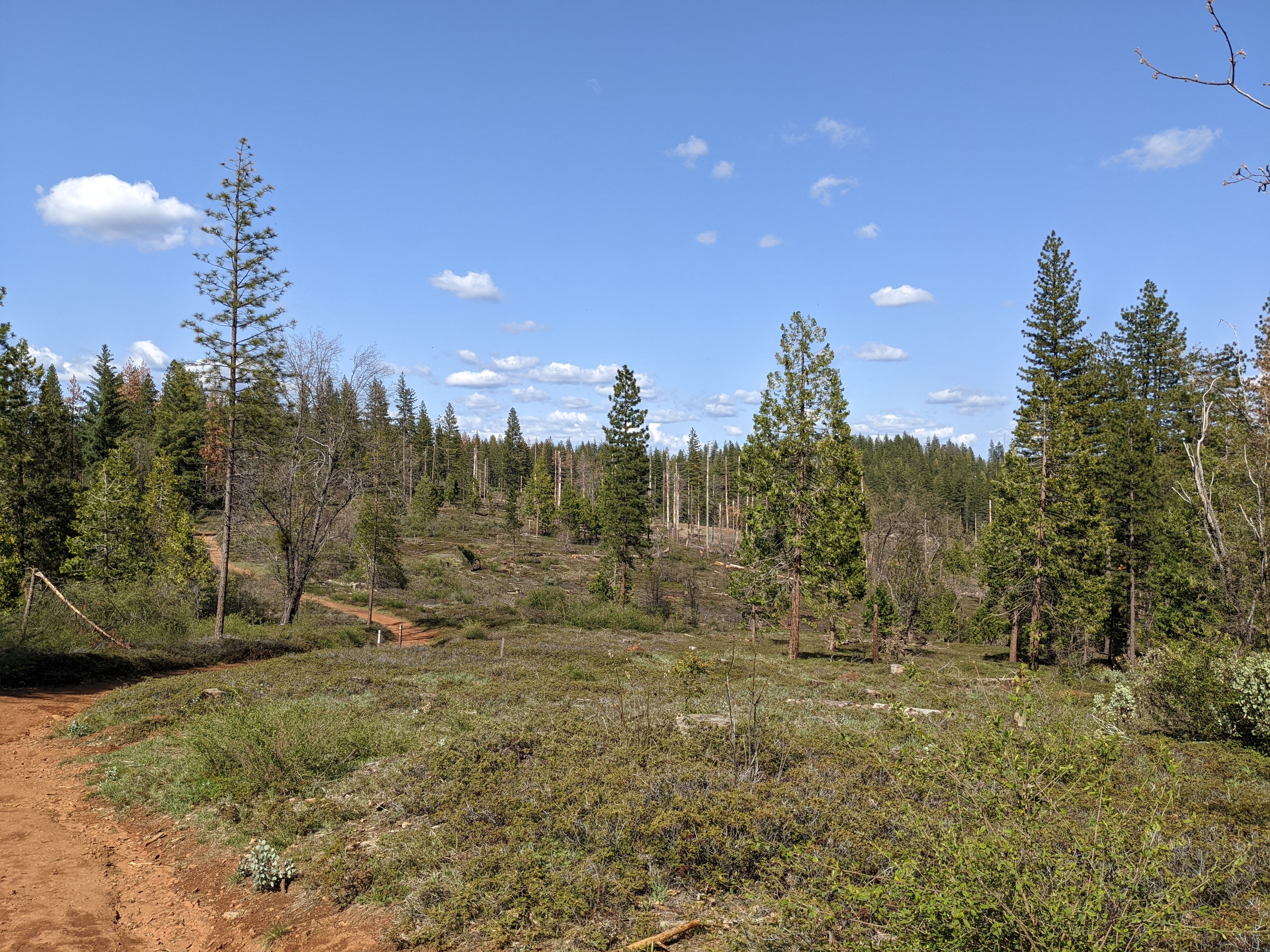
The first stop on our trip was Arnold Rim Trail. My dad mostly stayed in the car at this location because he's still recovering from an injury and using crutches. My mom and I were the only ones hiking this trail. Note that there were a ton of mosquitos on the trail, so bring mosquito repellant! My mom and I made the mistake of not bringing any and we ended up donating quite a bit of blood. I though it would still be cold enough there would be some snow on the ground. There was no snow and it was quite warm. We started our hike at the Fairway Drive/Cedar Center Gate and hiked towards Arnold Rim Alternative Trail.

A photo from Forest Route NF-5N49. This was from our hike towards Arnold Rim Alternative Trail from Fairway Drive/Cedar Center Gate.

A panorama from Manuel Peak on Arnold Rim Trail.

A scenery photo from Manuel Peak on Arnold Rim Trail.

A scenery photo with clouds from Top of the World on Arnold Rim Trail.

A panorama with clouds from Top of the World on Arnold Rim Trail.

A scenery photo with clouds from Top of the World on Arnold Rim Trail.

A scenery photo with clouds from Top of the World on Arnold Rim Trail.

Scenery photos from Top of the World on Arnold Rim Trail.

Scenery photos from Arnold Rim Alternative Trail. These were from our hike back towards the Fairway Drive/Cedar Center Gate from Arnold Rim Trail.

If you plan on hiking Arnold Rim Trail, please don't forget to download a trail map from the non-profit's website.

Once we finished up at Arnold Rim Trail, our family started driving towards Lake Alpine making a stop at Hells Kitchen Overlook.

A snowy scenery photo with clouds from Hells Kitchen Overlook on the side of State Route 4.

A snowy panorama with clouds from Hells Kitchen Overlook on the side of State Route 4.

We arrive at Lake Alpine next, the final destination on our drive. The ice on top of the lake is half melted.

A snowy scenery photo with clouds of Lake Alpine. On the left is Inspiration Point. Lake Alpine is still partially frozen.

A snowy scenery photo with clouds of Lake Alpine and Inspiration Point. Lake Alpine is still partially frozen.

A snowy scenery photo with clouds of Lake Alpine. On the left is Inspiration Point. Lake Alpine is still partially frozen.

A snowy scenery photo of a small waterfall at Bee Gulch near Lake Alpine. You can see this from the side of State Route 4, but I walked into the snow a little bit. The snow is still quite deep this time of year.

A snowy scenery photo of Silver Creek near Lake Alpine. This creek flows into Lake Alpine. This was shot on the bridge near Chickaree Day Use Area.

A snowy sunset scenery photo of Lake Alpine and Inspiration Point. Lake Alpine is still partially frozen.

A sunset snowy scenery photo of Lake Alpine. Lake Alpine is still partially frozen.

A snowy sunset panorama of Lake Alpine and Inspiration Point (left). Lake Alpine is still partially frozen.

This is all the photos for today. I hope you have enjoyed viewing the photos! Please don't forget to share the blog post with your friends and family members! Also, if you want to get notifications when I post up more photos, "Like" us on Facebook or follow me on Twitter and Instagram. These links can also be found on the top of the right sidebar.